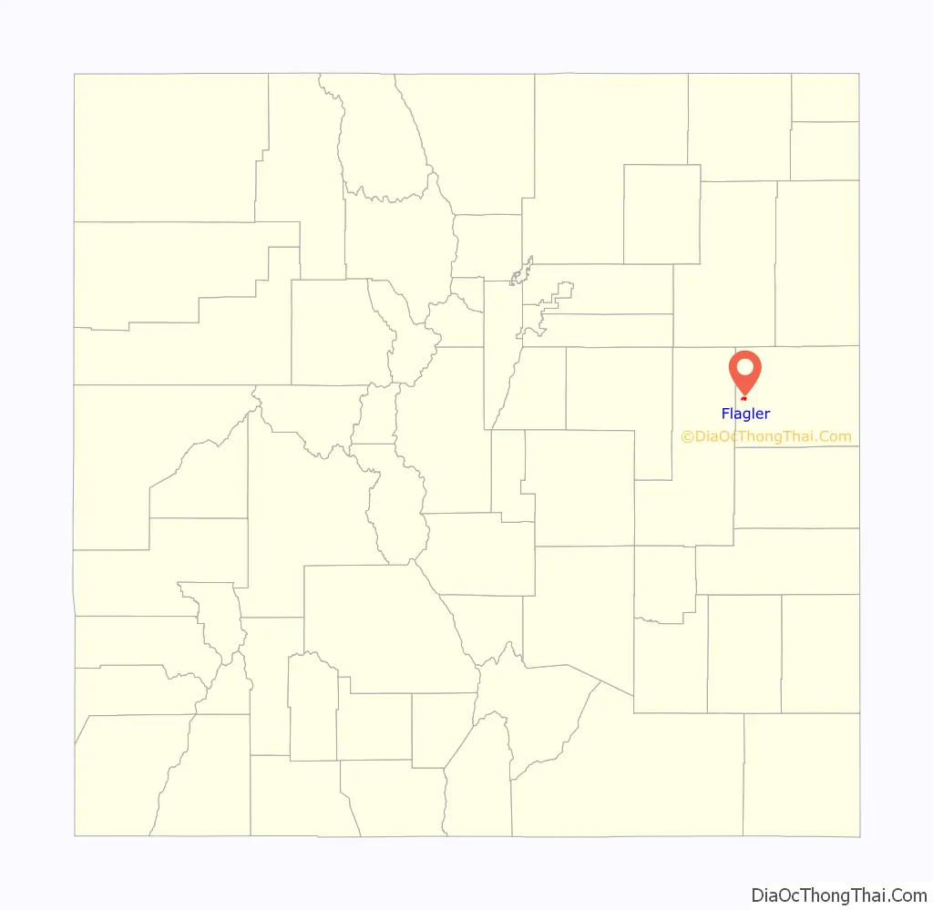
The Town of Flagler is a Statutory Town in western Kit Carson County, Colorado, United States. The town population was 567 at the 2020 United States Census. Flagler is near Exit 395 on I-70 and about 120 miles east of Denver and Colorado Springs.
| Name: | Flagler town |
|---|---|
| LSAD Code: | 43 |
| LSAD Description: | town (suffix) |
| State: | Colorado |
| County: | Kit Carson County |
| Elevation: | 4,941 ft (1,506 m) |
| Total Area: | 1.370 sq mi (3.547 km²) |
| Land Area: | 1.370 sq mi (3.547 km²) |
| Water Area: | 0.000 sq mi (0.000 km²) |
| Total Population: | 567 |
| Population Density: | 414/sq mi (160/km²) |
| ZIP code: | 80815 |
| Area code: | 719 |
| FIPS code: | 0826765 |
| GNISfeature ID: | 0204820 |
| Website: | flaglercolorado.com |
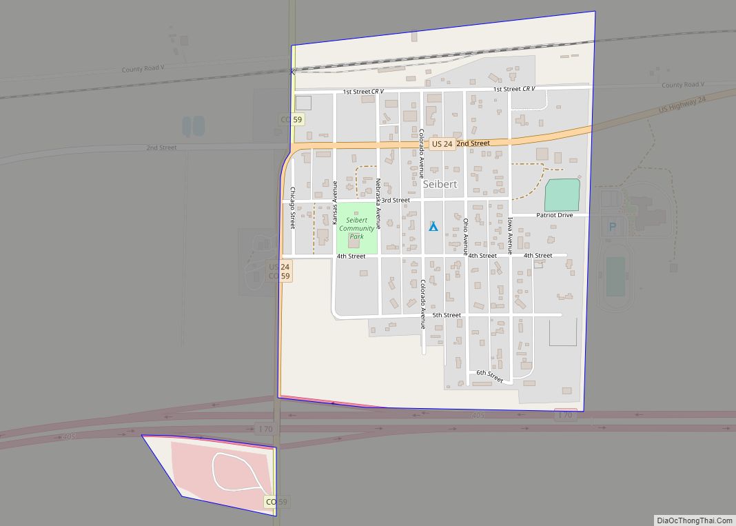
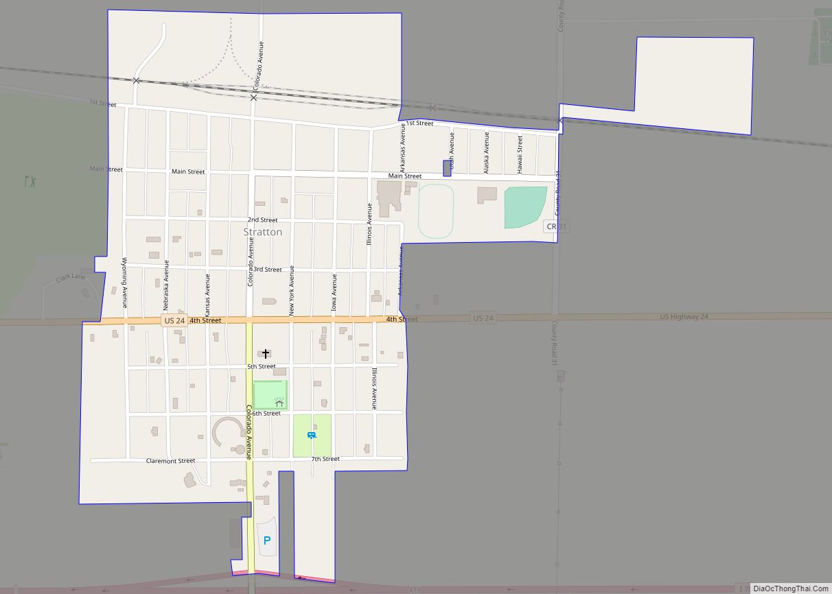
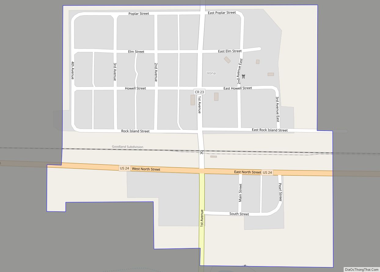
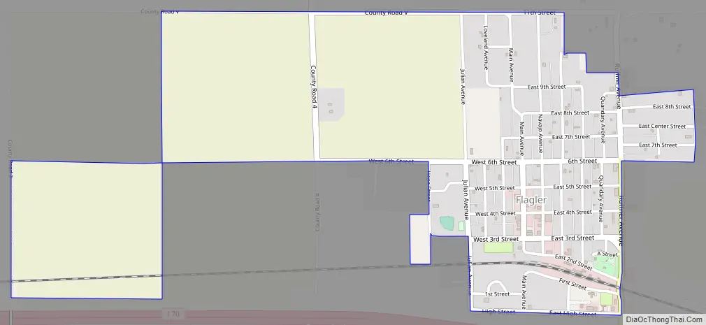
Online Interactive Map
Click on ![]() to view map in "full screen" mode.
to view map in "full screen" mode.
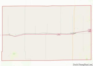
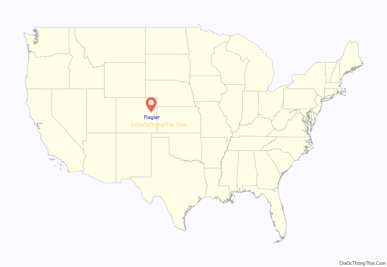
Flagler location map. Where is Flagler town?
History
The town was established in 1888 as a small settlement near the then-new Rock Island Railroad. The area has had several names, and prior to the settlement of the town, the location had been home to a combined general store and post office, owned by W.H. Lavington, and named Bowser in memory of the owner’s favorite dog who had died. When the town was founded, the town was named Malowe after Rock Island Railroad attorney M. A. Lowe. The town was later renamed after Henry Flagler, railroad builder and oil man, at the request of his daughter who liked the area.
The town was officially incorporated in 1916.
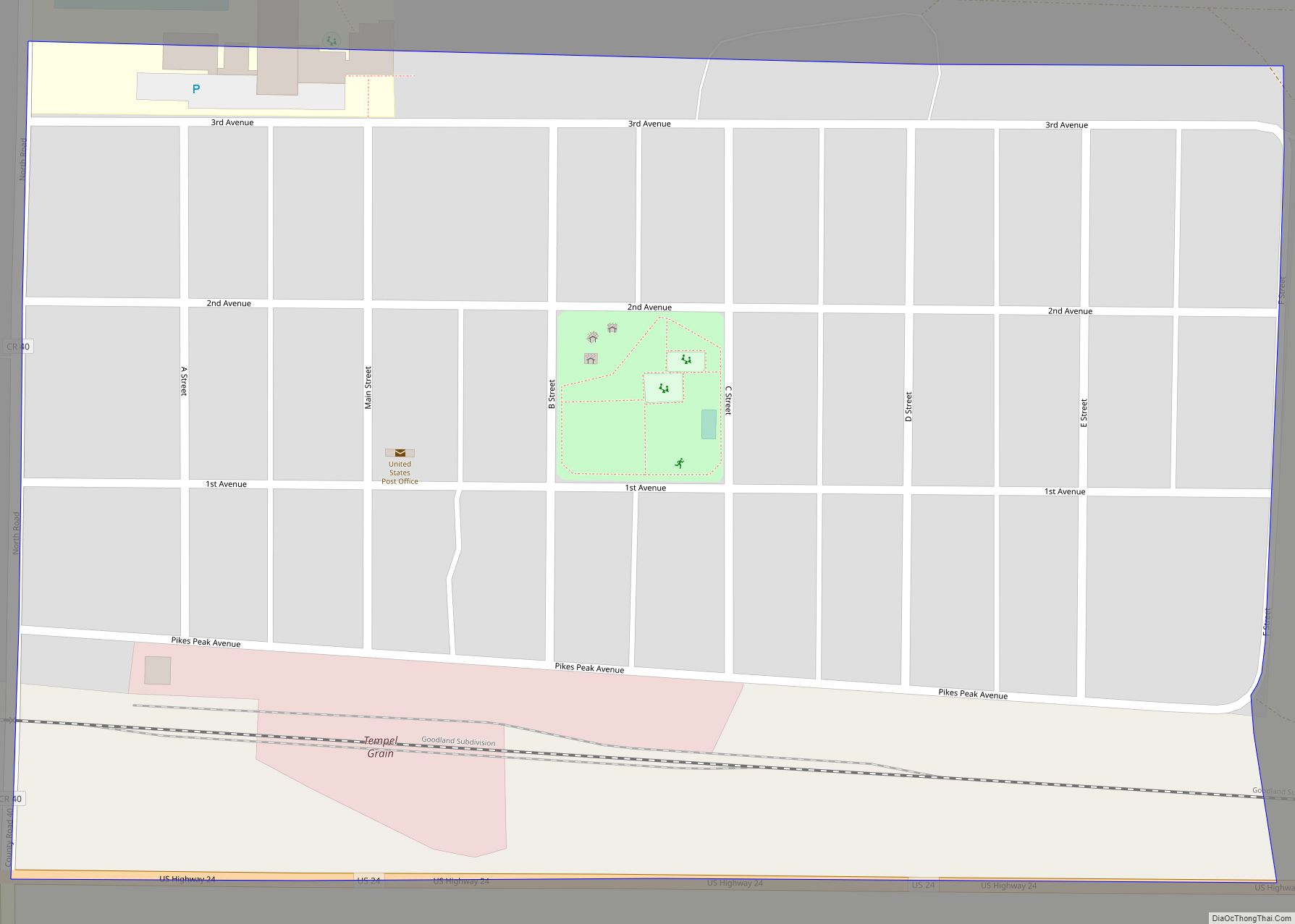
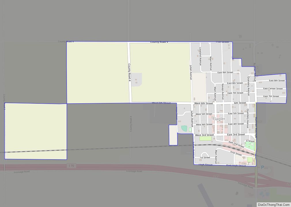
Flagler Road Map
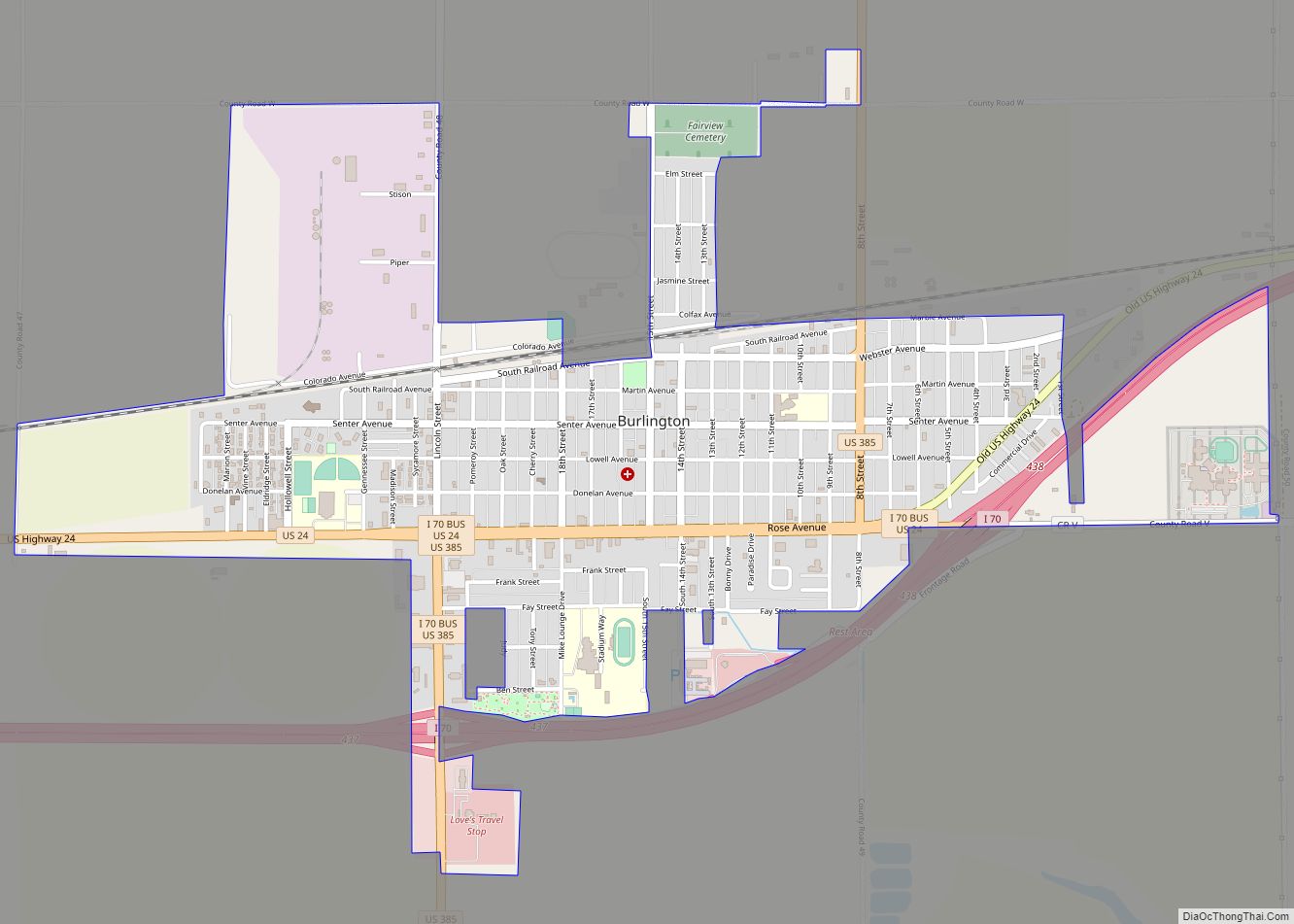
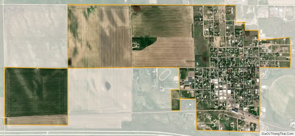
Flagler city Satellite Map
Geography
Flagler is located at 39°17′39″N 103°3′57″W / 39.29417°N 103.06583°W / 39.29417; -103.06583 (39.294031, -103.065832).
At the 2020 United States Census, the town had a total area of 876 acres (3.547 km), all of it land.
See also
Map of Colorado State and its subdivision:- Adams
- Alamosa
- Arapahoe
- Archuleta
- Baca
- Bent
- Boulder
- Broomfield
- Chaffee
- Cheyenne
- Clear Creek
- Conejos
- Costilla
- Crowley
- Custer
- Delta
- Denver
- Dolores
- Douglas
- Eagle
- El Paso
- Elbert
- Fremont
- Garfield
- Gilpin
- Grand
- Gunnison
- Hinsdale
- Huerfano
- Jackson
- Jefferson
- Kiowa
- Kit Carson
- La Plata
- Lake
- Larimer
- Las Animas
- Lincoln
- Logan
- Mesa
- Mineral
- Moffat
- Montezuma
- Montrose
- Morgan
- Otero
- Ouray
- Park
- Phillips
- Pitkin
- Prowers
- Pueblo
- Rio Blanco
- Rio Grande
- Routt
- Saguache
- San Juan
- San Miguel
- Sedgwick
- Summit
- Teller
- Washington
- Weld
- Yuma
- Alabama
- Alaska
- Arizona
- Arkansas
- California
- Colorado
- Connecticut
- Delaware
- District of Columbia
- Florida
- Georgia
- Hawaii
- Idaho
- Illinois
- Indiana
- Iowa
- Kansas
- Kentucky
- Louisiana
- Maine
- Maryland
- Massachusetts
- Michigan
- Minnesota
- Mississippi
- Missouri
- Montana
- Nebraska
- Nevada
- New Hampshire
- New Jersey
- New Mexico
- New York
- North Carolina
- North Dakota
- Ohio
- Oklahoma
- Oregon
- Pennsylvania
- Rhode Island
- South Carolina
- South Dakota
- Tennessee
- Texas
- Utah
- Vermont
- Virginia
- Washington
- West Virginia
- Wisconsin
- Wyoming