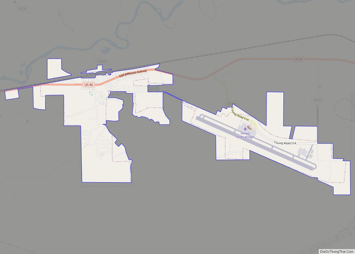
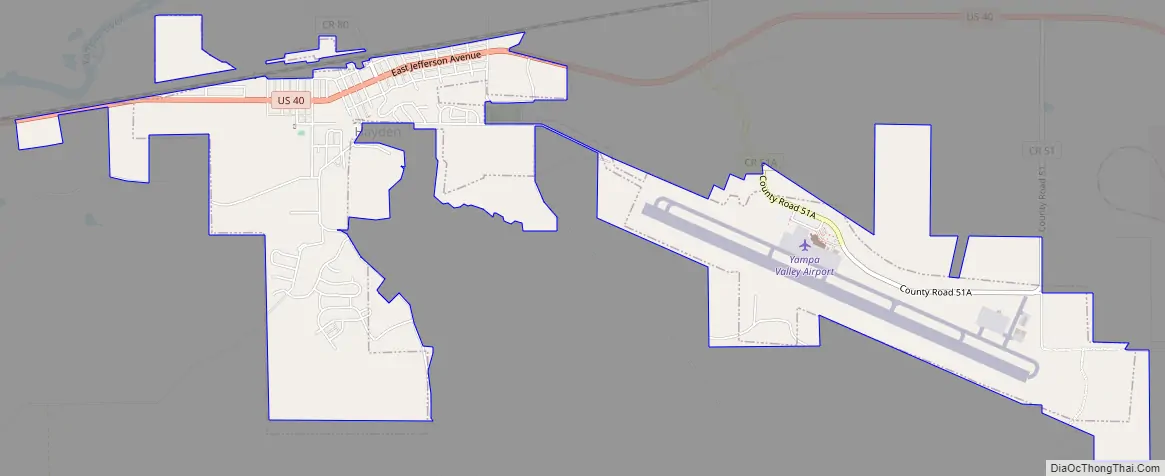
The Town of Hayden is a home rule municipality located in Routt County, Colorado, United States. The town population was 1,941 at the 2020 United States Census. Hayden is a part of the Steamboat Springs, CO Micropolitan Statistical Area. The town sits along U.S. Highway 40 in the Yampa River Valley between Craig and Steamboat Springs. Hayden is located near the Yampa Valley Regional Airport, by which Hayden is one of the smallest communities in the U.S. to have mainline passenger jet service provided by American Airlines, Delta Air Lines, Southwest Airlines and United Airlines on a scheduled basis.
| Name: | Hayden town |
|---|---|
| LSAD Code: | 43 |
| LSAD Description: | town (suffix) |
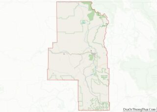
| State: | Colorado |
| County: | Routt County |
| Elevation: | 6,434 ft (1,961 m) |
| Total Area: | 3.278 sq mi (8.490 km²) |
| Land Area: | 3.278 sq mi (8.490 km²) |
| Water Area: | 0.000 sq mi (0.000 km²) |
| Total Population: | 1,941 |
| Population Density: | 592/sq mi (229/km²) |
| ZIP code: | 81639 |
| Area code: | 970 |
| FIPS code: | 0835070 |
| GNISfeature ID: | 0201992 |
| Website: | www.haydencolorado.com |
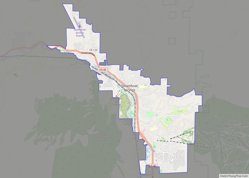
Online Interactive Map
Click on ![]() to view map in "full screen" mode.
to view map in "full screen" mode.
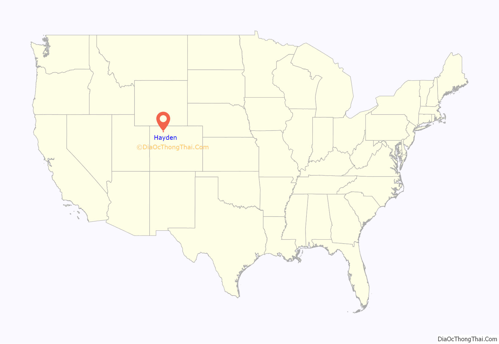
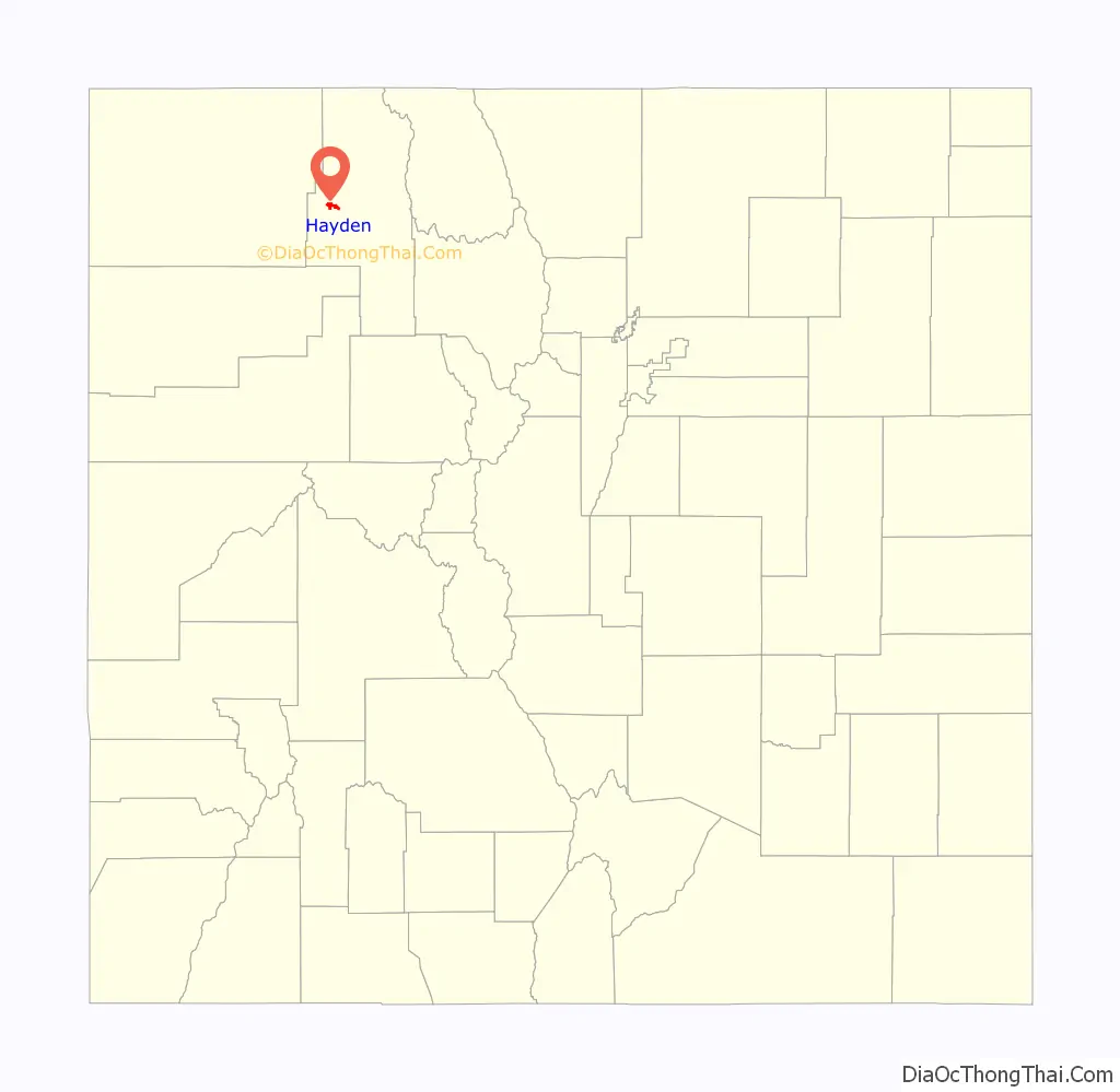
Hayden location map. Where is Hayden town?
History
The Ute people used the area for summer hunting before the town was settled. Trappers worked in the area in the early 1800s.
The area was first settled in 1875, with the town established in 1894 and incorporated in 1906. Hayden was named for F.V. Hayden, head of a survey party for the U.S. Geological & Geographic Survey in the late 1860s. Hayden explored western Colorado during the late nineteenth century.
The Denver and Salt Lake Railway reached Hayden by 1916, and the rail line continues on today as part of the Union Pacific Railroad.
Historically a center of coal mining and agriculture, it consists today of a small cluster of homes and businesses.
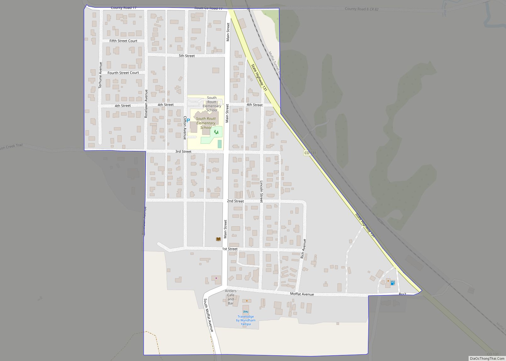
Hayden Road Map
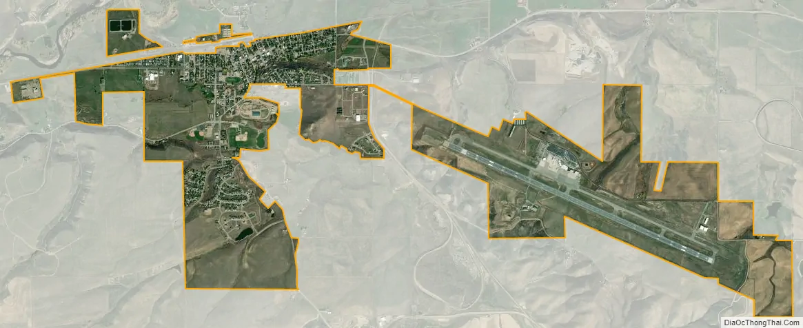
Hayden city Satellite Map
Geography
Hayden is located at 40°29′34″N 107°15′19″W / 40.49278°N 107.25528°W / 40.49278; -107.25528 (40.492731, -107.255186).
At the 2020 United States Census, the town had a total area of 2,098 acres (8.490 km), all of it land.
Climate
The Town of Hayden has a Humid continental climate (Köppen climate classification Dfb), with warm summers, cold winters with heavy snow, and equal precipitation year-round. The frost-free growing season is short, averaging 107 days.
See also
Map of Colorado State and its subdivision:- Adams
- Alamosa
- Arapahoe
- Archuleta
- Baca
- Bent
- Boulder
- Broomfield
- Chaffee
- Cheyenne
- Clear Creek
- Conejos
- Costilla
- Crowley
- Custer
- Delta
- Denver
- Dolores
- Douglas
- Eagle
- El Paso
- Elbert
- Fremont
- Garfield
- Gilpin
- Grand
- Gunnison
- Hinsdale
- Huerfano
- Jackson
- Jefferson
- Kiowa
- Kit Carson
- La Plata
- Lake
- Larimer
- Las Animas
- Lincoln
- Logan
- Mesa
- Mineral
- Moffat
- Montezuma
- Montrose
- Morgan
- Otero
- Ouray
- Park
- Phillips
- Pitkin
- Prowers
- Pueblo
- Rio Blanco
- Rio Grande
- Routt
- Saguache
- San Juan
- San Miguel
- Sedgwick
- Summit
- Teller
- Washington
- Weld
- Yuma
- Alabama
- Alaska
- Arizona
- Arkansas
- California
- Colorado
- Connecticut
- Delaware
- District of Columbia
- Florida
- Georgia
- Hawaii
- Idaho
- Illinois
- Indiana
- Iowa
- Kansas
- Kentucky
- Louisiana
- Maine
- Maryland
- Massachusetts
- Michigan
- Minnesota
- Mississippi
- Missouri
- Montana
- Nebraska
- Nevada
- New Hampshire
- New Jersey
- New Mexico
- New York
- North Carolina
- North Dakota
- Ohio
- Oklahoma
- Oregon
- Pennsylvania
- Rhode Island
- South Carolina
- South Dakota
- Tennessee
- Texas
- Utah
- Vermont
- Virginia
- Washington
- West Virginia
- Wisconsin
- Wyoming