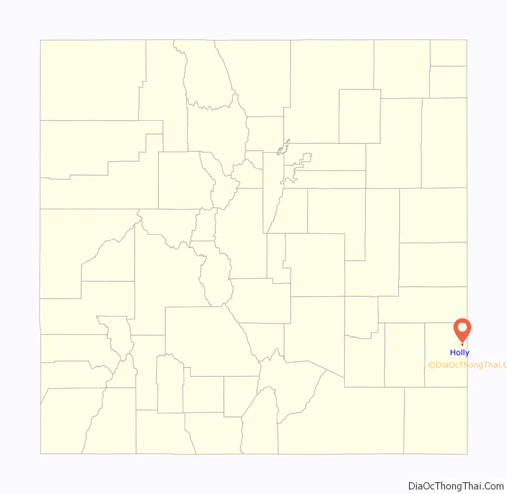
The Town of Holly is a statutory town in Prowers County in southeastern Colorado, United States, near the Kansas border. Located four miles (6 km) from the Kansas border at an elevation of 3,392 feet (1,034 m), Holly is the lowest elevation town in Colorado. The town population was 837 at the 2020 United States Census.
| Name: | Holly town |
|---|---|
| LSAD Code: | 43 |
| LSAD Description: | town (suffix) |
| State: | Colorado |
| County: | Prowers County |
| Elevation: | 3,392 ft (1,034 m) |
| Total Area: | 0.7244 sq mi (1.8763 km²) |
| Land Area: | 0.7234 sq mi (1.8737 km²) |
| Water Area: | 0.0010 sq mi (0.0026 km²) |
| Total Population: | 837 |
| Population Density: | 1,157/sq mi (447/km²) |
| ZIP code: | 81047 |
| Area code: | 719 |
| FIPS code: | 0837215 |
| GNISfeature ID: | 0203843 |
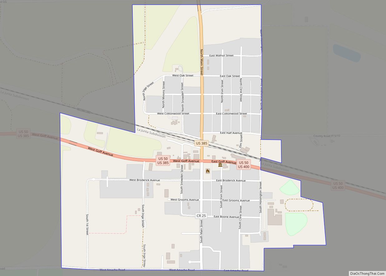
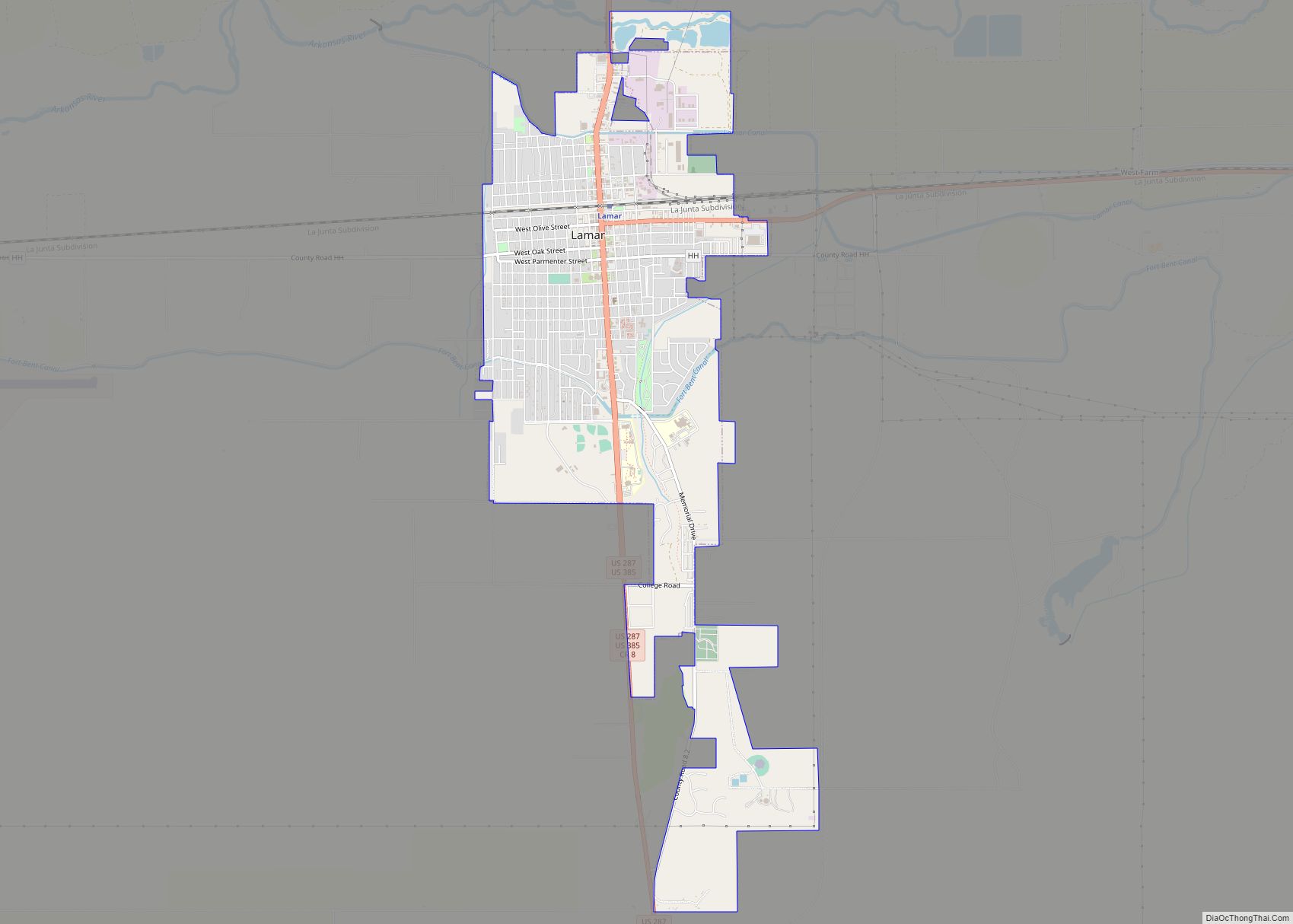
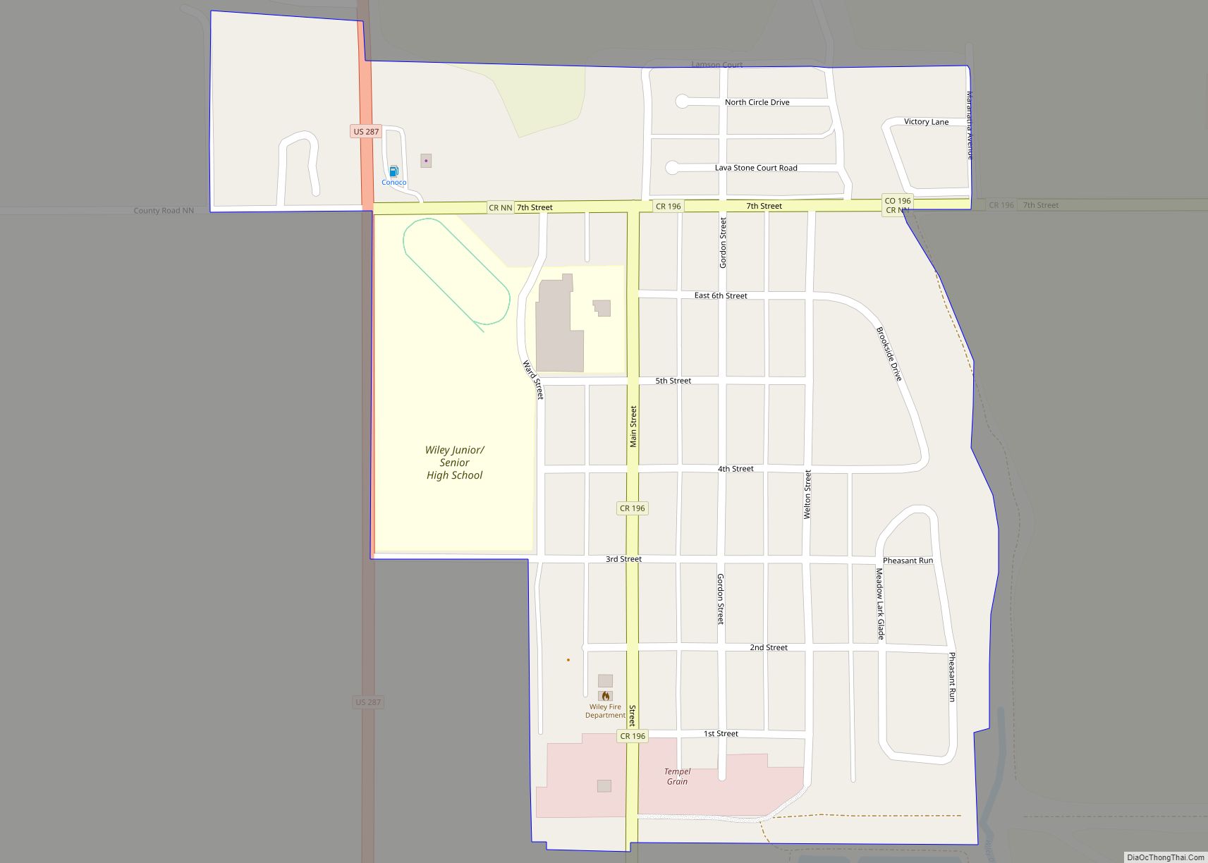
Online Interactive Map
Click on ![]() to view map in "full screen" mode.
to view map in "full screen" mode.
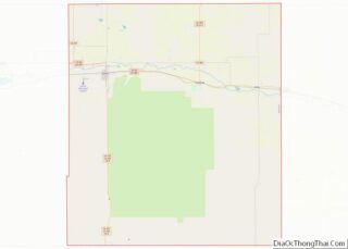
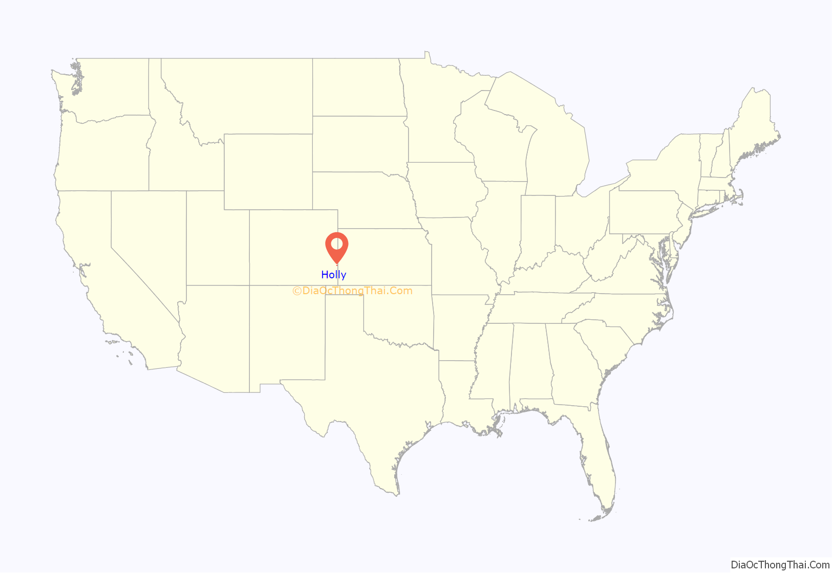
Holly location map. Where is Holly town?
History
Early history
Holly was settled as a ranching community, and the town was incorporated in 1903. The town was named for Hiram S. Holly, a local cattleman. Hiram S. Holly moved to the town in 1871, and brought 1,300 cattle with him. Holly’s ranch, the SS Ranch or Double S Ranch, was the first settlement in the area. The Holly SS Ranch Barn, a stone barn built in 1879, survives and is listed on the National Register of Historic Places. The original stone ranch house also survives, nearby, but is not listed.
Holly Sugar
Holly Sugar was created in the town in 1905 just in time for the sugarbeet harvest that year. The production was so successful the company quickly looked to expand to other communities. By 1911, Holly Sugar had expanded outside the State of Colorado. The company has long since left the Holly community. In 1988, Holly Sugar merged with Imperial Sugar.
2007 Holly tornado
2011 Jensen Farms listeriosis outbreak
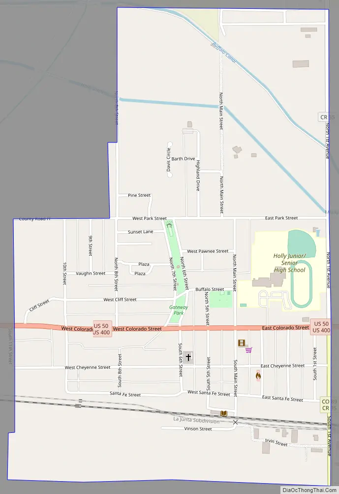
Holly Road Map
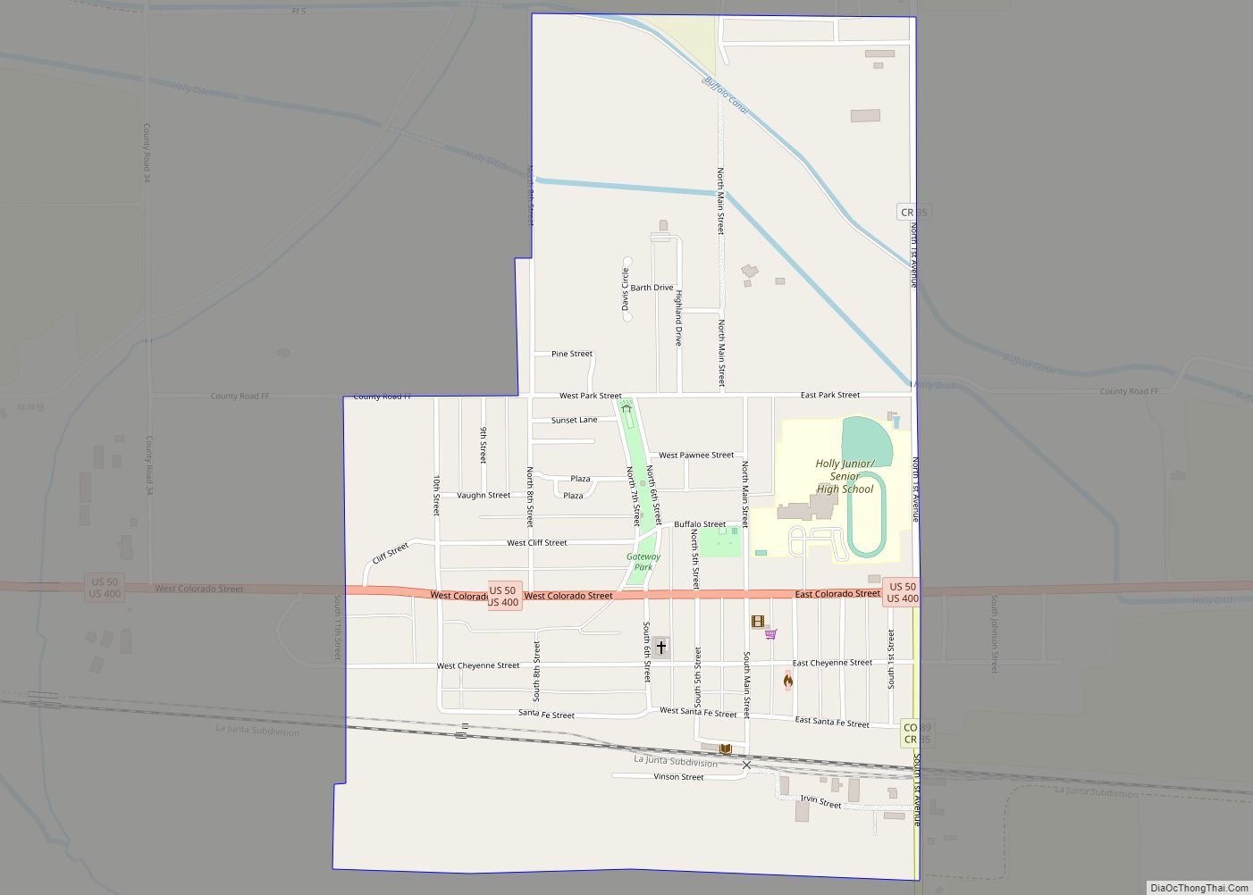
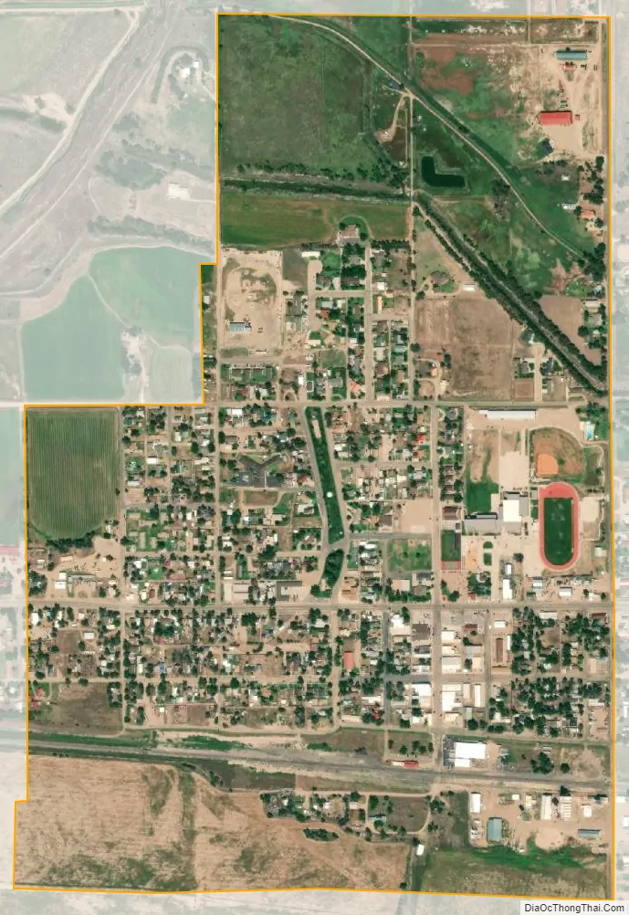
Holly city Satellite Map
Geography
Holly is located at 38°3′16″N 102°7′31″W / 38.05444°N 102.12528°W / 38.05444; -102.12528 (38.054520, -102.125398).
At the 2020 United States Census, the town had a total area of 463.6 acres (1.8763 km) including 0.64 acres (0.0026 km) of water.
Climate
The Köppen Climate system classifies the weather as semi-arid, abbreviated as BSk.
See also
Map of Colorado State and its subdivision:- Adams
- Alamosa
- Arapahoe
- Archuleta
- Baca
- Bent
- Boulder
- Broomfield
- Chaffee
- Cheyenne
- Clear Creek
- Conejos
- Costilla
- Crowley
- Custer
- Delta
- Denver
- Dolores
- Douglas
- Eagle
- El Paso
- Elbert
- Fremont
- Garfield
- Gilpin
- Grand
- Gunnison
- Hinsdale
- Huerfano
- Jackson
- Jefferson
- Kiowa
- Kit Carson
- La Plata
- Lake
- Larimer
- Las Animas
- Lincoln
- Logan
- Mesa
- Mineral
- Moffat
- Montezuma
- Montrose
- Morgan
- Otero
- Ouray
- Park
- Phillips
- Pitkin
- Prowers
- Pueblo
- Rio Blanco
- Rio Grande
- Routt
- Saguache
- San Juan
- San Miguel
- Sedgwick
- Summit
- Teller
- Washington
- Weld
- Yuma
- Alabama
- Alaska
- Arizona
- Arkansas
- California
- Colorado
- Connecticut
- Delaware
- District of Columbia
- Florida
- Georgia
- Hawaii
- Idaho
- Illinois
- Indiana
- Iowa
- Kansas
- Kentucky
- Louisiana
- Maine
- Maryland
- Massachusetts
- Michigan
- Minnesota
- Mississippi
- Missouri
- Montana
- Nebraska
- Nevada
- New Hampshire
- New Jersey
- New Mexico
- New York
- North Carolina
- North Dakota
- Ohio
- Oklahoma
- Oregon
- Pennsylvania
- Rhode Island
- South Carolina
- South Dakota
- Tennessee
- Texas
- Utah
- Vermont
- Virginia
- Washington
- West Virginia
- Wisconsin
- Wyoming