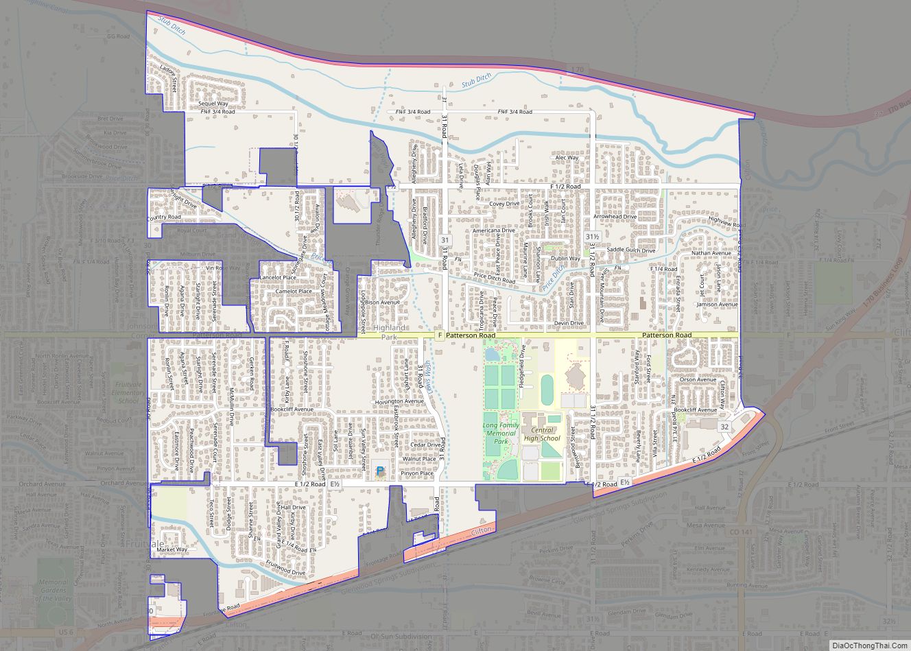
Orchard Mesa is a census-designated place (CDP) in and governed by Mesa County, Colorado, United States. It is part of the Grand Junction, CO Metropolitan Statistical Area. The population of the Orchard Mesa CDP was 6,688 at the 2020 census. The Grand Junction post office (ZIP Code 81503) serves the area.
| Name: | Orchard Mesa CDP |
|---|---|
| LSAD Code: | 57 |
| LSAD Description: | CDP (suffix) |
| State: | Colorado |
| County: | Mesa County |
| Elevation: | 4,682 ft (1,427 m) |
| Total Area: | 3.757 sq mi (9.73 km²) |
| Land Area: | 3.667 sq mi (9.50 km²) |
| Water Area: | 0.090 sq mi (0.23 km²) |
| Total Population: | 6,688 |
| Population Density: | 1,823.8/sq mi (704.2/km²) |
| ZIP code: | 81503 (Grand Junction) |
| Area code: | 970 |
| FIPS code: | 0856035 |
Online Interactive Map
Click on ![]() to view map in "full screen" mode.
to view map in "full screen" mode.
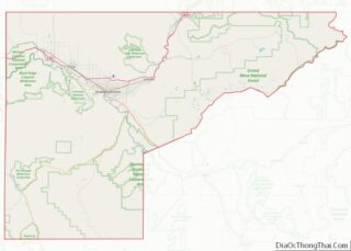
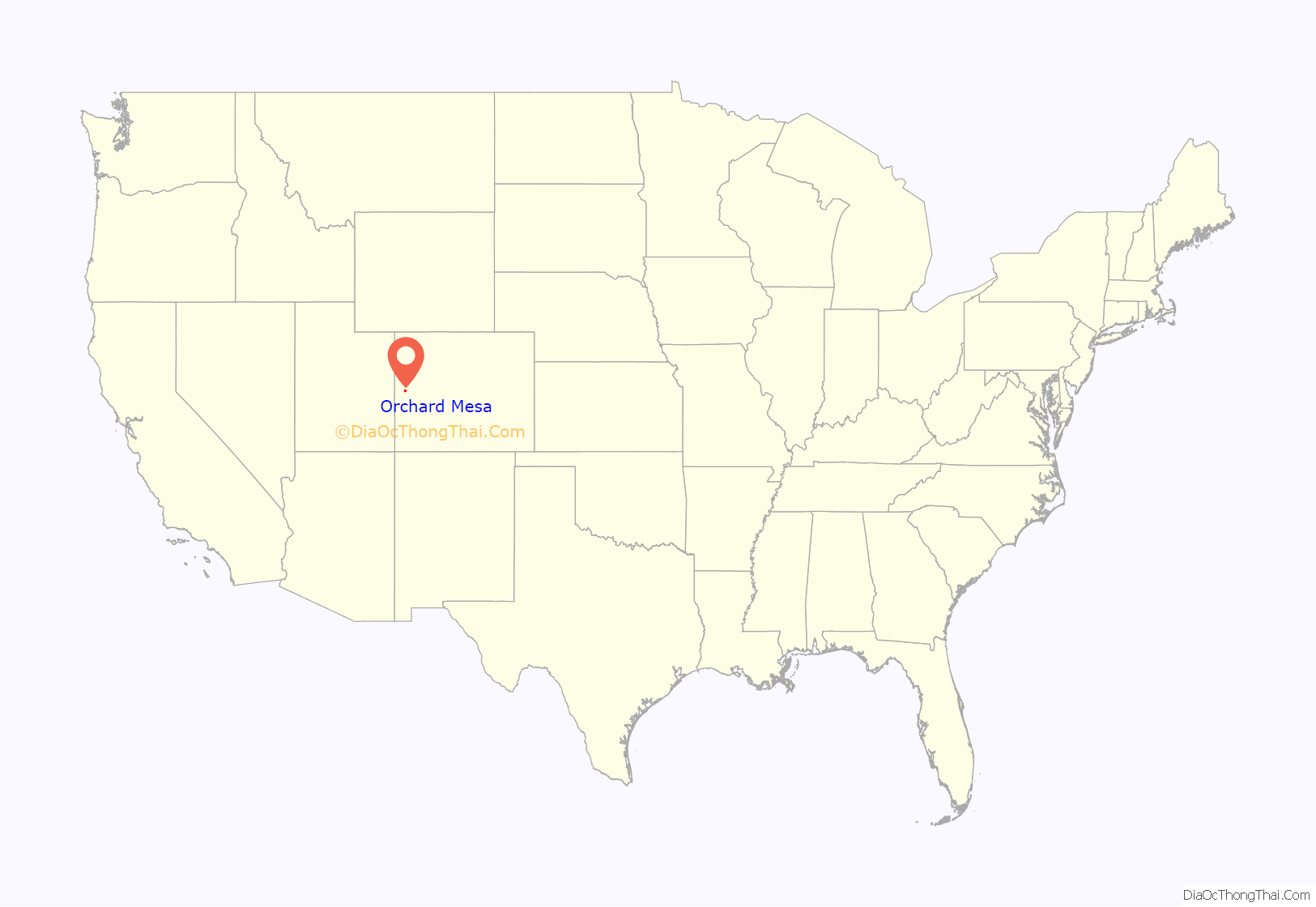
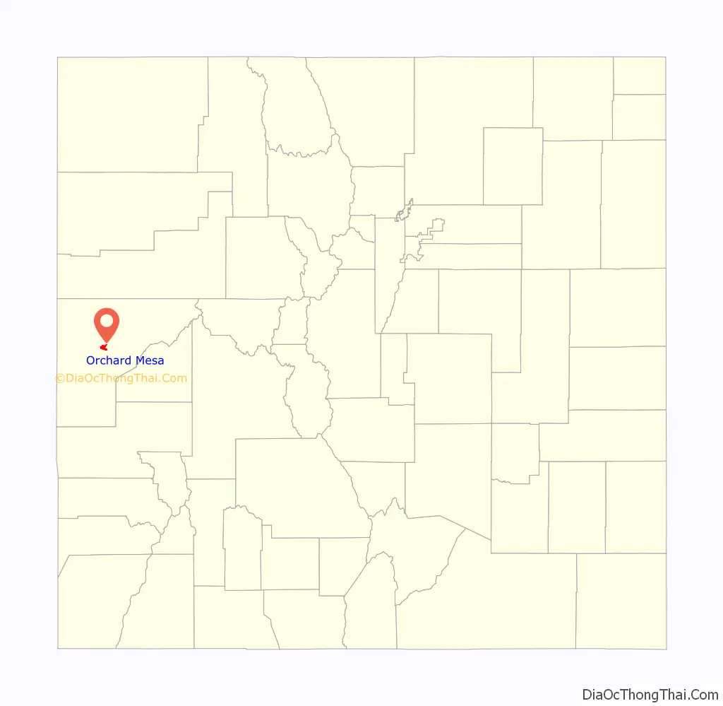
Orchard Mesa location map. Where is Orchard Mesa CDP?
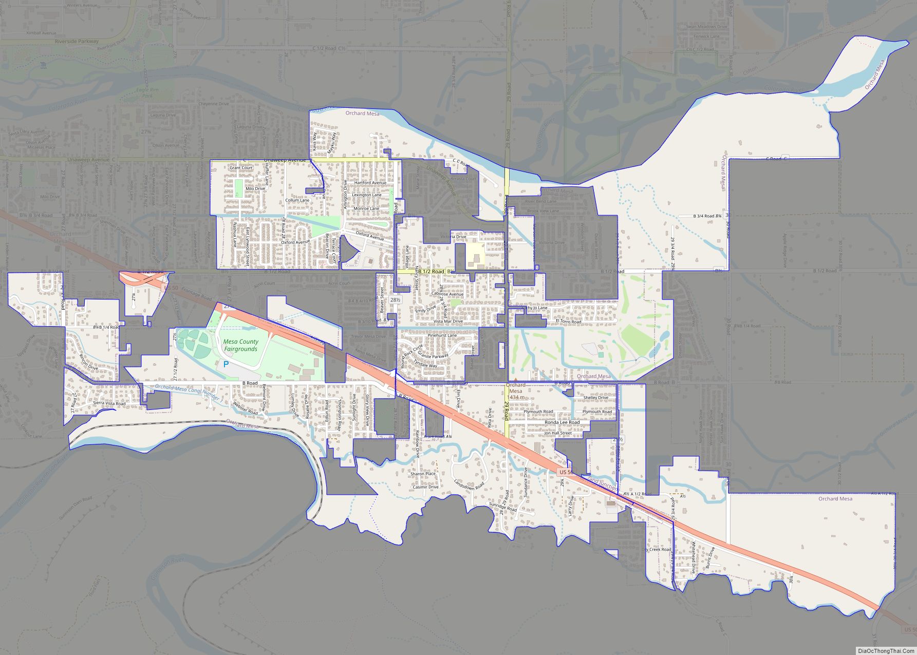
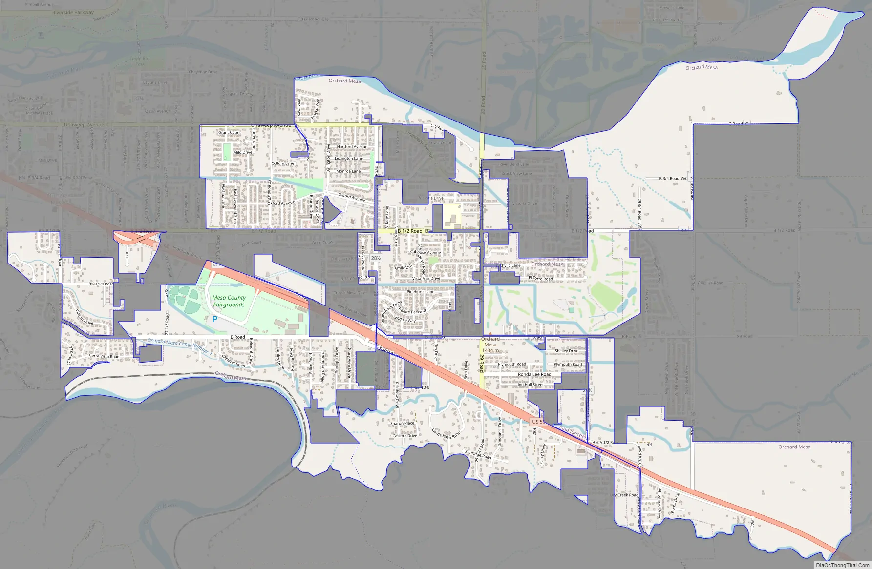
Orchard Mesa Road Map
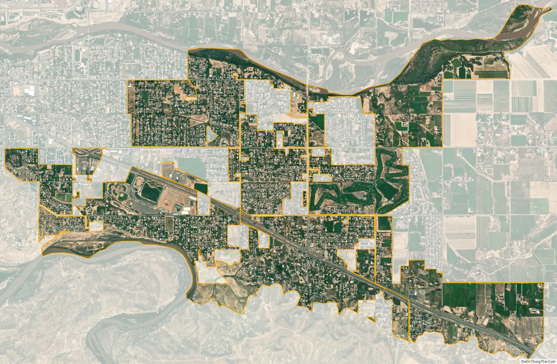
Orchard Mesa city Satellite Map
Geography
Orchard Mesa is in central Mesa County, on the southeast side of the city of Grand Junction, the county seat. It is bordered to the north by the Colorado River and to the southwest by the Gunnison River, its tributary. U.S. Route 50 passes through the community, leading northwest into Grand Junction and southeast 37 miles (60 km) to Delta. The Orchard Mesa CDP has an area of 3.8 square miles (9.8 km), of which 0.09 square miles (0.23 km), or 2.40%, are water.
See also
Map of Colorado State and its subdivision:- Adams
- Alamosa
- Arapahoe
- Archuleta
- Baca
- Bent
- Boulder
- Broomfield
- Chaffee
- Cheyenne
- Clear Creek
- Conejos
- Costilla
- Crowley
- Custer
- Delta
- Denver
- Dolores
- Douglas
- Eagle
- El Paso
- Elbert
- Fremont
- Garfield
- Gilpin
- Grand
- Gunnison
- Hinsdale
- Huerfano
- Jackson
- Jefferson
- Kiowa
- Kit Carson
- La Plata
- Lake
- Larimer
- Las Animas
- Lincoln
- Logan
- Mesa
- Mineral
- Moffat
- Montezuma
- Montrose
- Morgan
- Otero
- Ouray
- Park
- Phillips
- Pitkin
- Prowers
- Pueblo
- Rio Blanco
- Rio Grande
- Routt
- Saguache
- San Juan
- San Miguel
- Sedgwick
- Summit
- Teller
- Washington
- Weld
- Yuma
- Alabama
- Alaska
- Arizona
- Arkansas
- California
- Colorado
- Connecticut
- Delaware
- District of Columbia
- Florida
- Georgia
- Hawaii
- Idaho
- Illinois
- Indiana
- Iowa
- Kansas
- Kentucky
- Louisiana
- Maine
- Maryland
- Massachusetts
- Michigan
- Minnesota
- Mississippi
- Missouri
- Montana
- Nebraska
- Nevada
- New Hampshire
- New Jersey
- New Mexico
- New York
- North Carolina
- North Dakota
- Ohio
- Oklahoma
- Oregon
- Pennsylvania
- Rhode Island
- South Carolina
- South Dakota
- Tennessee
- Texas
- Utah
- Vermont
- Virginia
- Washington
- West Virginia
- Wisconsin
- Wyoming