Palmer Lake is a Statutory Town in El Paso County, Colorado, United States. The population was 2,636 at the 2020 census. Palmer Lake was founded by General William Jackson Palmer in 1871 and was incorporated in 1889.
Palmer Lake is one of three communities in the Tri-Lakes region between Denver and Colorado Springs. The three lakes are Palmer Lake, Monument Lake, and Lake Woodmoor. Located off Interstate 25 near two major metropolitan centers, Palmer Lake is a growing community on the Front Range of the Rocky Mountains.
Downtown Palmer Lake, though small, features restaurants and coffee shops on Colorado Highway 105. There is also a library, town hall, and a historical museum. The Tri-Lakes Center for the Arts, a nonprofit fine arts venue, features rotating art exhibitions and concert events with nationally recognized artists.
The town’s water comes from two reservoirs in the mountains behind the town and from wells. Both reservoirs and Monument Creek, which flows out of them, are considered part of the town’s watershed. The town’s namesake lake dried up completely during the summer of 2012 due to Douglas County stopping the water supply. They have allowed Palmer Lake a third of the previous area for aesthetics but will not allow drainage to travel through as it used to be. The town’s Board of Trustees held a firm stance against transferring water from the reservoirs to be stored in the lake, asking “Should our water supply be protected for the health and safety of all of our citizens, or should it be utilized for mostly aesthetic purposes?” Downtown businesses and resident morale suffered greatly due to the lack of any surface water within city limits. By 2014, the lake was nearly dry again
Library services for the city are provided by the Palmer Lake Branch Library, located at 66 Lower Glenway in Palmer Lake.
| Name: | Palmer Lake town |
|---|---|
| LSAD Code: | 43 |
| LSAD Description: | town (suffix) |
| State: | Colorado |
| County: | El Paso County |
| Elevation: | 7,297 ft (2,224 m) |
| Total Area: | 3.09 sq mi (8.01 km²) |
| Land Area: | 3.07 sq mi (7.95 km²) |
| Water Area: | 0.02 sq mi (0.06 km²) |
| Total Population: | 2,636 |
| Population Density: | 850/sq mi (330/km²) |
| ZIP code: | 80133 |
| Area code: | 719 |
| FIPS code: | 0857025 |
| GNISfeature ID: | 0204794 |
| Website: | www.townofpalmerlake.com |
Online Interactive Map
Click on ![]() to view map in "full screen" mode.
to view map in "full screen" mode.
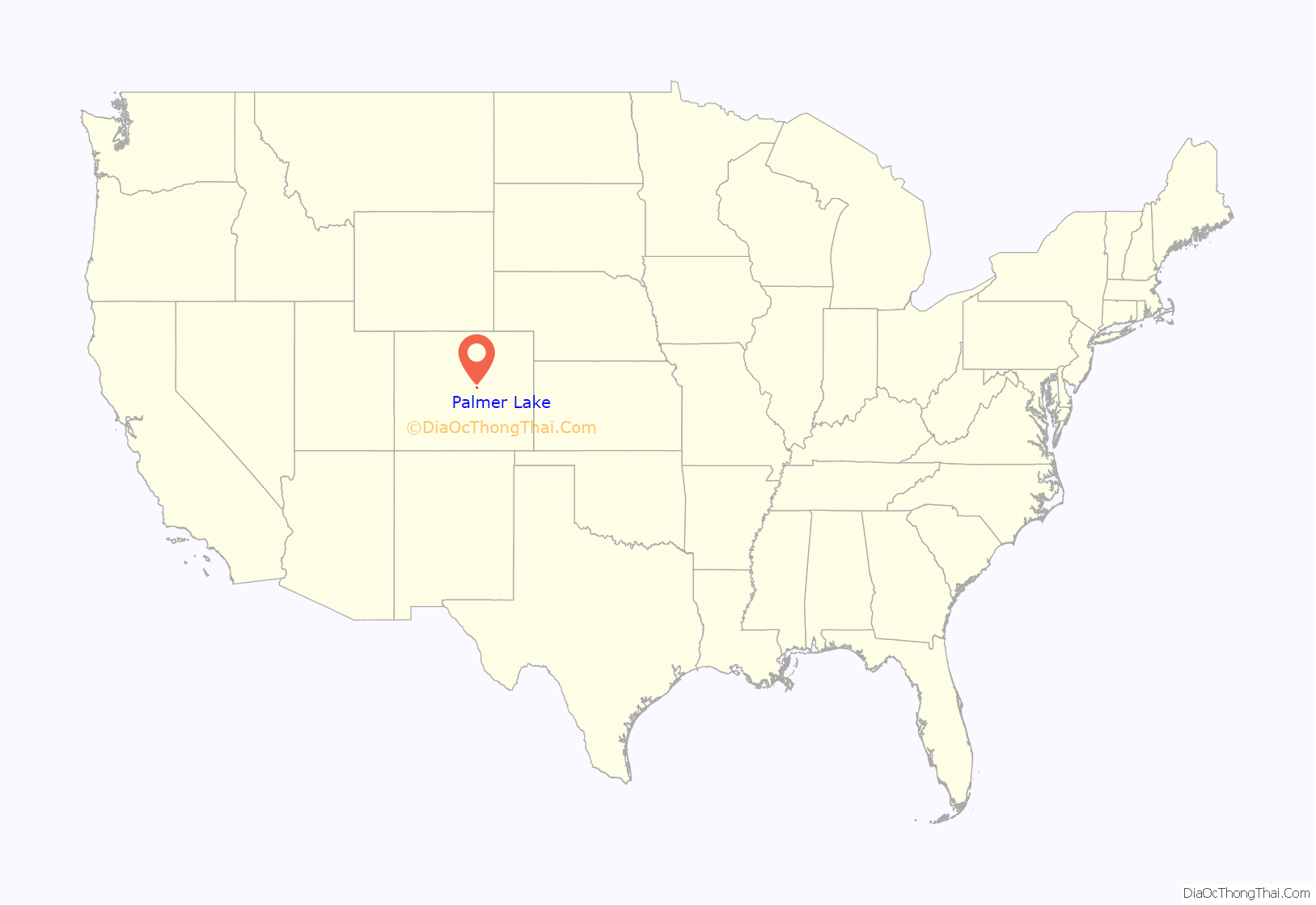
Palmer Lake location map. Where is Palmer Lake town?
History
The earliest known area inhabitants were Native American tribes – the Mountain Ute, Arapahoe, Kiowa, and Cheyenne. The earliest recorded non-Native activity in the area was the Army’s Major Stephen Long Expedition of 1820, which discovered the Colorado State Flower, the white and lavender columbine, somewhere between Monument and Palmer Lake. Many homesteaded ranches and farms straddled the El Paso-Douglas County line as early as the 1860s. David McShane is credited with being one of the first homesteaders, 1865, in the Town of Monument. Henry Limbach and his family were also early arrivals and had much to do with planning and developing of Monument which prospered as the commercial hub for the area on arrival of the railroad.
Critical role and a refuge
General William J. Palmer came west after the Civil War to found the city of Colorado Springs and start the Denver & Rio Grande Railroad, a 3 ft (0.91 m) narrow-gauge line, in 1871. He purchased the land known as the Monument Farms & Lake Property. Palmer Lake was critical to the railroad because the steam trains chugged up to the Palmer Divide summit and had to fill up with water from the lake to head down the Divide. The lake was the only natural water supply available in the area. Passenger trains stopped in town for 10 minutes to take on water, or for a fee of $1.00 roundtrip from Denver, passengers could take the train to Palmer Lake for a day of picnicking, fishing, and boating or hiking.
Dr. William Finley Thompson purchased land and plotted the town of Palmer Lake in 1882, intending it as a health resort & vacation community. Thompson was an oral surgeon originally from Randolph, Ohio, who practiced in the Midwest and in London. He built the Queen Anne Victorian mansion Estemere in 1887 for his family, but by 1890 was facing bankruptcy and fled from his creditors. Prior to the automobile, Palmer Lake was a popular destination for people from Denver and others wishing escape the heat of city summer temperatures. The Rocky Mountain Chautauqua – a people’s vacation university – was popular between 1887 and 1910, hosting programs in music, art, drama, religion, and nature. The Rockland, a 61-room hotel, provided amenities for visitors, including a petting zoo.
Beginnings of agriculture and the Air Force Academy
Historical industries in the area included fox farms, sawmills, angora rabbit farming, and dry-land potato and grain farming. Laborers also harvested ice from Monument and Palmer Lakes, and this industry continued until 1941. In 1894 there were over 20,000 acres (81 km) under cultivation, but in 1895 a potato blight infected the soil and potato farming eventually stopped. At that time, Monument was famous for holding an annual “Potato Bake”, a fall celebration where a free feast would be held just across the tracks from Front and Second Streets.
The land surrounding Palmer Lake and Monument remained largely ranch and farmland until the Air Force Academy was opened in 1958. Woodmoor, a township south of Palmer Lake and east of Monument, was originally planned to be an area where the staff of the Air Academy and other military retirees could take up residence. The land still kept to its ranching heritage until Colorado Springs growth spawned housing developments starting about the mid 1980s. Most growth along this part of the I-25 corridor has occurred since 1990.
The area has a remarkable history including events associated with the “wild west.” Raids, scalpings and saloon shootings are part of this history. There were several forts in the area where settlers or travelers could take refuge until trouble passed. One of these is the “McShane Fort” located just off Highway 105, close to the railroad overpass bordering Monument and Palmer Lake. Law enforcement apprehended and executed murderers in the Palmer Lake/Monument area. The area was also home to five gold mines, although gold was never found. The area has an extensive historical heritage.
Palmer Lake Road Map
Palmer Lake city Satellite Map
Geography
Palmer Lake is located at 39°6′48″N 104°54′18″W / 39.11333°N 104.90500°W / 39.11333; -104.90500 (39.113371, -104.904933).
The town is bordered by the Greenland Open Space Preserve to the north, Pike National Forest to the west, Monument to the south, and Ben Lomand and the I-25 corridor to the east. Palmer Lake sits at the north edge of El Paso County and offers sweeping views of the Rocky Mountain foothills.
According to the United States Census Bureau, the town has a total area of 3.1 square miles (8.0 km). 3.1 square miles (8.0 km) of this is land and 0.04 square miles (0.10 km) of it (0.65%) is water.
The town marks the top of the Palmer Divide, a ridge running from Palmer Lake eastward which separates the Arkansas River drainage to the south from the Platte River drainage to the north. The highest point of the divide is about 7,700 feet (2,300 m) above sea level at Vollmer Hill located in the Black Forest. At Monument Hill the elevation is about 7,352 feet (2,241 m). It staggers along the county line between Douglas County and El Paso County. This divide separates the Denver metropolitan area from the Pikes Peak area. The town’s namesake, Palmer Lake, is situated at 7,250 feet (2,210 m).
See also
Map of Colorado State and its subdivision:- Adams
- Alamosa
- Arapahoe
- Archuleta
- Baca
- Bent
- Boulder
- Broomfield
- Chaffee
- Cheyenne
- Clear Creek
- Conejos
- Costilla
- Crowley
- Custer
- Delta
- Denver
- Dolores
- Douglas
- Eagle
- El Paso
- Elbert
- Fremont
- Garfield
- Gilpin
- Grand
- Gunnison
- Hinsdale
- Huerfano
- Jackson
- Jefferson
- Kiowa
- Kit Carson
- La Plata
- Lake
- Larimer
- Las Animas
- Lincoln
- Logan
- Mesa
- Mineral
- Moffat
- Montezuma
- Montrose
- Morgan
- Otero
- Ouray
- Park
- Phillips
- Pitkin
- Prowers
- Pueblo
- Rio Blanco
- Rio Grande
- Routt
- Saguache
- San Juan
- San Miguel
- Sedgwick
- Summit
- Teller
- Washington
- Weld
- Yuma
- Alabama
- Alaska
- Arizona
- Arkansas
- California
- Colorado
- Connecticut
- Delaware
- District of Columbia
- Florida
- Georgia
- Hawaii
- Idaho
- Illinois
- Indiana
- Iowa
- Kansas
- Kentucky
- Louisiana
- Maine
- Maryland
- Massachusetts
- Michigan
- Minnesota
- Mississippi
- Missouri
- Montana
- Nebraska
- Nevada
- New Hampshire
- New Jersey
- New Mexico
- New York
- North Carolina
- North Dakota
- Ohio
- Oklahoma
- Oregon
- Pennsylvania
- Rhode Island
- South Carolina
- South Dakota
- Tennessee
- Texas
- Utah
- Vermont
- Virginia
- Washington
- West Virginia
- Wisconsin
- Wyoming
