Ponderosa Park is an unincorporated community and a census-designated place (CDP) located in and governed by Elbert County, Colorado, United States. The CDP is a part of the Denver–Aurora–Lakewood, CO Metropolitan Statistical Area. The population of the Ponderosa Park CDP was 3,334 at the United States Census 2020. Elbert County governs the unincorporated community. The Elizabeth post office (Zip Code 80107) serves the area.
| Name: | Ponderosa Park CDP |
|---|---|
| LSAD Code: | 57 |
| LSAD Description: | CDP (suffix) |
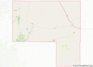
| State: | Colorado |
| County: | Elbert County |
| Total Area: | 14.583 sq mi (37.770 km²) |
| Land Area: | 14.583 sq mi (37.770 km²) |
| Water Area: | 0.000 sq mi (0.000 km²) |
| Total Population: | 3,334 |
| Population Density: | 230/sq mi (88/km²) |
| ZIP code: | Elizabeth 80107 |
| FIPS code: | 0860655 |
Online Interactive Map
Click on ![]() to view map in "full screen" mode.
to view map in "full screen" mode.
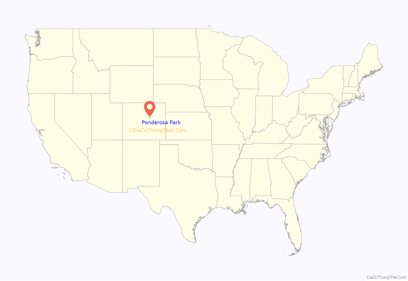
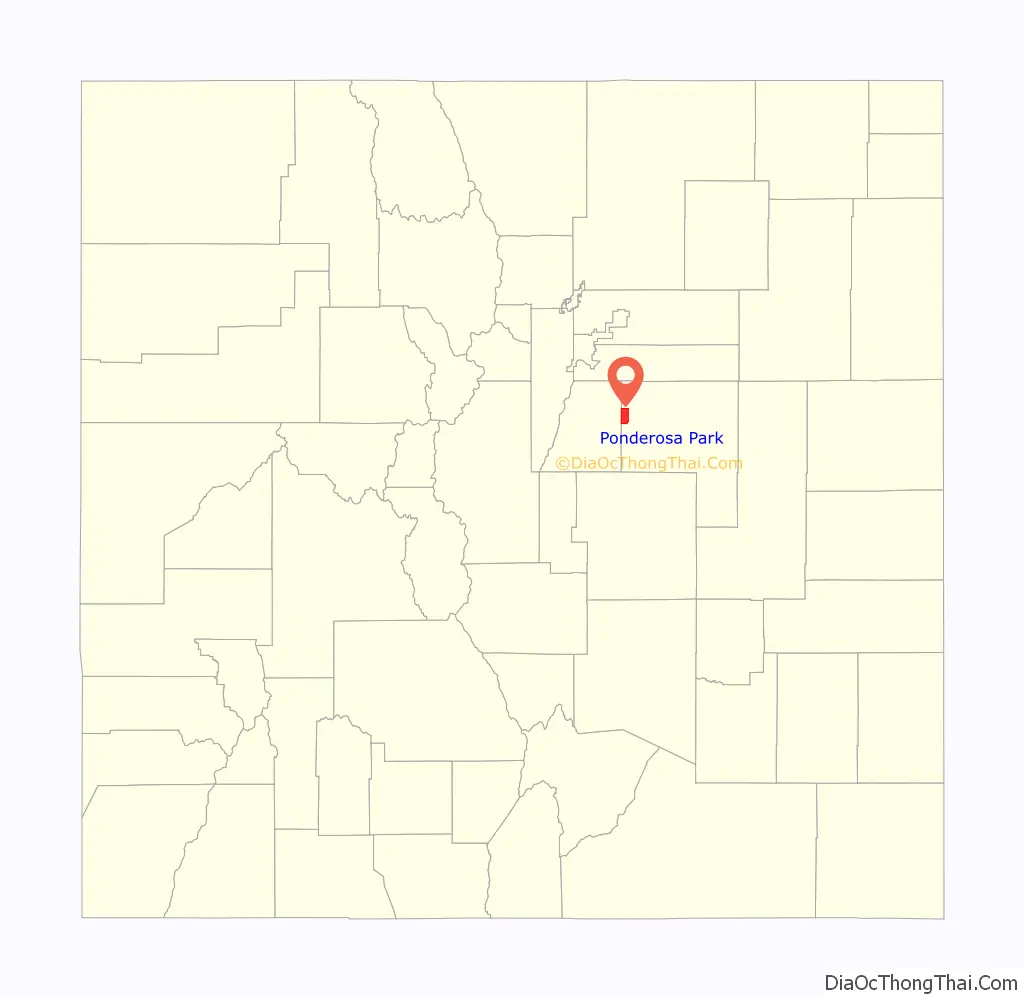
Ponderosa Park location map. Where is Ponderosa Park CDP?
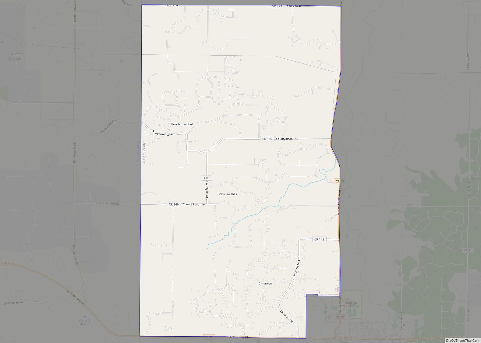
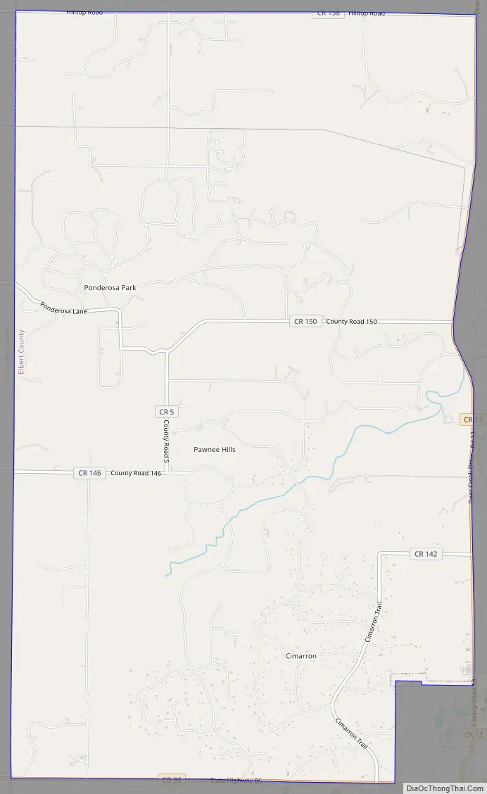
Ponderosa Park Road Map
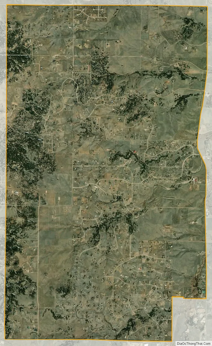
Ponderosa Park city Satellite Map
Geography
Ponderosa Park is located on the western border of Elbert County. It is bordered to the southeast by the town of Elizabeth. Colorado State Highway 86 forms the southern edge of the CDP, leading east 9 miles (14 km) to Kiowa, the county seat, and west 7 miles (11 km) to Franktown. Castle Rock is 13 miles (21 km) to the west, and Denver is 37 miles (60 km) to the northwest.
The Ponderosa Park CDP has an area of 9,333 acres (37.770 km), all land.
Climate
This climate type is usually found in the outskirts of true deserts in low-latitude, semiarid regions. It has a cooler, wetter winter resulting from the higher latitude and mid-latitude frontal cyclone activity. Annual precipitation totals are greater than in tropical and subtropical desert climates. Yearly variations in amount are not as extreme as in the true deserts but are nevertheless large. The Köppen Climate Classification subtype for this climate is “BSk”. (Tropical and Subtropical Steppe Climate).
See also
Map of Colorado State and its subdivision:- Adams
- Alamosa
- Arapahoe
- Archuleta
- Baca
- Bent
- Boulder
- Broomfield
- Chaffee
- Cheyenne
- Clear Creek
- Conejos
- Costilla
- Crowley
- Custer
- Delta
- Denver
- Dolores
- Douglas
- Eagle
- El Paso
- Elbert
- Fremont
- Garfield
- Gilpin
- Grand
- Gunnison
- Hinsdale
- Huerfano
- Jackson
- Jefferson
- Kiowa
- Kit Carson
- La Plata
- Lake
- Larimer
- Las Animas
- Lincoln
- Logan
- Mesa
- Mineral
- Moffat
- Montezuma
- Montrose
- Morgan
- Otero
- Ouray
- Park
- Phillips
- Pitkin
- Prowers
- Pueblo
- Rio Blanco
- Rio Grande
- Routt
- Saguache
- San Juan
- San Miguel
- Sedgwick
- Summit
- Teller
- Washington
- Weld
- Yuma
- Alabama
- Alaska
- Arizona
- Arkansas
- California
- Colorado
- Connecticut
- Delaware
- District of Columbia
- Florida
- Georgia
- Hawaii
- Idaho
- Illinois
- Indiana
- Iowa
- Kansas
- Kentucky
- Louisiana
- Maine
- Maryland
- Massachusetts
- Michigan
- Minnesota
- Mississippi
- Missouri
- Montana
- Nebraska
- Nevada
- New Hampshire
- New Jersey
- New Mexico
- New York
- North Carolina
- North Dakota
- Ohio
- Oklahoma
- Oregon
- Pennsylvania
- Rhode Island
- South Carolina
- South Dakota
- Tennessee
- Texas
- Utah
- Vermont
- Virginia
- Washington
- West Virginia
- Wisconsin
- Wyoming