Rye is a Statutory Town in Pueblo County, Colorado, United States. It is part of the Pueblo, Colorado Metropolitan Statistical Area. The population was 206 at the 2020 census.
A post office called Rye has been in operation since 1881. Some say the community was named for the wild rye native to the area, while others believe the place is named for rye whiskey.
| Name: | Rye town |
|---|---|
| LSAD Code: | 43 |
| LSAD Description: | town (suffix) |
| State: | Colorado |
| County: | Pueblo County |
| Incorporated: | November 22, 1937 |
| Elevation: | 6,801 ft (2,073 m) |
| Total Area: | 0.09 sq mi (0.24 km²) |
| Land Area: | 0.09 sq mi (0.24 km²) |
| Water Area: | 0.00 sq mi (0.00 km²) |
| Total Population: | 206 |
| Population Density: | 2,300/sq mi (860/km²) |
| ZIP code: | 81069 |
| Area code: | 719 |
| FIPS code: | 0866895 |
| GNISfeature ID: | 0193917 |
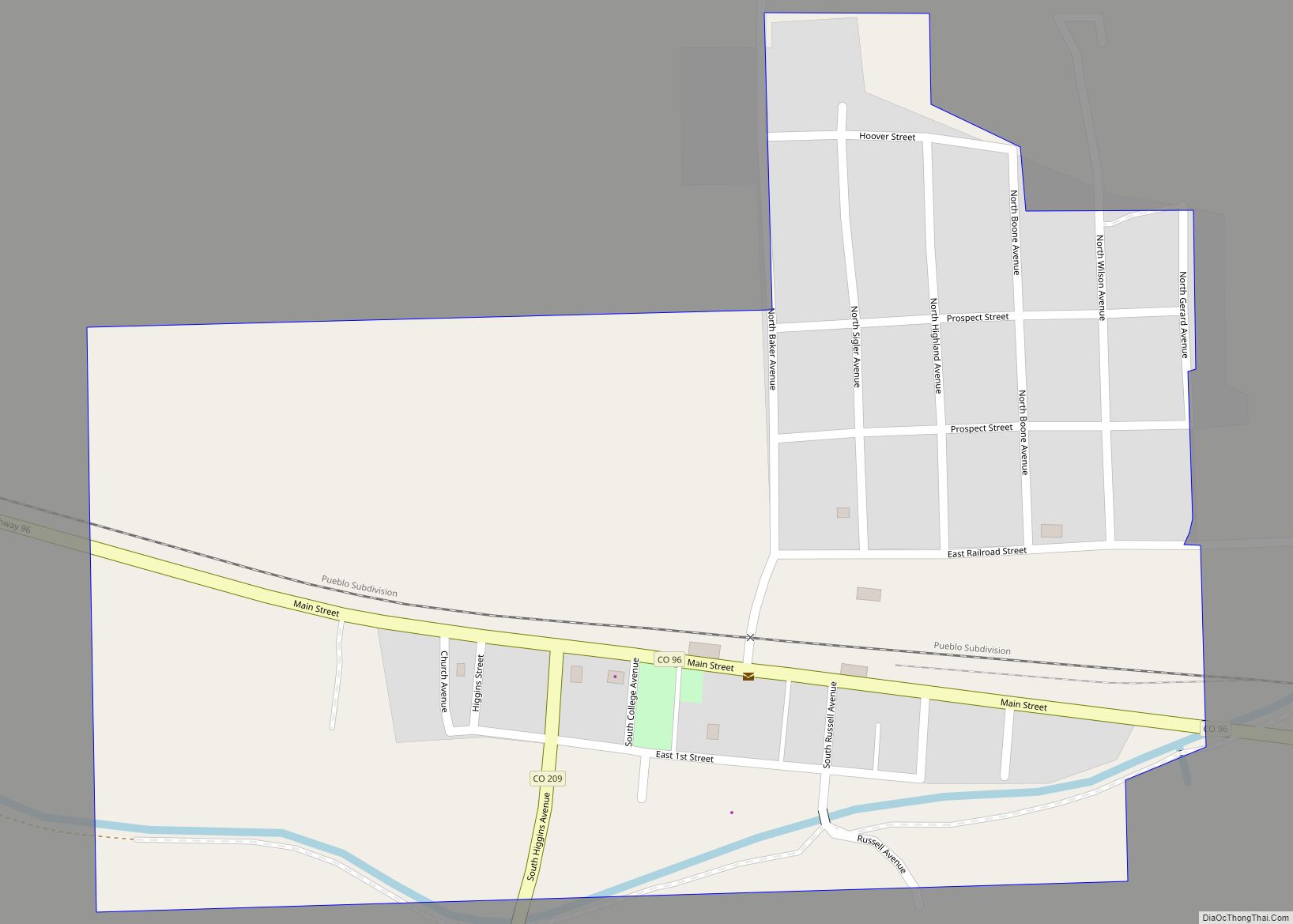
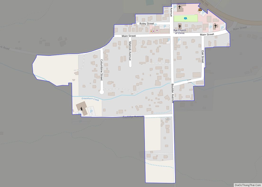
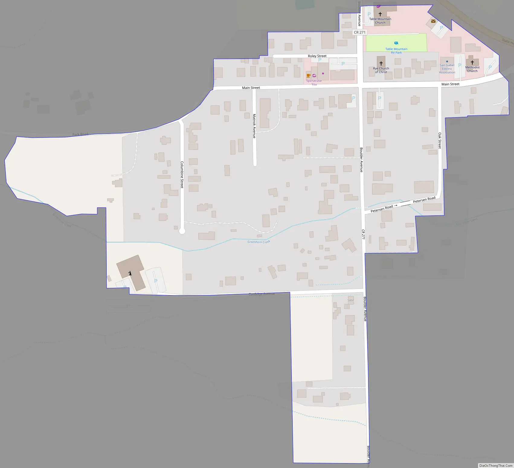
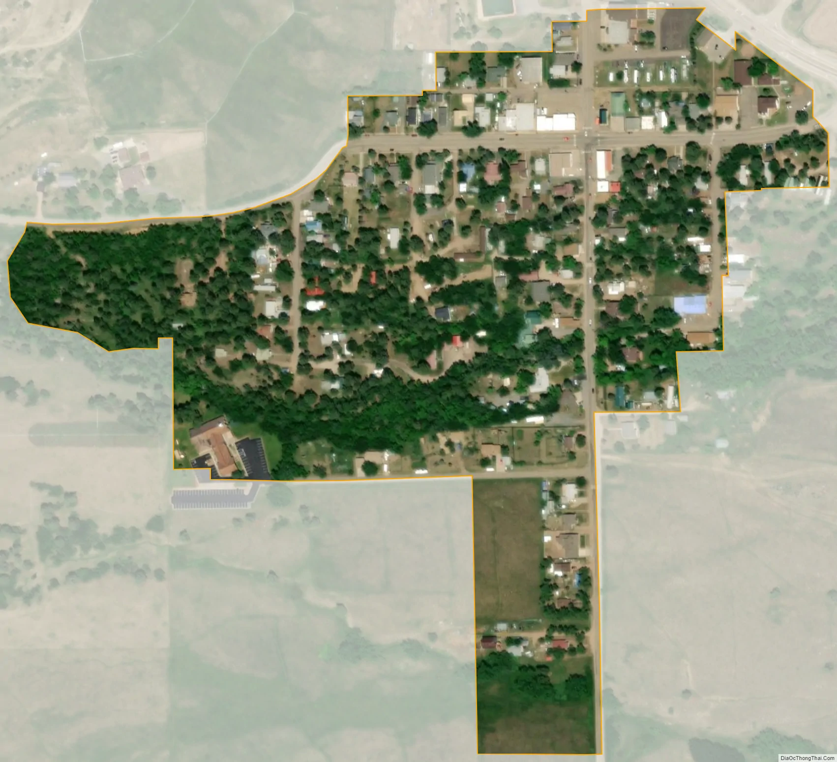
Online Interactive Map
Click on ![]() to view map in "full screen" mode.
to view map in "full screen" mode.
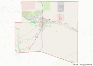
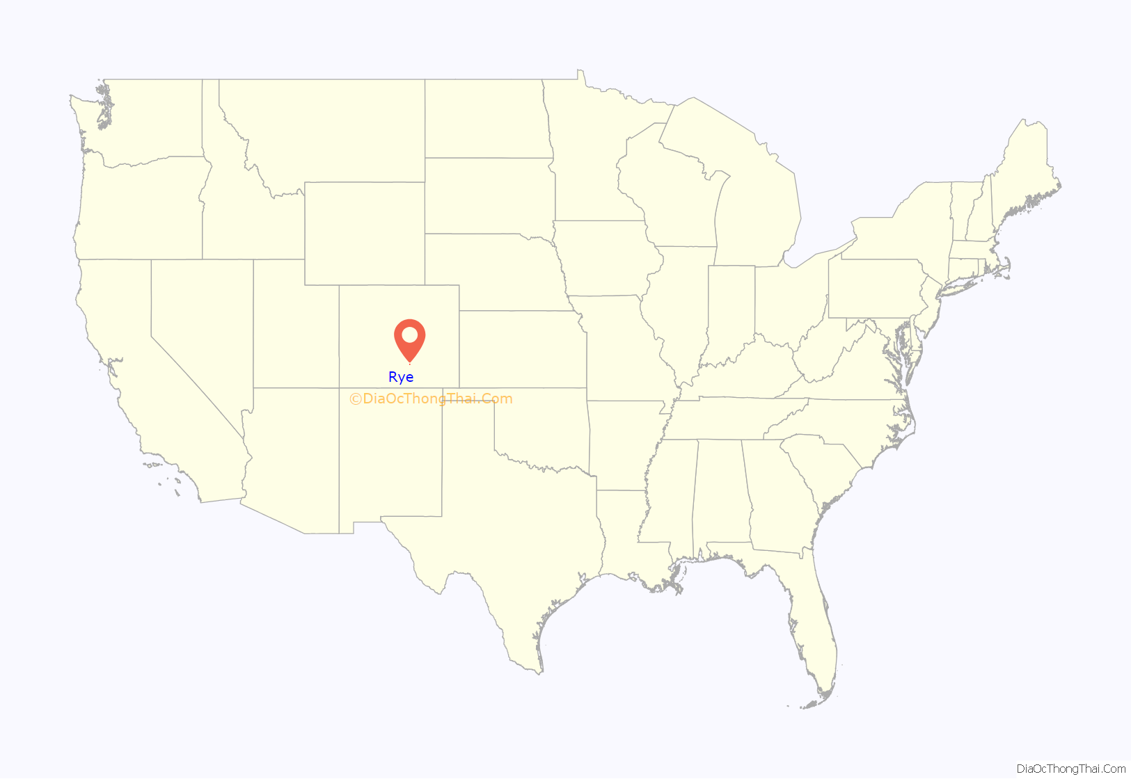
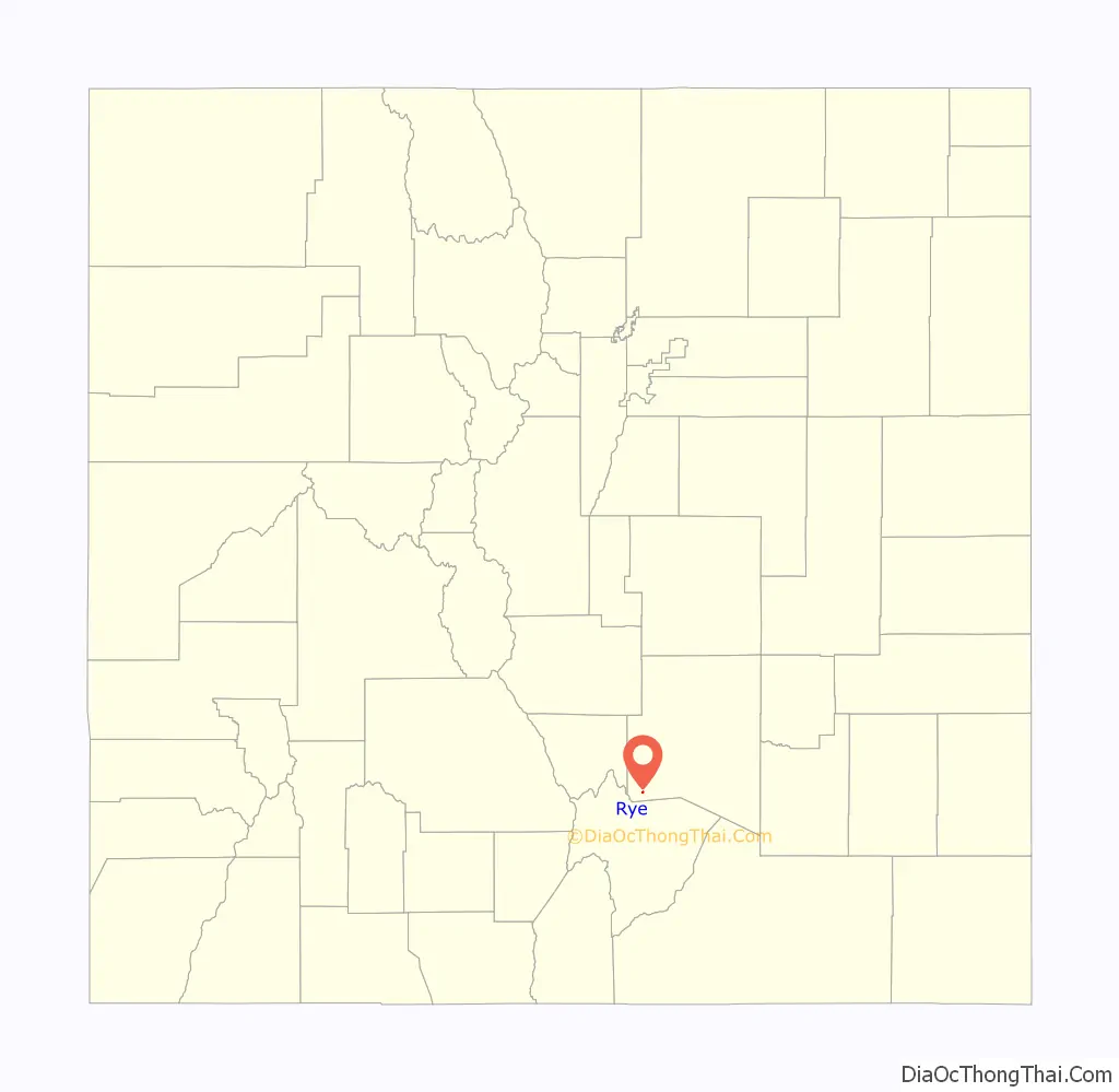
Rye location map. Where is Rye town?
Rye Road Map
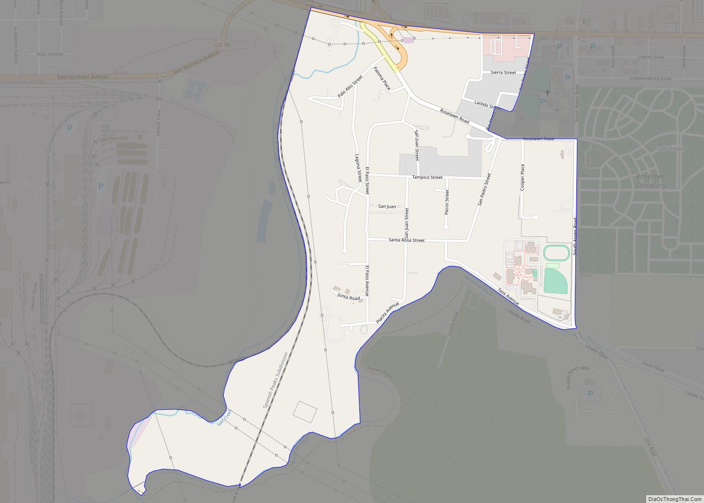
Rye city Satellite Map
Geography
Rye is located in the Greenhorn Valley at 37°55′19″N 104°55′48″W / 37.92194°N 104.93000°W / 37.92194; -104.93000 (37.921876, −104.929999).
According to the United States Census Bureau, the town has a total area of 0.1 square miles (0.26 km), all of it land.
Climate
Rye has a (Köppen Cfb), a climate type usually associated with maritime regions, but is also found in high elevation areas in which summer temperatures are moderated by altitude. Precipitation exceeds that of semi-arid places, and average winter temperatures exceed freezing (O°C, 32°F). This isolated pocket of climate exists due to the orographic enhancement of precipitation levels and summers moderated by altitude. Despite its Rye has much in common with other locations in its part of Colorado. Although conditions are not wet at any time of year, there is increased precipitation in March and April, as well as a snowfall maximum in March, with the snowiest periods being November and January through April. The North American Monsoon creates a second wet period in June and July. This climate features summers with warm daytime temperatures and mild to cool nights, along with chilly and snowy winters. Typical of its region, winters are quite variable, with December–February temperatures having ranged from as low as −36 °F (−38 °C) to as high as 76 °F (24.4 °C). The all-time record high is 101 °F (38.3 °C), set on June 21, 1981, and the all-time record low is −36 °F (−37.8 °C), set on January 12, 1963.
See also
Map of Colorado State and its subdivision:- Adams
- Alamosa
- Arapahoe
- Archuleta
- Baca
- Bent
- Boulder
- Broomfield
- Chaffee
- Cheyenne
- Clear Creek
- Conejos
- Costilla
- Crowley
- Custer
- Delta
- Denver
- Dolores
- Douglas
- Eagle
- El Paso
- Elbert
- Fremont
- Garfield
- Gilpin
- Grand
- Gunnison
- Hinsdale
- Huerfano
- Jackson
- Jefferson
- Kiowa
- Kit Carson
- La Plata
- Lake
- Larimer
- Las Animas
- Lincoln
- Logan
- Mesa
- Mineral
- Moffat
- Montezuma
- Montrose
- Morgan
- Otero
- Ouray
- Park
- Phillips
- Pitkin
- Prowers
- Pueblo
- Rio Blanco
- Rio Grande
- Routt
- Saguache
- San Juan
- San Miguel
- Sedgwick
- Summit
- Teller
- Washington
- Weld
- Yuma
- Alabama
- Alaska
- Arizona
- Arkansas
- California
- Colorado
- Connecticut
- Delaware
- District of Columbia
- Florida
- Georgia
- Hawaii
- Idaho
- Illinois
- Indiana
- Iowa
- Kansas
- Kentucky
- Louisiana
- Maine
- Maryland
- Massachusetts
- Michigan
- Minnesota
- Mississippi
- Missouri
- Montana
- Nebraska
- Nevada
- New Hampshire
- New Jersey
- New Mexico
- New York
- North Carolina
- North Dakota
- Ohio
- Oklahoma
- Oregon
- Pennsylvania
- Rhode Island
- South Carolina
- South Dakota
- Tennessee
- Texas
- Utah
- Vermont
- Virginia
- Washington
- West Virginia
- Wisconsin
- Wyoming