Miami Springs is a city in Miami-Dade County, Florida, United States. The city was founded by Glenn Hammond Curtiss, “The Father of Naval Aviation”, and James Bright, during the famous “land boom” of the 1920s and was originally named “Country Club Estates”. It, along with other cities in Miami-Dade County such as Coral Gables and Opa-locka, formed some of the first planned communities in the state. Like its counterparts, the city had an intended theme which in its case, was to reflect a particular architecture and ambiance.
In this case it was a regional style of architecture called Pueblo Revival developed in the American Southwest, primarily New Mexico, and incorporating design elements of pueblo architecture. Other buildings incorporated Mission-style design. In fact, the original Hotel Country Club was designed to resemble a pueblo village.
Shortly prior to incorporation in 1926, the city was renamed after a spring located in the area which provided parts of Miami with fresh water until the mid-1990s. As of 2020, the population recorded by the U.S. Census Bureau was 13,859.
| Name: | Miami Springs city |
|---|---|
| LSAD Code: | 25 |
| LSAD Description: | city (suffix) |
| State: | Florida |
| County: | Miami-Dade County |
| Incorporated: | August 23, 1926 |
| Elevation: | 6 ft (2 m) |
| Total Area: | 2.98 sq mi (7.73 km²) |
| Land Area: | 2.88 sq mi (7.46 km²) |
| Water Area: | 0.11 sq mi (0.27 km²) |
| Total Population: | 13,859 |
| Population Density: | 4,813.82/sq mi (1,858.78/km²) |
| ZIP code: | 33166, 33142 (Miami) |
| Area code: | 305, 786 |
| FIPS code: | 1245200 |
| GNISfeature ID: | 0286762 |
| Website: | www.miamisprings-fl.gov |
Online Interactive Map
Click on ![]() to view map in "full screen" mode.
to view map in "full screen" mode.
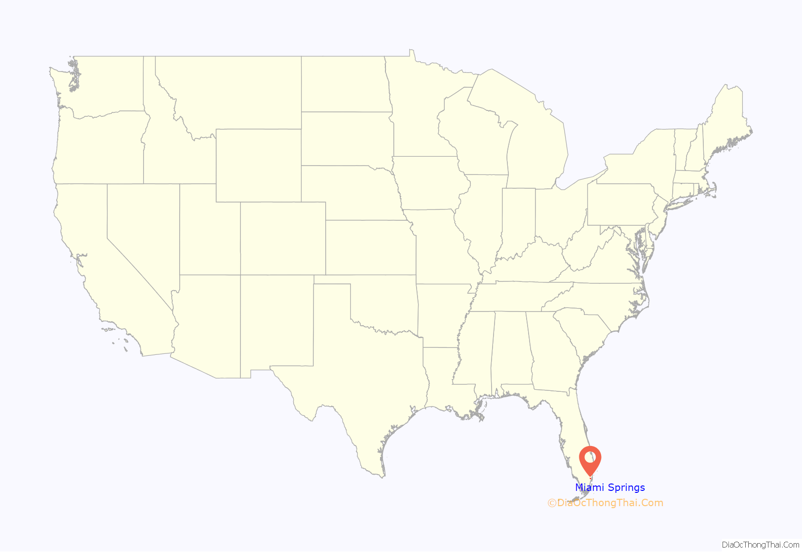
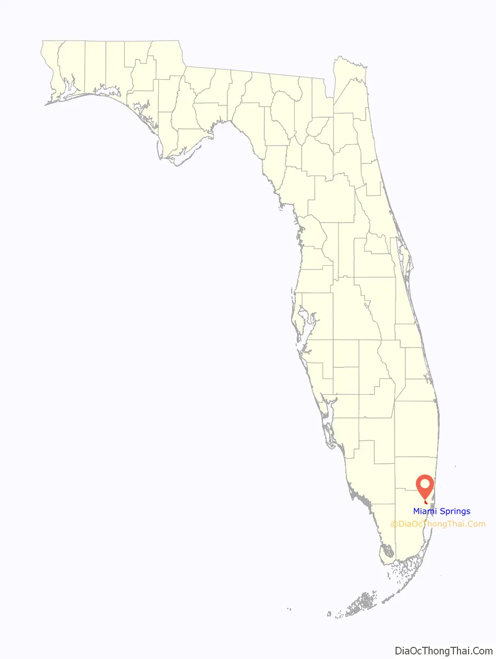
Miami Springs location map. Where is Miami Springs city?
History
Miami Springs was founded by an aviation pioneer, and thus, the fate of the city has always been intertwined with the aviation industry, particularly since Miami International Airport (MIA) is located just south of the city on the southern border of NW 36th Street. The airline industry brought many residents from airline crew bases, as well as employment opportunities at the airport, which brought much prosperity to the city. This dependence, however, left the city vulnerable. The sudden 1991 collapses of both Eastern Airlines and Pan American World Airways left many Miami Springs residents unemployed and unable to afford living in the neighborhood. Given that the businesses in Miami Springs had always relied upon the large disposable incomes of the employees of the large airline carriers, the bankruptcy of both corporations in the same year created a chain reaction, eventually causing many small businesses to close their doors. Despite the closure of the airlines, from a residential standpoint, Miami Springs remained strong. The city is often seen as blessedly isolated from the perceived turbulence of the rest of Miami-Dade County. This has continued to provide ample replacements for the older residents who are lost over time. Nonetheless the legacy of the airline closures remains. Residential millage taxation rates hover near the state mandated maximum.
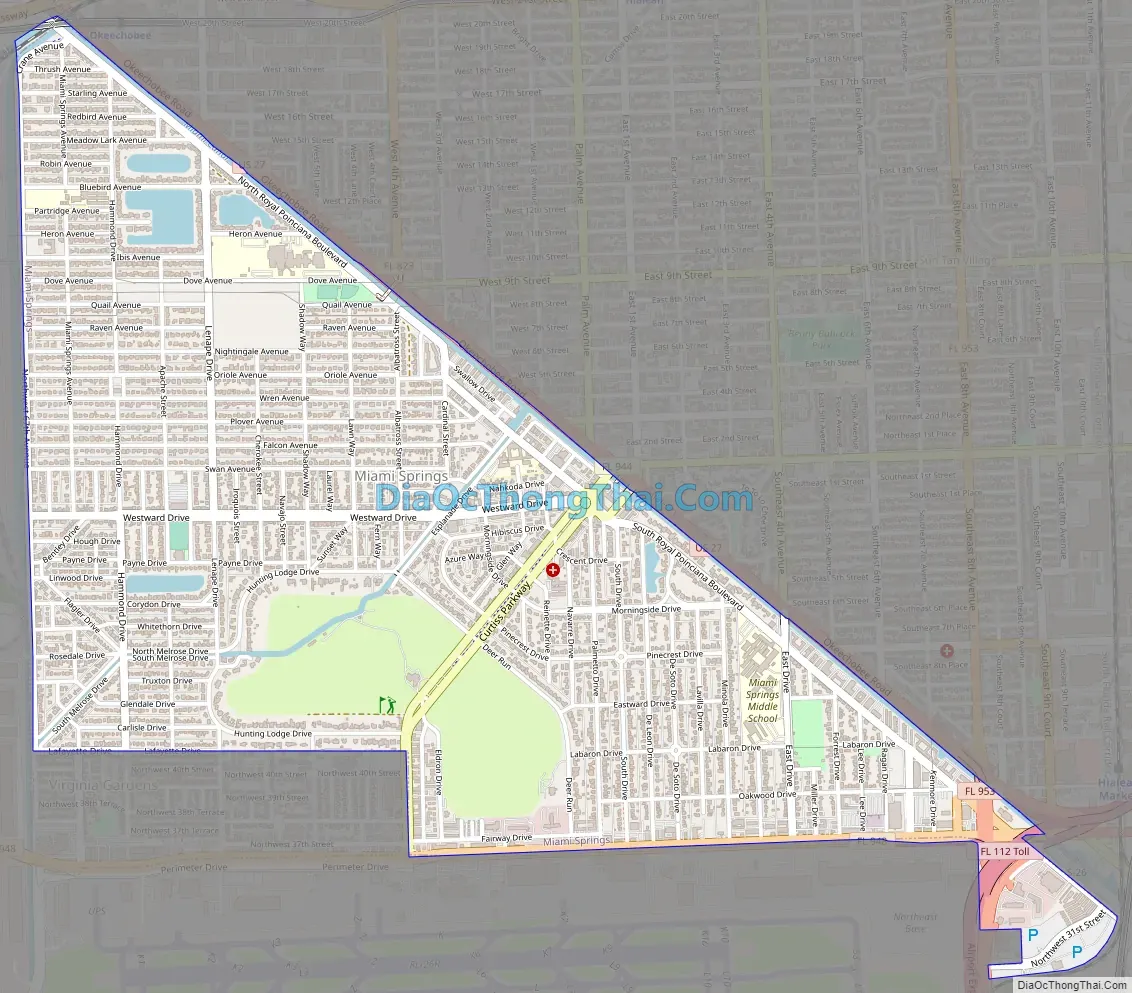
Miami Springs Road Map
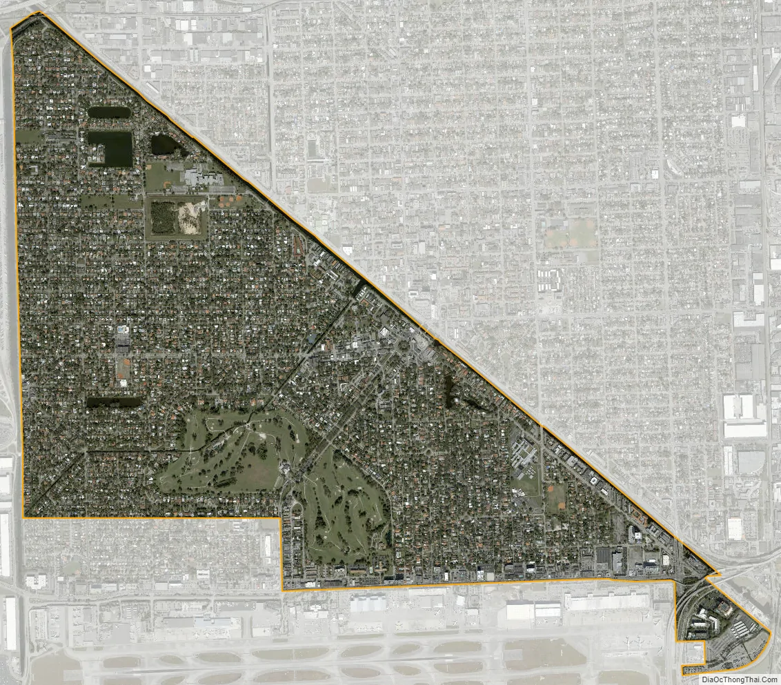
Miami Springs city Satellite Map
Geography
Miami Springs is located northwest of downtown Miami at 25°49′11″N 80°17′28″W / 25.819725°N 80.291071°W / 25.819725; -80.291071. It is bordered to the northeast by the city of Hialeah and to the southwest by the village of Virginia Gardens. U.S. Route 27 runs parallel to the Miami Springs/Hialeah border. It leads east 6 miles (10 km) to its southern terminus at U.S. Route 1 in Wynwood, Miami, and northwest 4 miles (6 km) to Hialeah Gardens. To the south Miami Springs is bordered by Miami International Airport.
According to the United States Census Bureau, Miami Springs has a total area of 3.0 square miles (7.8 km). 2.9 square miles (7.5 km) of it are land and 0.1 square miles (0.26 km) of it (3.55%) are water.
The core of Miami Springs (excluding the more recently annexed areas) is roughly shaped as a triangle with three definable sides. Northwest 36th Street forms most of the southern boundary, while the Miami River canal forms the northern/eastern boundary. Finally, the Ludlam Canal and Florida East Coast Railroad Yard delimit the western boundary.
Surrounding areas
- Hialeah
- Medley Miami
- Unincorporated Miami-Dade County, Virginia Gardens Hialeah, Miami, Unincorporated Miami-Dade County
- Unincorporated Miami-Dade County Unincorporated Miami-Dade County
- Virginia Gardens, Miami International Airport
See also
Map of Florida State and its subdivision:- Alachua
- Baker
- Bay
- Bradford
- Brevard
- Broward
- Calhoun
- Charlotte
- Citrus
- Clay
- Collier
- Columbia
- Desoto
- Dixie
- Duval
- Escambia
- Flagler
- Franklin
- Gadsden
- Gilchrist
- Glades
- Gulf
- Hamilton
- Hardee
- Hendry
- Hernando
- Highlands
- Hillsborough
- Holmes
- Indian River
- Jackson
- Jefferson
- Lafayette
- Lake
- Lee
- Leon
- Levy
- Liberty
- Madison
- Manatee
- Marion
- Martin
- Miami-Dade
- Monroe
- Nassau
- Okaloosa
- Okeechobee
- Orange
- Osceola
- Palm Beach
- Pasco
- Pinellas
- Polk
- Putnam
- Saint Johns
- Saint Lucie
- Santa Rosa
- Sarasota
- Seminole
- Sumter
- Suwannee
- Taylor
- Union
- Volusia
- Wakulla
- Walton
- Washington
- Alabama
- Alaska
- Arizona
- Arkansas
- California
- Colorado
- Connecticut
- Delaware
- District of Columbia
- Florida
- Georgia
- Hawaii
- Idaho
- Illinois
- Indiana
- Iowa
- Kansas
- Kentucky
- Louisiana
- Maine
- Maryland
- Massachusetts
- Michigan
- Minnesota
- Mississippi
- Missouri
- Montana
- Nebraska
- Nevada
- New Hampshire
- New Jersey
- New Mexico
- New York
- North Carolina
- North Dakota
- Ohio
- Oklahoma
- Oregon
- Pennsylvania
- Rhode Island
- South Carolina
- South Dakota
- Tennessee
- Texas
- Utah
- Vermont
- Virginia
- Washington
- West Virginia
- Wisconsin
- Wyoming


