Louisville is a village in Clay County, Illinois, United States, along the Little Wabash River. The population was 1,136 at the 2020 census. It is the county seat of Clay County.
The proper pronunciation of “Louisville” in the local dialect of mid-southern American is “Loose-vil” and is phonetically distinct from the southern American pronunciation of “lou-vle”
| Name: | Louisville village |
|---|---|
| LSAD Code: | 47 |
| LSAD Description: | village (suffix) |
| State: | Illinois |
| County: | Clay County |
| Total Area: | 0.83 sq mi (2.15 km²) |
| Land Area: | 0.83 sq mi (2.15 km²) |
| Water Area: | 0.00 sq mi (0.00 km²) |
| Total Population: | 1,136 |
| Population Density: | 1,371.98/sq mi (529.50/km²) |
| Area code: | 618 |
| FIPS code: | 1744927 |
| Website: | villageoflouisvilleil.com |
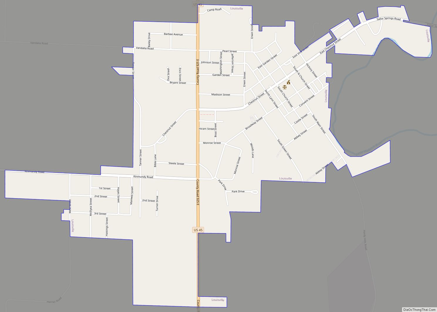
Online Interactive Map
Click on ![]() to view map in "full screen" mode.
to view map in "full screen" mode.
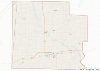
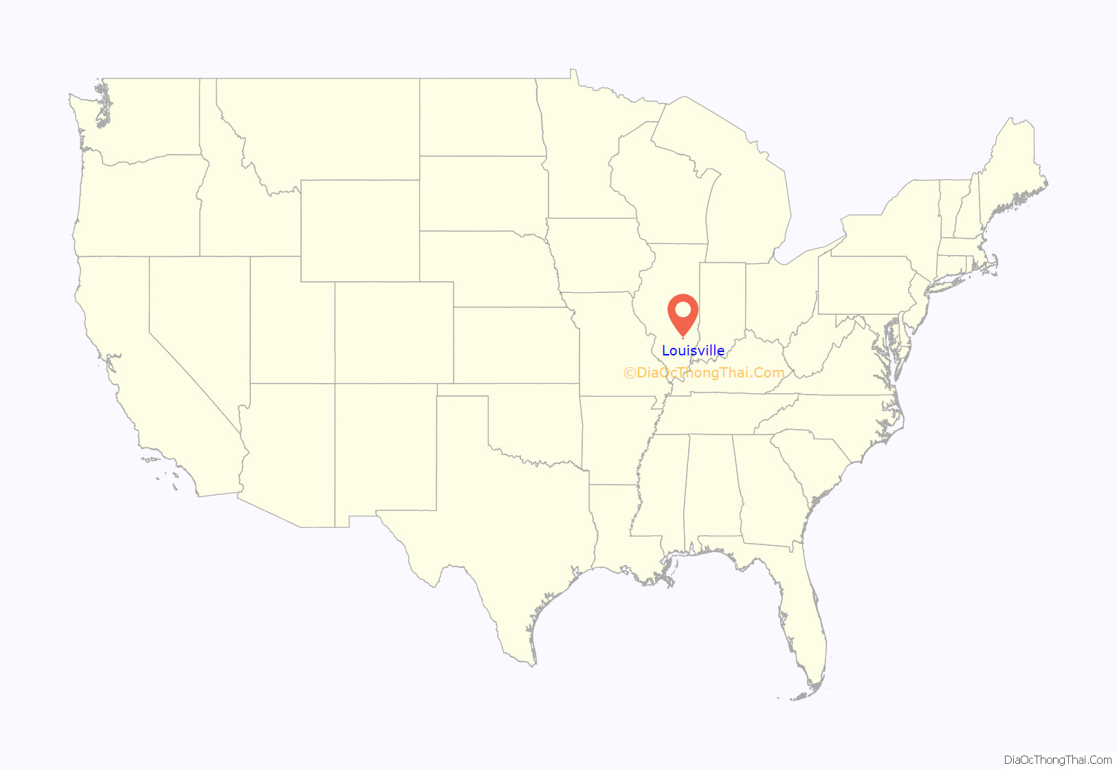
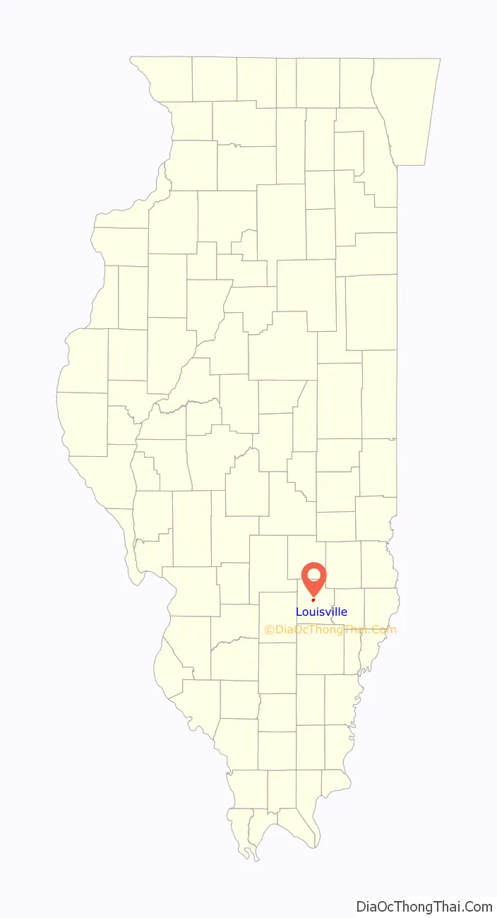
Louisville location map. Where is Louisville village?
History
The village was named for the Lewis family of settlers.
Grand Army of the Republic
The Grand Army of the Republic had a post known as the Louisville Post, No. 249 with the post name of William J. Stephenson. The post received its charter May 18, 1883.
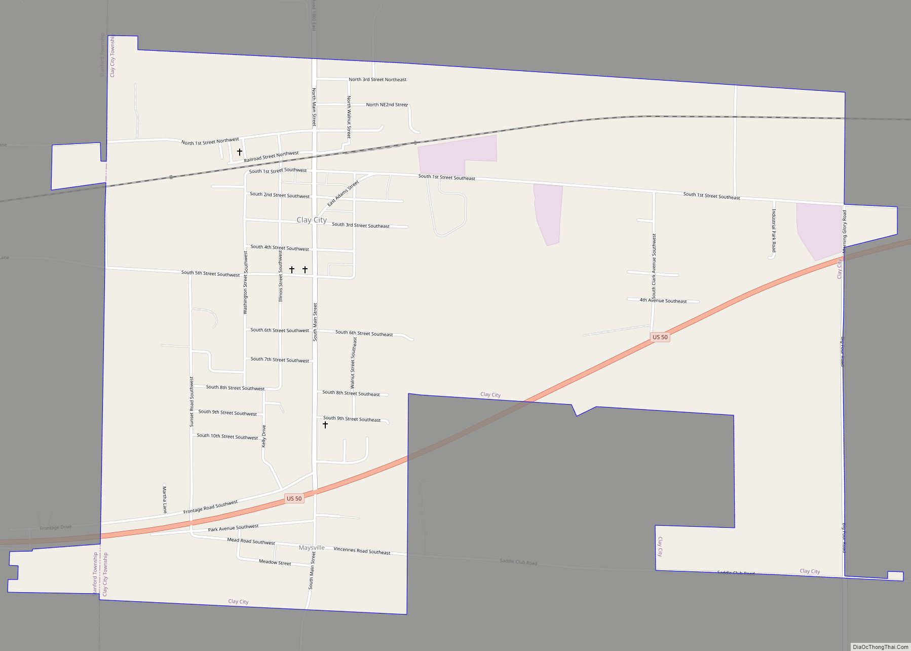
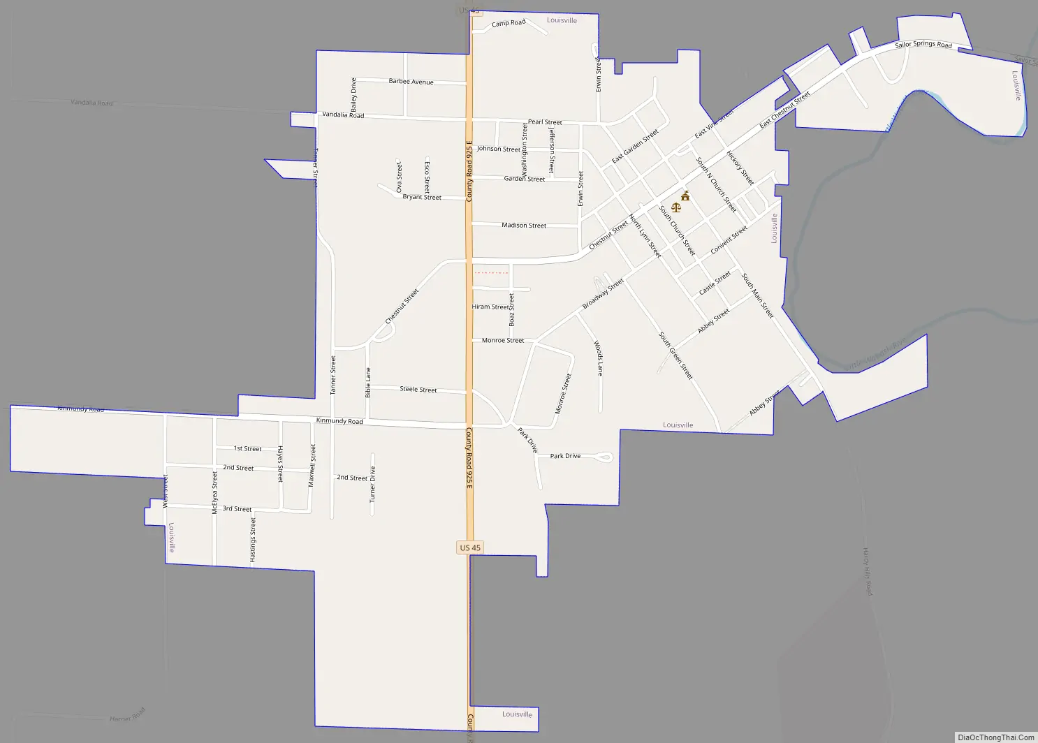
Louisville Road Map
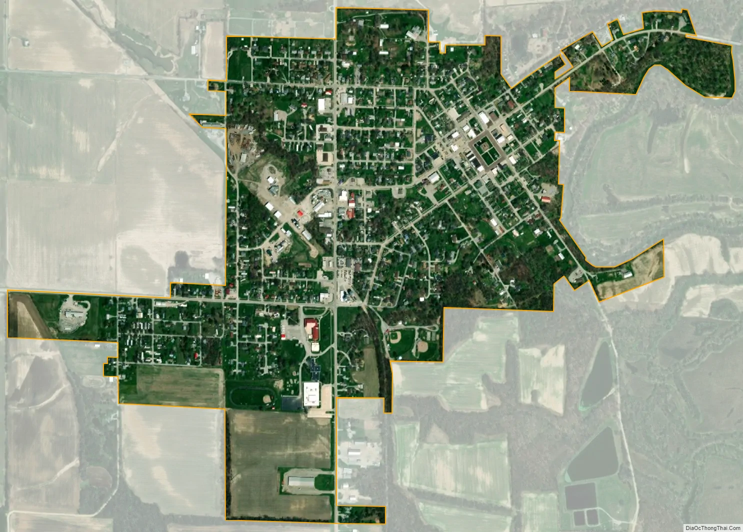
Louisville city Satellite Map
Geography
Louisville is located near the center of Clay County at 38°46′17″N 88°30′23″W / 38.77139°N 88.50639°W / 38.77139; -88.50639 (38.771356, -88.506301). U.S. Route 45 passes through the village, leading north 25 miles (40 km) to Effingham and south 8 miles (13 km) to Flora.
According to the 2021 census gazetteer files, Louisville has a total area of 0.83 square miles (2.15 km), all land. The Little Wabash River flows past the east side of the village.
See also
Map of Illinois State and its subdivision:- Adams
- Alexander
- Bond
- Boone
- Brown
- Bureau
- Calhoun
- Carroll
- Cass
- Champaign
- Christian
- Clark
- Clay
- Clinton
- Coles
- Cook
- Crawford
- Cumberland
- De Kalb
- De Witt
- Douglas
- Dupage
- Edgar
- Edwards
- Effingham
- Fayette
- Ford
- Franklin
- Fulton
- Gallatin
- Greene
- Grundy
- Hamilton
- Hancock
- Hardin
- Henderson
- Henry
- Iroquois
- Jackson
- Jasper
- Jefferson
- Jersey
- Jo Daviess
- Johnson
- Kane
- Kankakee
- Kendall
- Knox
- La Salle
- Lake
- Lake Michigan
- Lawrence
- Lee
- Livingston
- Logan
- Macon
- Macoupin
- Madison
- Marion
- Marshall
- Mason
- Massac
- McDonough
- McHenry
- McLean
- Menard
- Mercer
- Monroe
- Montgomery
- Morgan
- Moultrie
- Ogle
- Peoria
- Perry
- Piatt
- Pike
- Pope
- Pulaski
- Putnam
- Randolph
- Richland
- Rock Island
- Saint Clair
- Saline
- Sangamon
- Schuyler
- Scott
- Shelby
- Stark
- Stephenson
- Tazewell
- Union
- Vermilion
- Wabash
- Warren
- Washington
- Wayne
- White
- Whiteside
- Will
- Williamson
- Winnebago
- Woodford
- Alabama
- Alaska
- Arizona
- Arkansas
- California
- Colorado
- Connecticut
- Delaware
- District of Columbia
- Florida
- Georgia
- Hawaii
- Idaho
- Illinois
- Indiana
- Iowa
- Kansas
- Kentucky
- Louisiana
- Maine
- Maryland
- Massachusetts
- Michigan
- Minnesota
- Mississippi
- Missouri
- Montana
- Nebraska
- Nevada
- New Hampshire
- New Jersey
- New Mexico
- New York
- North Carolina
- North Dakota
- Ohio
- Oklahoma
- Oregon
- Pennsylvania
- Rhode Island
- South Carolina
- South Dakota
- Tennessee
- Texas
- Utah
- Vermont
- Virginia
- Washington
- West Virginia
- Wisconsin
- Wyoming