Agenda is a city in Republic County, Kansas, United States. As of the 2020 census, the population of the city was 47.
| Name: | Agenda city |
|---|---|
| LSAD Code: | 25 |
| LSAD Description: | city (suffix) |
| State: | Kansas |
| County: | Republic County |
| Founded: | 1880s |
| Incorporated: | 1916 |
| Elevation: | 1,414 ft (431 m) |
| Total Area: | 0.17 sq mi (0.45 km²) |
| Land Area: | 0.17 sq mi (0.45 km²) |
| Water Area: | 0.00 sq mi (0.00 km²) |
| Total Population: | 47 |
| Population Density: | 280/sq mi (100/km²) |
| ZIP code: | 66930 |
| Area code: | 785 |
| FIPS code: | 2000475 |
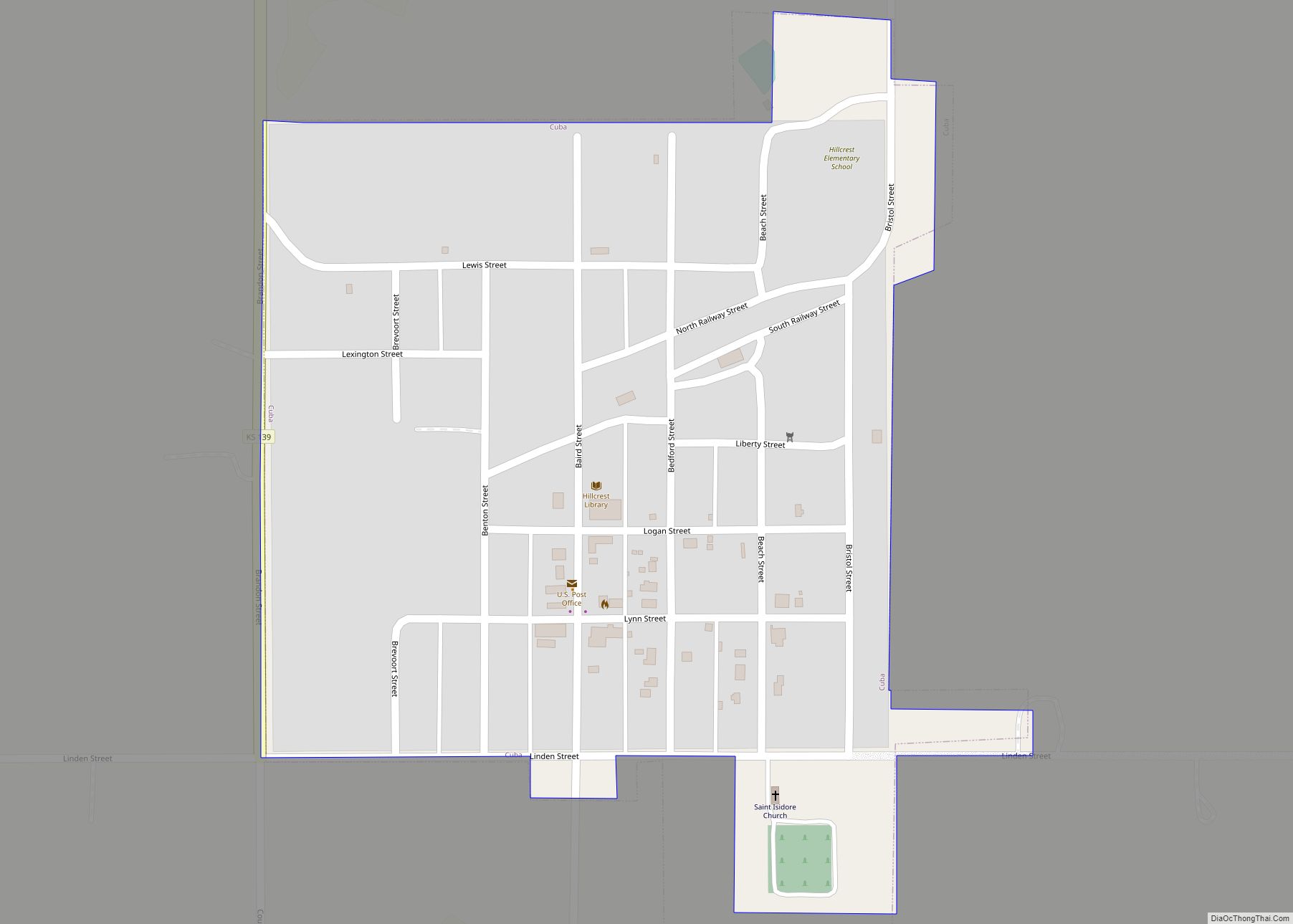
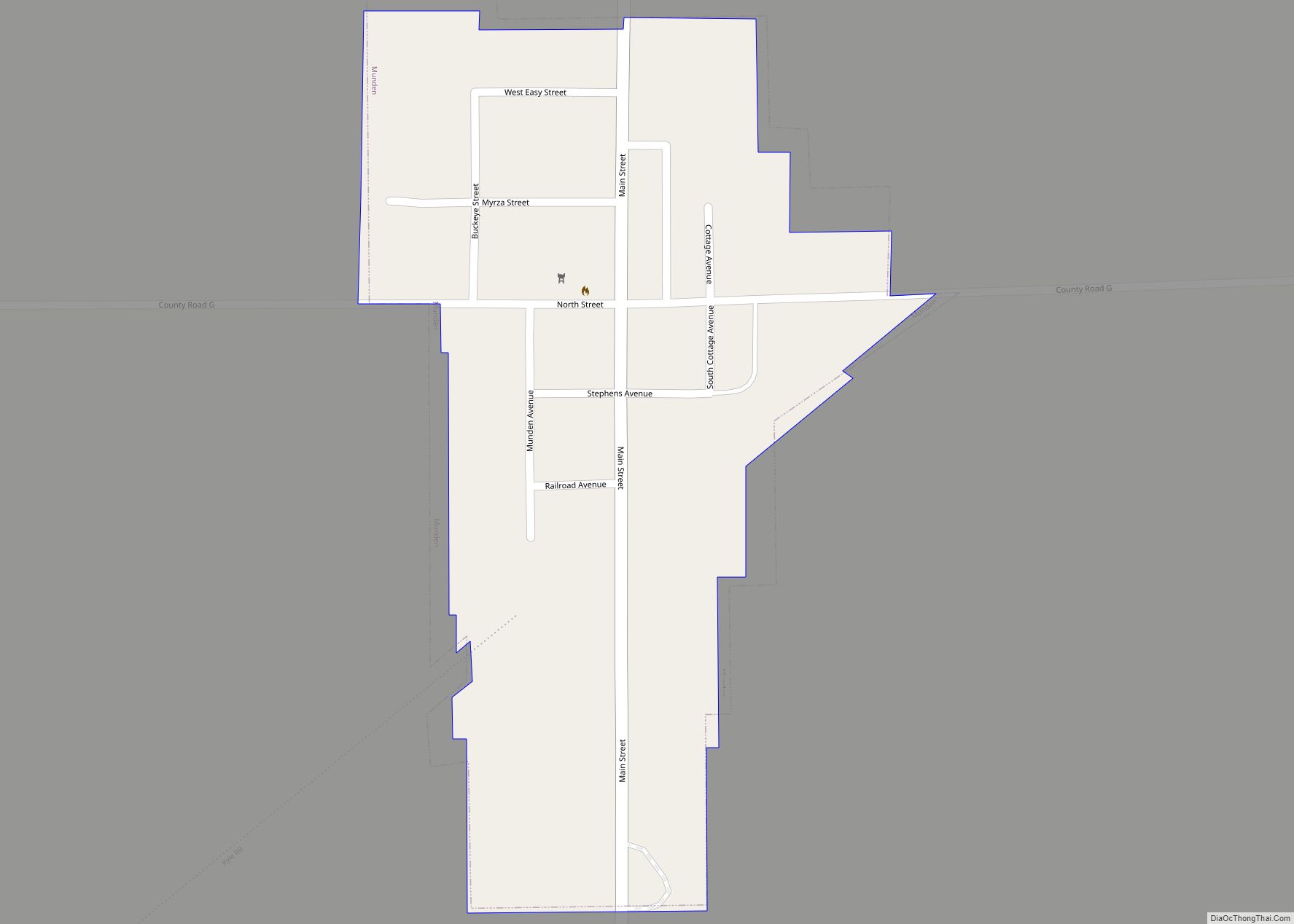
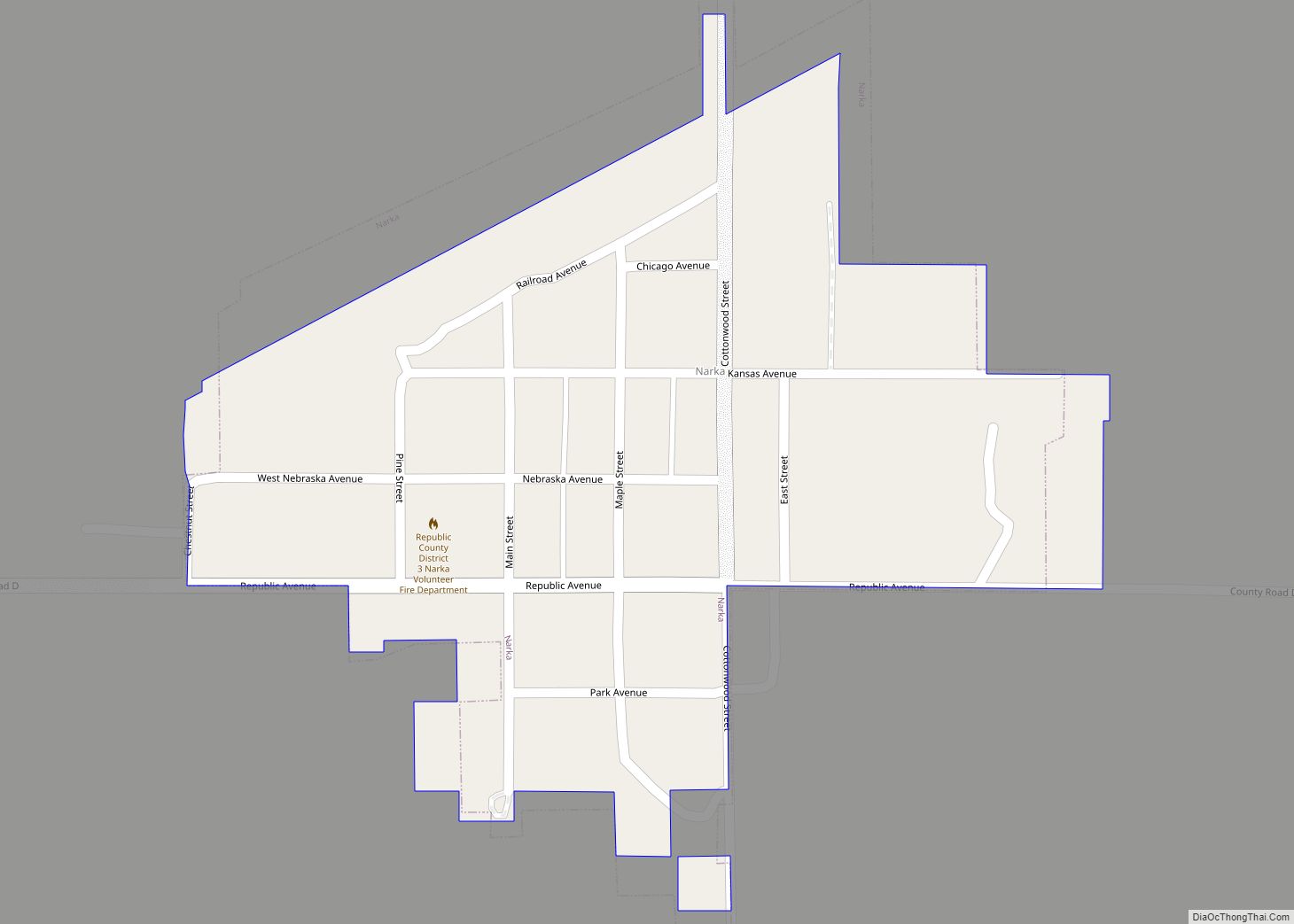
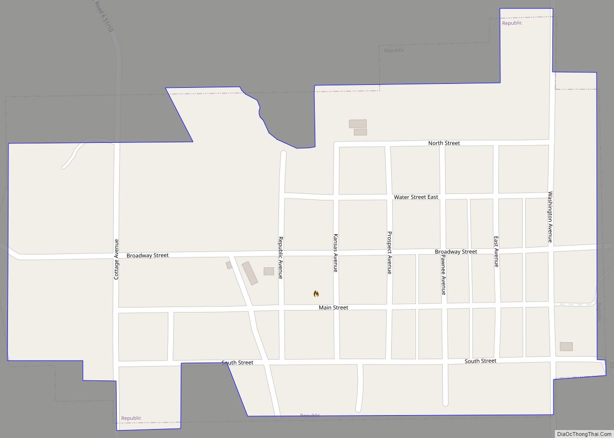
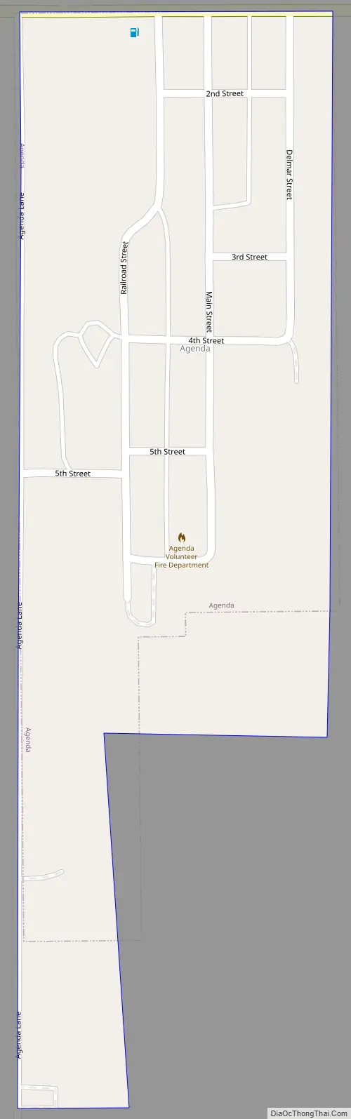
Online Interactive Map
Click on ![]() to view map in "full screen" mode.
to view map in "full screen" mode.
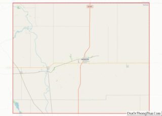
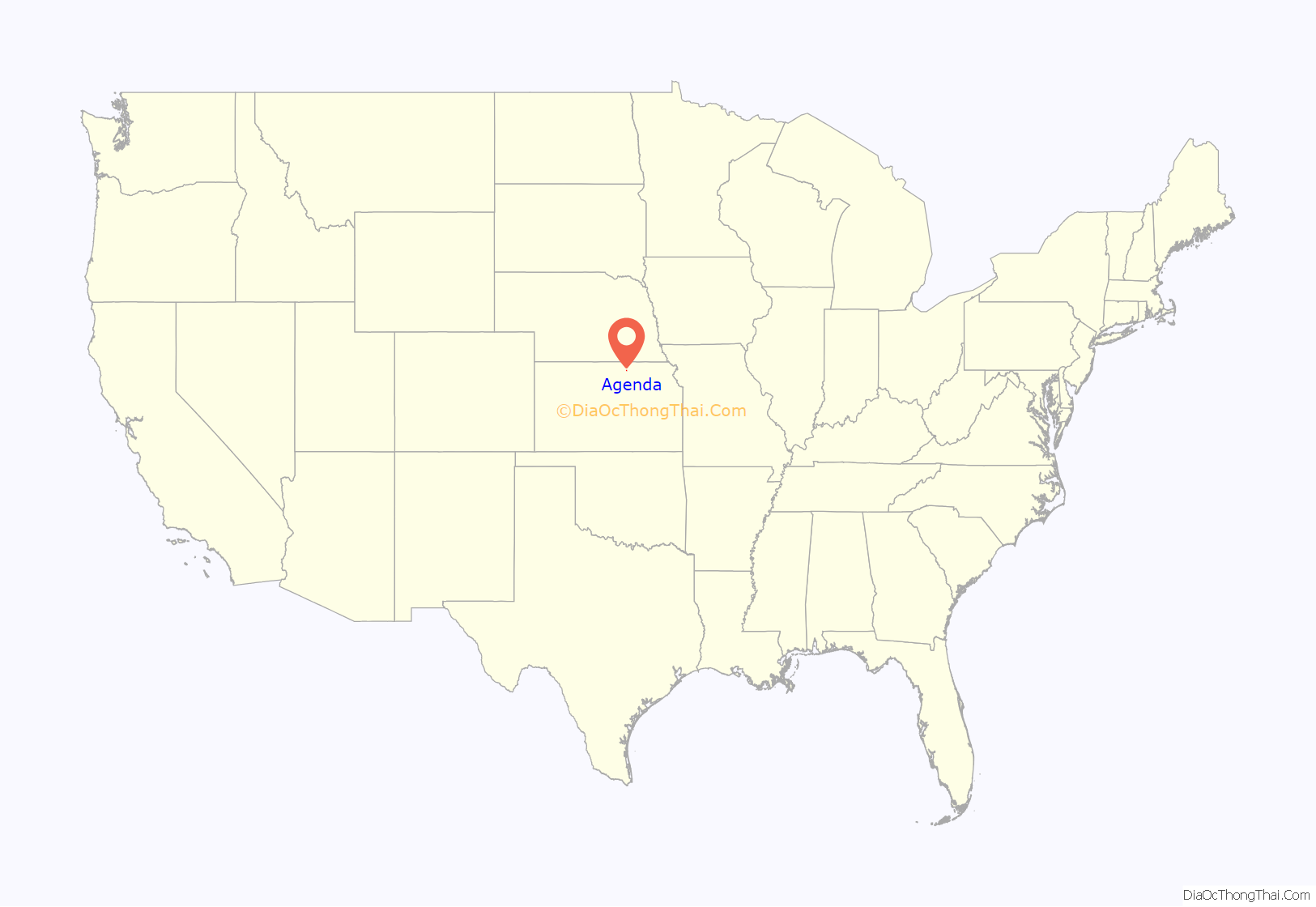
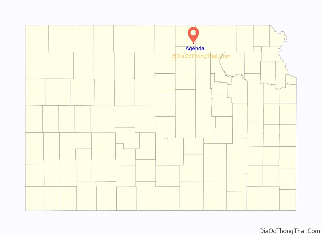
Agenda location map. Where is Agenda city?
History
Agenda (formerly Neva) was laid out in 1887 on the Chicago, Rock Island and Pacific Railroad line. The name Agenda derives from Latin meaning “what ought to be done”.
The first house in Agenda was erected by Joseph Cox in 1887. In the early 1900s, it had a money order post office with one rural delivery route, express and telegraph offices, several general stores and other business establishments, a bank, a grain elevator, and in 1910 reported a population of 200.
The post office in Agenda was discontinued in 1998.
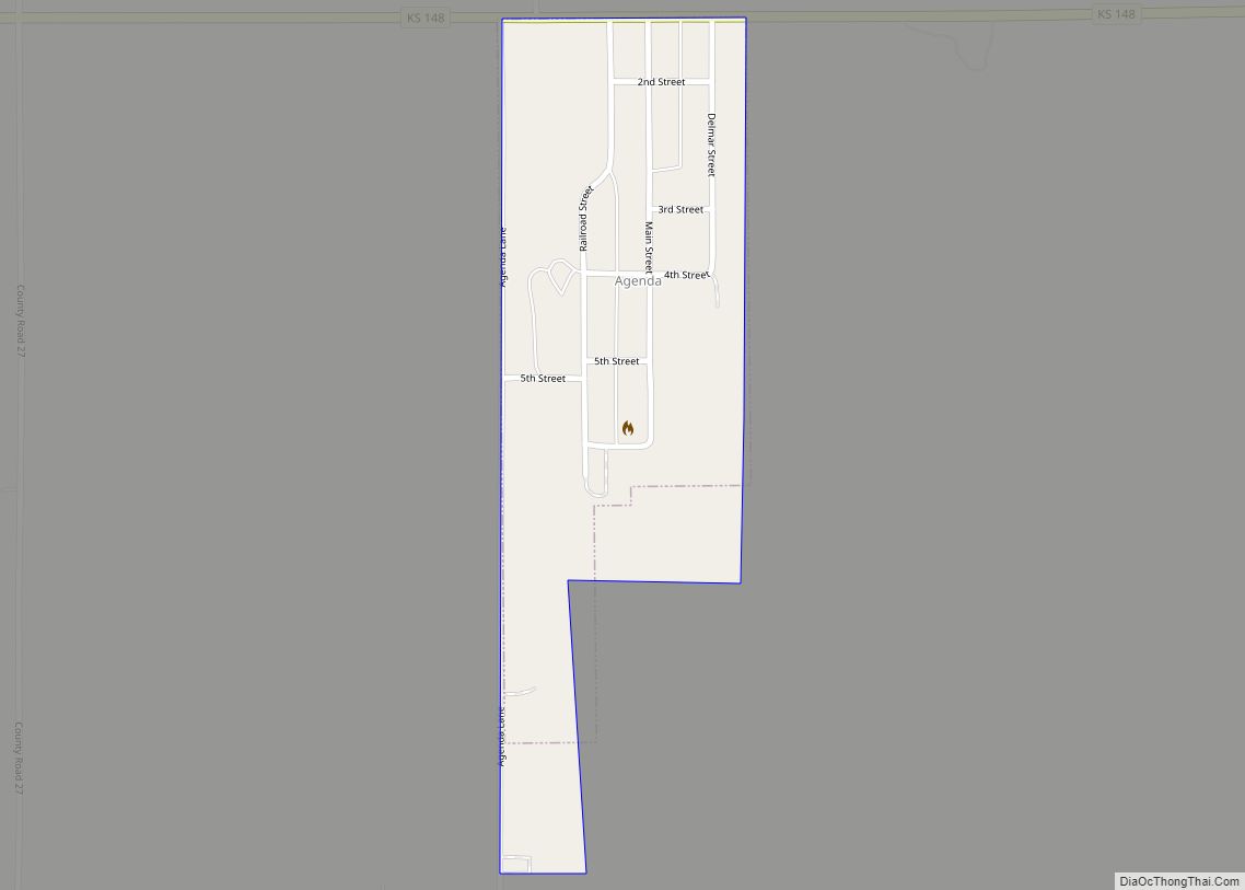
Agenda Road Map
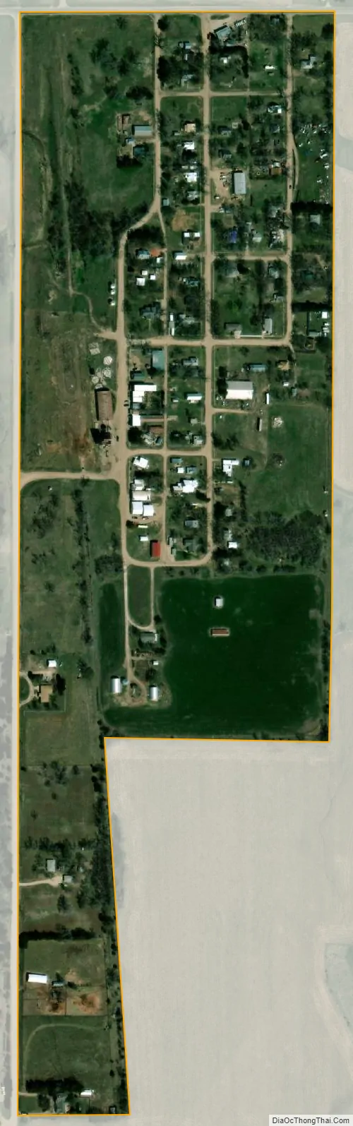
Agenda city Satellite Map
Geography
Agenda is located at 39°42′32″N 97°25′56″W / 39.70889°N 97.43222°W / 39.70889; -97.43222 (39.708897, -97.432156). According to the United States Census Bureau, the city has a total area of 0.15 square miles (0.39 km), all of it land.
See also
Map of Kansas State and its subdivision:- Allen
- Anderson
- Atchison
- Barber
- Barton
- Bourbon
- Brown
- Butler
- Chase
- Chautauqua
- Cherokee
- Cheyenne
- Clark
- Clay
- Cloud
- Coffey
- Comanche
- Cowley
- Crawford
- Decatur
- Dickinson
- Doniphan
- Douglas
- Edwards
- Elk
- Ellis
- Ellsworth
- Finney
- Ford
- Franklin
- Geary
- Gove
- Graham
- Grant
- Gray
- Greeley
- Greenwood
- Hamilton
- Harper
- Harvey
- Haskell
- Hodgeman
- Jackson
- Jefferson
- Jewell
- Johnson
- Kearny
- Kingman
- Kiowa
- Labette
- Lane
- Leavenworth
- Lincoln
- Linn
- Logan
- Lyon
- Marion
- Marshall
- McPherson
- Meade
- Miami
- Mitchell
- Montgomery
- Morris
- Morton
- Nemaha
- Neosho
- Ness
- Norton
- Osage
- Osborne
- Ottawa
- Pawnee
- Phillips
- Pottawatomie
- Pratt
- Rawlins
- Reno
- Republic
- Rice
- Riley
- Rooks
- Rush
- Russell
- Saline
- Scott
- Sedgwick
- Seward
- Shawnee
- Sheridan
- Sherman
- Smith
- Stafford
- Stanton
- Stevens
- Sumner
- Thomas
- Trego
- Wabaunsee
- Wallace
- Washington
- Wichita
- Wilson
- Woodson
- Wyandotte
- Alabama
- Alaska
- Arizona
- Arkansas
- California
- Colorado
- Connecticut
- Delaware
- District of Columbia
- Florida
- Georgia
- Hawaii
- Idaho
- Illinois
- Indiana
- Iowa
- Kansas
- Kentucky
- Louisiana
- Maine
- Maryland
- Massachusetts
- Michigan
- Minnesota
- Mississippi
- Missouri
- Montana
- Nebraska
- Nevada
- New Hampshire
- New Jersey
- New Mexico
- New York
- North Carolina
- North Dakota
- Ohio
- Oklahoma
- Oregon
- Pennsylvania
- Rhode Island
- South Carolina
- South Dakota
- Tennessee
- Texas
- Utah
- Vermont
- Virginia
- Washington
- West Virginia
- Wisconsin
- Wyoming