Scandia is a city in Republic County, Kansas, United States. As of the 2020 census, the population of the city was 344.
| Name: | Scandia city |
|---|---|
| LSAD Code: | 25 |
| LSAD Description: | city (suffix) |
| State: | Kansas |
| County: | Republic County |
| Founded: | 1868 |
| Incorporated: | 1879 |
| Elevation: | 1,440 ft (440 m) |
| Total Area: | 0.47 sq mi (1.22 km²) |
| Land Area: | 0.47 sq mi (1.22 km²) |
| Water Area: | 0.00 sq mi (0.00 km²) |
| Total Population: | 344 |
| Population Density: | 730/sq mi (280/km²) |
| ZIP code: | 66966 |
| Area code: | 785 |
| FIPS code: | 2063350 |
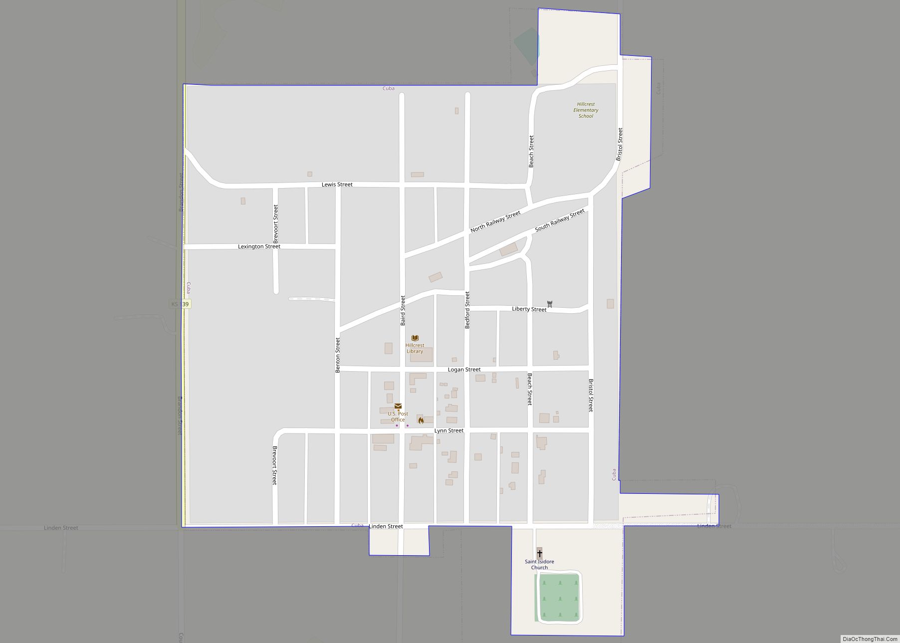
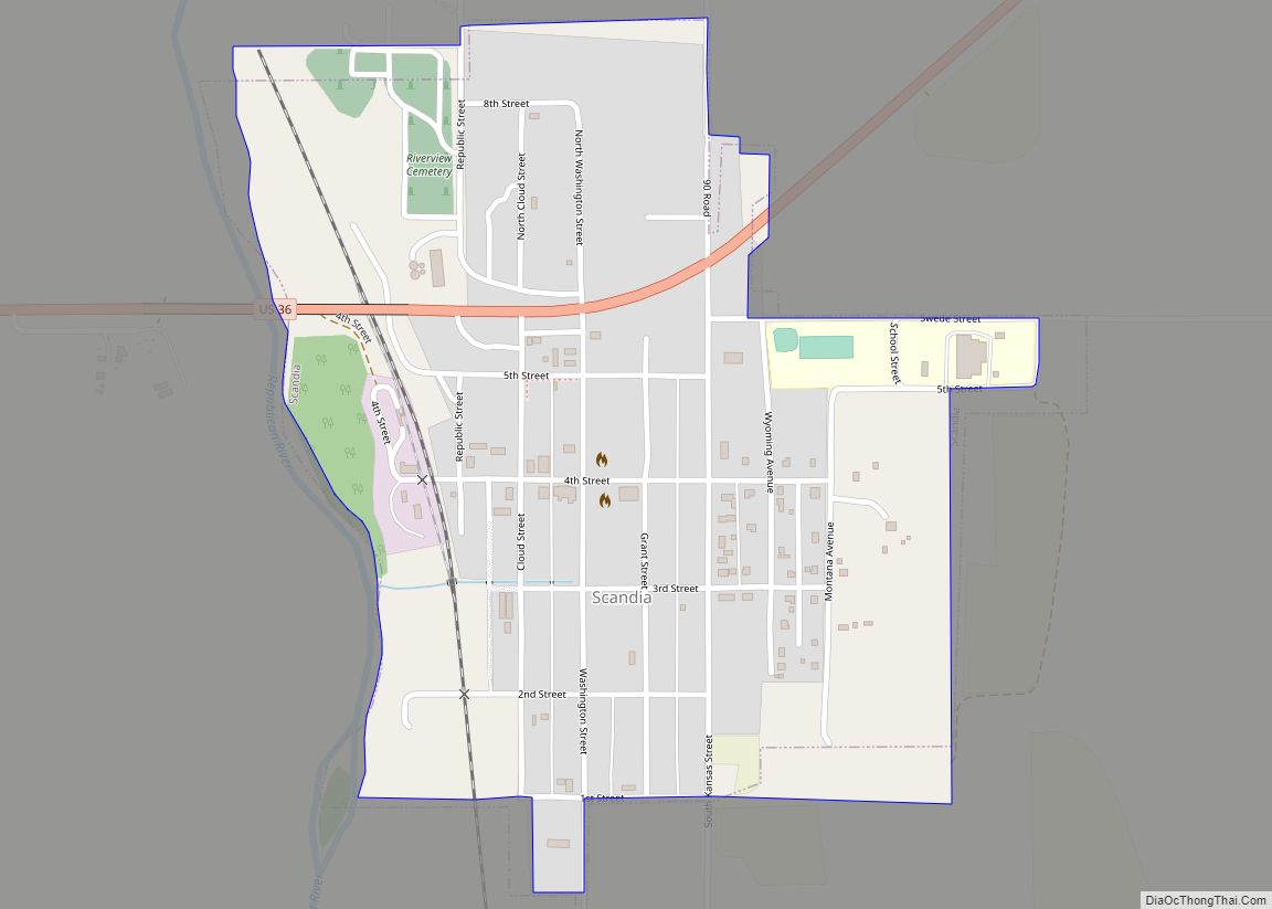
Online Interactive Map
Click on ![]() to view map in "full screen" mode.
to view map in "full screen" mode.
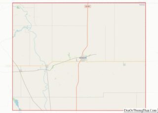
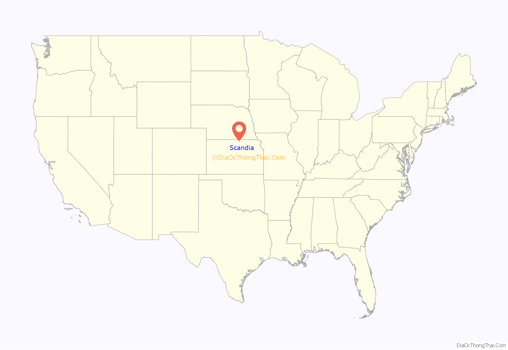
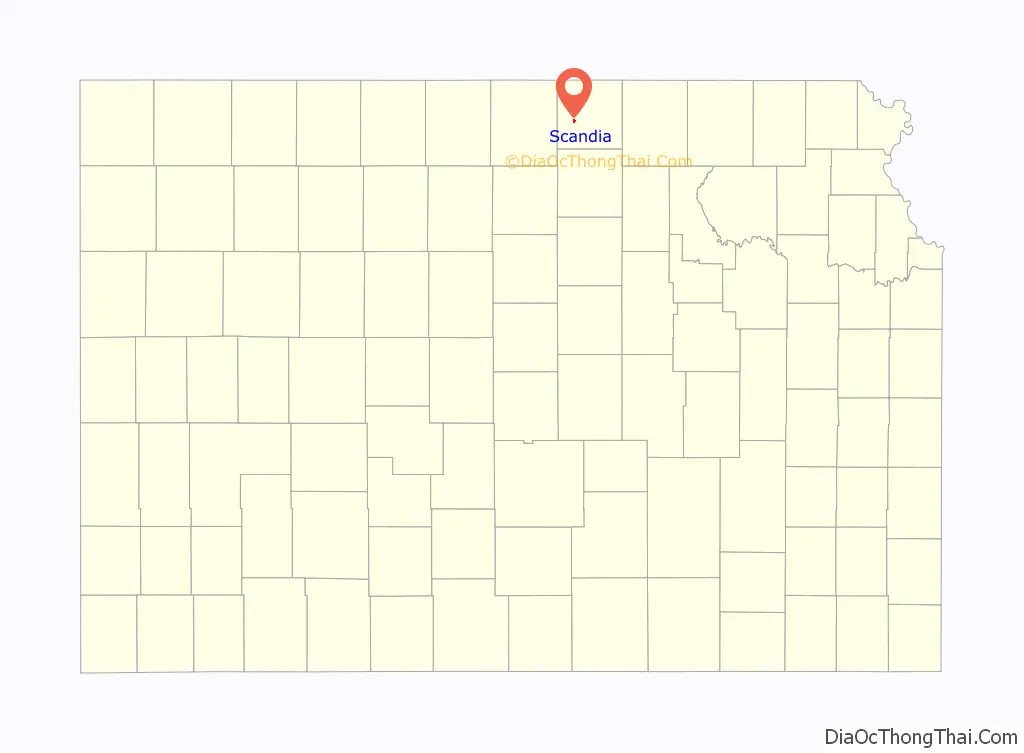
Scandia location map. Where is Scandia city?
History
The first American flag to be flown in what is now Kansas was raised in 1806 near the area of Scandia. The area was not settled until much later by Swedish immigrants and was first called New Scandinavia. The settlement of Scandia was promoted by crop failures during the 1860s in Sweden. In 1868, the Scandinavian Agricultural Society of Chicago purchased 12 sections of land along the Republican River and formed a colony. The name was changed to Scandia in 1876, according to post office records. Scandia was incorporated as a city in 1879. From there it became a transition point for trade and travel in the early 1900s. It is now a small rural community.
Scandia is the site of several historic houses dating to the early days of settlement. The three-story Wohlfort Mansion was built in the early 1890s by Thure Wohlfort (1835-1916) who was an early member of the society and one of the original founders of Scandia.
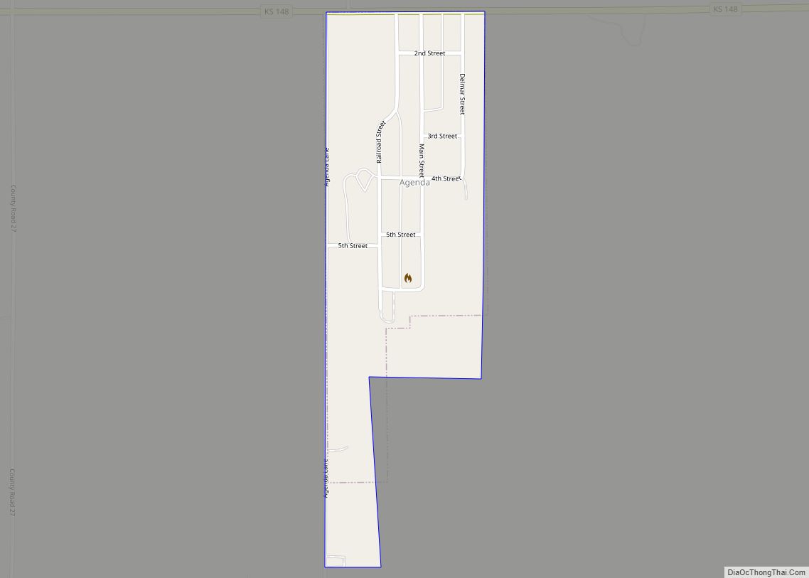
Scandia Road Map
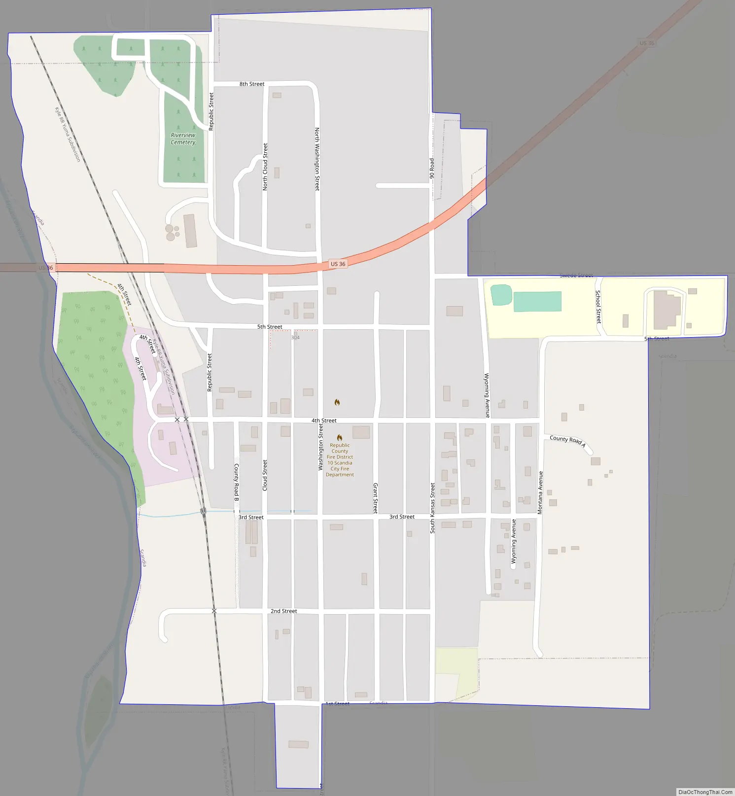
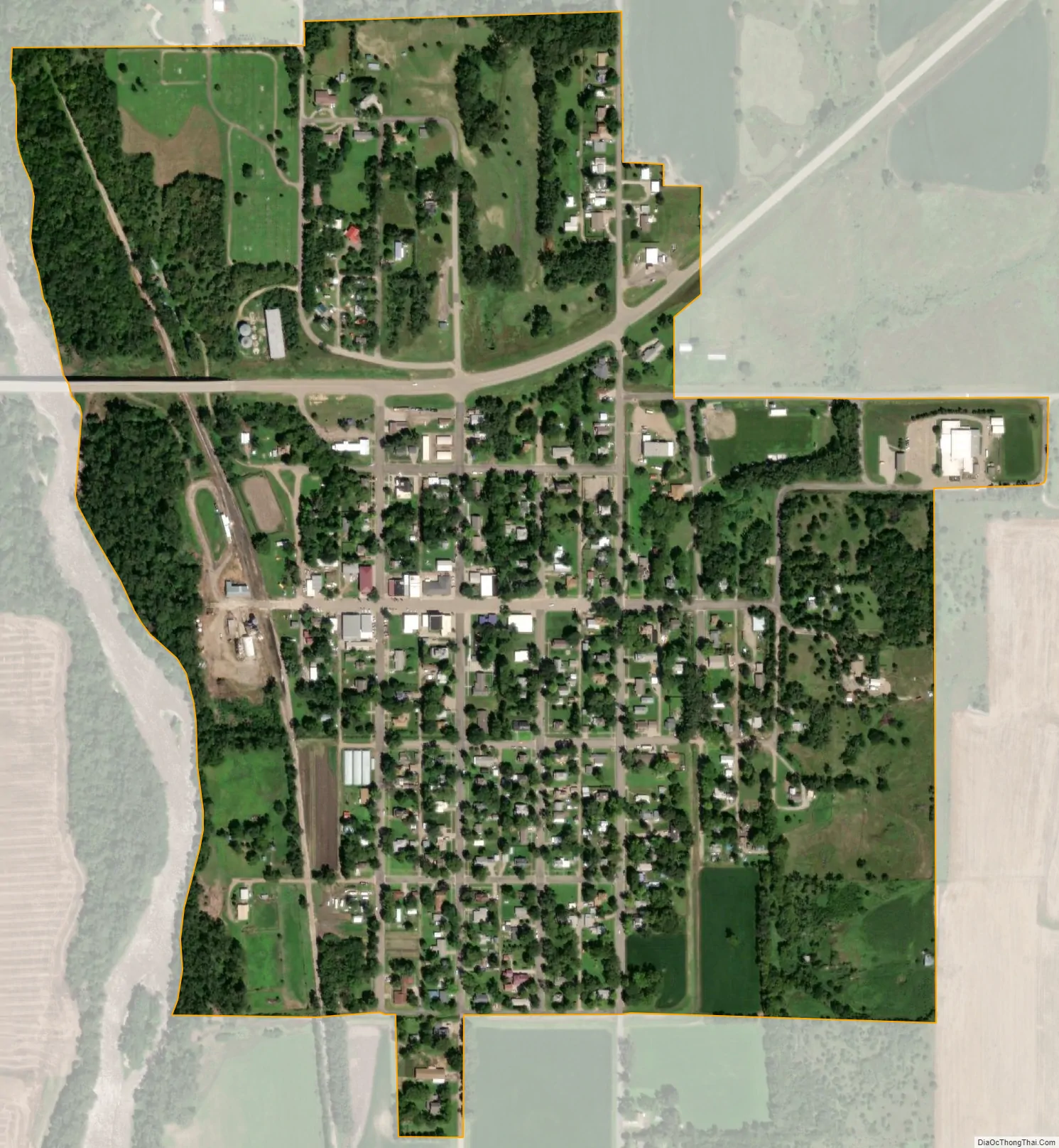
Scandia city Satellite Map
Geography
According to the United States Census Bureau, the city has a total area of 0.48 square miles (1.24 km), all of it land.
See also
Map of Kansas State and its subdivision:- Allen
- Anderson
- Atchison
- Barber
- Barton
- Bourbon
- Brown
- Butler
- Chase
- Chautauqua
- Cherokee
- Cheyenne
- Clark
- Clay
- Cloud
- Coffey
- Comanche
- Cowley
- Crawford
- Decatur
- Dickinson
- Doniphan
- Douglas
- Edwards
- Elk
- Ellis
- Ellsworth
- Finney
- Ford
- Franklin
- Geary
- Gove
- Graham
- Grant
- Gray
- Greeley
- Greenwood
- Hamilton
- Harper
- Harvey
- Haskell
- Hodgeman
- Jackson
- Jefferson
- Jewell
- Johnson
- Kearny
- Kingman
- Kiowa
- Labette
- Lane
- Leavenworth
- Lincoln
- Linn
- Logan
- Lyon
- Marion
- Marshall
- McPherson
- Meade
- Miami
- Mitchell
- Montgomery
- Morris
- Morton
- Nemaha
- Neosho
- Ness
- Norton
- Osage
- Osborne
- Ottawa
- Pawnee
- Phillips
- Pottawatomie
- Pratt
- Rawlins
- Reno
- Republic
- Rice
- Riley
- Rooks
- Rush
- Russell
- Saline
- Scott
- Sedgwick
- Seward
- Shawnee
- Sheridan
- Sherman
- Smith
- Stafford
- Stanton
- Stevens
- Sumner
- Thomas
- Trego
- Wabaunsee
- Wallace
- Washington
- Wichita
- Wilson
- Woodson
- Wyandotte
- Alabama
- Alaska
- Arizona
- Arkansas
- California
- Colorado
- Connecticut
- Delaware
- District of Columbia
- Florida
- Georgia
- Hawaii
- Idaho
- Illinois
- Indiana
- Iowa
- Kansas
- Kentucky
- Louisiana
- Maine
- Maryland
- Massachusetts
- Michigan
- Minnesota
- Mississippi
- Missouri
- Montana
- Nebraska
- Nevada
- New Hampshire
- New Jersey
- New Mexico
- New York
- North Carolina
- North Dakota
- Ohio
- Oklahoma
- Oregon
- Pennsylvania
- Rhode Island
- South Carolina
- South Dakota
- Tennessee
- Texas
- Utah
- Vermont
- Virginia
- Washington
- West Virginia
- Wisconsin
- Wyoming