Houghton (/ˈhoʊtən/; HO-tən) is the largest city and seat of government of Houghton County in the U.S. state of Michigan. Located on the Keweenaw Peninsula, Houghton is the largest city in the Copper Country region. It is the fifth-largest city in the Upper Peninsula, with a population of 8,386 at the 2020 census. Houghton is the principal city of the Houghton micropolitan area, which includes all of Houghton and Keweenaw counties. Houghton lies upon the Keweenaw Waterway, a partly natural, partly artificial waterway connecting at both ends to Lake Superior. Across the waterway from Houghton lies the city of Hancock.
The city of Houghton was named for Douglass Houghton, an American geologist and physician, primarily known for his exploration of the Keweenaw Peninsula. Houghton is home to Michigan Technological University, a public research college founded in 1885. Michigan Tech hosts a yearly Winter Carnival in February, drawing thousands of visitors from around the world. Michigan Tech’s athletic teams are nicknamed the Huskies, and compete primarily in the NCAA Division II Great Lakes Intercollegiate Athletic Conference (GLIAC). The Michigan Tech Huskies men’s ice hockey team competes in the NCAA Division I Central Collegiate Hockey Association (CCHA), and has won three national championships, in 1962, 1965, and 1975.
| Name: | Houghton city |
|---|---|
| LSAD Code: | 25 |
| LSAD Description: | city (suffix) |
| State: | Michigan |
| County: | Houghton County |
| Incorporated: | 1861 (village) 1970 (city) |
| Elevation: | 643 ft (196 m) |
| Total Area: | 4.65 sq mi (12.05 km²) |
| Land Area: | 4.41 sq mi (11.42 km²) |
| Water Area: | 0.24 sq mi (0.63 km²) 5.12% |
| Total Population: | 8,386 |
| Population Density: | 1,902.45/sq mi (734.53/km²) |
| Area code: | 906 |
| FIPS code: | 2639360 |
| GNISfeature ID: | 0628661 |
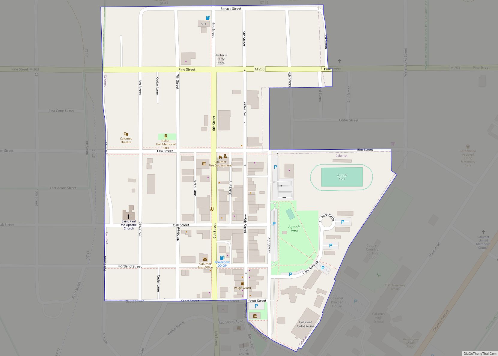
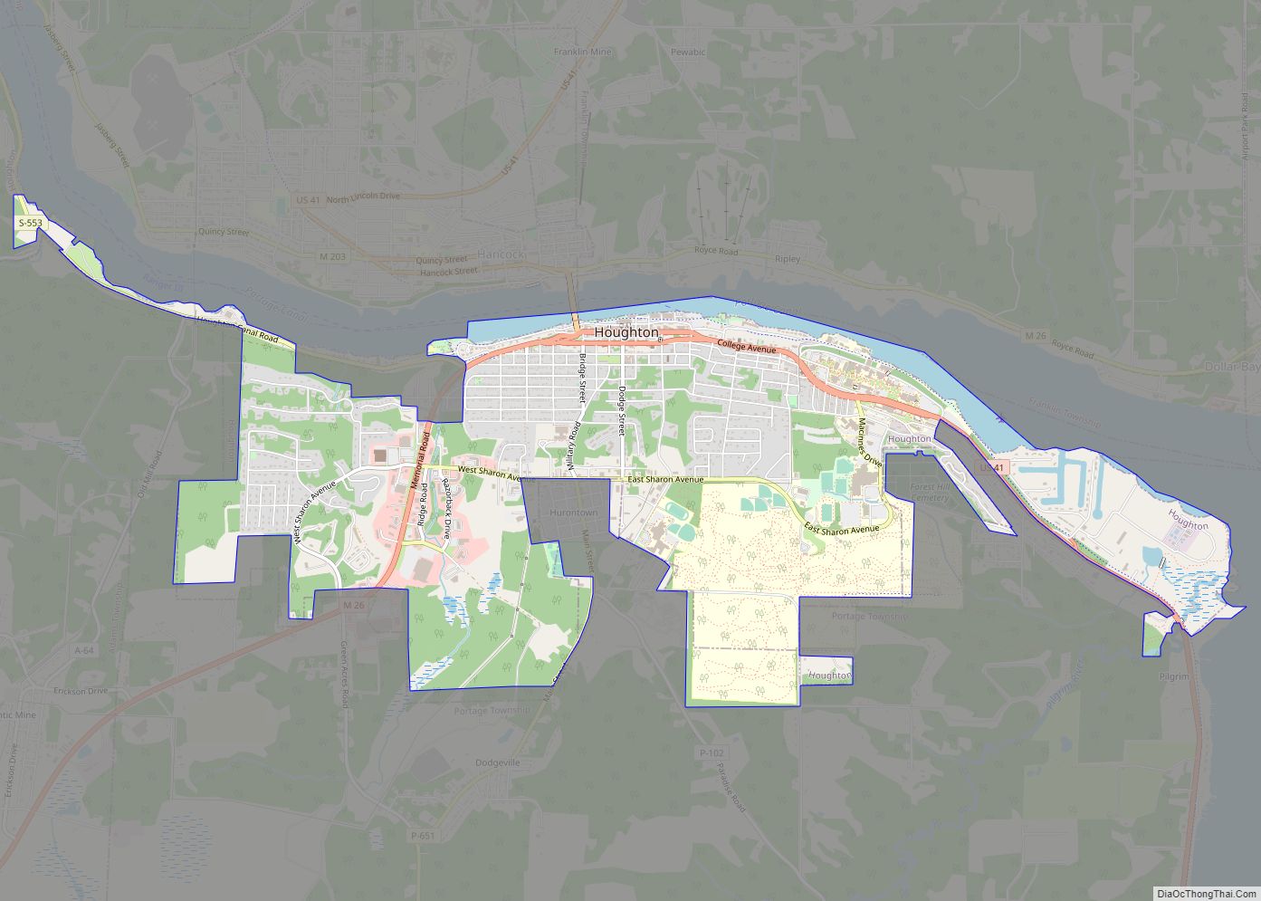
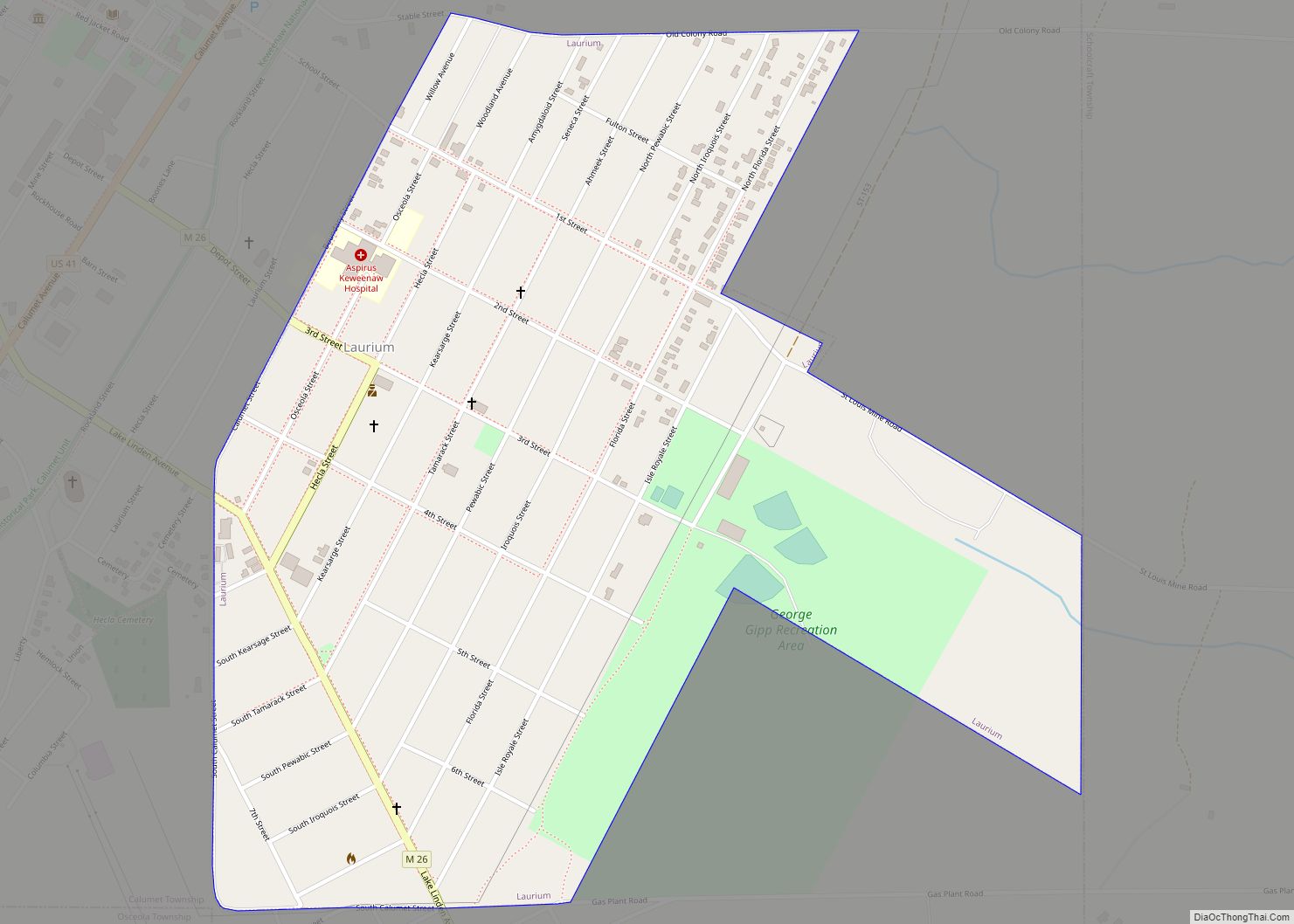
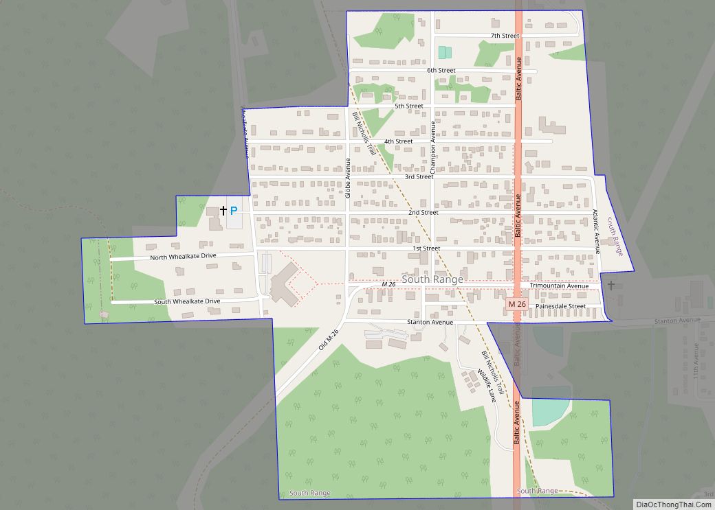
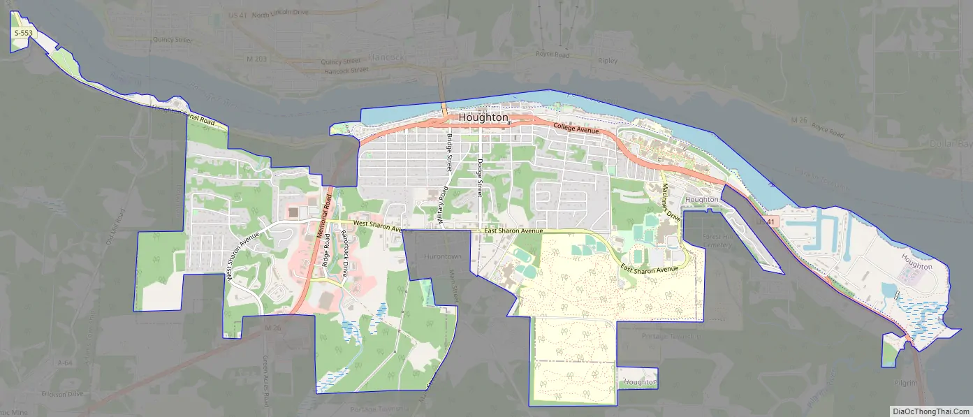
Online Interactive Map
Click on ![]() to view map in "full screen" mode.
to view map in "full screen" mode.
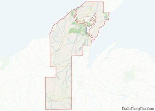
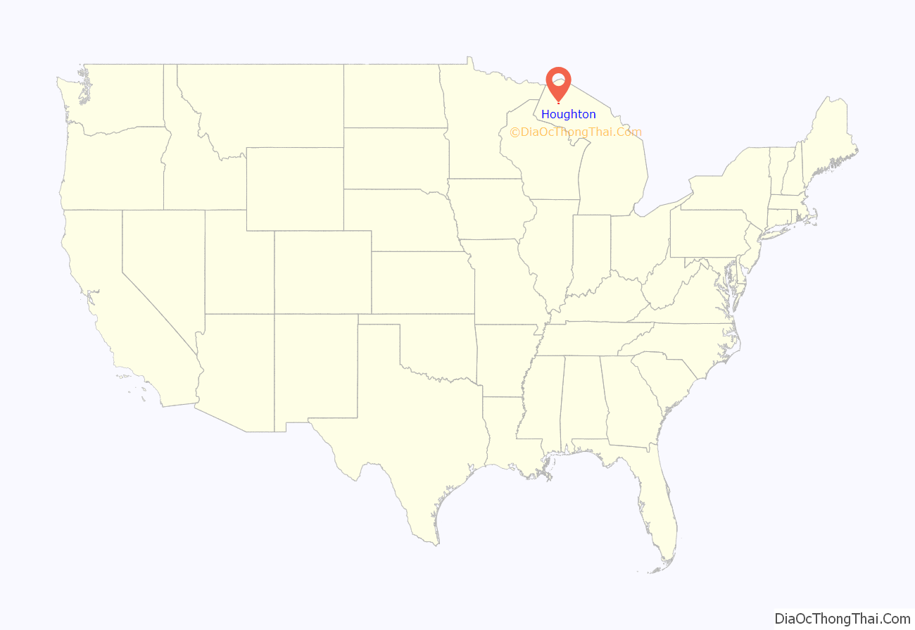
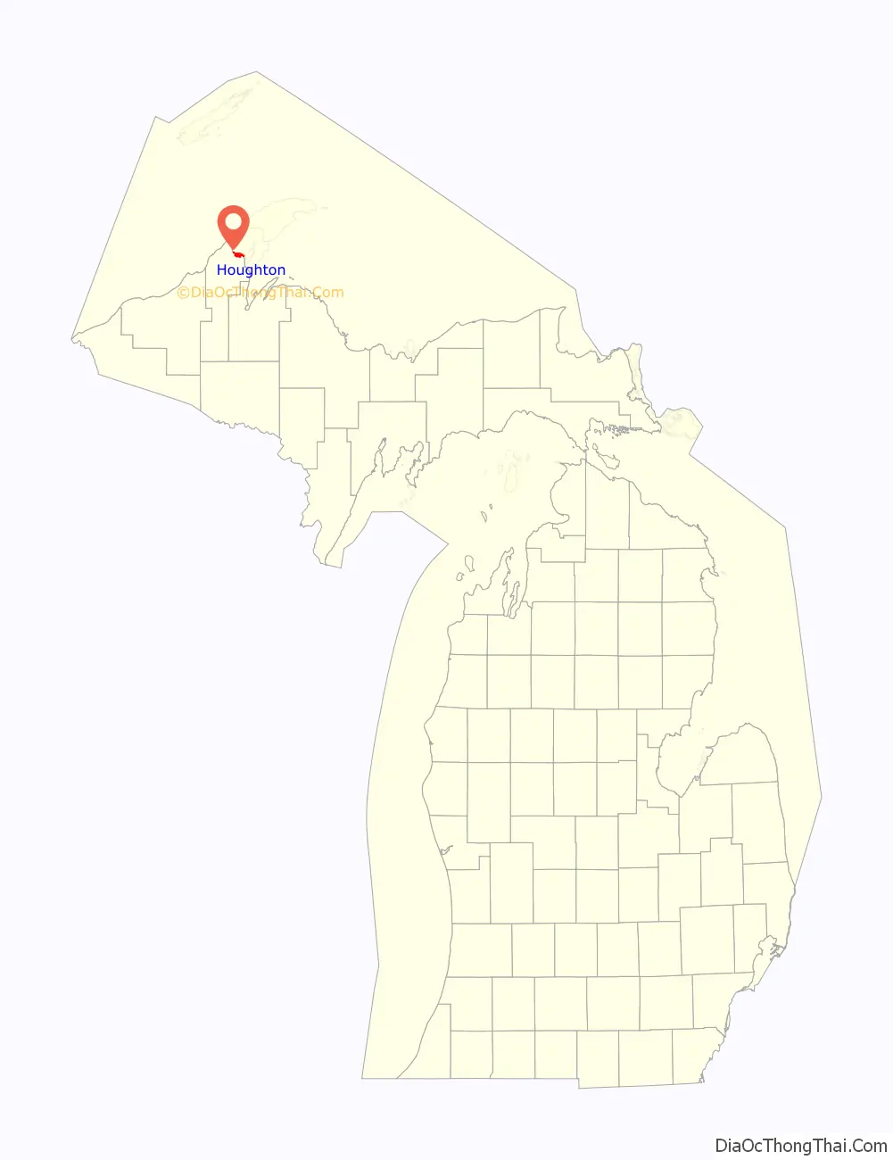
Houghton location map. Where is Houghton city?
History
Native Americans mined copper in and around what would later be Houghton thousands of years before European settlement. “French explorers had noted… [its] existence [in the area] as early as the seventeenth century, [and in] 1772 Alexander Henry had prospected for copper on the Ontonagon River near Victoria.”
Many Cornish and Finnish immigrants arrived in the Houghton area to work in the copper mines in the mining boom that made Copper Country on the Keweenaw Peninsula; both groups have had a great influence on the culture and cuisine of the local area. The Finns and others called much of the area Copper Island. Smaller numbers of French-Canadian immigrants moved to Houghton, while more of them settled elsewhere in Houghton County.
The last nearby mines closed in the late 1960s, but a school founded in 1885 by the Michigan State Legislature to teach metallurgy and mining engineering, the Michigan College of Mines, continues today under the name of Michigan Technological University and is the primary employer in the city.
The first known European settler of Houghton was named Ransom Shelden, who set up a store named Ransom’s near Portage Lake, though it is unclear whether this was in the same building as the 1852 Shelden and Shafer drugs, sometimes described as “the first commercial building constructed in Houghton,” which Shelden owned with his son Ransom B. The main street of Houghton, variously called “Sheldon Avenue,” (incorrectly) Sheldon Street, and Shelden Avenue, is named for him. In the 1970s the construction of a parking deck and the connection of downtown stores to create Shelden Center significantly changed the downtown.
William W. Henderson was appointed the first postmaster of Houghton in 1852.
In 1854, Ernest F. Pletschke platted Houghton, and was incorporated as a village in 1861. In Houghton’s first days it was said that “only thieves, crooks, murderers and Indians” lived there. The postwar boom and increasing demand for copper wiring fueled the development of Houghton in the 1860s and 1870s.
Houghton gained in importance as a port with the opening of the Keweenaw Waterway in 1873, the waterway being the cumulative dredging and extension of the Portage Lake, Portage Shipping Canal and Lily Pond so as to isolate the northern part of the Keweenaw Peninsula into Copper Island. By 1880 Houghton had become “a burgeoning city” and in 1883, the railroad was extended from Marquette.
1909 saw the founding of what would later become Portage Lake District Library.
During the bitter Copper Country Strike of 1913-1914, the Michigan National Guard was called in after the sheriff petitioned the governor.
Houghton was the birthplace of professional ice hockey in the United States when the Portage Lakers were formed in 1903. Houghton is the home of the Portage Lake Pioneers Senior Hockey Team. The team’s home ice is Dee Stadium, named after James R. Dee. Dee Stadium was originally called the Amphidrome, before it was severely damaged in a 1927 fire.
Houghton was incorporated as a city in 1970.
In the winter of 2001, Houghton was the site of one of the first lumitalos (Finnish temporary snow houses) to be constructed in the United States.
Philatelic history
On October 28, 2002, the first day of issue ceremony was held in Houghton for the “snowman stamps” issued by the United States Postal Service.
One of the 2006 United States Postal Service snowflake stamps (“photographed in Houghton by Caltech physicist Kenneth Libbrecht using a digital camera and special microscope”) were unveiled in Houghton.
A pictorial postmark commemorating Winter Carnival 2007, “Ancient Worlds Come to Play in Snowy Drifts of Modern Day”, was applied at the Winter Carnival temporary station in Michigan Technological University’s Memorial Union Building, February 10, 2007.
Houghton Road Map
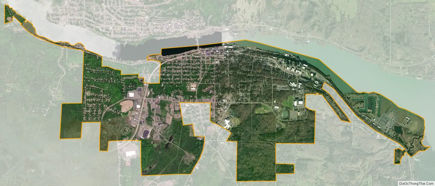
Houghton city Satellite Map
Geography
The city is located on the south shore of the Keweenaw Waterway, primarily “on rolling wooded hills less than a mile” across Portage Lake.” from Hancock. The city is bounded on the east by Portage Township and Pilgrim, on the west by Dakota Heights and on the south by Hurontown and Isle Royale Location, unincorporated communities that are part of Portage Township; and also on the west by Adams Township. Houghton is named after Douglass Houghton, discoverer of copper nearby. Houghton is also the home of Michigan Technological University. The city is served by Houghton County Memorial Airport in nearby Oneco.
According to the United States Census Bureau, the city has a total area of 4.69 square miles (12.15 km), of which 4.45 square miles (11.53 km) is land and 0.24 square miles (0.62 km) is water.
In the West Houghton neighborhood is West Houghton Park, containing an outdoor ice rink and lawn tennis courts. Along Portage Lake is the Raymond Kestner Waterfront Recreation Area, the principal feature of which is a large “Chutes and Ladders” playground; it also includes Houghton Beach. Along the waterfront, in the area that used to be occupied by the railroad tracks, runs the “flat, paved” Waterfront Trail for bikers and pedestrians; at one end of this is the Houghton RV Park, at the other end the Nara Nature Park and midway along this corridor is “Mattila Square”. Prince’s Point is also along this trail. Veterans Park is just across the Portage Lake Lift Bridge from Hancock, and contains the memorial to the Houghton Company, which fought in the Civil War. Houghton is the headquarters for Isle Royale National Park.
The Portage Lift Bridge connects Hancock and Houghton, Michigan, by crossing over Portage Lake, which is part of the river and canal system that crosses the entire peninsula. The Portage Lift Bridge is the world’s heaviest and widest double-decked vertical lift bridge. Its center span “lifts” to provide 100 feet (30 m) of clearance for ships. Since rail traffic was discontinued in the Keweenaw, the lower deck is used to accommodate snowmobile traffic in the winter. This is the only land based link between the north and south section of the Keweenaw peninsula, and is crucial.
Climate
Houghton has a humid continental climate (Köppen Dfb) but the (typically) long and snowy (due to lake-effect snow, with an average of 218 inches or 5.54 metres) winters make the city feel as though it is in a climate much farther north. It holds the distinction of having the third-most (behind Duluth and International Falls in Minnesota) maxima below 32 °F or 0 °C of any incorporated city in the contiguous US, with the top temperature failing to reach freezing on 100.9 days per year. It is sometimes said that Houghton has “two seasons: winter’s here and winter’s coming.”
While Houghton’s winters may be the subject of humor, residents take the subject of snow and winter very seriously. Houghton is one of the premier “Winter Cities” found anywhere. A “Winter City” is a community that accommodates winter, celebrates it, and whose residents generally enjoy the season by participating in a variety of outdoor activities. Among those activities are cross country skiing, snow-shoeing, ice fishing, snowmobiling, ice skating and outdoor ice hockey, among other activities. Houghton celebrates winter through the “Winter Carnival” organized by Michigan Tech every year in February.
Houghton’s summer climate tends to be especially pleasant, as hot temperatures are often moderated by the cool waters of nearby Lake Superior. The city’s record high temperature of 102 °F (38.9 °C) was recorded July 7, 1988; this is the only day in the city’s history with a temperature over 100 °F or 37.8 °C. Temperatures below 0 °F or −17.8 °C are also relatively infrequent due to the moderating effect of the lake, being reached only on 18.3 nights per year as against over fifty at International Falls. The coldest temperature on record is −30 °F (−34.4 °C), set on February 9, 1951. The heaviest monthly snow total was 119 inches (3.02 m) in December 1978; the winter of 1978–1979 saw 354.1 inches (8.99 m) of snow fall, making it the snowiest in 109 years of continuous records at the county airport (1891-2000). The greatest snow depth recorded was 73 inches (1.85 m) at the end of February 1937; in only two winters between 1891–1892 and 1999–2000 (1925–26 with 16 inches or 0.41 metres and 1932–33 with 19 inches or 0.48 metres) did the snow depth never reach at least two feet (24 inches or 0.61 metres).
See also
Map of Michigan State and its subdivision:- Alcona
- Alger
- Allegan
- Alpena
- Antrim
- Arenac
- Baraga
- Barry
- Bay
- Benzie
- Berrien
- Branch
- Calhoun
- Cass
- Charlevoix
- Cheboygan
- Chippewa
- Clare
- Clinton
- Crawford
- Delta
- Dickinson
- Eaton
- Emmet
- Genesee
- Gladwin
- Gogebic
- Grand Traverse
- Gratiot
- Hillsdale
- Houghton
- Huron
- Ingham
- Ionia
- Iosco
- Iron
- Isabella
- Jackson
- Kalamazoo
- Kalkaska
- Kent
- Keweenaw
- Lake
- Lake Hurron
- Lake Michigan
- Lake St. Clair
- Lake Superior
- Lapeer
- Leelanau
- Lenawee
- Livingston
- Luce
- Mackinac
- Macomb
- Manistee
- Marquette
- Mason
- Mecosta
- Menominee
- Midland
- Missaukee
- Monroe
- Montcalm
- Montmorency
- Muskegon
- Newaygo
- Oakland
- Oceana
- Ogemaw
- Ontonagon
- Osceola
- Oscoda
- Otsego
- Ottawa
- Presque Isle
- Roscommon
- Saginaw
- Saint Clair
- Saint Joseph
- Sanilac
- Schoolcraft
- Shiawassee
- Tuscola
- Van Buren
- Washtenaw
- Wayne
- Wexford
- Alabama
- Alaska
- Arizona
- Arkansas
- California
- Colorado
- Connecticut
- Delaware
- District of Columbia
- Florida
- Georgia
- Hawaii
- Idaho
- Illinois
- Indiana
- Iowa
- Kansas
- Kentucky
- Louisiana
- Maine
- Maryland
- Massachusetts
- Michigan
- Minnesota
- Mississippi
- Missouri
- Montana
- Nebraska
- Nevada
- New Hampshire
- New Jersey
- New Mexico
- New York
- North Carolina
- North Dakota
- Ohio
- Oklahoma
- Oregon
- Pennsylvania
- Rhode Island
- South Carolina
- South Dakota
- Tennessee
- Texas
- Utah
- Vermont
- Virginia
- Washington
- West Virginia
- Wisconsin
- Wyoming