Elmira (/ɛlˈmaɪrə/) is a city and the county seat of Chemung County, New York, United States. It is the principal city of the Elmira, New York, metropolitan statistical area, which encompasses Chemung County. The population was 26,523 at the 2020 census, down from 29,200 at the 2010 census, a decline of more than 7 percent.
The City of Elmira is in the south-central part of the county, surrounded on three sides by the Town of Elmira. It is in the Southern Tier of New York, a short distance north of the Pennsylvania state line.
| Name: | Elmira city |
|---|---|
| LSAD Code: | 25 |
| LSAD Description: | city (suffix) |
| State: | New York |
| County: | Chemung County |
| Incorporated: | 1864; 159 years ago (1864) |
| Elevation: | 860 ft (260 m) |
| Land Area: | 7.25 sq mi (18.78 km²) |
| Water Area: | 0.33 sq mi (0.85 km²) |
| Population Density: | 3,657.34/sq mi (1,412.09/km²) |
| Area code: | 607 |
| FIPS code: | 3624229 |
| Website: | www.CityOfElmira.net |
Online Interactive Map
Click on ![]() to view map in "full screen" mode.
to view map in "full screen" mode.
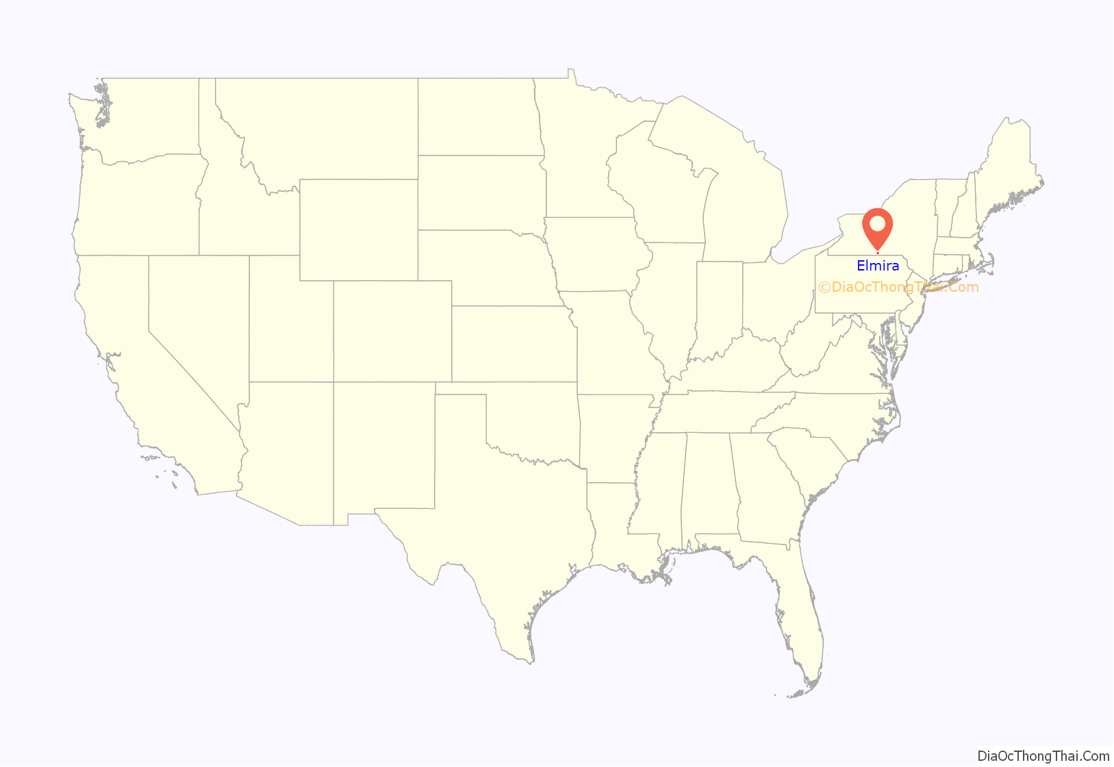
Elmira location map. Where is Elmira city?
History
Early history
The region of Elmira was inhabited by the Cayuga nation (also known as the Kanawaholla) of the Haudenosaunee prior to European colonization. Cayuga residing in the region maintained relations with European settlers, primarily related to the fur trade, but were otherwise relatively isolated from encroaching colonial settlements.
During the American Revolutionary War, the Sullivan Expedition of 1779 was mounted by the Continental Army against the four Haudenosaunee nations which had allied with the British. The expeditionary force fought a combined British-Haudenosaunee force at the Battle of Newtown, south of the current city, in which the Continental Army emerged victorious. After the conclusion of the war, the Haudenosaunee and the United States signed a treaty at Elmira in 1791 to settle territorial disputes in the region. Most of the Cayuga emigrated under pressure from encroaching American settlements with the other nations of the Haudenosaunee to Canada, where they resettled on land provided by the British Crown.
The first European-American settler in Elmira was Abraham Miller, who served as a captain in the Continental Army. Miller constructed a cabin after resigning just before the end of the Revolutionary War. Miller’s Pond and Miller Street are named after him and are near the location of his house.
Elmira’s formation
The New York legislature established the Township of Chemung, now Chemung County, in 1788. The settlement of Newtown was soon established at the intersection of Newtown Creek and the Chemung River. In 1792, the settlement at Newtown joined with the Wisnerburg and DeWittsburg settlements to form the village of Newtown. In 1808, the village officially changed its name to the Town of Elmira, at a town meeting held at Teal’s Tavern. It is said the town was named after tavern owner Nathan Teal’s young daughter, but that story has never been confirmed. According to Amos Bugbee Carpenter’s “Carpenter Memorial” family history book printed in 1898, Elmira is named after Major General Matthew Carpenter’s daughter. This naming occurred, according to this book, in 1821 at the constitutional convention to which Matthew was a delegate. In any case, the City of Elmira, nicknamed “The Queen City,” was incorporated in 1864 from part of the town of Elmira and the village of Elmira. The remaining part of the town of Elmira exists still, surrounding the city on the west, north and east. The city and town share an intricately entwined history.
It appears that Amos Carpenter in his 1898 book was referencing an 1879 book.
Elmira served as a transportation hub for New York’s Southern Tier in the 1800s, connecting commercial centers in Rochester and Buffalo with Albany and New York City, via the canal system and railroads. The city was the southern terminus of the Chemung Canal completed in 1833; later, the Junction Canal was constructed to connect Elmira with Corning, facilitating transport of coal from the Pennsylvania mines via the Northern branch of the Susquehanna Canal system. In 1849, the New York and Erie Railroad was built through Elmira, giving the area a New York City to Buffalo route. In 1850, the Elmira and Jefferson Railroad gave the area a route north and, in 1854, the Elmira and Williamsport Railroad a route south. These railroads and their connections made the city a prime location for an Army training and muster point early in the Civil War.
In 1872 construction began on the Utica, Ithaca and Elmira Railroad, eventually creating a route to Cortland and Syracuse via Horseheads, Breesport and Van Etten. The Delaware, Lackawanna and Western Railroad, completed in 1884, competed with the Erie’s New York City to Buffalo line.
1909 Extension of Chemung Canal.
1869 map showing Elmira’s location as a transportation hub in Chemung County
Map of Delaware, Lackawanna and Westerny Railroad in New York State / Pennsylvania, 1893.
Aerial view of station – Erie Railway, Elmira Station, Railroad Avenue, Elmira New York
Prisoner-of-war camp
A great deal of the 30-acre (120,000 m) Union installation, known as Camp Rathbun, fell into disuse as the Civil War progressed, and the camp’s “Barracks #3” were converted into a Civil War prisoner of war camp in the summer of 1864. The camp, in use from June 6, 1864, until autumn 1865, was dubbed “Hellmira” by its inmates. Towner’s history of 1892 and maps from the period indicate the camp occupied a somewhat irregular parallelogram, running about 1,000 feet (300 m) west and approximately the same distance south of a location several hundred feet west of Hoffman Street (Foster Avenue) and Winsor Avenue, bordered on the south by Foster’s Pond, on the north bank of the Chemung River.
In the months the site was used as a camp, 12,123 Confederate soldiers were incarcerated; of these, 2,963 died during their stay from a combination of malnutrition, prolonged exposure to brutal winter weather and disease directly attributable to the dismal sanitary conditions on Foster’s Pond and lack of medical care. The camp’s dead were prepared for burial and laid to rest by the sexton at Woodlawn National Cemetery, ex-slave John W. Jones. At the end of the war, each prisoner was given a loyalty oath and given a train ticket back home; the last prisoner left the camp on September 27, 1865. The camp was closed, demolished and converted to farmland. Woodlawn Cemetery, about 2 miles (3 km) north of the original prison camp site (bounded by West Hill, Bancroft, Davis and Mary Streets), was designated a “National Cemetery” in 1877. The prison camp site is today a residential area.
Evening roll-call at Camp Rathburn, ca. 1864.
Changing of the guard at Camp Rathburn, ca. 1864.
Artillery on guard over prisoners at Camp Rathburn, ca. 1864.
Civil War monument dedicated to soldiers who were trained and imprisoned at Camp Rathburn, dedicated May 3, 1992.
Reformatory and correctional facility
The state legislature authorized the building of a state prison for first offenders in 1866. It opened in 1876 as the Elmira Reformatory, under the direction of Zebulon Brockway, serving offenders aged sixteen to thirty. It was the first institution of its kind, and a model for others to follow. In 1970 the complex was renamed the Elmira Correctional and Reception Center.
Elmira Reformatory, circa 1897.
Elmira economy
In 1950, the Elmira’s population peaked at about 50,000, which represented 57 percent of Chemung County’s total population at the time. Today, the city has approximately 30,000 residents, which represents 34 percent of Chemung County’s population. This population decline is due to the national decline in railroads and manufacturing as well as a population shift to the outer suburbs around Elmira. The Elmira Metro area has nearly 100,000 people.
The population decline began during the recession of the early 1970s during which several large employers (Ann Page, American Bridge, General Electric, American LaFrance, Westinghouse and Remington Rand) either closed their factories or moved to other states. The decline was exacerbated by the flood of 1972, during which many of the downtown businesses and single-family homes were destroyed or replaced by subsequent Urban Renewal projects in the Chemung River flood plain.
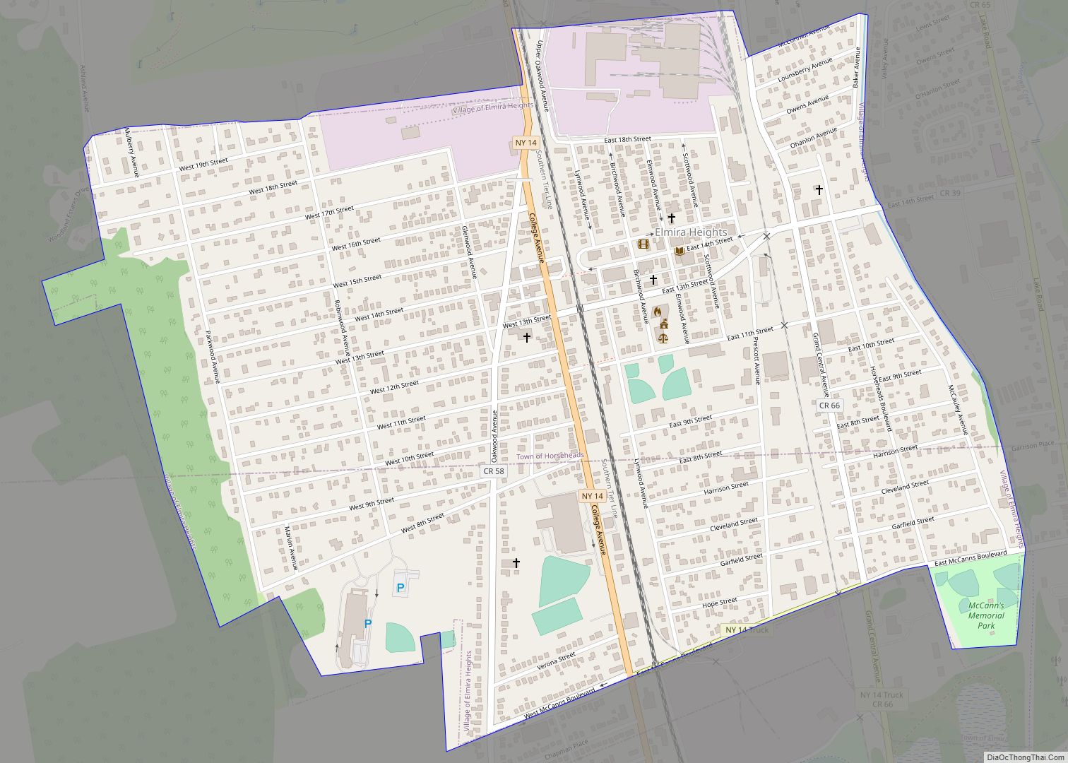
Anchor Glass Container Corporation, headquartered in Tampa, Florida, is in the old Thatcher Glass facility in Elmira Heights. Anchor Glass produces a diverse line of flint, amber, green and other colored glass containers of various types and designs for the beer, food, beverage and liquor markets in North America. Anchor Glass is now wholly owned by the Ardagh Group S.A.
CAF-USA Inc has its main U.S. plant in Elmira Heights on the site of the former American Bridge Company. CAF USA is a subsidiary company of Construcciones y Auxiliar de Ferrocarriles, a Spanish manufacturer of passenger rail products (including trains, high-speed trains, locomotives, light rail vehicles and other rail equipment). CAF-USA Inc trains are typically designed for North America’s market, based on Spanish design and technologies.
Elmira Heat Treating, established in 1962 in Elmira, offers a wide variety of heat treatment technologies to both domestic and international customers such as Hilliard Corp., Ford Motors, General Signal and others.
Hardinge, Inc. (formerly Hardinge Brothers), established in 1890 and now headquartered in Elmira, manufactures precise turning machines for the domestic and international market. Starting in 1995, Hardinge began expanding their product line and over the years has acquired L. Kellenberger & Co. AG, Hauser-Tripet-Tschudin AG, Jones & Shipman, and Usach Technologies, Inc. In 2004 they also acquired Bridgeport, world-famous for its milling machines and machining centers.
Hilliard Corporation, established in 1905, has two locations in Elmira and serves the international market in filters, brakes, clutches and starters for a variety of industrial and commercial uses as well as consumer equipment from Polaris and MTD.
Kennedy Valve, located in Elmira since 1905, is one of the world’s largest manufacturers of products for waterworks distribution, potable and wastewater treatment, and fire protection system projects. They are most famous for their fire hydrants which can be found around the world. Kennedy Valve was acquired by McWane in 1988.
Trayer Products, established in 1929, manufactures parts mostly for the heavy truck industry; primarily truck chassis parts such as king pins and shackles.
Hurricane Agnes and the Flood of ’72
During the summer of 1972, Hurricane Agnes struck the eastern seaboard of the United States, causing significant damage stretching from Florida into New England. Elmira was particularly hit hard by the flood, with over an estimated $291 million in damage. Over 15,000 people had to flee the city, and approximately 5,000 homes were damaged or destroyed. Coordinated efforts between local churches and regional businesses helped with the cleanup. Operating in secrecy, Rochester, NY-based Eastman Kodak sent crews as part of Operation Rebuild. Their efforts rebuilt 78 homes and assisted in the repairs of countless others.
Elmira city leaders approached the New York State Urban Development Corporation (UDC) to lead the redevelopment of the city post-flood. With a select group of businessmen and city officials attempting to minimize public input, the UDC implemented the “New Elmira Plan”. This entailed the removal of buildings along the river to create Riverside Park, and razing other buildings in the business district for two parking garages. Altogether, forty percent of Elmira’s commercial space was eliminated as part of the plan. Local citizens lamented the loss of character and vibrancy of downtown Elmira.
2012 Tornado
On July 26, 2012, an EF1 tornado touched down near Cottage Drive off of Route 352 and traveled through Golden Glow and the rest of the city. Moderate damage was seen after the storm passed and hundreds of trees and power lines were blown down. No one was injured. The tornado was 0.5 miles (0.80 km) wide and took the city by surprise as this area has not been prone to tornadic activity.
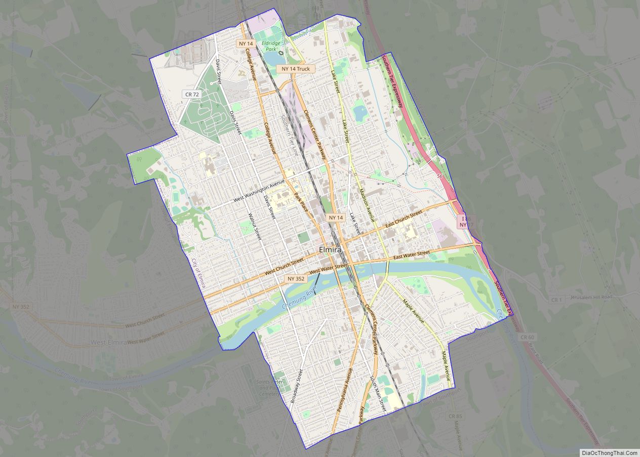
Elmira Road Map
Elmira city Satellite Map
Geography
Elmira is at 42°5′23″N 76°48′34″W / 42.08972°N 76.80944°W / 42.08972; -76.80944 (42.089874, −76.809559).
According to the United States Census Bureau, the city has an area of 7.6 sq mi (19.6 km), of which 7.3 sq mi (19.0 km) is land and 0.27 sq mi (0.7 km) (3.56%) is water.
The Chemung River flows eastward through the city. Elmira is built almost entirely in the flood plain of the Chemung River and has suffered many floods, the worst from Hurricane Agnes in 1972. Newtown Creek, flowing from the north, joins the Chemung River at the city’s southeast corner.
Interstate 86/New York State Route 17, The Southern Tier Expressway, connects with the city at Exit 56. New York State Route 14 passes through Elmira between Watkins Glen and Pennsylvania. New York State Route 13 begins near Lake Ontario and travels through Cortland and Ithaca before ending in Elmira. New York State Route 352 begins in Elmira at Exit 56 of the Southern Tier Expressway and continues West into Corning.
See also
Map of New York State and its subdivision:- Albany
- Allegany
- Bronx
- Broome
- Cattaraugus
- Cayuga
- Chautauqua
- Chemung
- Chenango
- Clinton
- Columbia
- Cortland
- Delaware
- Dutchess
- Erie
- Essex
- Franklin
- Fulton
- Genesee
- Greene
- Hamilton
- Herkimer
- Jefferson
- Kings
- Lake Ontario
- Lewis
- Livingston
- Madison
- Monroe
- Montgomery
- Nassau
- New York
- Niagara
- Oneida
- Onondaga
- Ontario
- Orange
- Orleans
- Oswego
- Otsego
- Putnam
- Queens
- Rensselaer
- Richmond
- Rockland
- Saint Lawrence
- Saratoga
- Schenectady
- Schoharie
- Schuyler
- Seneca
- Steuben
- Suffolk
- Sullivan
- Tioga
- Tompkins
- Ulster
- Warren
- Washington
- Wayne
- Westchester
- Wyoming
- Yates
- Alabama
- Alaska
- Arizona
- Arkansas
- California
- Colorado
- Connecticut
- Delaware
- District of Columbia
- Florida
- Georgia
- Hawaii
- Idaho
- Illinois
- Indiana
- Iowa
- Kansas
- Kentucky
- Louisiana
- Maine
- Maryland
- Massachusetts
- Michigan
- Minnesota
- Mississippi
- Missouri
- Montana
- Nebraska
- Nevada
- New Hampshire
- New Jersey
- New Mexico
- New York
- North Carolina
- North Dakota
- Ohio
- Oklahoma
- Oregon
- Pennsylvania
- Rhode Island
- South Carolina
- South Dakota
- Tennessee
- Texas
- Utah
- Vermont
- Virginia
- Washington
- West Virginia
- Wisconsin
- Wyoming
