Dresden is a village in Yates County, New York, United States. The population was 308 at the 2010 census. The village was named after Dresden in Germany.
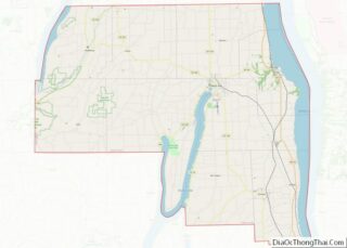
The Village of Dresden is located in the Town of Torrey and is twelve miles south of Geneva. Dresden is located in the Finger Lakes Region of New York.
| Name: | Dresden village |
|---|---|
| LSAD Code: | 47 |
| LSAD Description: | village (suffix) |
| State: | New York |
| County: | Yates County |
| Incorporated: | July 16, 1867 (1867-07-16) |
| Elevation: | 509 ft (155 m) |
| Total Area: | 0.31 sq mi (0.80 km²) |
| Land Area: | 0.30 sq mi (0.78 km²) |
| Water Area: | 0.01 sq mi (0.01 km²) |
| Total Population: | 293 |
| Population Density: | 970.20/sq mi (374.88/km²) |
| ZIP code: | 14441 |
| Area code: | 315 |
| FIPS code: | 3620896 |
| GNISfeature ID: | 0948642 |
Online Interactive Map
Click on ![]() to view map in "full screen" mode.
to view map in "full screen" mode.
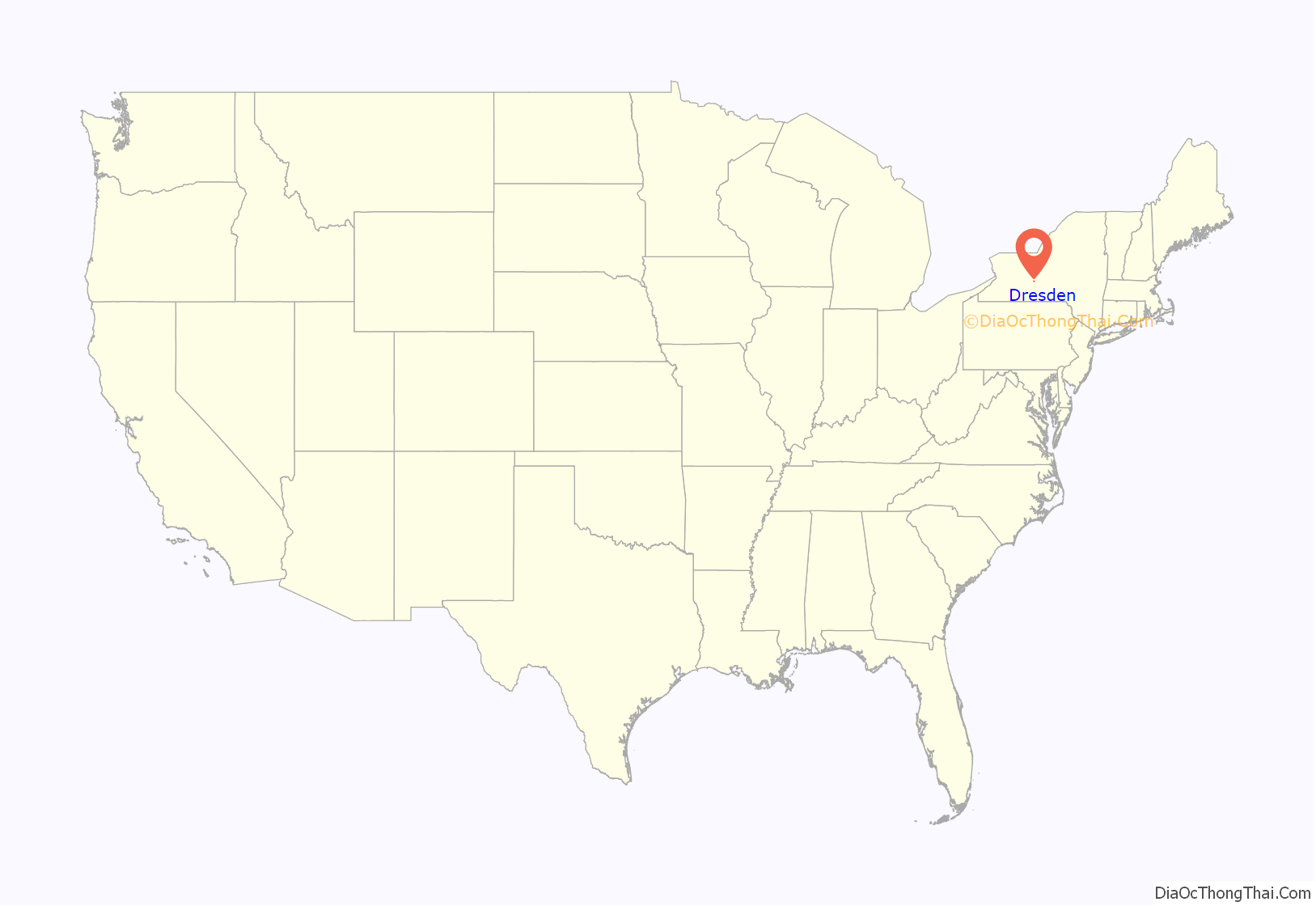
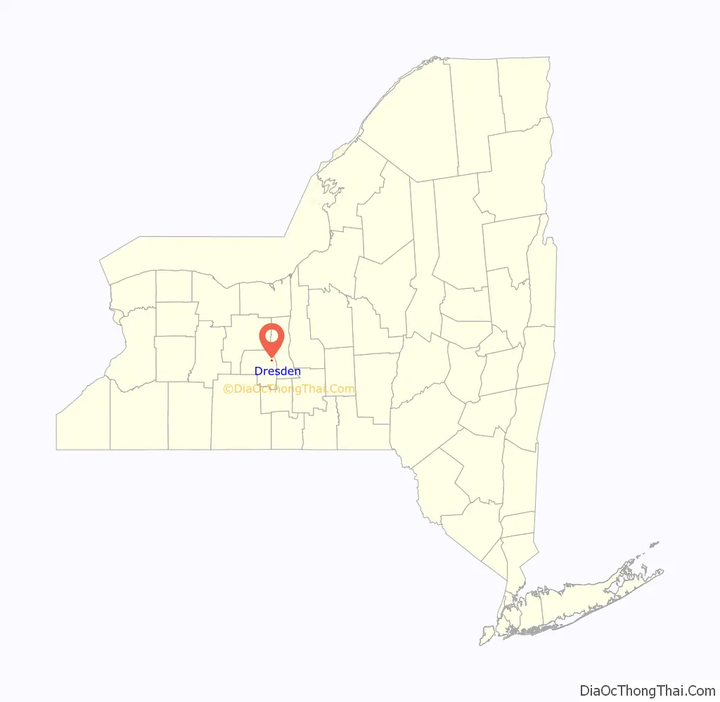
Dresden location map. Where is Dresden village?
History
The region was known as “Kashong” (or “Kashanquash”) to the natives and was part of the Phelps and Gorham Purchase.
At the end of the 18th century, followers of the Public Universal Friend, a religious leader, began to settle in the area. They called the area “Jerusalem” and founded a community near the present site of Dresden.
Dresden was founded in 1811 as a planned community. The Village of Dresden was incorporated in 1867.
Dresden was the eastern terminus for the former Crooked Lake Canal, which operated from 1833 to 1877. This canal linked the area through other lake canals to the Erie Canal.
The Robert Ingersoll Birthplace and Christopher Willis House are listed on the National Register of Historic Places.
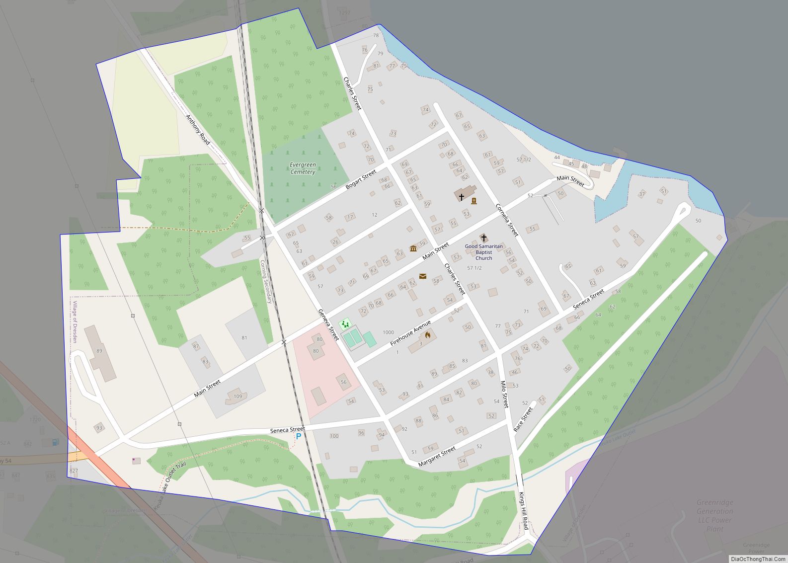
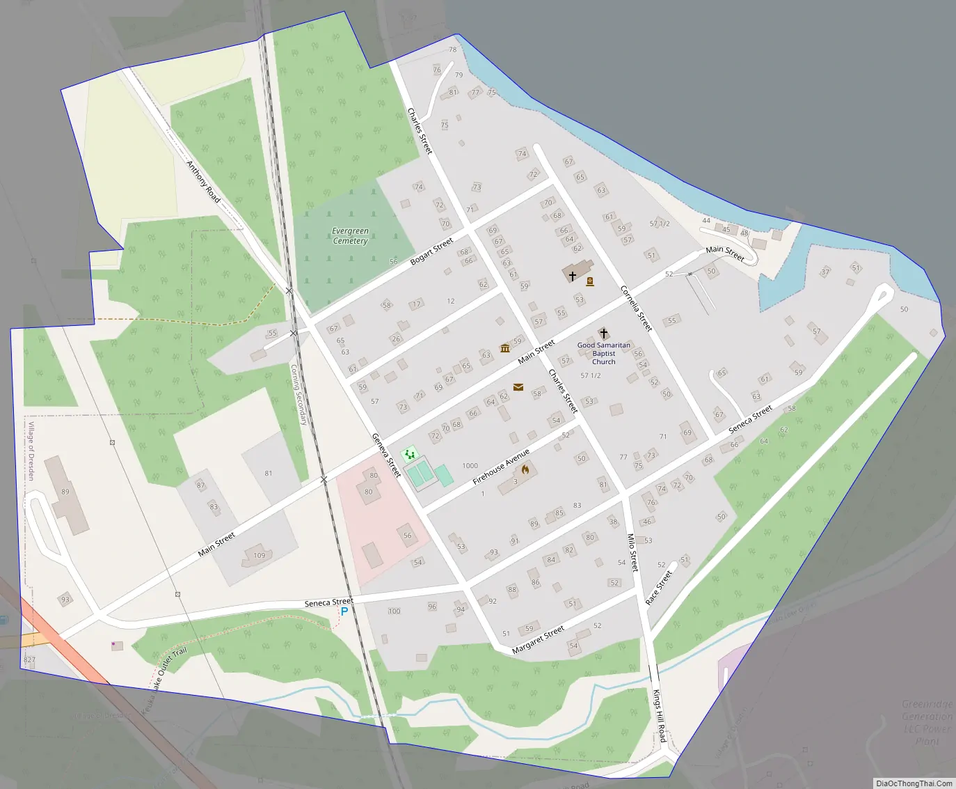
Dresden Road Map
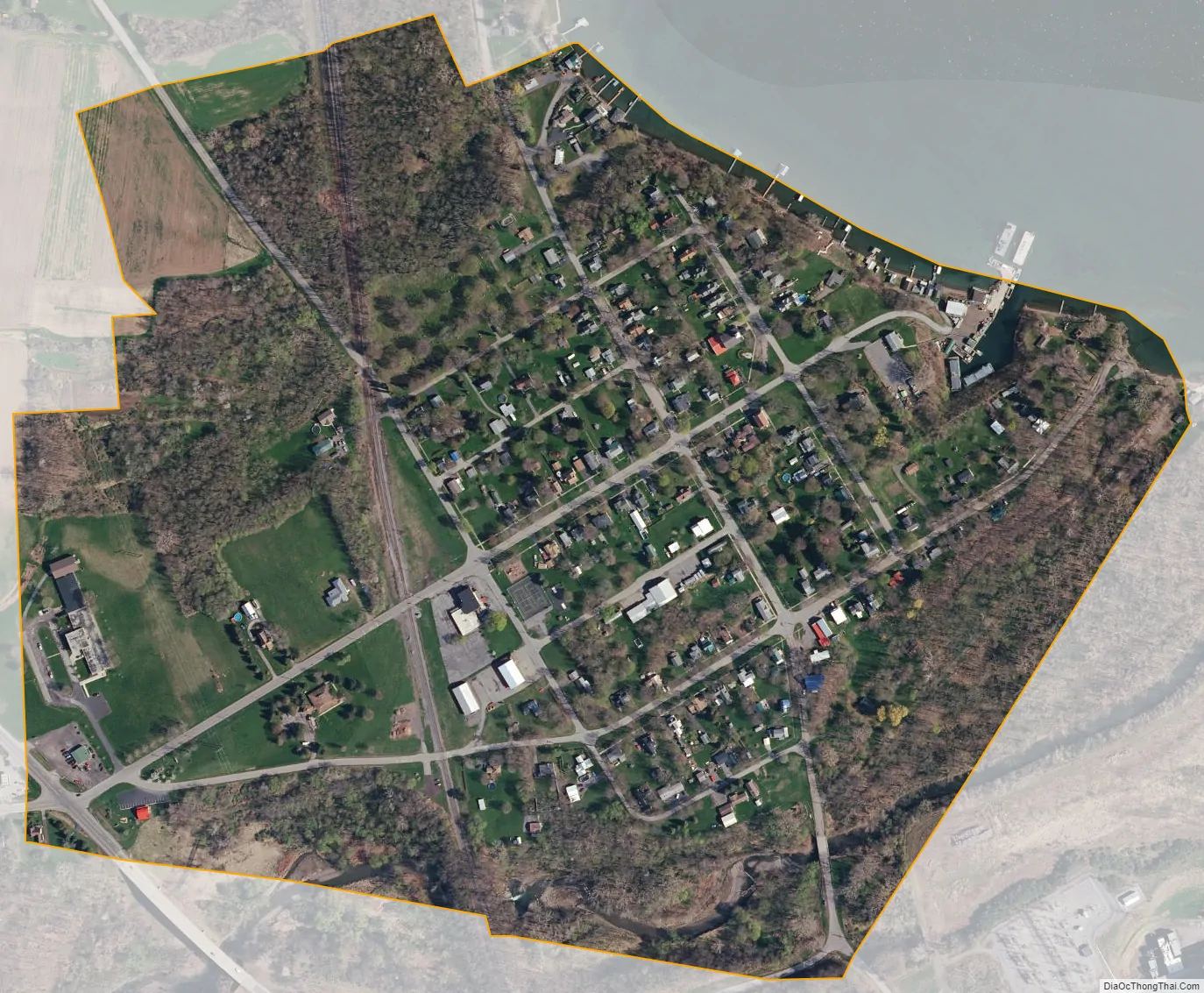
Dresden city Satellite Map
Geography
Dresden is located at 42°41′2″N 76°57′26″W / 42.68389°N 76.95722°W / 42.68389; -76.95722 (42.683857, -76.957296).
According to the United States Census Bureau, the village has a total area of 0.3 square miles (0.78 km), all land.
The village on the west shore of Seneca Lake. Keuka Lake Outlet (known early as “Crooked Lake Outlet”), a stream connecting Keuka Lake with Seneca Lake, flows past the south side of the village. At first the significant water drop made it an important location for mills. Later it was developed as a canal between the lakes.
New York State Route 14 intersects New York State Route 54 at Dresden.
See also
Map of New York State and its subdivision:- Albany
- Allegany
- Bronx
- Broome
- Cattaraugus
- Cayuga
- Chautauqua
- Chemung
- Chenango
- Clinton
- Columbia
- Cortland
- Delaware
- Dutchess
- Erie
- Essex
- Franklin
- Fulton
- Genesee
- Greene
- Hamilton
- Herkimer
- Jefferson
- Kings
- Lake Ontario
- Lewis
- Livingston
- Madison
- Monroe
- Montgomery
- Nassau
- New York
- Niagara
- Oneida
- Onondaga
- Ontario
- Orange
- Orleans
- Oswego
- Otsego
- Putnam
- Queens
- Rensselaer
- Richmond
- Rockland
- Saint Lawrence
- Saratoga
- Schenectady
- Schoharie
- Schuyler
- Seneca
- Steuben
- Suffolk
- Sullivan
- Tioga
- Tompkins
- Ulster
- Warren
- Washington
- Wayne
- Westchester
- Wyoming
- Yates
- Alabama
- Alaska
- Arizona
- Arkansas
- California
- Colorado
- Connecticut
- Delaware
- District of Columbia
- Florida
- Georgia
- Hawaii
- Idaho
- Illinois
- Indiana
- Iowa
- Kansas
- Kentucky
- Louisiana
- Maine
- Maryland
- Massachusetts
- Michigan
- Minnesota
- Mississippi
- Missouri
- Montana
- Nebraska
- Nevada
- New Hampshire
- New Jersey
- New Mexico
- New York
- North Carolina
- North Dakota
- Ohio
- Oklahoma
- Oregon
- Pennsylvania
- Rhode Island
- South Carolina
- South Dakota
- Tennessee
- Texas
- Utah
- Vermont
- Virginia
- Washington
- West Virginia
- Wisconsin
- Wyoming