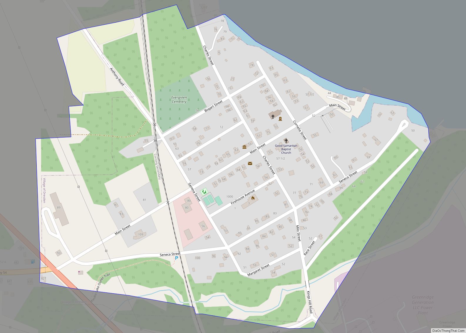
Dundee is a village in Yates County, New York, United States. The population was 1,725 at the 2010 census. The name was taken from Dundee, the city in Scotland with a population of 148,260.
The Village of Dundee is in the Town of Starkey. The village is in the Finger Lakes Region of New York, halfway between Elmira and Geneva.
Dundee Airport (D48) is located northeast of the village.
| Name: | Dundee village |
|---|---|
| LSAD Code: | 47 |
| LSAD Description: | village (suffix) |
| State: | New York |
| County: | Yates County |
| Incorporated: | 1848 (1848) |
| Elevation: | 984 ft (300 m) |
| Total Area: | 1.10 sq mi (2.85 km²) |
| Land Area: | 1.10 sq mi (2.85 km²) |
| Water Area: | 0.00 sq mi (0.00 km²) |
| Total Population: | 1,690 |
| Population Density: | 1,533.58/sq mi (592.12/km²) |
| ZIP code: | 14837 |
| Area code: | 607 |
| FIPS code: | 3621050 |
| GNISfeature ID: | 0948784 |
Online Interactive Map
Click on ![]() to view map in "full screen" mode.
to view map in "full screen" mode.
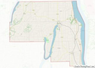
Dundee location map. Where is Dundee village?


History
The community was known early by the name “Plainview”. At first, the village did not thrive due to competition from another neighboring community, “Eddytown”, but eventually prevailed over its rival.
Around 1834, residents began to seek a new name for the village and, persuaded by a native of Scotland, named the village “Dundee”. He then moved to Illinois and persuaded the natives of his new home to rename their community “Dundee”.
In 1859, 1860, and 1861, the village was severely damaged by fires.
Dundee was the original home of Seneca Foods.
The Uriah Hair House, Dundee Methodist Church, First Presbyterian Church, and Dundee Village Historic District are listed on the National Register of Historic Places.
Dundee Road Map
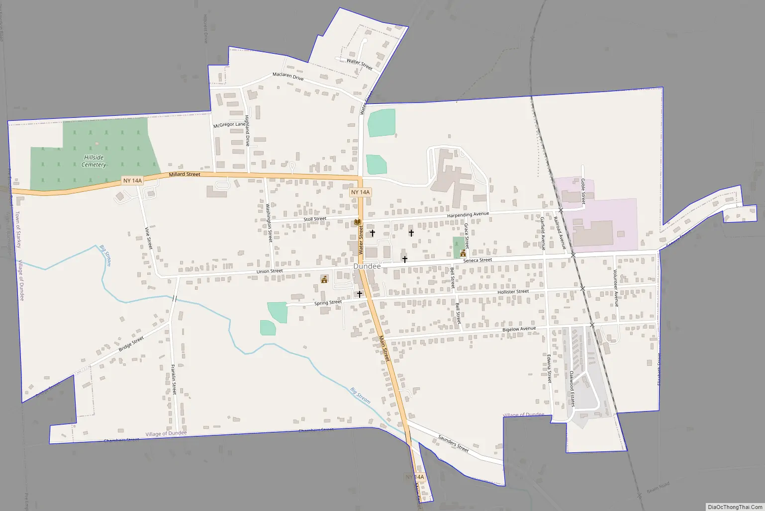
Dundee city Satellite Map

Geography
Dundee is located at 42°31′28″N 76°58′29″W / 42.52444°N 76.97472°W / 42.52444; -76.97472 (42.524453, -76.974804).
According to the United States Census Bureau, the village has a total area of 1.1 square miles (2.8 km), all land.
Seneca Lake, one of the Finger Lakes, is four miles east of Dundee. Big Stream is a stream flowing through the village. “Big Stream” is also known for its seasonal fishing.
Dundee is on New York State Route 14A, a north-south highway. New York State Route 230 terminates at NY-14A west of Dundee.
See also
Map of New York State and its subdivision:- Albany
- Allegany
- Bronx
- Broome
- Cattaraugus
- Cayuga
- Chautauqua
- Chemung
- Chenango
- Clinton
- Columbia
- Cortland
- Delaware
- Dutchess
- Erie
- Essex
- Franklin
- Fulton
- Genesee
- Greene
- Hamilton
- Herkimer
- Jefferson
- Kings
- Lake Ontario
- Lewis
- Livingston
- Madison
- Monroe
- Montgomery
- Nassau
- New York
- Niagara
- Oneida
- Onondaga
- Ontario
- Orange
- Orleans
- Oswego
- Otsego
- Putnam
- Queens
- Rensselaer
- Richmond
- Rockland
- Saint Lawrence
- Saratoga
- Schenectady
- Schoharie
- Schuyler
- Seneca
- Steuben
- Suffolk
- Sullivan
- Tioga
- Tompkins
- Ulster
- Warren
- Washington
- Wayne
- Westchester
- Wyoming
- Yates
- Alabama
- Alaska
- Arizona
- Arkansas
- California
- Colorado
- Connecticut
- Delaware
- District of Columbia
- Florida
- Georgia
- Hawaii
- Idaho
- Illinois
- Indiana
- Iowa
- Kansas
- Kentucky
- Louisiana
- Maine
- Maryland
- Massachusetts
- Michigan
- Minnesota
- Mississippi
- Missouri
- Montana
- Nebraska
- Nevada
- New Hampshire
- New Jersey
- New Mexico
- New York
- North Carolina
- North Dakota
- Ohio
- Oklahoma
- Oregon
- Pennsylvania
- Rhode Island
- South Carolina
- South Dakota
- Tennessee
- Texas
- Utah
- Vermont
- Virginia
- Washington
- West Virginia
- Wisconsin
- Wyoming