Ellenville is a village within the town of Wawarsing, Ulster County, New York, United States. Its population was 4,167 at the 2020 census.
| Name: | Ellenville village |
|---|---|
| LSAD Code: | 47 |
| LSAD Description: | village (suffix) |
| State: | New York |
| County: | Ulster County |
| Elevation: | 338 ft (103 m) |
| Total Area: | 8.78 sq mi (22.74 km²) |
| Land Area: | 8.69 sq mi (22.51 km²) |
| Water Area: | 0.09 sq mi (0.22 km²) |
| Total Population: | 4,167 |
| Population Density: | 479.35/sq mi (185.08/km²) |
| ZIP code: | 12428 |
| FIPS code: | 3623965 |
| GNISfeature ID: | 0949508 |
Online Interactive Map
Click on ![]() to view map in "full screen" mode.
to view map in "full screen" mode.
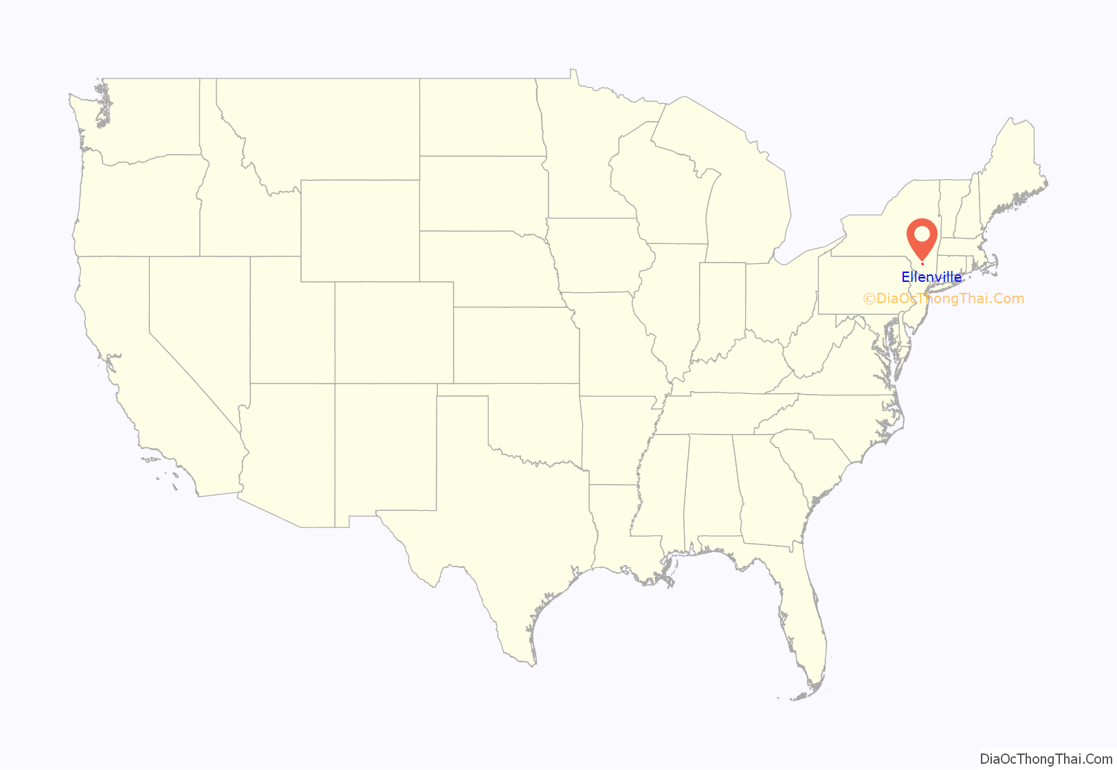
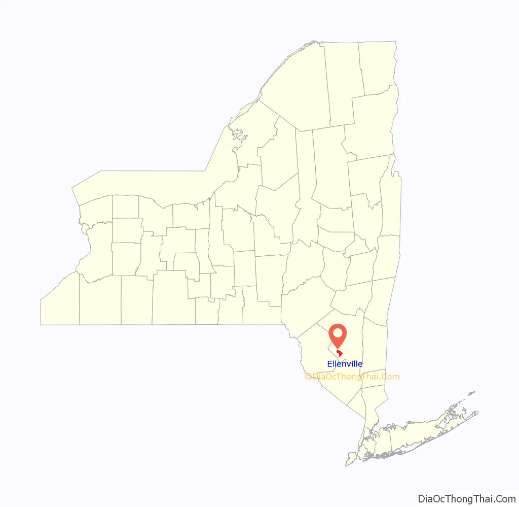
Ellenville location map. Where is Ellenville village?
History
Originally called “Socconessing” by the first inhabitants, the Esopus Munsee of the Lenni Lenape. Socconessing means “a muddy place where the water comes out”, referencing the Sandburg Creek. The Esopus lived in this area for thousands of years before being pushed out by the early pioneers.
The first building erected in what is now the center of the village was built around 1798 by Alpheus Fairchild, who moved west from Connecticut. However, in what is now the easternmost part of the village, the Bodley homestead most likely stood well before the Revolution, as did portions of the Bevier and Sax farms. It was named “Fairchild City” or just “The City” after Alpheus Fairchild, who bought most of today’s village in 1798 from John A. DeWitt; Fairchild had a dwelling erected on part of the site where the George and John R. Hunt Memorial Building stands today. Nathan and Maria Hoornbeek bought the dwelling and enlarged it, converting it into an inn. The Hoornbeek Tavern was a gathering place for the citizens, and many important decisions about the community were made at meetings held there. Indeed, the decision to change the name of the community to “Ellenville” was proposed at the Hoornbeek Tavern. Village leaders, unable to agree upon a new name, were persuaded by Ellen Snyder, Maria Hoornbeek’s sister, to name the village after her.
Charles Hartshorn came to “The City” to try a case in the Hoornbeek Tavern in 1823. He opened the first store that same year, and led a drive to choose a “real” name for the community. Hartshorn also applied to the federal government for approval of a post office and was named the first postmaster. He later erected a home for his family on the former site of the Hoornbeek Tavern. In 1856, he was elected first president of the newly incorporated village of Ellenville.
Noted American composer Homer Newton Bartlett resided at 32 Maple Avenue in Ellenville for many years during the late 19th century.
Just north of the village, the Joseph Y. Resnick Airport (N89) is named in honor and memory of U.S. Congressman Joseph Yale Resnick, a Wawarsing native. Ellenville Regional Hospital, just north of the airport, and the Nevele Tower, just south of the village, were both dedicated by then-President Lyndon B. Johnson, at Congressman Resnick’s request.
Ellenville was the fourth community featured on ABC’s television show, My Kind of Town, recorded in New York City on August 6, 2005, and broadcast on September 4, 2005.
The village’s Christ Lutheran Church and Parsonage, Ellenville Downtown Historic District, George and John R. Hunt Memorial Building, and United States Post Office are listed in the National Register of Historic Places.
Ellenville has three copies of the statue known as The Boy with the Leaking Boot.
Due to good launch sites and favorable weather conditions, Ellenville became a major center for the development of hang gliding in the 1970s and 1980s. The area is now home to three major hang-gliding schools and is considered one of the best sites for instruction east of the Mississippi. On most weekends, hang gliders can be seen launching off of two sites on the Shawangunk Ridge just south of Nevele and Honors Haven.
St. Mary’s Church
Father John Raffeiner was a German priest who ministered to German-speaking Catholics throughout the Diocese of New York well before it was split into the dioceses of Albany, Brooklyn, Buffalo, and Newark. Ellenville was one of his less accessible destinations, but he formed a congregation there in 1850. Rev. John Raufeisen became pastor and built a small frame structure known as St. Mary’s. Raufeisen also established the Church of Sts. Michael and Wendilinus in Ulster Heights, and the Church of the Immaculate Conception in Woodbourne, where a number of Bavarians had settled. He preached in Bridgeville, Callicoon, Fallsburgh, Grahamsville, Lackawack, Neversink, North Branch, Otisville, Stephen’s, and Factories. Raffeiner assisted in establishing St. Peter’s for the German community of Rondout. From 1861 Raufeisen lived in Rondout, where the need was greater, but continued to visit Ellenville.
In 1864, Rev. George J. Veith was appointed pastor of St. Mary’s, Ellenville, although he resided in Jeffersonville. In 1871, Rev. Constantine Van Drost became St. Mary’s first resident pastor. In 1881,, Rev. Andrew J. Sauer built a new church, dedicated to St. Andrew. In 1903, a dam above the village burst, threatening to carry away St. Mary’s, when a floating barge lodged against a tree, diverting the water.
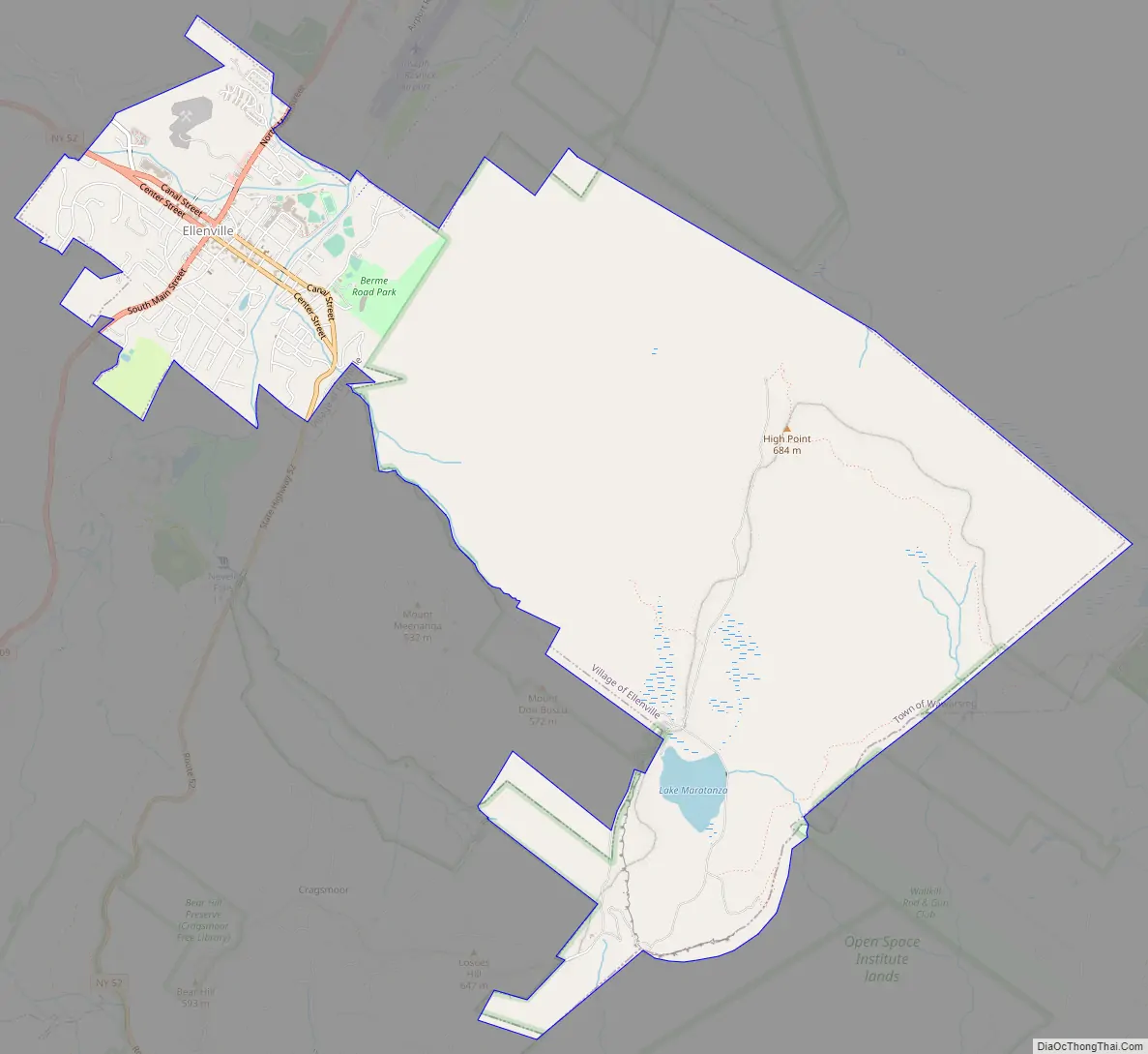
Ellenville Road Map
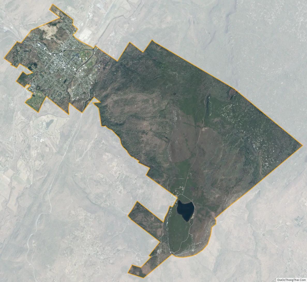
Ellenville city Satellite Map
Geography
The village of Ellenville is about 90 miles northwest of New York City and 90 miles southwest of Albany. The village is located at the junction of routes NY 52 and U.S. Route 209, and is bisected by the recently designated Shawangunk Scenic Byway. Ellenville lies in the Rondout Valley, at the eastern base of the Catskill Mountains, and the western base of the Shawangunk Ridge, which is listed by the Nature Conservancy as one of the “75 Last Great Places on Earth.”
The north-flowing Sandburg Creek and east-flowing Beer Kill intersect in Ellenville near the current site of the Ellenville Central School to become the Rondout Creek, which flows north to join the Hudson River near Kingston. Ellenville is within the Hudson River Valley National Heritage Area.
According to the United States Census Bureau, the village has a total area of 8.8 square miles (22.7 km), of which 0.1 square mile (0.2 km, 0.68%) is covered by water.
See also
Map of New York State and its subdivision:- Albany
- Allegany
- Bronx
- Broome
- Cattaraugus
- Cayuga
- Chautauqua
- Chemung
- Chenango
- Clinton
- Columbia
- Cortland
- Delaware
- Dutchess
- Erie
- Essex
- Franklin
- Fulton
- Genesee
- Greene
- Hamilton
- Herkimer
- Jefferson
- Kings
- Lake Ontario
- Lewis
- Livingston
- Madison
- Monroe
- Montgomery
- Nassau
- New York
- Niagara
- Oneida
- Onondaga
- Ontario
- Orange
- Orleans
- Oswego
- Otsego
- Putnam
- Queens
- Rensselaer
- Richmond
- Rockland
- Saint Lawrence
- Saratoga
- Schenectady
- Schoharie
- Schuyler
- Seneca
- Steuben
- Suffolk
- Sullivan
- Tioga
- Tompkins
- Ulster
- Warren
- Washington
- Wayne
- Westchester
- Wyoming
- Yates
- Alabama
- Alaska
- Arizona
- Arkansas
- California
- Colorado
- Connecticut
- Delaware
- District of Columbia
- Florida
- Georgia
- Hawaii
- Idaho
- Illinois
- Indiana
- Iowa
- Kansas
- Kentucky
- Louisiana
- Maine
- Maryland
- Massachusetts
- Michigan
- Minnesota
- Mississippi
- Missouri
- Montana
- Nebraska
- Nevada
- New Hampshire
- New Jersey
- New Mexico
- New York
- North Carolina
- North Dakota
- Ohio
- Oklahoma
- Oregon
- Pennsylvania
- Rhode Island
- South Carolina
- South Dakota
- Tennessee
- Texas
- Utah
- Vermont
- Virginia
- Washington
- West Virginia
- Wisconsin
- Wyoming


