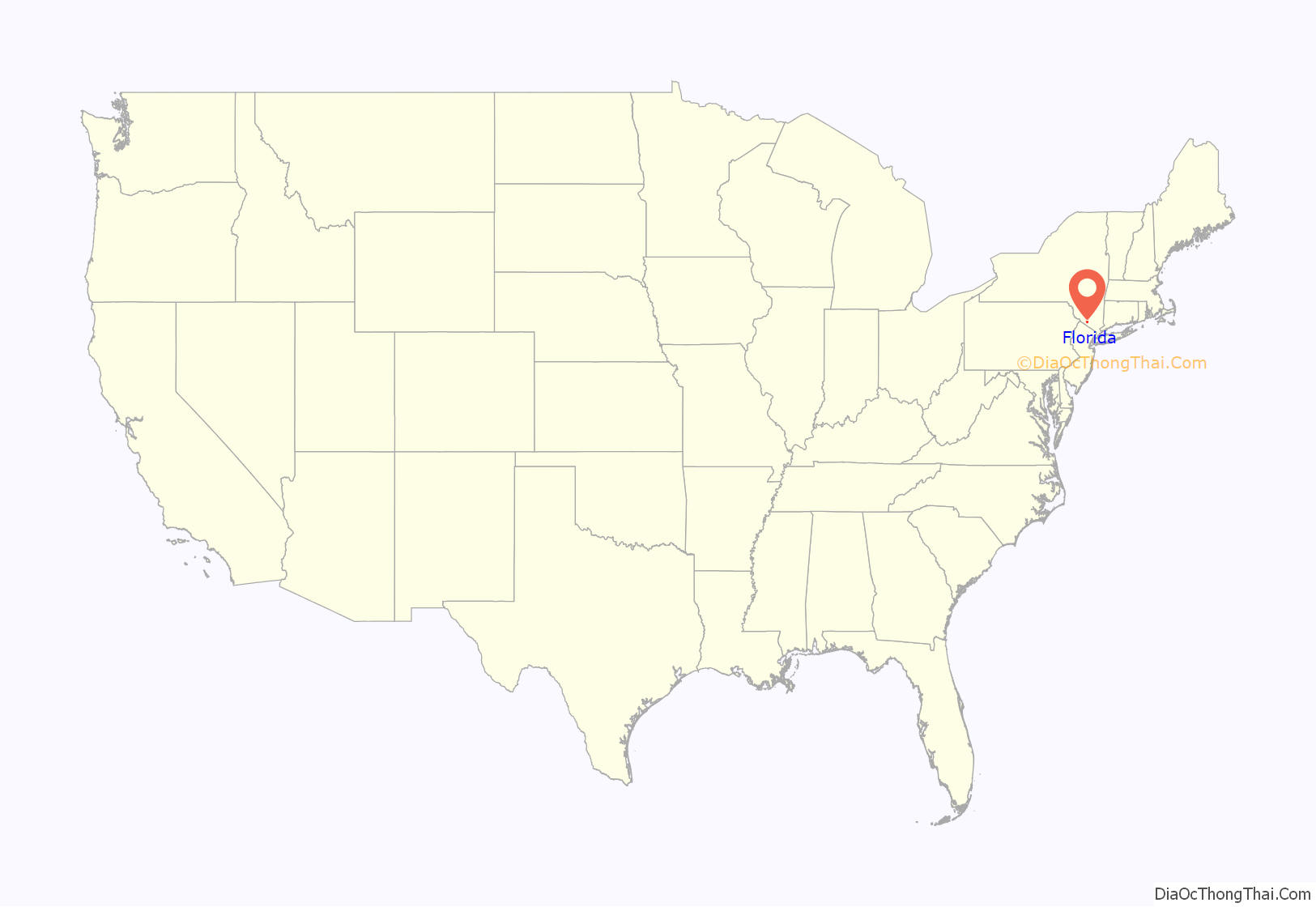
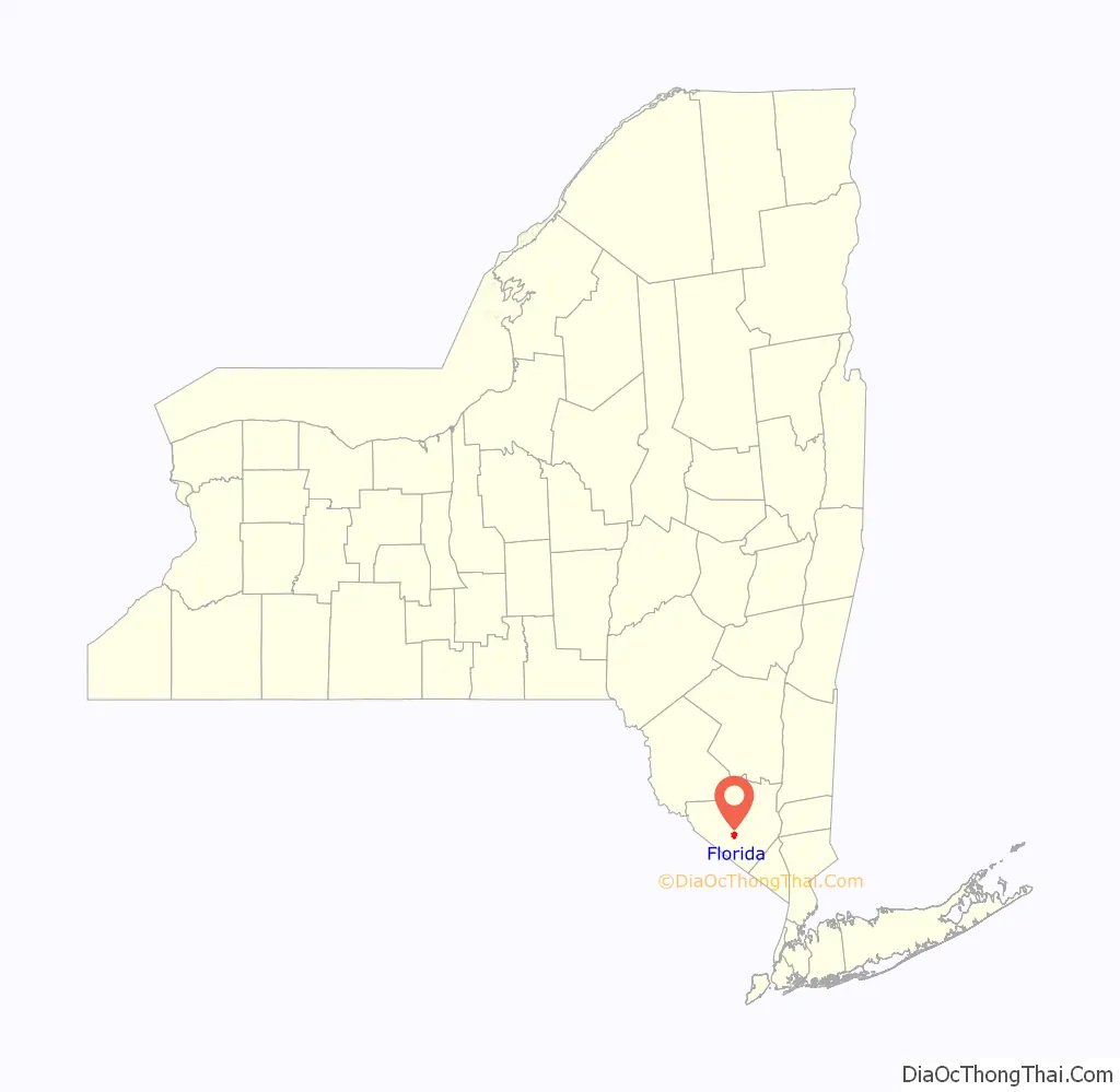
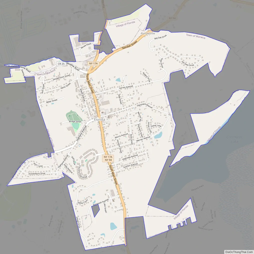
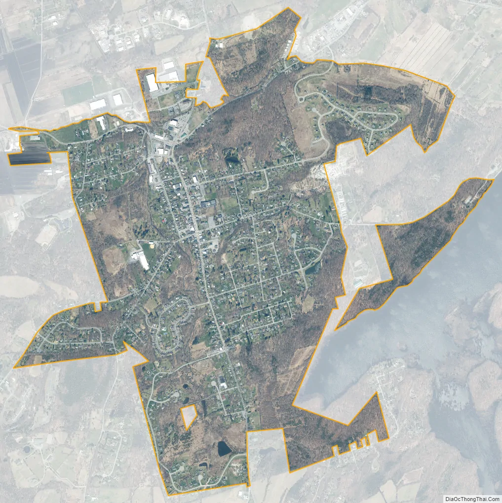
Florida is a village in Orange County, New York, United States. The population was 3,049 as of the 2020 census. It is part of the Poughkeepsie-Newburgh-Middletown Metropolitan Statistical Area as well as the larger New York–Newark–Bridgeport, NY-NJ–CT–PA Combined Statistical Area. The village is located in the town of Warwick, with two small northern portions in the town of Goshen. Florida is at the convergence of Routes 17A and 94.
Florida has its own school district known as the Florida Union Free School District. The district consists of Golden Hill Elementary School and S. S. Seward Institute. The mascot for S.S. Seward Institute is a Spartan.
The current mayor is Daniel Harter, Jr., who was elected in March 2018.
| Name: | Florida village |
|---|---|
| LSAD Code: | 47 |
| LSAD Description: | village (suffix) |
| State: | New York |
| County: | Orange County |
| Elevation: | 446 ft (136 m) |
| Total Area: | 2.25 sq mi (5.84 km²) |
| Land Area: | 2.25 sq mi (5.83 km²) |
| Water Area: | 0.00 sq mi (0.01 km²) 0% |
| Total Population: | 2,888 |
| Population Density: | 1,282.99/sq mi (495.26/km²) |
| ZIP code: | 10921 |
| Area code: | 845 |
| FIPS code: | 3626319 |
| GNISfeature ID: | 0950303 |
Online Interactive Map
Click on ![]() to view map in "full screen" mode.
to view map in "full screen" mode.
Florida location map. Where is Florida village?
History
The area had been occupied by indigenous peoples for thousands of years.
The part of the Wawayanda Patent which contained the present day village was known as the Florida Tract. The initial settlement on the site was known as Brookland but was given its current name in the 1760s. It was incorporated in 1946.
Florida is in a farming area known for the vast onion fields in the nearby Black Dirt Region.
Local radio station, WTBQ was located in Florida from 1984 to 2007, on Main Street, in the white professional bldg, across from Seward High School. The station is currently located two miles south of the Village of Warwick.
Florida Road Map
Florida city Satellite Map
Geography
The village is west of Glenmere Lake and east of Warwick.
Florida is located at 41°19′52″N 74°21′33″W / 41.33111°N 74.35917°W / 41.33111; -74.35917 (41.331217, -74.359167).
According to the United States Census Bureau, the village has a total area of 1.9 square miles (4.9 km), all land.
See also
Map of New York State and its subdivision:- Albany
- Allegany
- Bronx
- Broome
- Cattaraugus
- Cayuga
- Chautauqua
- Chemung
- Chenango
- Clinton
- Columbia
- Cortland
- Delaware
- Dutchess
- Erie
- Essex
- Franklin
- Fulton
- Genesee
- Greene
- Hamilton
- Herkimer
- Jefferson
- Kings
- Lake Ontario
- Lewis
- Livingston
- Madison
- Monroe
- Montgomery
- Nassau
- New York
- Niagara
- Oneida
- Onondaga
- Ontario
- Orange
- Orleans
- Oswego
- Otsego
- Putnam
- Queens
- Rensselaer
- Richmond
- Rockland
- Saint Lawrence
- Saratoga
- Schenectady
- Schoharie
- Schuyler
- Seneca
- Steuben
- Suffolk
- Sullivan
- Tioga
- Tompkins
- Ulster
- Warren
- Washington
- Wayne
- Westchester
- Wyoming
- Yates
- Alabama
- Alaska
- Arizona
- Arkansas
- California
- Colorado
- Connecticut
- Delaware
- District of Columbia
- Florida
- Georgia
- Hawaii
- Idaho
- Illinois
- Indiana
- Iowa
- Kansas
- Kentucky
- Louisiana
- Maine
- Maryland
- Massachusetts
- Michigan
- Minnesota
- Mississippi
- Missouri
- Montana
- Nebraska
- Nevada
- New Hampshire
- New Jersey
- New Mexico
- New York
- North Carolina
- North Dakota
- Ohio
- Oklahoma
- Oregon
- Pennsylvania
- Rhode Island
- South Carolina
- South Dakota
- Tennessee
- Texas
- Utah
- Vermont
- Virginia
- Washington
- West Virginia
- Wisconsin
- Wyoming


