The Village of Hamilton is a village located within the town of Hamilton in Madison County, New York, United States. Notably, it is the location of Colgate University and has a population of 4,239, according to the 2010 census. The 2017 movie Pottersville starring Michael Shannon and Judy Greer was filmed here.
| Name: | Hamilton village |
|---|---|
| LSAD Code: | 47 |
| LSAD Description: | village (suffix) |
| State: | New York |
| County: | Madison County |
| Elevation: | 1,122 ft (342 m) |
| Total Area: | 2.69 sq mi (6.96 km²) |
| Land Area: | 2.49 sq mi (6.46 km²) |
| Water Area: | 0.19 sq mi (0.50 km²) |
| Total Population: | 4,107 |
| Population Density: | 1,646.75/sq mi (635.91/km²) |
| ZIP code: | 13346 |
| Area code: | 315 |
| FIPS code: | 3631709 |
| GNISfeature ID: | 0952091 |
| Website: | hamilton-ny.gov |
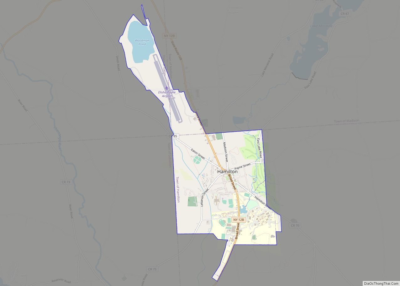
Online Interactive Map
Click on ![]() to view map in "full screen" mode.
to view map in "full screen" mode.
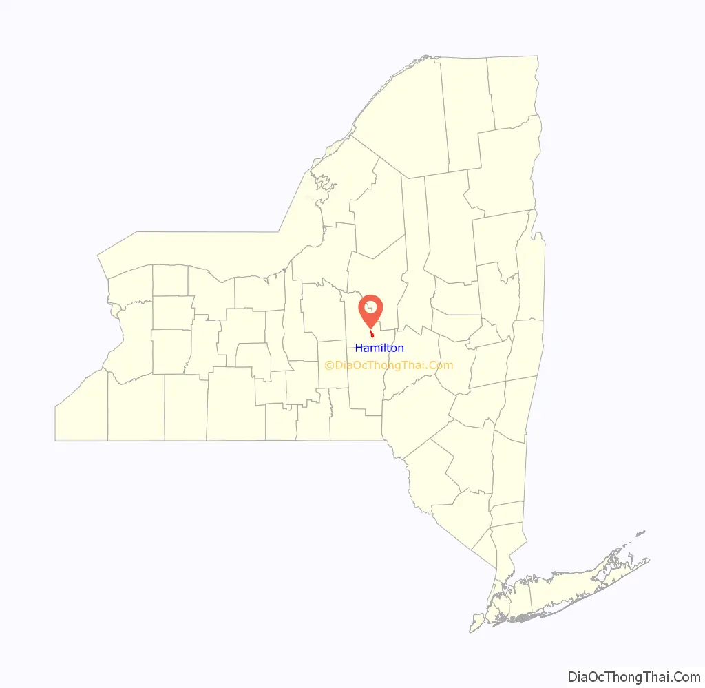
Hamilton location map. Where is Hamilton village?

History
The area that became the town of Hamilton (including the village of Hamilton) was originally inhabited by members of the Iroquois League, and some of the territory is still considered to be sacred by the Oneida Indian Nation. Following the American Revolution, the area was ceded to the State of New York. Until 1878, Hamilton was an original outpost of the Chenango Canal.
The town of Hamilton was founded near what is now Earlville, and has gradually expanded into a wide area populated by farms and settlements.
The family of the brothers Samuel and Elisha Payne had been prominent in Connecticut since before the Revolutionary War, in which they had served, possibly at Ft. Stanwix, near what is now Rome, New York. At the close of the Revolutionary War, The pair moved from Lebanon, Connecticut, to the town of Whitestone (now Whitesboro, New York), a few miles from Utica.
In 1794, Samuel Payne moved southwest from Whitestone into the town of Hamilton, where he started a farm on the hill that is today’s location of Colgate University.
In 1795, a year after his brother moved into the town of Hamilton, Elisha Payne did so as well. He and others from Whitestone and Connecticut moved to an unsettled area just north of his brother and that settlement grew to become today’s village of Hamilton. Because of Elisha Payne’s interest and ability in developing the settlement, it became known as “Payne’s Settlement”. He built a barn, the first framed building in the village, and in 1802 he opened a tavern at the intersection of Broad and Lebanon streets, taking the place of an existing tavern that had opened in 1800. This became the Park House (hotel), which in 1925 was replaced by the present-day Colgate Inn.
By 1800, Payne’s Settlement had, in addition to log cabins, five framed buildings and a nearby sawmill. By 1806 much of the land surrounding the settlement had been cleared and replaced by orchards and farms. Salt was the accepted form of currency in the settlement.
Payne’s Settlement experienced a financial boom from 1800 through the War of 1812 due to extensive crop exports to Europe and to the high prices obtained for provisions in New York during the war. Serving as the trading center, the Settlement naturally prospered when farmers received higher prices. In addition, the 1808 opening of the Skaneateles Turnpike, which connected the village to western New York, probably contributed to the favorable economic climate.
From the beginning, Payne’s Settlement and the other settlements within the town of Hamilton strongly competed to be the principal location for development. Due to the advantages of its location, the balance of power shifted toward Payne’s Settlement and, in 1812, the settlement obtained a charter incorporating the Village of Hamilton.
Early commerce in the village included groceries, blacksmiths, book sellers, furniture and carriage makers, feed stores, quarries and lumber mills. The village’s first newspaper, the Hamilton Recorder, was started in 1817. The Chenango Canal (1834–1878) passed through the west side of the village alongside what is now the Barge Canal Cafe, providing another connection between the Erie Canal, Midwest grain farms and East Coast markets. Agriculture in the surrounding area initially emphasized hops which gave way after the Civil War to dairy farming.
Colgate University was founded in the village in 1819. Today, Colgate’s campus is located on what was Samuel Payne’s farm. In 1827, the farm, valued at $4,000 (then current dollars) covering 123 acres (50 ha), was donated by Payne and his wife to the Baptist Theological Society as the new location of the Society’s Theological Institution, known as the Hamilton Literary and Theological Institution, which later became Colgate. In 1846, the name of Hamilton Literary and Theological Institution was changed to Madison University. The year 1890 brought about the change in the university’s name to Colgate University, in honor of the involvement and financial support of the Colgate family over many years.
In 1903, John Vincent Atanasoff, creator of the first digital electronic computer, was born in Hamilton.
Much of the historic core of the village is part of the Hamilton Village Historic District, which became listed on the National Register of Historic Places in 1984. Many of the buildings in today’s village date from 1895, the year of “the great fire” which destroyed much of the village. Many of those buildings were rebuilt in the same year, with “1895” on their facades.
Also listed on the National Register of Historic Places are the Old Biology Hall (today called Hascall Hall) on Colgate University’s campus, Adon Smith House, and United States Post Office.
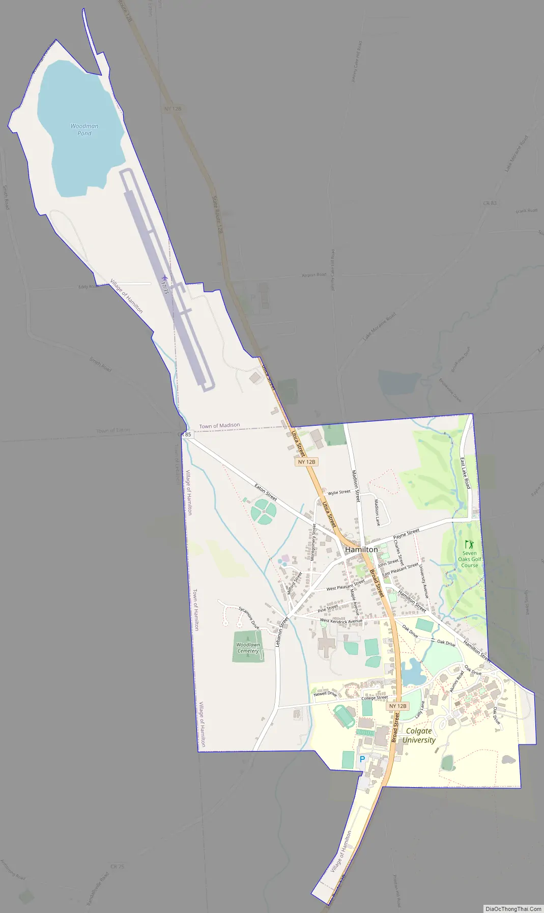
Hamilton Road Map
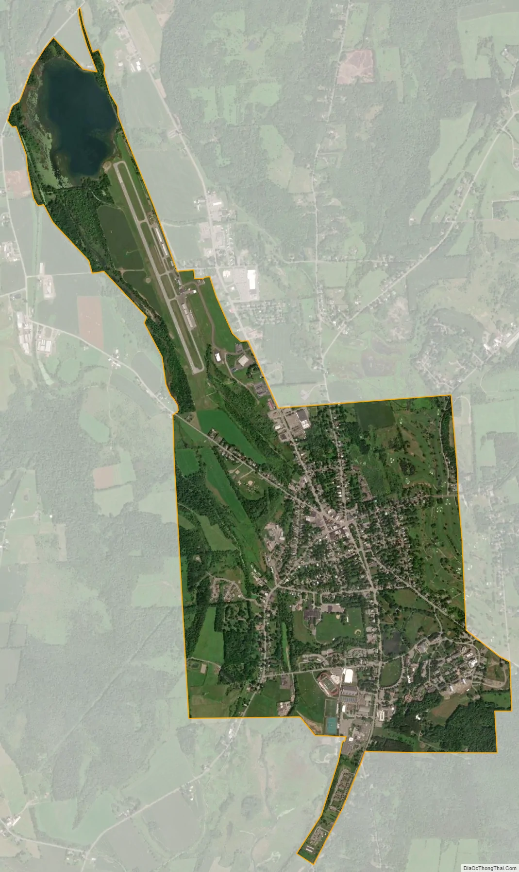
Hamilton city Satellite Map
Geography
The village, located at 42°49′32″N 75°32′40″W / 42.82556°N 75.54444°W / 42.82556; -75.54444 (42.825646, -75.544673), lies in the Chenango Valley, just south of the headwaters of the Chenango River. Northeast of the village is the river Payne Brook, which starts at Lake Moraine and travels through the village before converging with the Chenango River. The village is approximately 40 miles (64 km) southeast of Syracuse and 30 miles (48 km) southwest of Utica. The elevation of the village’s municipal airport (Hamilton Municipal Airport) is approximately 1,100 feet (340 m) above sea level.
According to the United States Census Bureau, the village’s total area is 2.5 square miles (6.5 km), of which 2.3 square miles (6.1 km) is land and 0.2 square miles (0.4 km) (6.37%) is water.
Snowfall is the most notable aspect of the area’s climate, which is typical of central Upstate New York in the vicinity of Syracuse. Snowfall produced by lake-effect snow from Lake Erie and Lake Ontario usually extends into the Mohawk Valley and often inland as far as the southern Finger Lakes and the nearby southern tier of counties; with snowfall, at a minimum, in the range of 40 to 50 inches per season. Heavy snow falls frequently occur, generating from 1 to 2 feet of snow and occasionally 4 feet or more. The village’s average seasonal snowfall is approximately 80 inches.
See also
Map of New York State and its subdivision:- Albany
- Allegany
- Bronx
- Broome
- Cattaraugus
- Cayuga
- Chautauqua
- Chemung
- Chenango
- Clinton
- Columbia
- Cortland
- Delaware
- Dutchess
- Erie
- Essex
- Franklin
- Fulton
- Genesee
- Greene
- Hamilton
- Herkimer
- Jefferson
- Kings
- Lake Ontario
- Lewis
- Livingston
- Madison
- Monroe
- Montgomery
- Nassau
- New York
- Niagara
- Oneida
- Onondaga
- Ontario
- Orange
- Orleans
- Oswego
- Otsego
- Putnam
- Queens
- Rensselaer
- Richmond
- Rockland
- Saint Lawrence
- Saratoga
- Schenectady
- Schoharie
- Schuyler
- Seneca
- Steuben
- Suffolk
- Sullivan
- Tioga
- Tompkins
- Ulster
- Warren
- Washington
- Wayne
- Westchester
- Wyoming
- Yates
- Alabama
- Alaska
- Arizona
- Arkansas
- California
- Colorado
- Connecticut
- Delaware
- District of Columbia
- Florida
- Georgia
- Hawaii
- Idaho
- Illinois
- Indiana
- Iowa
- Kansas
- Kentucky
- Louisiana
- Maine
- Maryland
- Massachusetts
- Michigan
- Minnesota
- Mississippi
- Missouri
- Montana
- Nebraska
- Nevada
- New Hampshire
- New Jersey
- New Mexico
- New York
- North Carolina
- North Dakota
- Ohio
- Oklahoma
- Oregon
- Pennsylvania
- Rhode Island
- South Carolina
- South Dakota
- Tennessee
- Texas
- Utah
- Vermont
- Virginia
- Washington
- West Virginia
- Wisconsin
- Wyoming