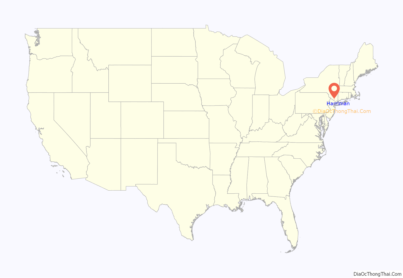
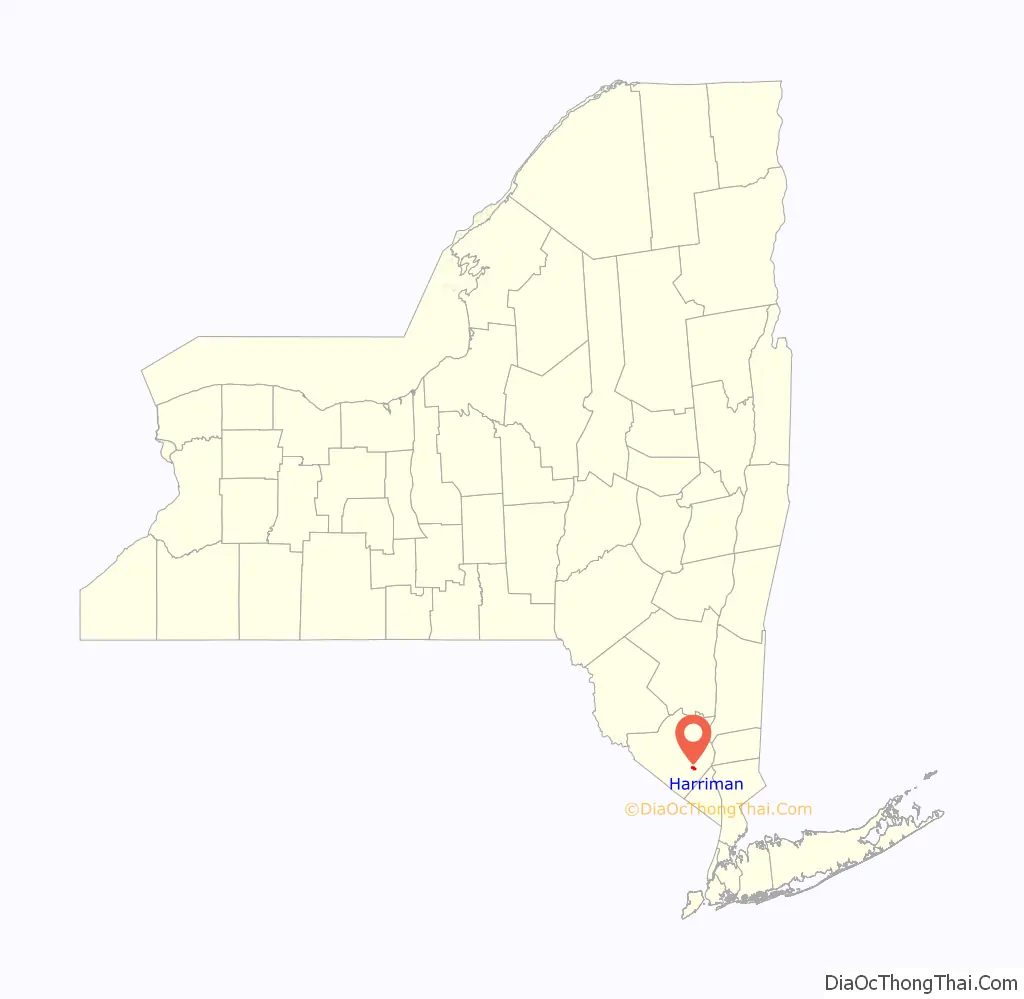
Harriman is a village in Orange County, New York, United States. It is in the southeastern section of the town of Monroe, with a small portion in the town of Woodbury. The population was 2,714 at the 2020 census. It is part of the Poughkeepsie–Newburgh–Middletown, NY Metropolitan Statistical Area as well as the larger New York–Newark–Bridgeport, NY-NJ–CT–PA Combined Statistical Area.
| Name: | Harriman village |
|---|---|
| LSAD Code: | 47 |
| LSAD Description: | village (suffix) |
| State: | New York |
| County: | Orange County |
| Elevation: | 538 ft (164 m) |
| Total Area: | 1.02 sq mi (2.65 km²) |
| Land Area: | 1.00 sq mi (2.60 km²) |
| Water Area: | 0.02 sq mi (0.05 km²) |
| Total Population: | 2,714 |
| Population Density: | 2,703.19/sq mi (1,043.28/km²) |
| ZIP code: | 10926 |
| Area code: | 845 |
| FIPS code: | 3632325 |
| GNISfeature ID: | 0952253 |
| Website: | www.villageofharriman.org |
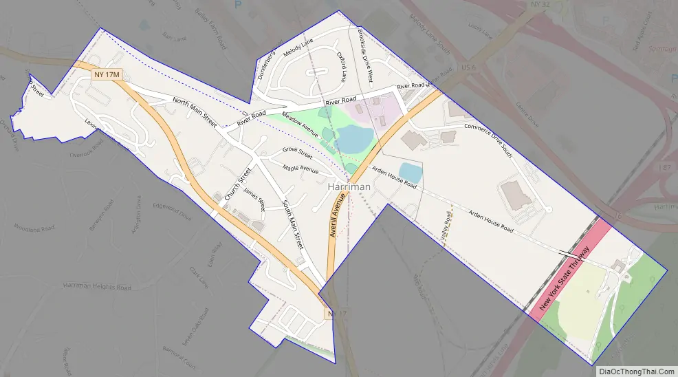
Online Interactive Map
Click on ![]() to view map in "full screen" mode.
to view map in "full screen" mode.
Harriman location map. Where is Harriman village?
History
The village is named after E. H. Harriman, former president of the Union Pacific railroad, whose estate — Arden — is adjacent to the village. Previously, the village was known as Turner, from the early restaurant of Peter Turner.
Edward Henry Harriman attended school in New York and New Jersey, but dropped out when he was 14 years old and took on the job of Wall Street message boy. He swiftly became a managing clerk, and then at the age of 22 he became a stockbroker with a seat on the New York Stock Exchange. He married Mary Williamson Averell and by 1881 his career as a rebuilder of bankrupt tracks began on the Lake Ontario Southern Railway, which Harriman fixed up and sold to the Pennsylvania Railroad for an outstanding profit. He became one of the most powerful men in America from owning various railroads with aspirations of owning all of them.
Harriman went on a voyage which became known as the Harriman Alaska Expedition. In 1899, Harriman along with a superior group of scientists, photographers, artists, and naturalists set out to explore the coast of Alaska. This was a two-month expedition traveling from Seattle to Siberia, and then back again. He visited and documented several different places along the Alaskan coast with various discoveries he brought back to Seattle at the end of the voyage on July 30. E.H. Harriman died September 9, at his home at age 62.
In 1950, Harriman had a population of 676.
Harriman Road Map
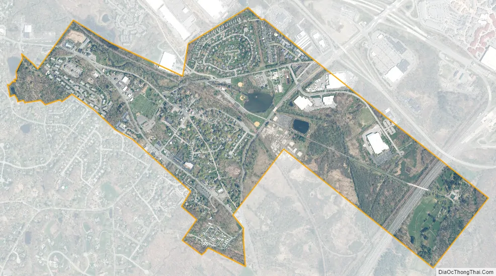
Harriman city Satellite Map
Geography
Harriman is located at 41°18′30″N 74°8′50″W / 41.30833°N 74.14722°W / 41.30833; -74.14722 (41.308442, -74.147317).
According to the United States Census Bureau, the village has a total area of 1.0 square mile (2.6 km), of which 1.0 square mile (2.6 km) is land and 1.00% is water.
NY-17, NY-17M and NY-32 connect in the village. New York Route 17, US Route 6, and Interstate 87 (New York State Thruway) connect north of the village. Harriman State Park is located east of the village.
See also
Map of New York State and its subdivision:- Albany
- Allegany
- Bronx
- Broome
- Cattaraugus
- Cayuga
- Chautauqua
- Chemung
- Chenango
- Clinton
- Columbia
- Cortland
- Delaware
- Dutchess
- Erie
- Essex
- Franklin
- Fulton
- Genesee
- Greene
- Hamilton
- Herkimer
- Jefferson
- Kings
- Lake Ontario
- Lewis
- Livingston
- Madison
- Monroe
- Montgomery
- Nassau
- New York
- Niagara
- Oneida
- Onondaga
- Ontario
- Orange
- Orleans
- Oswego
- Otsego
- Putnam
- Queens
- Rensselaer
- Richmond
- Rockland
- Saint Lawrence
- Saratoga
- Schenectady
- Schoharie
- Schuyler
- Seneca
- Steuben
- Suffolk
- Sullivan
- Tioga
- Tompkins
- Ulster
- Warren
- Washington
- Wayne
- Westchester
- Wyoming
- Yates
- Alabama
- Alaska
- Arizona
- Arkansas
- California
- Colorado
- Connecticut
- Delaware
- District of Columbia
- Florida
- Georgia
- Hawaii
- Idaho
- Illinois
- Indiana
- Iowa
- Kansas
- Kentucky
- Louisiana
- Maine
- Maryland
- Massachusetts
- Michigan
- Minnesota
- Mississippi
- Missouri
- Montana
- Nebraska
- Nevada
- New Hampshire
- New Jersey
- New Mexico
- New York
- North Carolina
- North Dakota
- Ohio
- Oklahoma
- Oregon
- Pennsylvania
- Rhode Island
- South Carolina
- South Dakota
- Tennessee
- Texas
- Utah
- Vermont
- Virginia
- Washington
- West Virginia
- Wisconsin
- Wyoming


