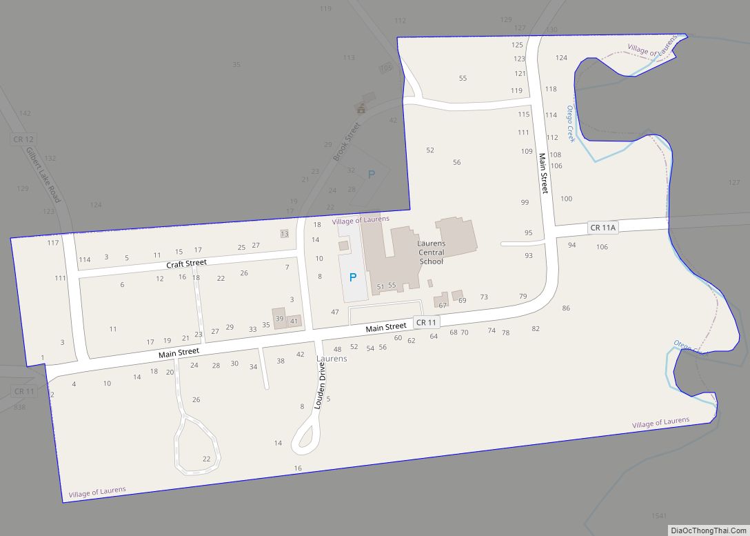
Laurens is a village in Otsego County, New York, United States. The population was 263 at the 2010 census.
The Village of Laurens is in the eastern part of the Town of Laurens. It is also north of the City of Oneonta.
| Name: | Laurens village |
|---|---|
| LSAD Code: | 47 |
| LSAD Description: | village (suffix) |
| State: | New York |
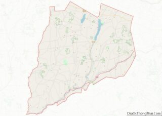
| County: | Otsego County |
| Elevation: | 1,112 ft (339 m) |
| Total Area: | 0.13 sq mi (0.33 km²) |
| Land Area: | 0.13 sq mi (0.33 km²) |
| Water Area: | 0.00 sq mi (0.00 km²) |
| Total Population: | 185 |
| Population Density: | 1,445.31/sq mi (556.27/km²) |
| ZIP code: | 13796 |
| Area code: | 607 |
| FIPS code: | 3641520 |
| GNISfeature ID: | 2390935 |
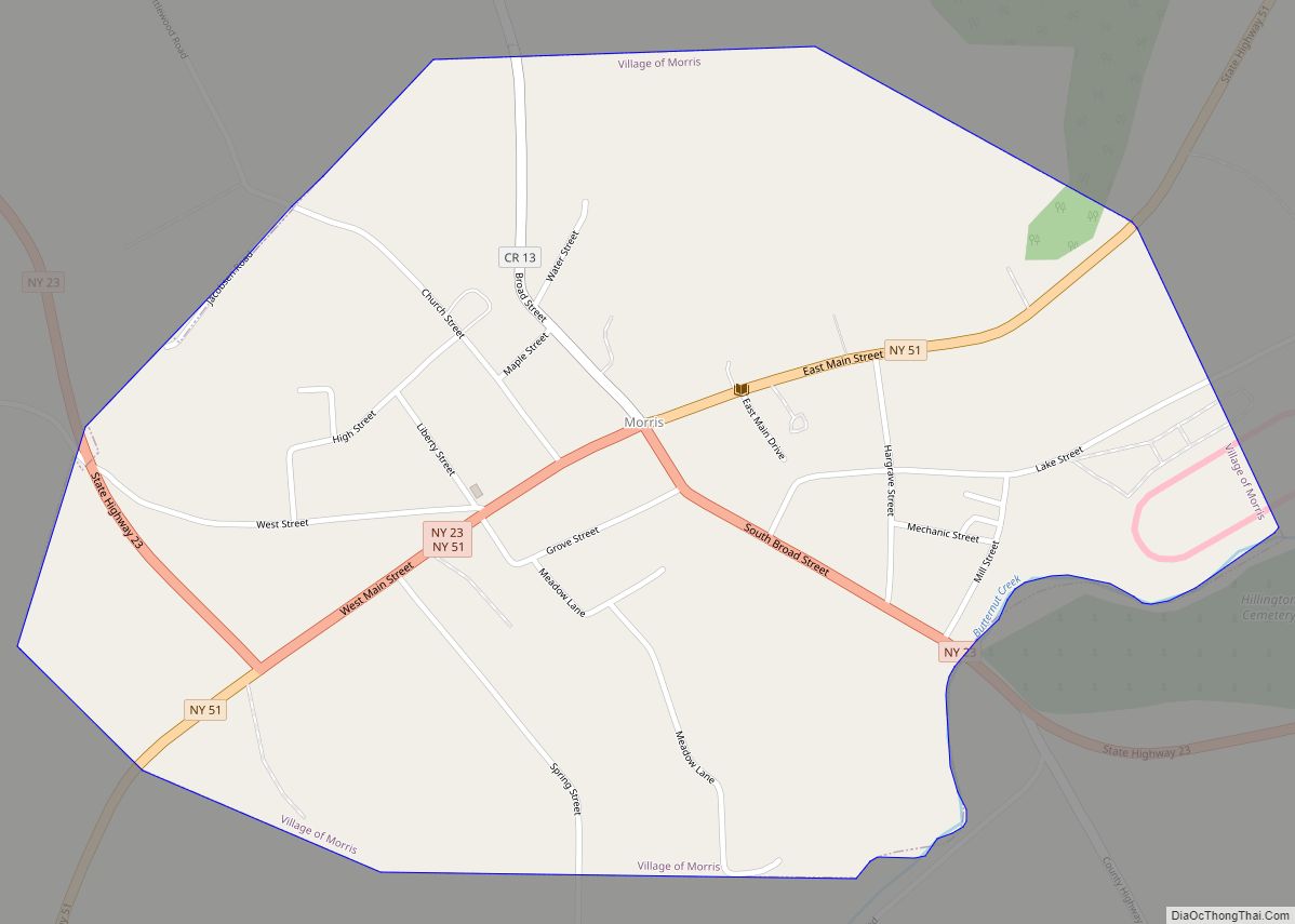
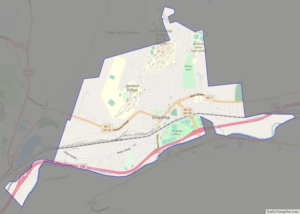
Online Interactive Map
Click on ![]() to view map in "full screen" mode.
to view map in "full screen" mode.
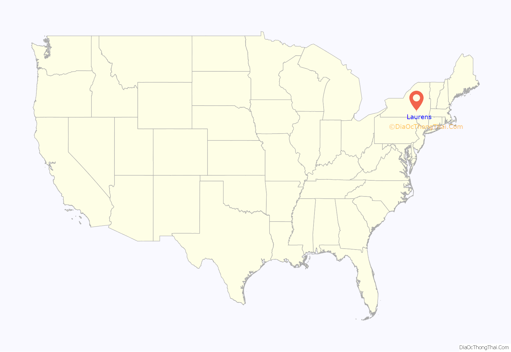
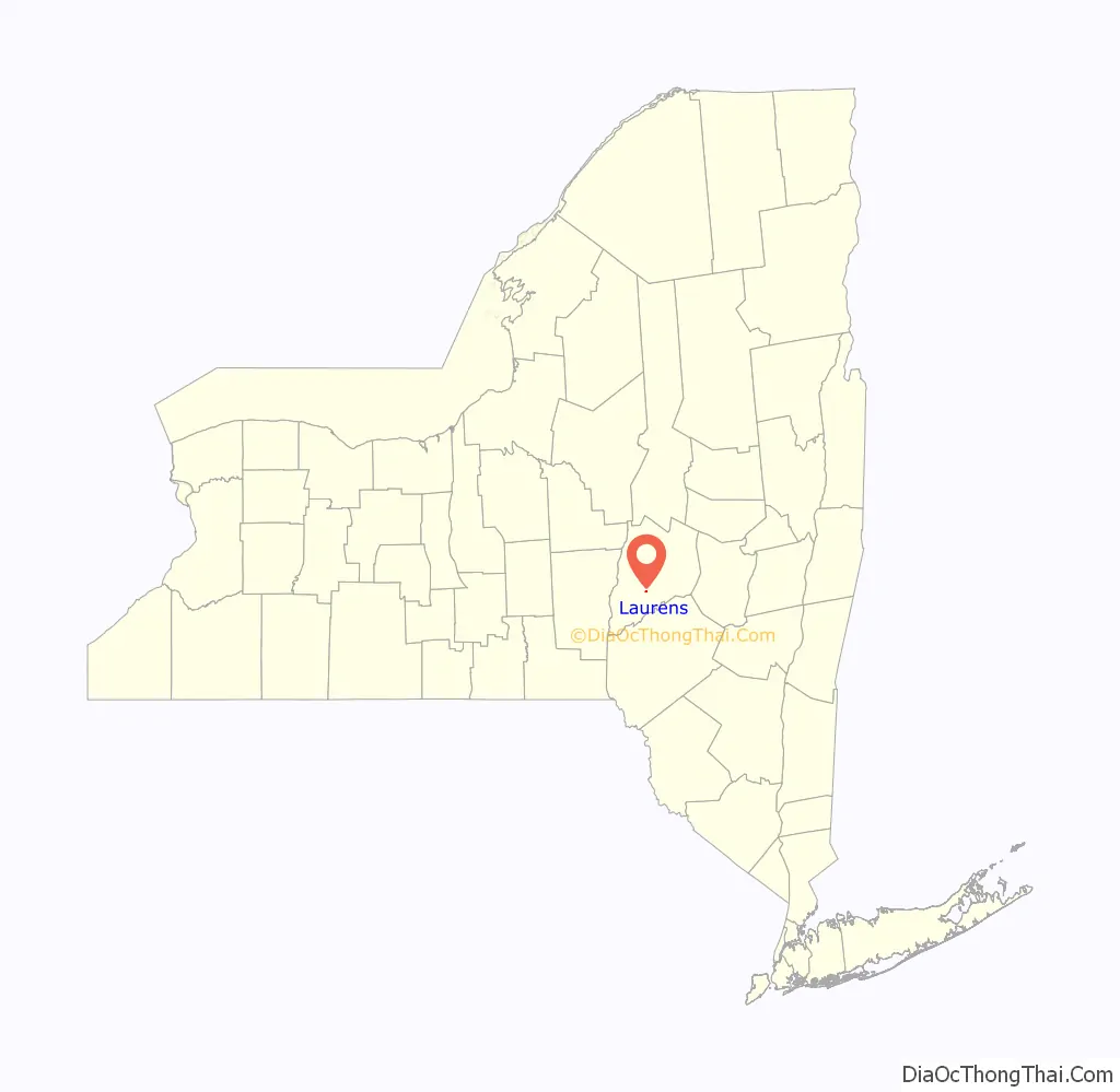
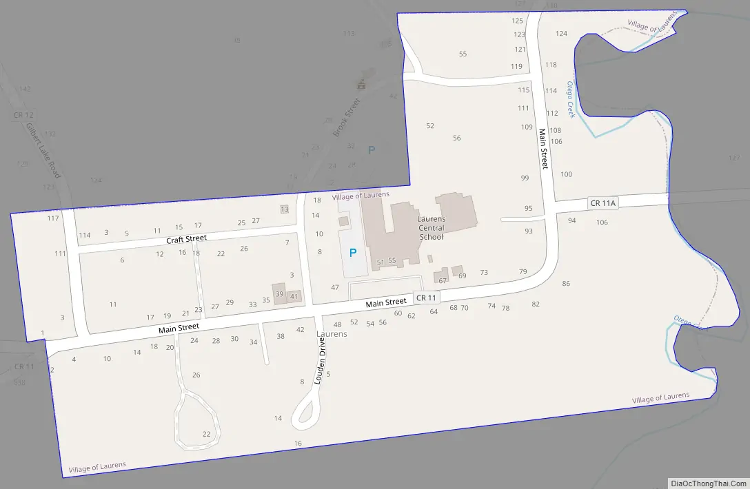
Laurens location map. Where is Laurens village?
History
Laurens is the oldest community in the town. Laurens set itself apart from the town by incorporating as a village in 1811. It was named for Revolutionary War hero Henry Laurens. In 1860, the village had a population of 726 and contained a tannery, an iron foundry, a sawmill, and a cotton mill that was powered by water from Gilbert Lake, north of the town line in New Lisbon. A sulfur spring is located north of the village. The Southern New York Railroad route passed through Laurens, the first car reaching Laurens from Oneonta on July 4, 1901. A logging operator named Emmons Peck from Carbondale, Pennsylvania, would ship tanning bark and nine million feet of lumber from his mill at Gilbert Lake by horse and wagon to the Laurens station by 1909, employing many men.
Laurens Road Map
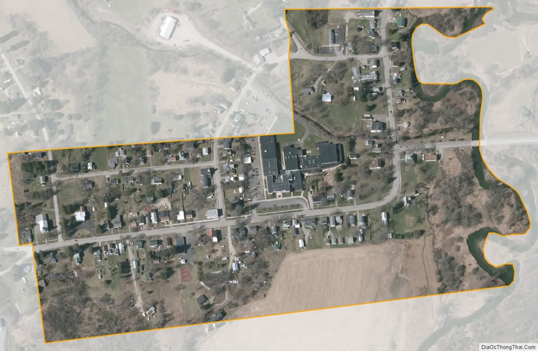
Laurens city Satellite Map
Geography
Laurens is located at 42°32′N 75°5′W / 42.533°N 75.083°W / 42.533; -75.083 (42.5314, -75.0882).
According to the United States Census Bureau, the village has a total area of 0.1 square mile (0.3 km), all land.
The village is located at the junction of County Roads, 10, 11, and 12 and is near Otego Creek. New York State Route 205 runs just outside the eastern end of the village.
See also
Map of New York State and its subdivision:- Albany
- Allegany
- Bronx
- Broome
- Cattaraugus
- Cayuga
- Chautauqua
- Chemung
- Chenango
- Clinton
- Columbia
- Cortland
- Delaware
- Dutchess
- Erie
- Essex
- Franklin
- Fulton
- Genesee
- Greene
- Hamilton
- Herkimer
- Jefferson
- Kings
- Lake Ontario
- Lewis
- Livingston
- Madison
- Monroe
- Montgomery
- Nassau
- New York
- Niagara
- Oneida
- Onondaga
- Ontario
- Orange
- Orleans
- Oswego
- Otsego
- Putnam
- Queens
- Rensselaer
- Richmond
- Rockland
- Saint Lawrence
- Saratoga
- Schenectady
- Schoharie
- Schuyler
- Seneca
- Steuben
- Suffolk
- Sullivan
- Tioga
- Tompkins
- Ulster
- Warren
- Washington
- Wayne
- Westchester
- Wyoming
- Yates
- Alabama
- Alaska
- Arizona
- Arkansas
- California
- Colorado
- Connecticut
- Delaware
- District of Columbia
- Florida
- Georgia
- Hawaii
- Idaho
- Illinois
- Indiana
- Iowa
- Kansas
- Kentucky
- Louisiana
- Maine
- Maryland
- Massachusetts
- Michigan
- Minnesota
- Mississippi
- Missouri
- Montana
- Nebraska
- Nevada
- New Hampshire
- New Jersey
- New Mexico
- New York
- North Carolina
- North Dakota
- Ohio
- Oklahoma
- Oregon
- Pennsylvania
- Rhode Island
- South Carolina
- South Dakota
- Tennessee
- Texas
- Utah
- Vermont
- Virginia
- Washington
- West Virginia
- Wisconsin
- Wyoming