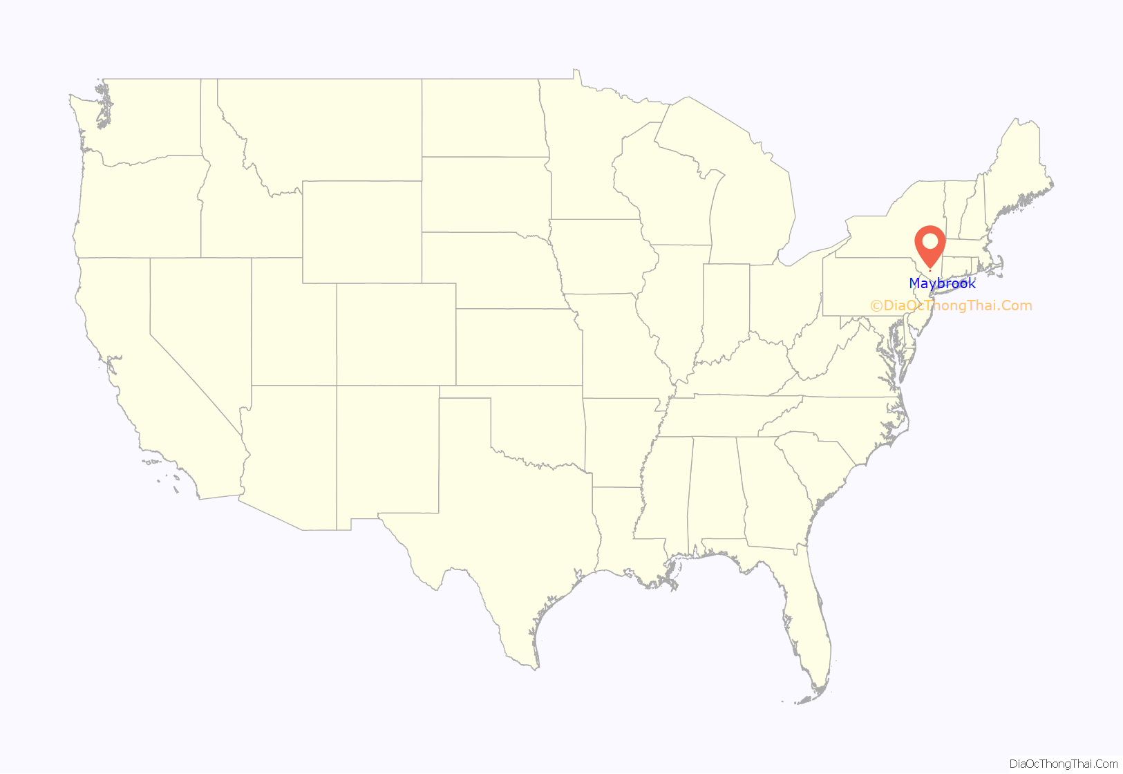
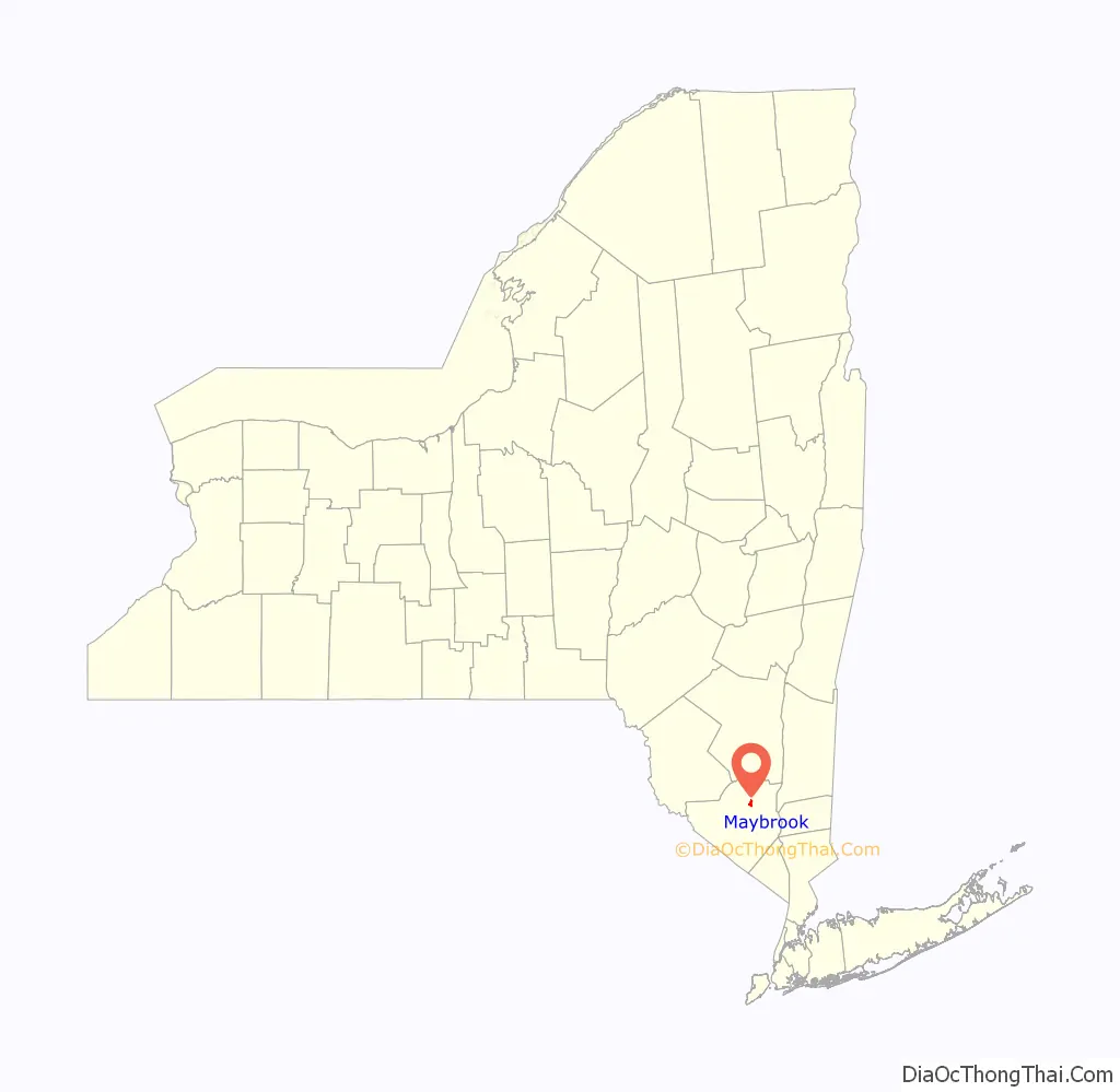
Maybrook is a village in Orange County, New York, United States. The population was 3,150 at the 2020 census. It is part of the Poughkeepsie–Newburgh–Middletown, NY Metropolitan Statistical Area as well as the larger New York–Newark–Bridgeport, NY-NJ–CT–PA Combined Statistical Area.
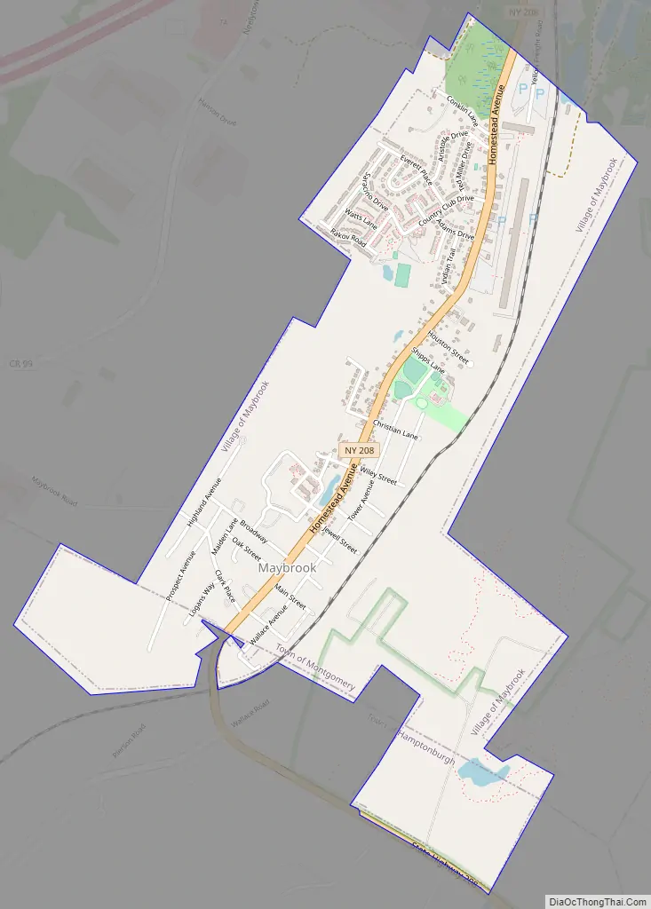
It is located mostly in the town of Montgomery, but a small portion is in the town of Hamptonburgh. It is also defined by the 427 telephone exchange in the 845 area code and the 12543 ZIP code, as well as its own eponymous fire district.
| Name: | Maybrook village |
|---|---|
| LSAD Code: | 47 |
| LSAD Description: | village (suffix) |
| State: | New York |
| County: | Orange County |
| Founded: | 1926 |
| Elevation: | 420 ft (130 m) |
| Total Area: | 1.36 sq mi (3.52 km²) |
| Land Area: | 1.35 sq mi (3.51 km²) |
| Water Area: | 0.01 sq mi (0.01 km²) |
| Total Population: | 3,150 |
| Population Density: | 2,326.44/sq mi (898.09/km²) |
| ZIP code: | 12543 |
| Area code: | 845 |
| FIPS code: | 3646162 |
| GNISfeature ID: | 0956701 |
| Website: | villageofmaybrook.com |
Online Interactive Map
Click on ![]() to view map in "full screen" mode.
to view map in "full screen" mode.
Maybrook location map. Where is Maybrook village?
History
The hamlet was not incorporated as a village until 1926, making it the last of the town of Montgomery’s three villages to be created. Its growth was spurred by the development of Maybrook Yard, an important railroad switching terminal where eastbound traffic from several railroads was funneled across the Poughkeepsie Bridge. At its peak, the yard employed over 1,500 workers. All yards, terminals and roundhouses have since been removed following the closing of the Poughkeepsie Bridge in 1974. There remains freight service to Maybrook via the Middletown and New Jersey Railroad.
Maybrook Road Map
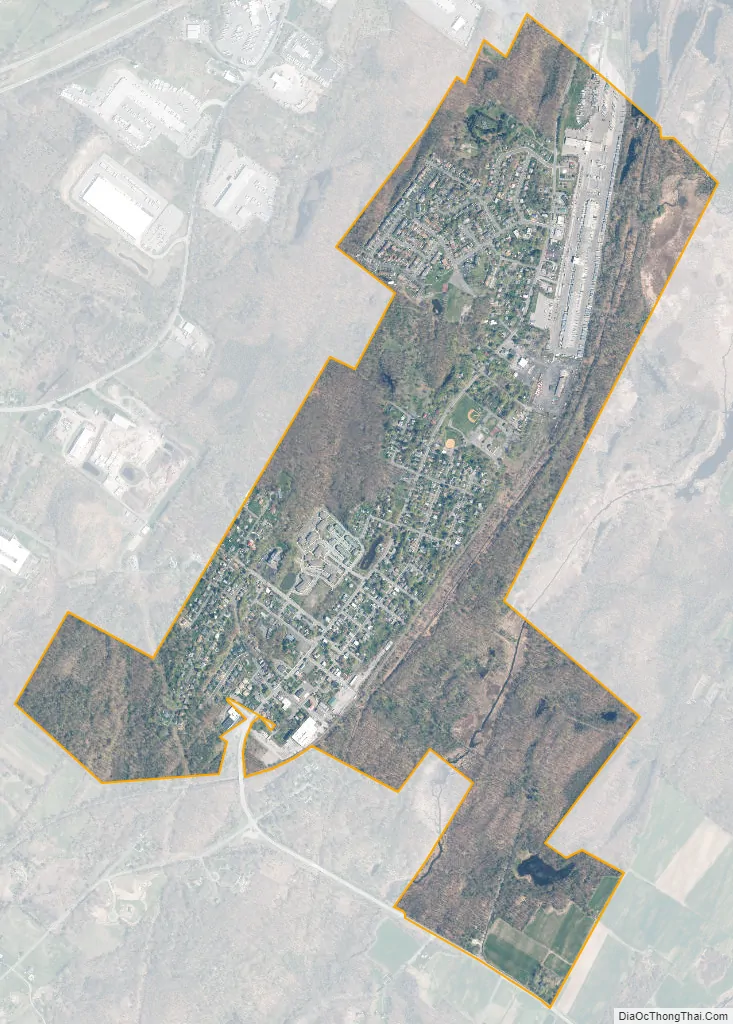
Maybrook city Satellite Map
Geography
Maybrook is located at 41°29′12″N 74°12′52″W / 41.48667°N 74.21444°W / 41.48667; -74.21444 (41.486660, -74.214463).
According to the United States Census Bureau, the village has a total area of 1.3 square miles (3.4 km), all land. The village is centered on NY 208, which runs through it for the village’s two-mile (3.2 km) length in a northeast–southwest orientation, from the small extension in the Town of Hamptonburgh to its northern boundary. By contrast, it is only one mile wide at its widest point, near its south end, and even narrower to the north.
The village is mostly flat, rising up to hills on its western side. The summit of one is its highest elevation, at 520 feet (160 m) above sea level. Maybrook’s lowest point is a swampy, undeveloped area in iterns northeast corner, 360 feet (110 m) in elevation.
Stewart Dairy Farm
In 1930 Thomas “Archie” Stewart, an early aviation enthusiast and descendant of prominent local dairy farmer Lachlan Stewart, convinced his uncle Samuel Stewart to donate “Stoney Lonesome”, split between the towns of Newburgh and New Windsor, to the nearby city of Newburgh for use as an airport.
In the early 1970s, Governor Nelson Rockefeller’s administration saw the potential for Stewart Airport to support the metropolitan area. Its long runway made it particularly attractive for intercontinental service via supersonic transport (SST), then under development in the U.S. and elsewhere. The Metropolitan Transportation Authority was the first government body to try to convert it into the New York metropolitan area’s fourth major airport. It tripled the airport’s territory, extending its land well beyond its previous western boundary at Drury Lane, a two-lane rural road. The state government used its eminent domain powers to take 7,500 acres (30 km) for terminals, runways and a buffer zone expanding the airport from Newburgh into neighboring towns of Montgomery and a small portion of Hamptonburgh. The land was bounded by I-84 to the north, Route 207 along the south and roughly by Rock Tavern and Maybrook in the west.
See also
Map of New York State and its subdivision:- Albany
- Allegany
- Bronx
- Broome
- Cattaraugus
- Cayuga
- Chautauqua
- Chemung
- Chenango
- Clinton
- Columbia
- Cortland
- Delaware
- Dutchess
- Erie
- Essex
- Franklin
- Fulton
- Genesee
- Greene
- Hamilton
- Herkimer
- Jefferson
- Kings
- Lake Ontario
- Lewis
- Livingston
- Madison
- Monroe
- Montgomery
- Nassau
- New York
- Niagara
- Oneida
- Onondaga
- Ontario
- Orange
- Orleans
- Oswego
- Otsego
- Putnam
- Queens
- Rensselaer
- Richmond
- Rockland
- Saint Lawrence
- Saratoga
- Schenectady
- Schoharie
- Schuyler
- Seneca
- Steuben
- Suffolk
- Sullivan
- Tioga
- Tompkins
- Ulster
- Warren
- Washington
- Wayne
- Westchester
- Wyoming
- Yates
- Alabama
- Alaska
- Arizona
- Arkansas
- California
- Colorado
- Connecticut
- Delaware
- District of Columbia
- Florida
- Georgia
- Hawaii
- Idaho
- Illinois
- Indiana
- Iowa
- Kansas
- Kentucky
- Louisiana
- Maine
- Maryland
- Massachusetts
- Michigan
- Minnesota
- Mississippi
- Missouri
- Montana
- Nebraska
- Nevada
- New Hampshire
- New Jersey
- New Mexico
- New York
- North Carolina
- North Dakota
- Ohio
- Oklahoma
- Oregon
- Pennsylvania
- Rhode Island
- South Carolina
- South Dakota
- Tennessee
- Texas
- Utah
- Vermont
- Virginia
- Washington
- West Virginia
- Wisconsin
- Wyoming


