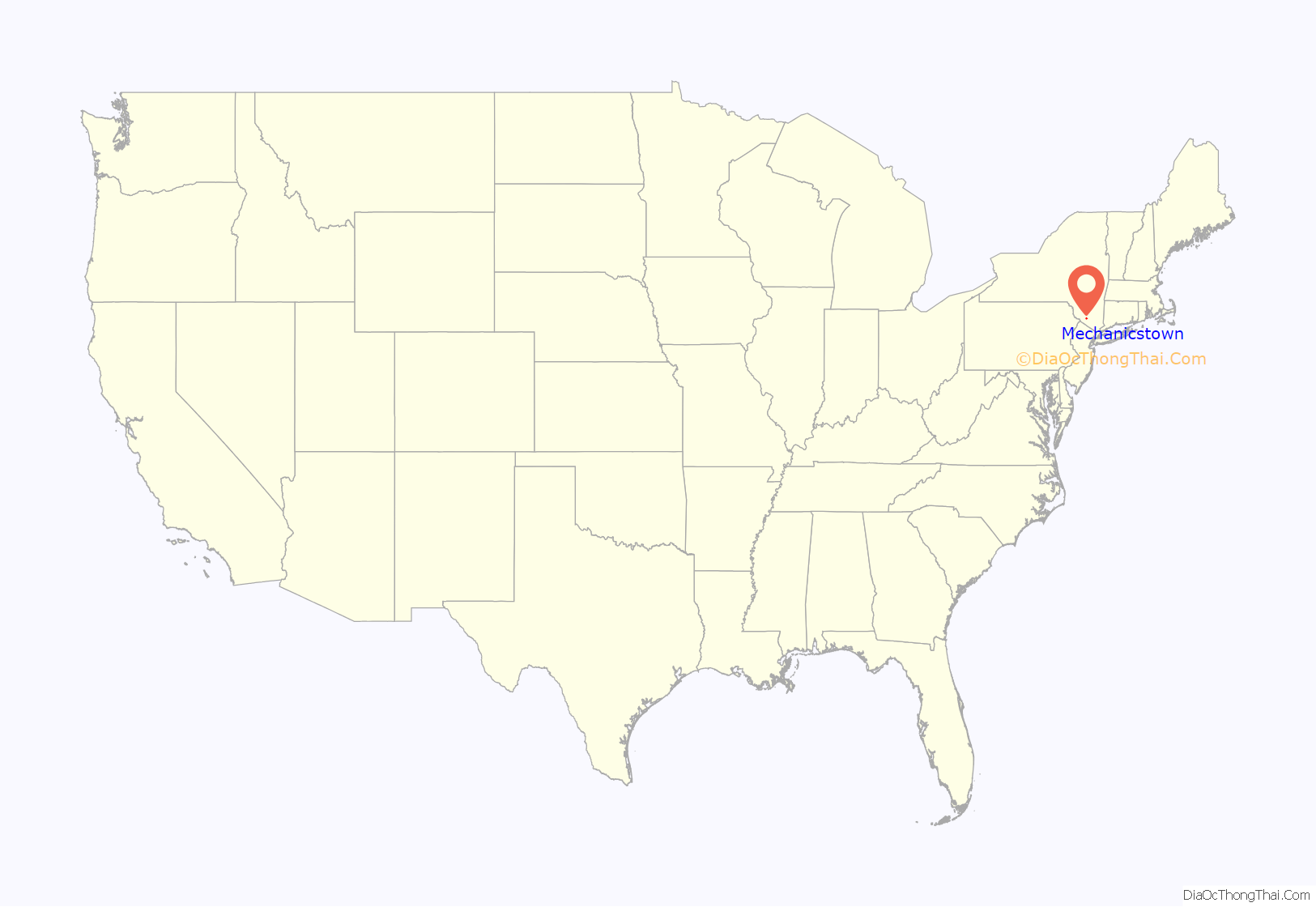
Mechanicstown is a hamlet (and census-designated place) in Orange County, New York, United States. The population was 8,065 at the 2020 census. It is part of the Poughkeepsie–Newburgh–Middletown, NY Metropolitan Statistical Area as well as the larger New York–Newark–Bridgeport, NY-NJ–CT–PA Combined Statistical Area.
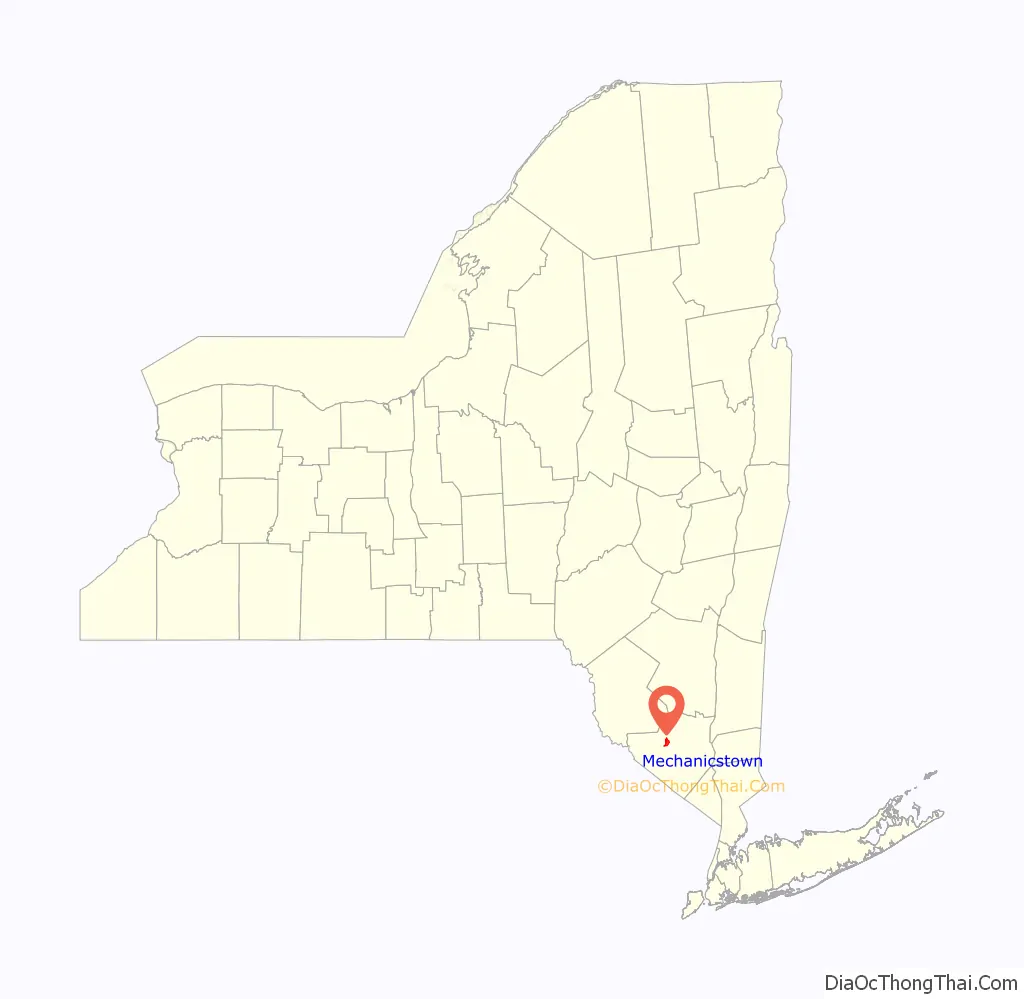
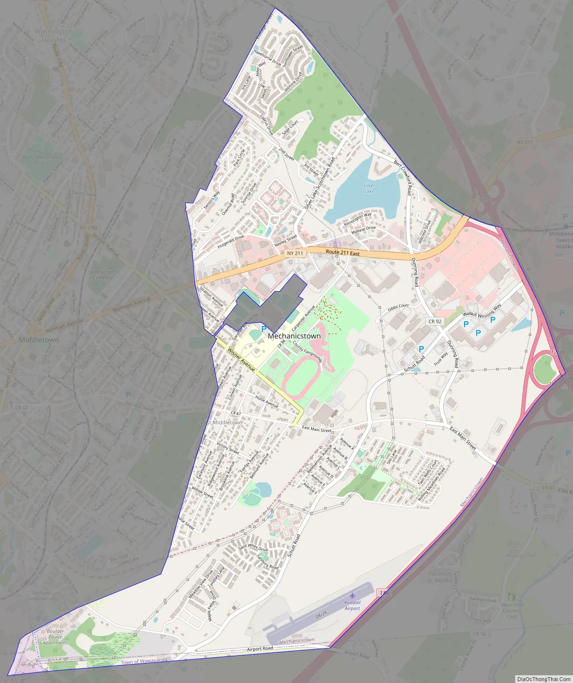
Mechanicstown is in the Town of Walkill, southeast of City of Middletown.
| Name: | Mechanicstown CDP |
|---|---|
| LSAD Code: | 57 |
| LSAD Description: | CDP (suffix) |
| State: | New York |
| County: | Orange County |
| Elevation: | 531 ft (162 m) |
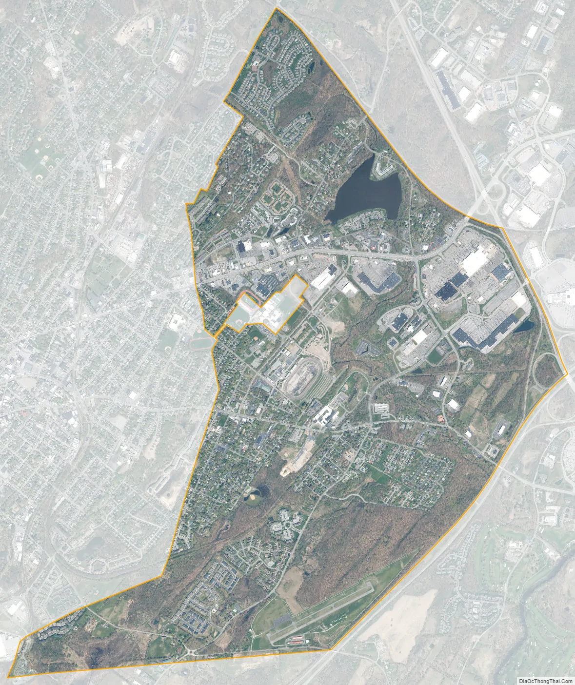
| Total Area: | 3.41 sq mi (8.82 km²) |
| Land Area: | 3.35 sq mi (8.67 km²) |
| Water Area: | 0.06 sq mi (0.14 km²) |
| Total Population: | 8,065 |
| Population Density: | 2,408.18/sq mi (929.81/km²) |
| FIPS code: | 3646349 |
| GNISfeature ID: | 0956896 |
Online Interactive Map
Click on ![]() to view map in "full screen" mode.
to view map in "full screen" mode.
Mechanicstown location map. Where is Mechanicstown CDP?
Mechanicstown Road Map
Mechanicstown city Satellite Map
Geography
Mechanicstown is located at 41°26′58″N 74°23′39″W / 41.44944°N 74.39417°W / 41.44944; -74.39417 (41.449568, -74.394114).
According to the United States Census Bureau, the CDP has a total area of 3.4 square miles (8.8 km), of which 3.3 square miles (8.5 km) is land and 0.1 square miles (0.26 km) (2.06%) is water.
See also
Map of New York State and its subdivision:- Albany
- Allegany
- Bronx
- Broome
- Cattaraugus
- Cayuga
- Chautauqua
- Chemung
- Chenango
- Clinton
- Columbia
- Cortland
- Delaware
- Dutchess
- Erie
- Essex
- Franklin
- Fulton
- Genesee
- Greene
- Hamilton
- Herkimer
- Jefferson
- Kings
- Lake Ontario
- Lewis
- Livingston
- Madison
- Monroe
- Montgomery
- Nassau
- New York
- Niagara
- Oneida
- Onondaga
- Ontario
- Orange
- Orleans
- Oswego
- Otsego
- Putnam
- Queens
- Rensselaer
- Richmond
- Rockland
- Saint Lawrence
- Saratoga
- Schenectady
- Schoharie
- Schuyler
- Seneca
- Steuben
- Suffolk
- Sullivan
- Tioga
- Tompkins
- Ulster
- Warren
- Washington
- Wayne
- Westchester
- Wyoming
- Yates
- Alabama
- Alaska
- Arizona
- Arkansas
- California
- Colorado
- Connecticut
- Delaware
- District of Columbia
- Florida
- Georgia
- Hawaii
- Idaho
- Illinois
- Indiana
- Iowa
- Kansas
- Kentucky
- Louisiana
- Maine
- Maryland
- Massachusetts
- Michigan
- Minnesota
- Mississippi
- Missouri
- Montana
- Nebraska
- Nevada
- New Hampshire
- New Jersey
- New Mexico
- New York
- North Carolina
- North Dakota
- Ohio
- Oklahoma
- Oregon
- Pennsylvania
- Rhode Island
- South Carolina
- South Dakota
- Tennessee
- Texas
- Utah
- Vermont
- Virginia
- Washington
- West Virginia
- Wisconsin
- Wyoming


