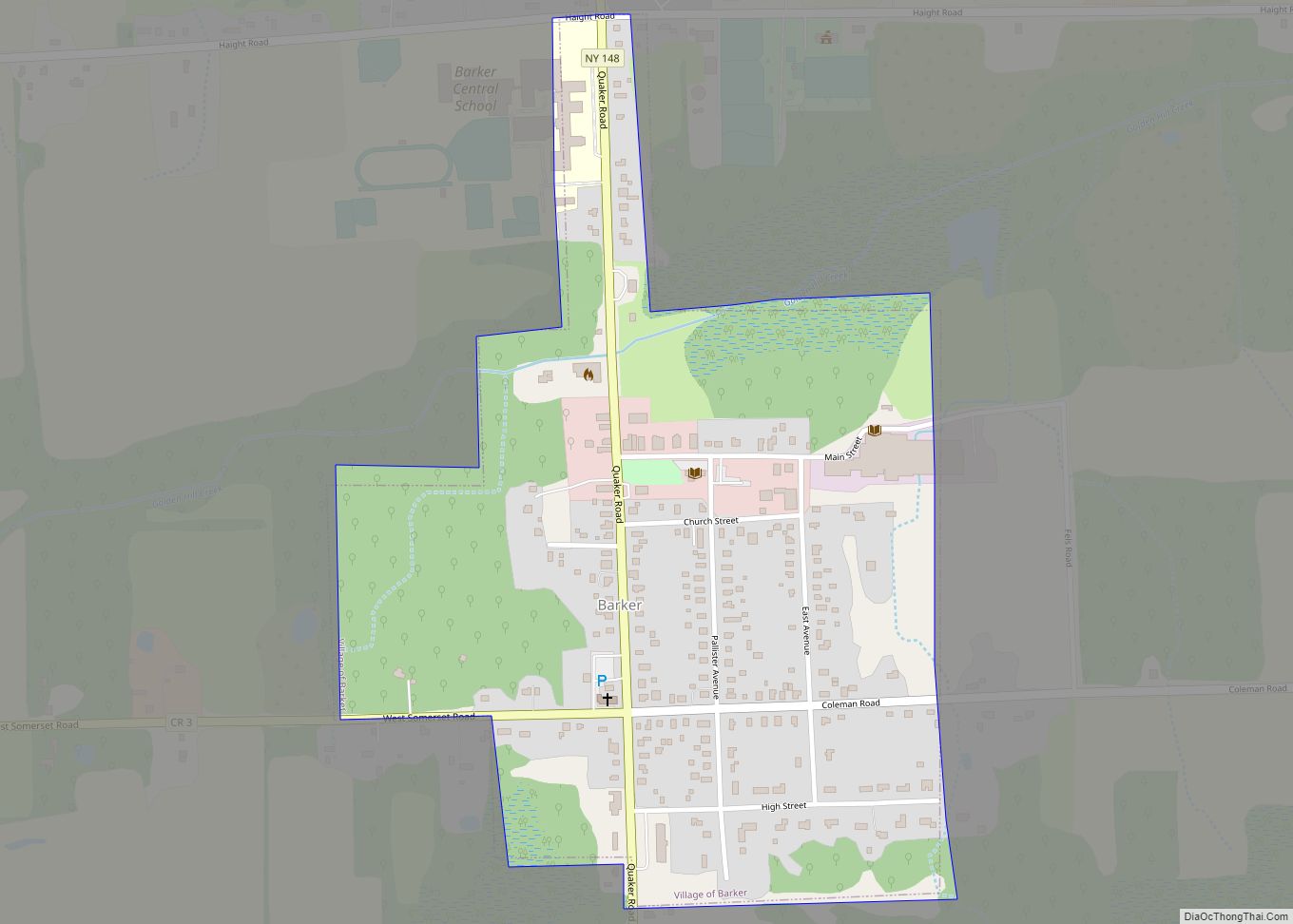
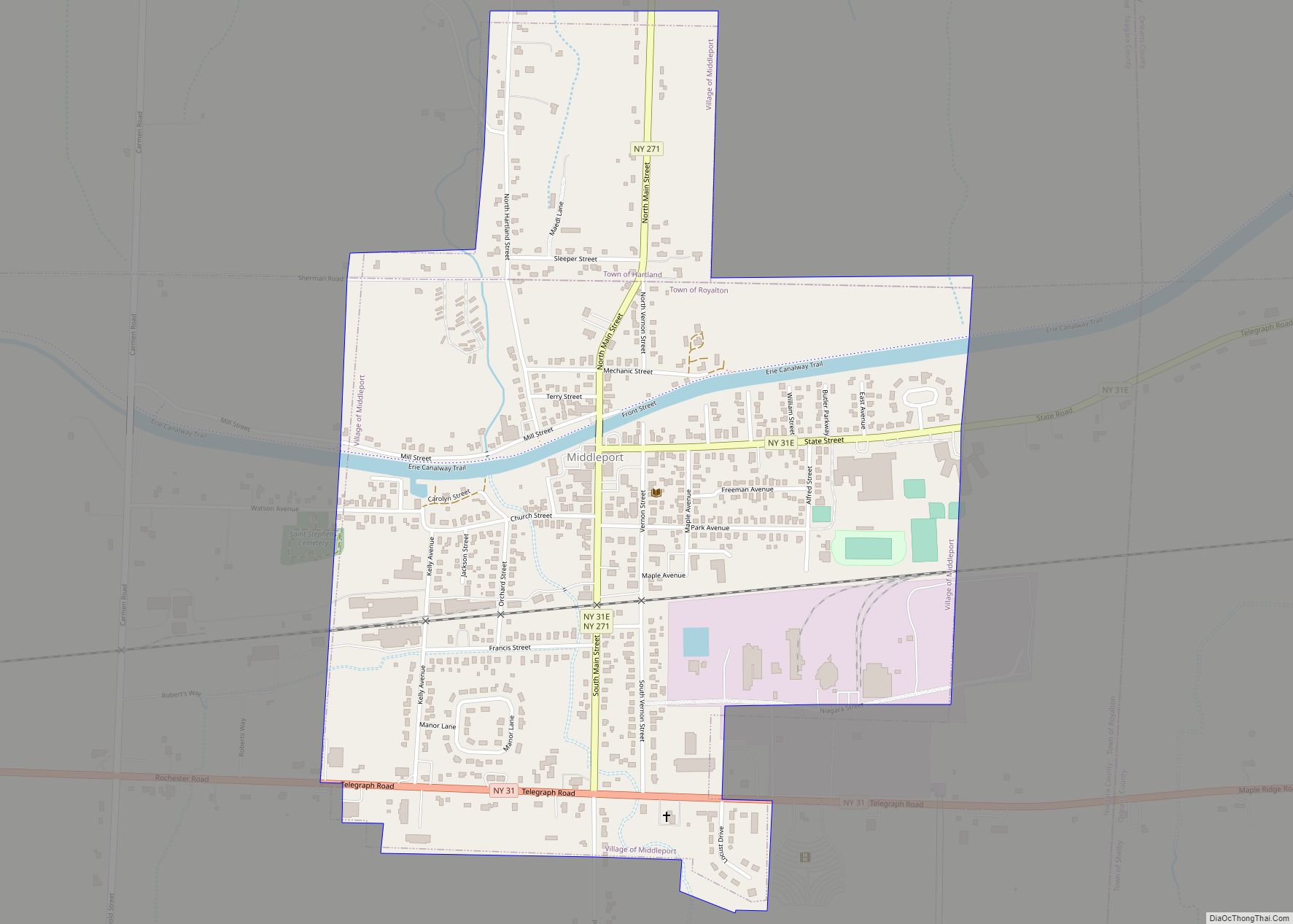
Middleport is a village in Niagara County, New York, United States. The population was 1,840 at the 2010 census. The mail ZIP code is 14105. It is part of the Buffalo–Niagara Falls Metropolitan Statistical Area.
The Village of Middleport lies on the eastern edge of Niagara County, mostly inside the boundaries of the Town of Royalton, but a small part is within the Town of Hartland. Middleport is a port on the Erie Canal.
| Name: | Middleport village |
|---|---|
| LSAD Code: | 47 |
| LSAD Description: | village (suffix) |
| State: | New York |
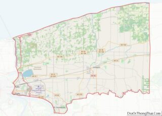
| County: | Niagara County |
| Elevation: | 515 ft (157 m) |
| Total Area: | 0.87 sq mi (2.26 km²) |
| Land Area: | 0.87 sq mi (2.26 km²) |
| Water Area: | 0.00 sq mi (0.00 km²) |
| Total Population: | 1,729 |
| Population Density: | 1,982.80/sq mi (765.70/km²) |
| ZIP code: | 14105 |
| Area code: | 716 |
| FIPS code: | 3646998 |
| GNISfeature ID: | 0957150 |
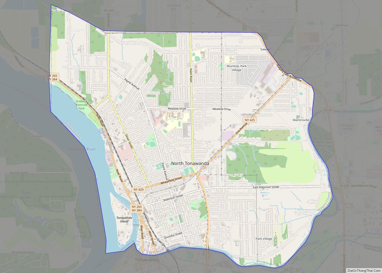
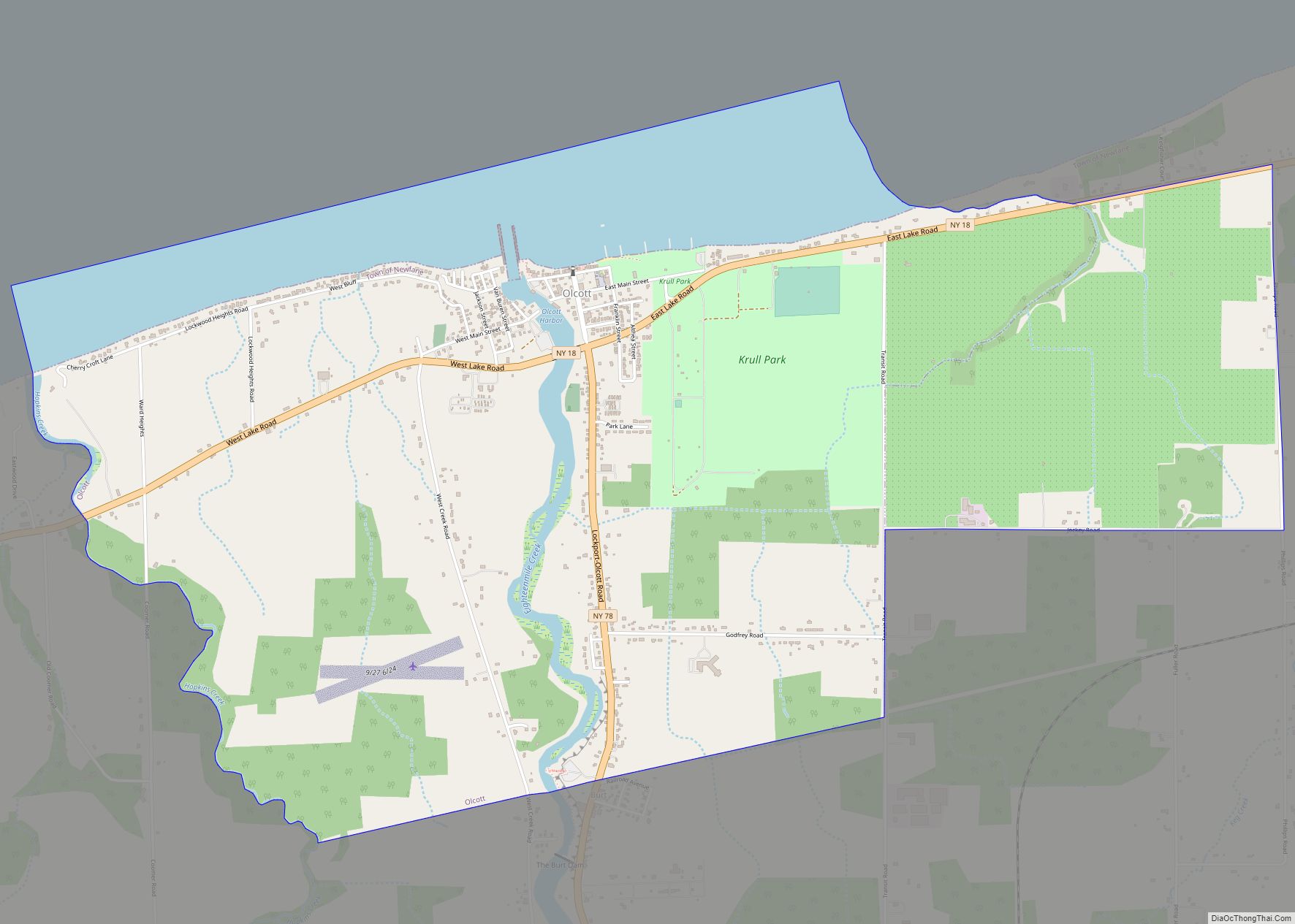
Online Interactive Map
Click on ![]() to view map in "full screen" mode.
to view map in "full screen" mode.
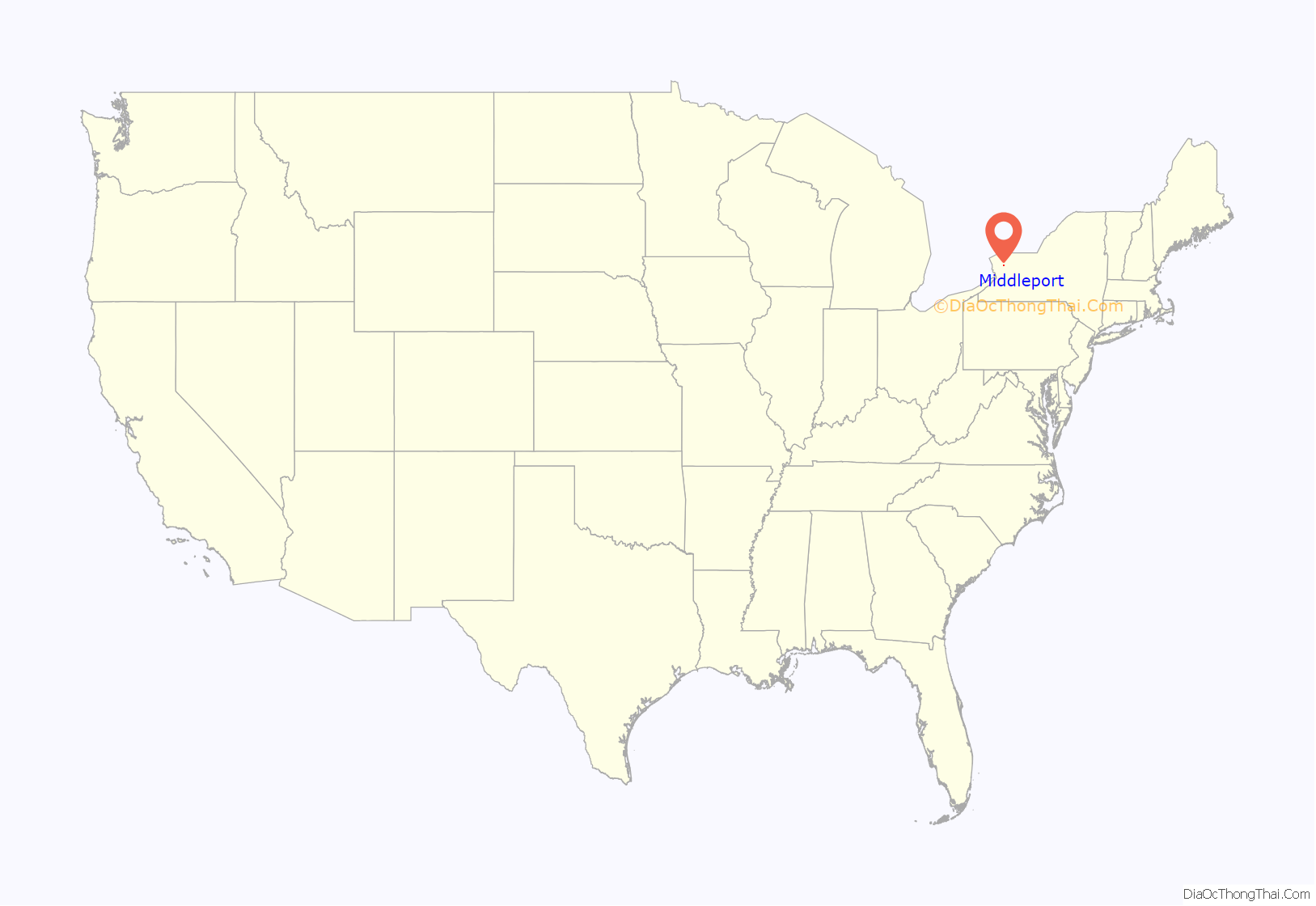
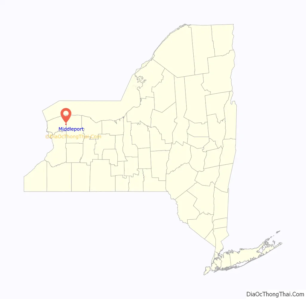
Middleport location map. Where is Middleport village?
History
Settlers began moving into the area circa 1808. The first store opened in the future village in 1822, before the canal reached the community.
The Erie Canal was opened along its entire length in 1825, and the community became an important location on the canal.
The village was formerly known as Tea-Pot Hollow before it was renamed Middleport.
The Village of Middleport was incorporated in 1872. The first election was held on March 22, 1859. The first meeting of the Board of Trustees was held on March 28, 1859.
The William Taylor House and U.S. Post Office are listed on the National Register of Historic Places.
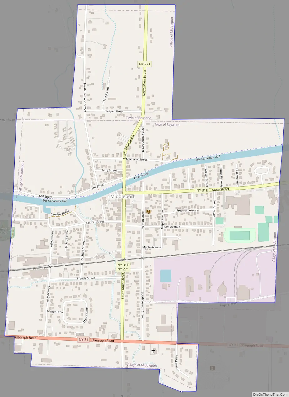
Middleport Road Map
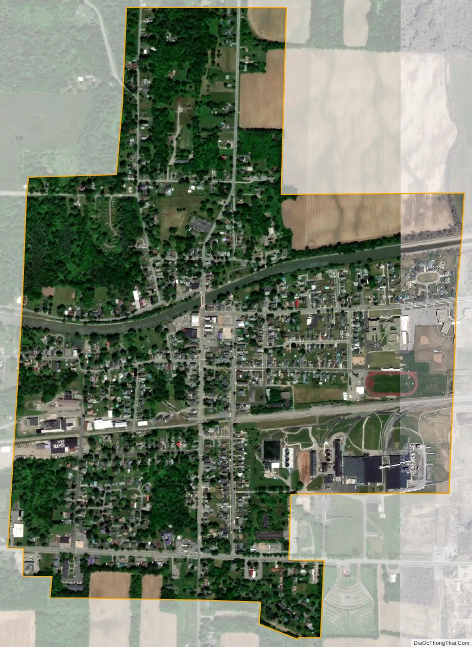
Middleport city Satellite Map
Geography
According to the United States Census Bureau, the village has a total area of 0.9 square miles (2.3 km), all land.
The village is located where north–south New York State Route 271 (Main Street) intersects east–west highways New York State Route 31 (Telegraph Road) and New York State Route 31E (State Street).
See also
Map of New York State and its subdivision:- Albany
- Allegany
- Bronx
- Broome
- Cattaraugus
- Cayuga
- Chautauqua
- Chemung
- Chenango
- Clinton
- Columbia
- Cortland
- Delaware
- Dutchess
- Erie
- Essex
- Franklin
- Fulton
- Genesee
- Greene
- Hamilton
- Herkimer
- Jefferson
- Kings
- Lake Ontario
- Lewis
- Livingston
- Madison
- Monroe
- Montgomery
- Nassau
- New York
- Niagara
- Oneida
- Onondaga
- Ontario
- Orange
- Orleans
- Oswego
- Otsego
- Putnam
- Queens
- Rensselaer
- Richmond
- Rockland
- Saint Lawrence
- Saratoga
- Schenectady
- Schoharie
- Schuyler
- Seneca
- Steuben
- Suffolk
- Sullivan
- Tioga
- Tompkins
- Ulster
- Warren
- Washington
- Wayne
- Westchester
- Wyoming
- Yates
- Alabama
- Alaska
- Arizona
- Arkansas
- California
- Colorado
- Connecticut
- Delaware
- District of Columbia
- Florida
- Georgia
- Hawaii
- Idaho
- Illinois
- Indiana
- Iowa
- Kansas
- Kentucky
- Louisiana
- Maine
- Maryland
- Massachusetts
- Michigan
- Minnesota
- Mississippi
- Missouri
- Montana
- Nebraska
- Nevada
- New Hampshire
- New Jersey
- New Mexico
- New York
- North Carolina
- North Dakota
- Ohio
- Oklahoma
- Oregon
- Pennsylvania
- Rhode Island
- South Carolina
- South Dakota
- Tennessee
- Texas
- Utah
- Vermont
- Virginia
- Washington
- West Virginia
- Wisconsin
- Wyoming