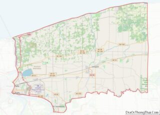
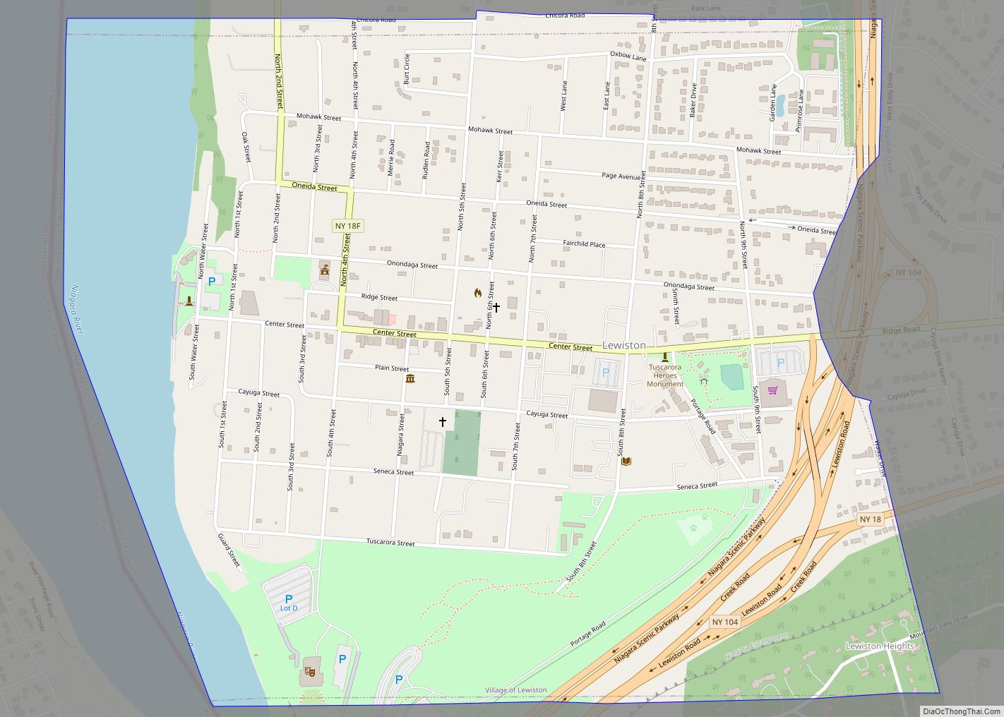
Lewiston is a town in Niagara County, New York, United States. The population was 15,944 at the 2020 census. The town and its contained village are named after Morgan Lewis, a governor of New York.
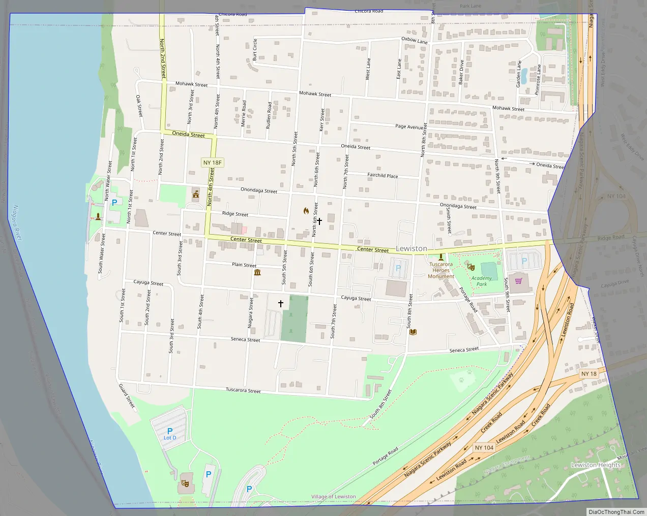
The Town of Lewiston is on the western border of the county. The Village of Lewiston is within the town.
| Name: | Lewiston village |
|---|---|
| LSAD Code: | 47 |
| LSAD Description: | village (suffix) |
| State: | New York |
| County: | Niagara County |
| Total Area: | 41.13 sq mi (106.53 km²) |
| Land Area: | 37.12 sq mi (96.14 km²) |
| Water Area: | 4.01 sq mi (10.39 km²) |
| Total Population: | 15,944 |
| Population Density: | 431.42/sq mi (166.57/km²) |
| FIPS code: | 3642147 |
Online Interactive Map
Click on ![]() to view map in "full screen" mode.
to view map in "full screen" mode.
Lewiston location map. Where is Lewiston village?


History
The Town of Lewiston was formed in 1818 from the town of Cambria. Lewiston was the first European settlement in Western New York. A French explorer by the name of Étienne Brûlé arrived in 1615.
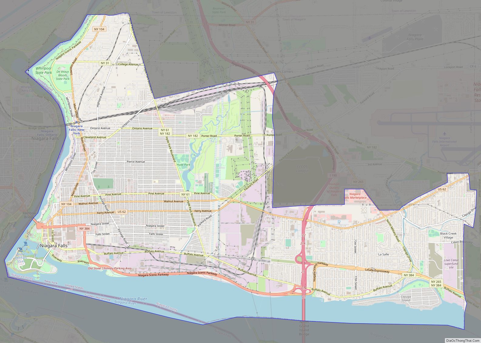
Lewiston Road Map
Lewiston city Satellite Map

Geography
According to the United States Census Bureau, the town has a total area of 41.0 square miles (106.3 km), of which 37.3 square miles (96.5 km) is land and 3.8 square miles (9.7 km) (9.16%) is water.
The Niagara River forms the western boundary of the town, which is an international border with Canada. The Town of Lewiston’s southern border is with the City of Niagara Falls, NY, the Town of Niagara, NY, and the Town of Wheatfield, NY. The southern portion of the town also is on the top of the Niagara Escarpment. The eastern border of the town is at Townline Road which separates the Towns of Cambria and Lewiston. The northern border of the town is with the Towns of Porter and Wilson.
New York State Route 104 passes across the town as “Lewiston Road” on top of the Niagara Escarpment and “Ridge Road” below the Escarpment. There are three exits of Interstate 190 in Lewiston: exit 24 at Witmer Road New York State Route 31, exit 25A at Military Road New York State Route 265, and exit 25B for Route 104 and the Niagara Scenic Parkway.
Communities and locations within Lewiston
- Bonds Lake County Park – a park in the northeast corner of the town.
- Colonial Village – a hamlet by the south town line on Route 31 (Saunders Settlement Road).
- Devil’s Hole State Park – in the southwest corner of the town.
- Dickersonville – a hamlet in the northeastern part of the town on Route 104 (Ridge Road).
- Earl W. Brydges Artpark State Park – a New York State Park on the eastern edge of the town.
- Falcon Manor – a location on the south town line, east of Colonial Village.
- Lewiston Heights – an upscale neighborhood built atop the Niagara Escarpment.
- Model City – a hamlet on Route 104 (Lewiston Road).
- Pekin – a hamlet on the eastern town line.
- Lewiston Reservoir – a human-made 1,900-acre (770 ha), 22-billion-US-gallon (83,000,000 m) reservoir which stores water before being released into the forebay of the Robert Moses Power Station (also known as the Robert Moses Power Plant Reservoir).
- Reservoir State Park – a park on the south shore of the reservoir and Route 265 (Military Road).
- Sanborn – a hamlet originally called South Pekin that was later renamed Sanborn, after Ebenezer Sanborn, in 1866. It is in the southeast corner of the town on Route 429 (Cambria-Lewiston Town Line Road) and Route 31 (Saunders Settlement Road).
- Tuscarora Reservation – a 9.3 mi (24.0 km) reservation for the Tuscarora tribe (members of the Iroquois confederacy), east of the Reservoir, that lies entirely within the Town of Lewiston.
- Village of Lewiston – a historic village in the western part of the town.
- Joseph Davis State Park– a NY State Park
Adjacent cities and towns
- Town of Porter – north
- Town of Cambria – east
- Town of Wheatfield – southeast
- Town of Niagara – south
- City of Niagara Falls – southwest
- Niagara-on-the-Lake, Ontario, Canada – northwest
- Niagara Falls, Ontario, Canada – west
See also
Map of New York State and its subdivision:- Albany
- Allegany
- Bronx
- Broome
- Cattaraugus
- Cayuga
- Chautauqua
- Chemung
- Chenango
- Clinton
- Columbia
- Cortland
- Delaware
- Dutchess
- Erie
- Essex
- Franklin
- Fulton
- Genesee
- Greene
- Hamilton
- Herkimer
- Jefferson
- Kings
- Lake Ontario
- Lewis
- Livingston
- Madison
- Monroe
- Montgomery
- Nassau
- New York
- Niagara
- Oneida
- Onondaga
- Ontario
- Orange
- Orleans
- Oswego
- Otsego
- Putnam
- Queens
- Rensselaer
- Richmond
- Rockland
- Saint Lawrence
- Saratoga
- Schenectady
- Schoharie
- Schuyler
- Seneca
- Steuben
- Suffolk
- Sullivan
- Tioga
- Tompkins
- Ulster
- Warren
- Washington
- Wayne
- Westchester
- Wyoming
- Yates
- Alabama
- Alaska
- Arizona
- Arkansas
- California
- Colorado
- Connecticut
- Delaware
- District of Columbia
- Florida
- Georgia
- Hawaii
- Idaho
- Illinois
- Indiana
- Iowa
- Kansas
- Kentucky
- Louisiana
- Maine
- Maryland
- Massachusetts
- Michigan
- Minnesota
- Mississippi
- Missouri
- Montana
- Nebraska
- Nevada
- New Hampshire
- New Jersey
- New Mexico
- New York
- North Carolina
- North Dakota
- Ohio
- Oklahoma
- Oregon
- Pennsylvania
- Rhode Island
- South Carolina
- South Dakota
- Tennessee
- Texas
- Utah
- Vermont
- Virginia
- Washington
- West Virginia
- Wisconsin
- Wyoming