Millbrook is a village in Dutchess County, New York, United States. Millbrook is located in the Hudson Valley, on the east side of the Hudson River, 90 miles (140 km) north of New York City. Millbrook is near the center of the town of Washington, of which it is a part. As of the 2020 census, Millbrook’s population was 1,455. It is often referred to as a low-key version of the Hamptons, and is one of the most affluent villages in New York.
Millbrook is part of the Poughkeepsie–Newburgh–Middletown Metropolitan Statistical Area as well as the larger New York–Newark–Bridgeport Combined Statistical Area.
| Name: | Millbrook village |
|---|---|
| LSAD Code: | 47 |
| LSAD Description: | village (suffix) |
| State: | New York |
| County: | Dutchess County |
| Founded: | 1895 |
| Elevation: | 480 ft (150 m) |
| Total Area: | 1.92 sq mi (4.96 km²) |
| Land Area: | 1.86 sq mi (4.82 km²) |
| Water Area: | 0.06 sq mi (0.14 km²) |
| Total Population: | 1,455 |
| Population Density: | 782.26/sq mi (302.08/km²) |
| ZIP code: | 12545 |
| Area code: | 845 |
| FIPS code: | 3647273 |
| GNISfeature ID: | 0957288 |
Online Interactive Map
Click on ![]() to view map in "full screen" mode.
to view map in "full screen" mode.
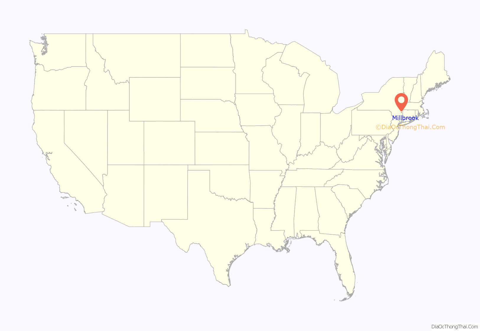
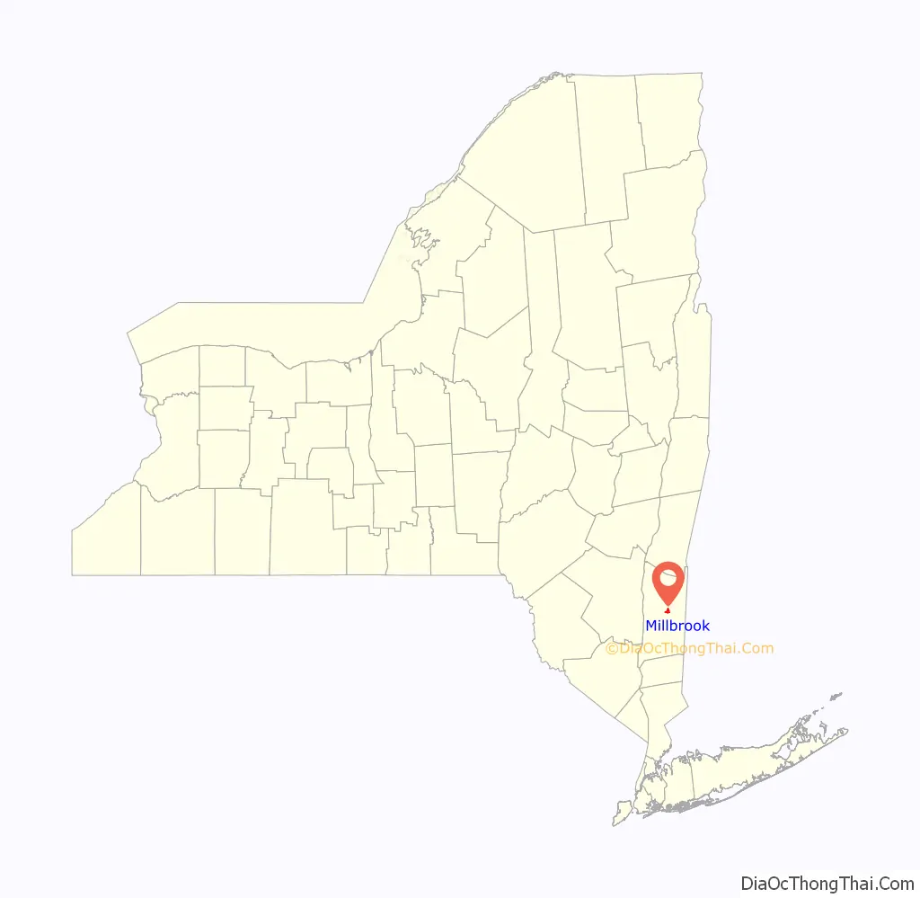
Millbrook location map. Where is Millbrook village?
History
The site of present-day Millbrook was originally part of a much larger land grant given in 1697. In the years before the American Revolution, two nearby settlements – Mechanic and Hart’s Village – were established within the confines of the modern Millbrook.
In 1869, the Dutchess and Columbia Railroad commenced operating with a stop called Millbrook, named after an adjacent farm. This new rail stop lay between Mechanic and Hart’s Village and the economic opportunities it afforded soon led to a developing village centered on the Millbrook stop. However, it was not until 1895 that Millbrook was incorporated as a village.
Millbrook is the site of the Hitchcock Estate, which Timothy Leary made a nexus of the psychedelic movement in the 1960s and where he conducted research and wrote The Psychedelic Experience.
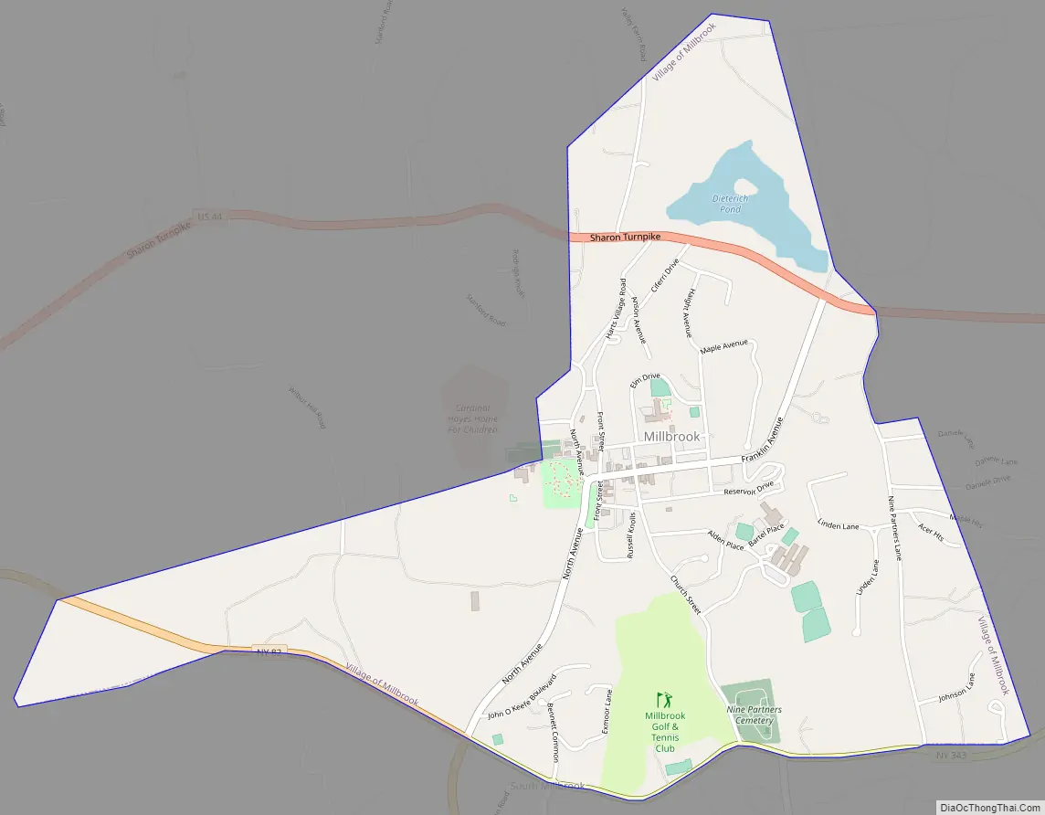
Millbrook Road Map
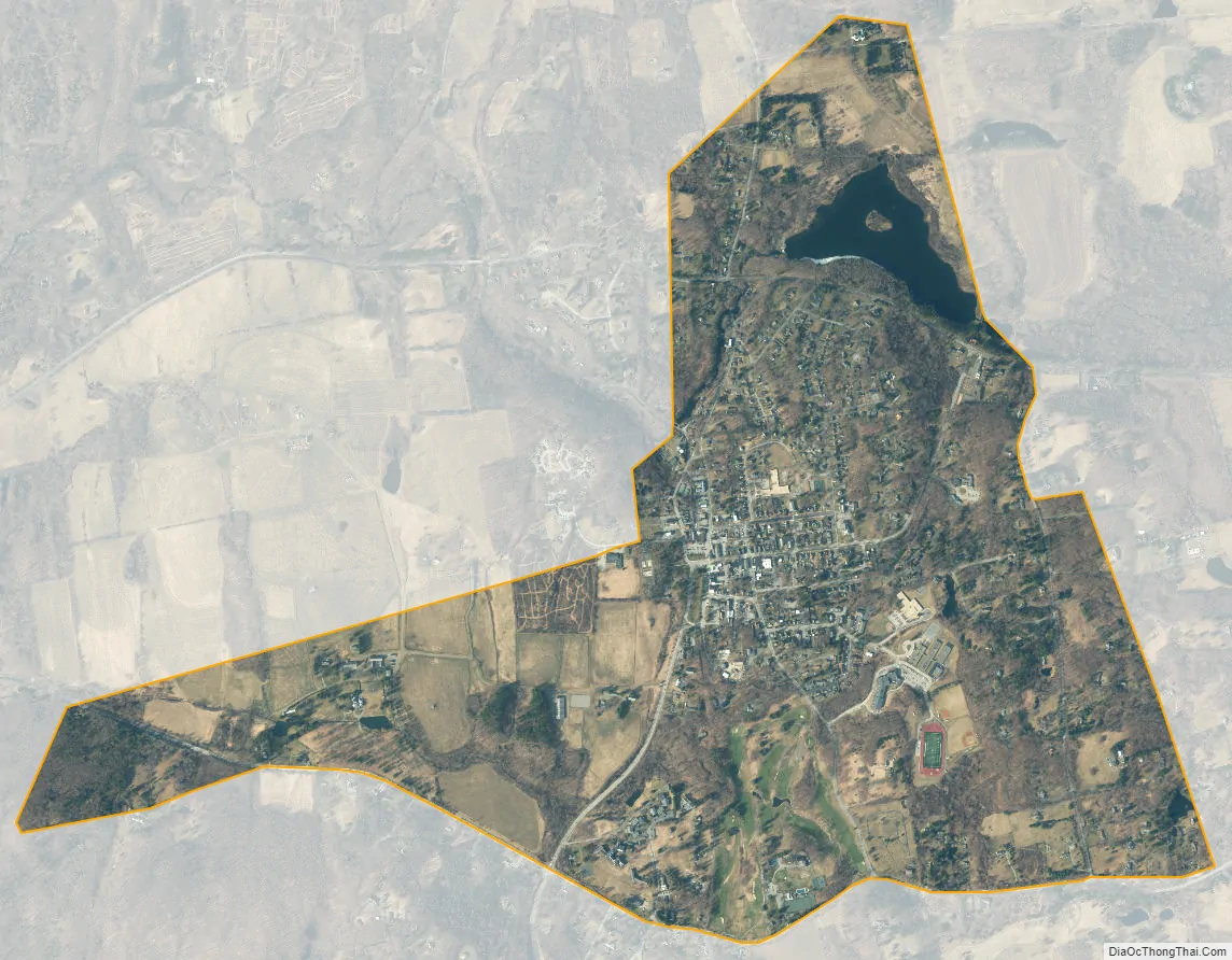
Millbrook city Satellite Map
Geography
According to the United States Census Bureau, the village has a total area of 1.901 square miles (4.92 km), of which 1.9 square miles (4.9 km) is land and 0.1 square miles (0.26 km) (2.60%) is water.
See also
Map of New York State and its subdivision:- Albany
- Allegany
- Bronx
- Broome
- Cattaraugus
- Cayuga
- Chautauqua
- Chemung
- Chenango
- Clinton
- Columbia
- Cortland
- Delaware
- Dutchess
- Erie
- Essex
- Franklin
- Fulton
- Genesee
- Greene
- Hamilton
- Herkimer
- Jefferson
- Kings
- Lake Ontario
- Lewis
- Livingston
- Madison
- Monroe
- Montgomery
- Nassau
- New York
- Niagara
- Oneida
- Onondaga
- Ontario
- Orange
- Orleans
- Oswego
- Otsego
- Putnam
- Queens
- Rensselaer
- Richmond
- Rockland
- Saint Lawrence
- Saratoga
- Schenectady
- Schoharie
- Schuyler
- Seneca
- Steuben
- Suffolk
- Sullivan
- Tioga
- Tompkins
- Ulster
- Warren
- Washington
- Wayne
- Westchester
- Wyoming
- Yates
- Alabama
- Alaska
- Arizona
- Arkansas
- California
- Colorado
- Connecticut
- Delaware
- District of Columbia
- Florida
- Georgia
- Hawaii
- Idaho
- Illinois
- Indiana
- Iowa
- Kansas
- Kentucky
- Louisiana
- Maine
- Maryland
- Massachusetts
- Michigan
- Minnesota
- Mississippi
- Missouri
- Montana
- Nebraska
- Nevada
- New Hampshire
- New Jersey
- New Mexico
- New York
- North Carolina
- North Dakota
- Ohio
- Oklahoma
- Oregon
- Pennsylvania
- Rhode Island
- South Carolina
- South Dakota
- Tennessee
- Texas
- Utah
- Vermont
- Virginia
- Washington
- West Virginia
- Wisconsin
- Wyoming


