Monroe is a village in Orange County, New York, United States. The population was 9,343 at the 2020 census. It is part of the Poughkeepsie–Newburgh–Middletown, NY Metropolitan Statistical Area as well as the larger New York–Newark–Bridgeport, NY-NJ–CT–PA Combined Statistical Area. The community is named not after President James Monroe; rather its name is taken from that of an early 19th-century New York state senator.
The Village of Monroe is in the northwestern part of the Town of Monroe by NY Route 17 (soon to be Interstate 86) and US 6. NY 17M is its main street.
| Name: | Monroe village |
|---|---|
| LSAD Code: | 47 |
| LSAD Description: | village (suffix) |
| State: | New York |
| County: | Orange County |
| Incorporated: | 1894 |
| Elevation: | 600 ft (200 m) |
| Total Area: | 3.56 sq mi (9.21 km²) |
| Land Area: | 3.49 sq mi (9.05 km²) |
| Water Area: | 0.06 sq mi (0.17 km²) |
| Total Population: | 9,343 |
| Population Density: | 2,674.78/sq mi (1,032.64/km²) |
| ZIP code: | 10950 |
| FIPS code: | 3647988 |
| GNISfeature ID: | 0957528 |
Online Interactive Map
Click on ![]() to view map in "full screen" mode.
to view map in "full screen" mode.
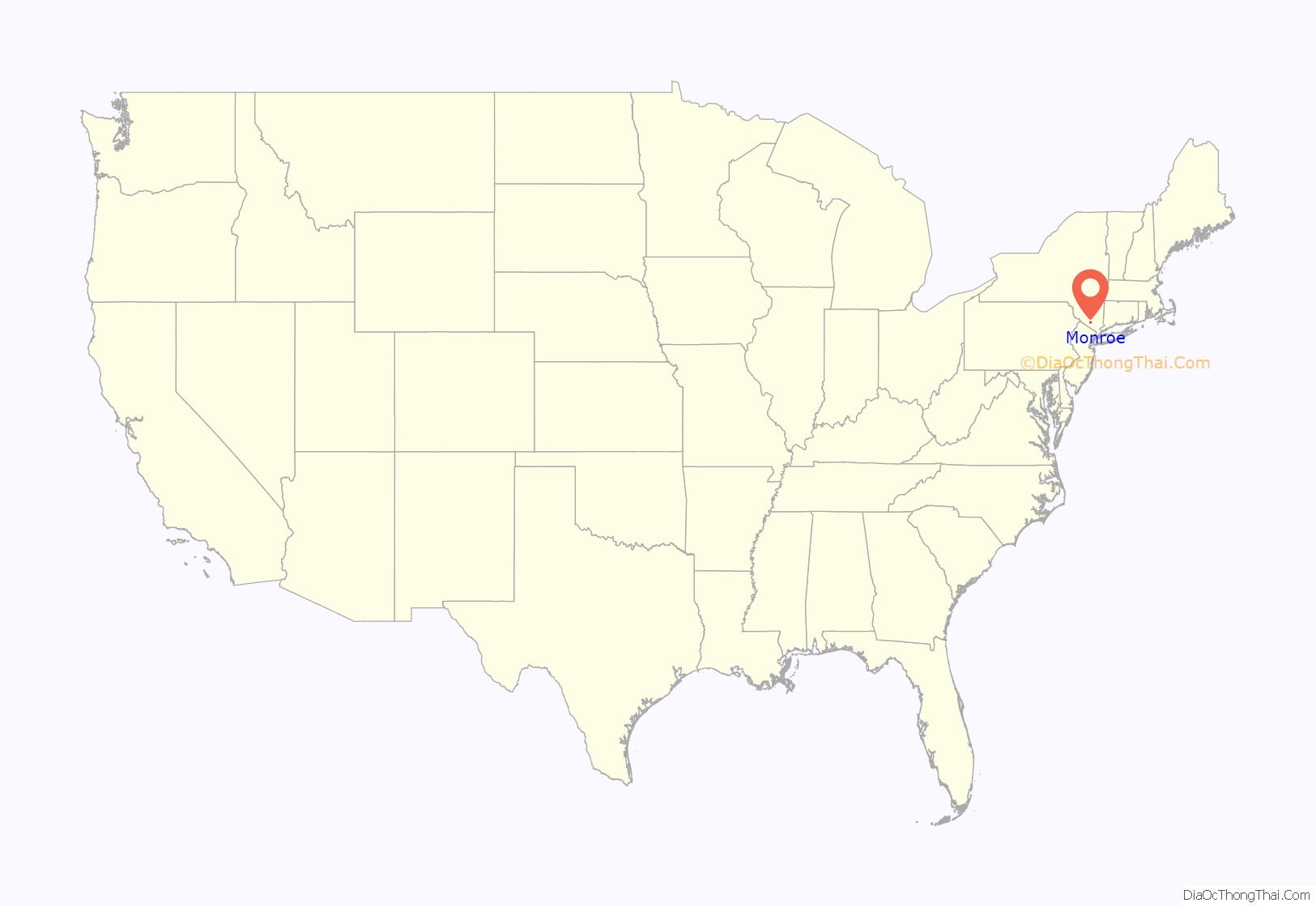
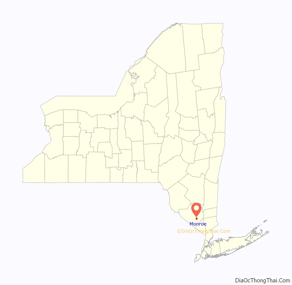
Monroe location map. Where is Monroe village?
History
The former Village of Kiryas Joel in Orange County officially split from Monroe, New York on New Year’s Day 2019, becoming the Town of Palm Tree, New York.
Palm Tree came into being as a result of a 2017 referendum in which more than 80% of Monroe voters opted to branch off into their own town, the paper reported. Palm Tree — all 220 acres and roughly 20,000 residents of it — becomes New York’s first new town since East Rochester, was formed in 1981.
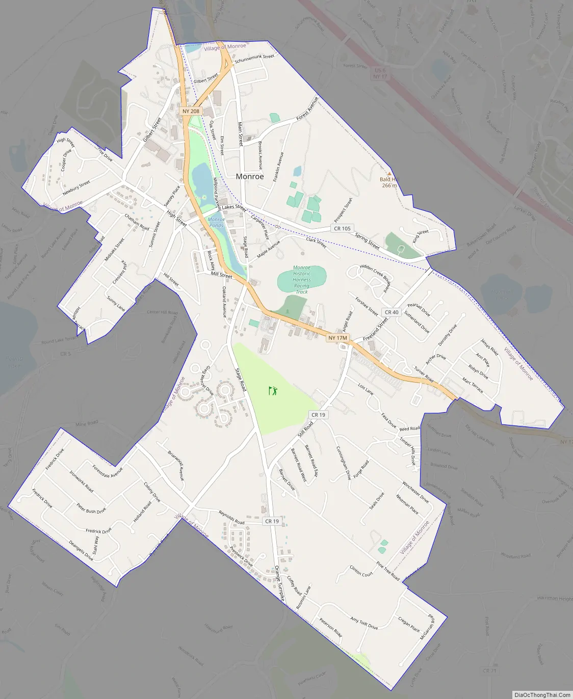
Monroe Road Map
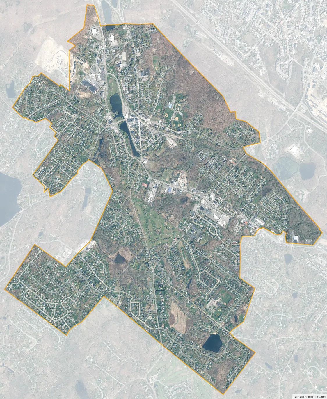
Monroe city Satellite Map
Geography
Monroe is located at 41°19′25″N 74°11′16″W / 41.32361°N 74.18778°W / 41.32361; -74.18778 (41.323786, -74.187969).
According to the United States Census Bureau, the village has a total area of 3.5 square miles (9.0 km), of which 3.4 square miles (8.9 km) is land and 0.1 square mile (0.1 km) (1.44%) is water.
See also
Map of New York State and its subdivision:- Albany
- Allegany
- Bronx
- Broome
- Cattaraugus
- Cayuga
- Chautauqua
- Chemung
- Chenango
- Clinton
- Columbia
- Cortland
- Delaware
- Dutchess
- Erie
- Essex
- Franklin
- Fulton
- Genesee
- Greene
- Hamilton
- Herkimer
- Jefferson
- Kings
- Lake Ontario
- Lewis
- Livingston
- Madison
- Monroe
- Montgomery
- Nassau
- New York
- Niagara
- Oneida
- Onondaga
- Ontario
- Orange
- Orleans
- Oswego
- Otsego
- Putnam
- Queens
- Rensselaer
- Richmond
- Rockland
- Saint Lawrence
- Saratoga
- Schenectady
- Schoharie
- Schuyler
- Seneca
- Steuben
- Suffolk
- Sullivan
- Tioga
- Tompkins
- Ulster
- Warren
- Washington
- Wayne
- Westchester
- Wyoming
- Yates
- Alabama
- Alaska
- Arizona
- Arkansas
- California
- Colorado
- Connecticut
- Delaware
- District of Columbia
- Florida
- Georgia
- Hawaii
- Idaho
- Illinois
- Indiana
- Iowa
- Kansas
- Kentucky
- Louisiana
- Maine
- Maryland
- Massachusetts
- Michigan
- Minnesota
- Mississippi
- Missouri
- Montana
- Nebraska
- Nevada
- New Hampshire
- New Jersey
- New Mexico
- New York
- North Carolina
- North Dakota
- Ohio
- Oklahoma
- Oregon
- Pennsylvania
- Rhode Island
- South Carolina
- South Dakota
- Tennessee
- Texas
- Utah
- Vermont
- Virginia
- Washington
- West Virginia
- Wisconsin
- Wyoming


