Monsey (/ˈmʌnsi/, Yiddish: מאנסי, romanized: Monsi) is a hamlet and census-designated place in the town of Ramapo, Rockland County, New York, United States, located north of Airmont, east of Viola, south of New Hempstead, and west of Spring Valley. The village of Kaser is surrounded by the hamlet of Monsey. The 2020 census listed the population at 26,954; a 46% increase since the 2010 census.
The hamlet has a large, and growing, community of Orthodox Jews.
| Name: | Monsey CDP |
|---|---|
| LSAD Code: | 57 |
| LSAD Description: | CDP (suffix) |
| State: | New York |
| County: | Rockland County |
| Elevation: | 548 ft (167 m) |
| Total Area: | 2.31 sq mi (5.97 km²) |
| Land Area: | 2.29 sq mi (5.94 km²) |
| Water Area: | 0.01 sq mi (0.04 km²) |
| Total Population: | 26,954 |
| Population Density: | 11,754.91/sq mi (4,539.32/km²) |
| ZIP code: | 10952 |
| Area code: | 845 |
| FIPS code: | 3648010 |
| GNISfeature ID: | 0957535 |
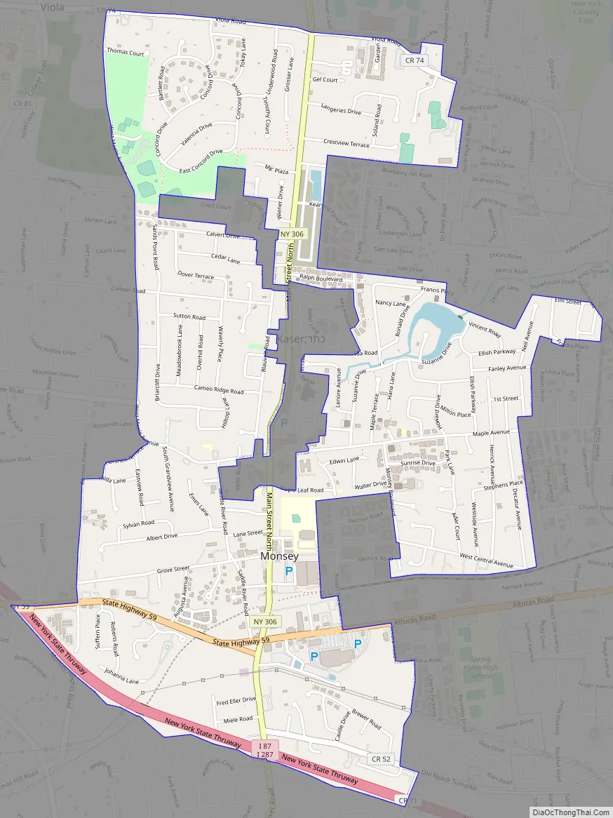
Online Interactive Map
Click on ![]() to view map in "full screen" mode.
to view map in "full screen" mode.
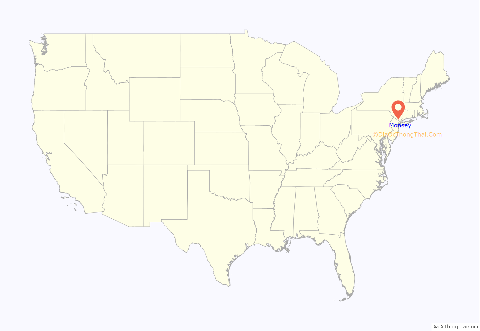
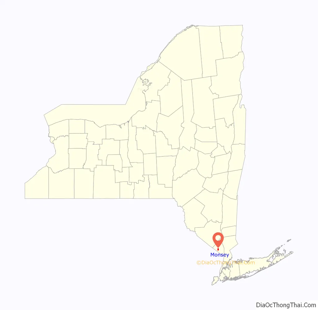
Monsey location map. Where is Monsey CDP?
History
Rockland County was inhabited by the Munsee band of Lenape Native Americans, who were speakers of the Algonquian languages. Monsey Glen, a Native American encampment, is located west of the intersection of State Route 59 and State Route 306. Numerous artifacts have been found there and some rock shelters are still visible. The Monsey railroad station, which received its name from an alternate spelling of the Munsee Lenape, was built when the New York & Erie Railroad passed through the glen in 1841.
In the 1950s, Monsey was a one stoplight town with a single yeshiva. By 1997, Monsey had 112 synagogues and 45 yeshivas.
Located in Monsey is the Houser-Conklin House, listed on the National Register of Historic Places in 2010.
On December 28, 2019 it was the site of a mass stabbing in the home of a Hasidic rabbi who was hosting a Hanukkah party, leaving five injured and one dead.
Monsey Road Map
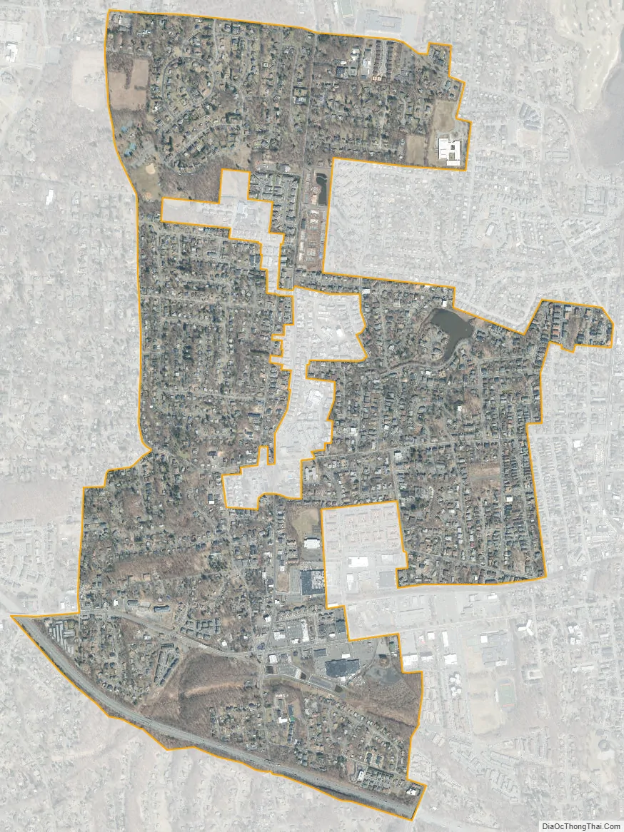
Monsey city Satellite Map
Geography
Monsey is located at 41°7′10″N 74°3′57″W / 41.11944°N 74.06583°W / 41.11944; -74.06583 .
According to the United States Census Bureau, the CDP has a total area of 2.2 square miles (5.8 km), of which 2.2 square miles (5.7 km) is land and 0.04 square mile (0.1 km) (0.90%) is water.
See also
Map of New York State and its subdivision:- Albany
- Allegany
- Bronx
- Broome
- Cattaraugus
- Cayuga
- Chautauqua
- Chemung
- Chenango
- Clinton
- Columbia
- Cortland
- Delaware
- Dutchess
- Erie
- Essex
- Franklin
- Fulton
- Genesee
- Greene
- Hamilton
- Herkimer
- Jefferson
- Kings
- Lake Ontario
- Lewis
- Livingston
- Madison
- Monroe
- Montgomery
- Nassau
- New York
- Niagara
- Oneida
- Onondaga
- Ontario
- Orange
- Orleans
- Oswego
- Otsego
- Putnam
- Queens
- Rensselaer
- Richmond
- Rockland
- Saint Lawrence
- Saratoga
- Schenectady
- Schoharie
- Schuyler
- Seneca
- Steuben
- Suffolk
- Sullivan
- Tioga
- Tompkins
- Ulster
- Warren
- Washington
- Wayne
- Westchester
- Wyoming
- Yates
- Alabama
- Alaska
- Arizona
- Arkansas
- California
- Colorado
- Connecticut
- Delaware
- District of Columbia
- Florida
- Georgia
- Hawaii
- Idaho
- Illinois
- Indiana
- Iowa
- Kansas
- Kentucky
- Louisiana
- Maine
- Maryland
- Massachusetts
- Michigan
- Minnesota
- Mississippi
- Missouri
- Montana
- Nebraska
- Nevada
- New Hampshire
- New Jersey
- New Mexico
- New York
- North Carolina
- North Dakota
- Ohio
- Oklahoma
- Oregon
- Pennsylvania
- Rhode Island
- South Carolina
- South Dakota
- Tennessee
- Texas
- Utah
- Vermont
- Virginia
- Washington
- West Virginia
- Wisconsin
- Wyoming


