Morris is a village in Otsego County, New York, United States. The population was 583 at the 2010 census.
The Village of Morris is centrally located in the Town of Morris and is northwest of the City of Oneonta.
| Name: | Morris village |
|---|---|
| LSAD Code: | 47 |
| LSAD Description: | village (suffix) |
| State: | New York |
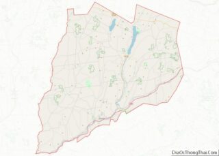
| County: | Otsego County |
| Elevation: | 1,145 ft (349 m) |
| Total Area: | 0.75 sq mi (1.95 km²) |
| Land Area: | 0.75 sq mi (1.93 km²) |
| Water Area: | 0.01 sq mi (0.02 km²) |
| Total Population: | 486 |
| Population Density: | 651.47/sq mi (251.66/km²) |
| ZIP code: | 13808 |
| Area code: | 607 |
| FIPS code: | 3648483 |
| GNISfeature ID: | 0957686 |
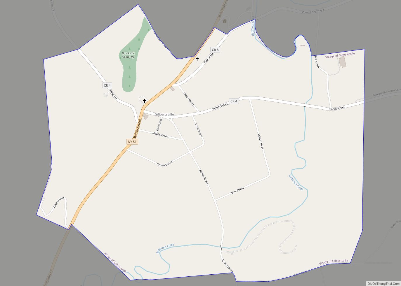
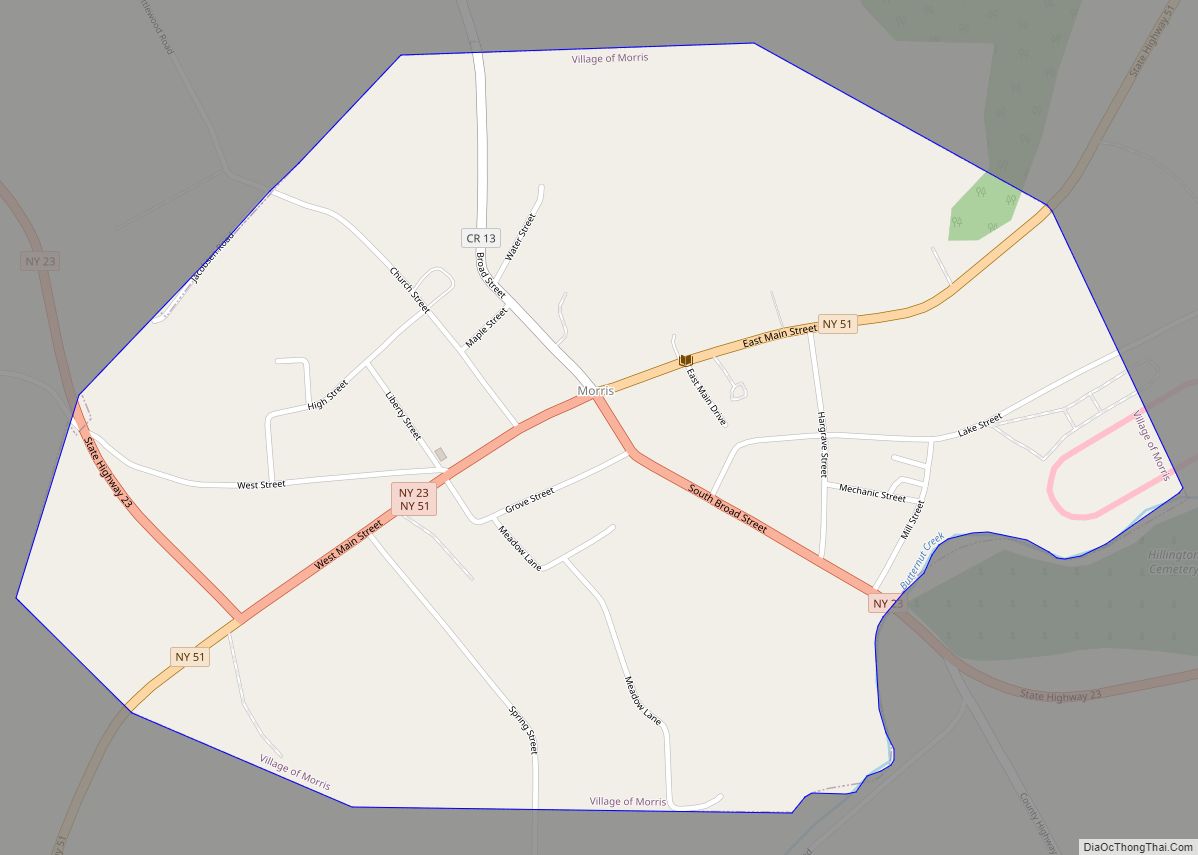
Online Interactive Map
Click on ![]() to view map in "full screen" mode.
to view map in "full screen" mode.
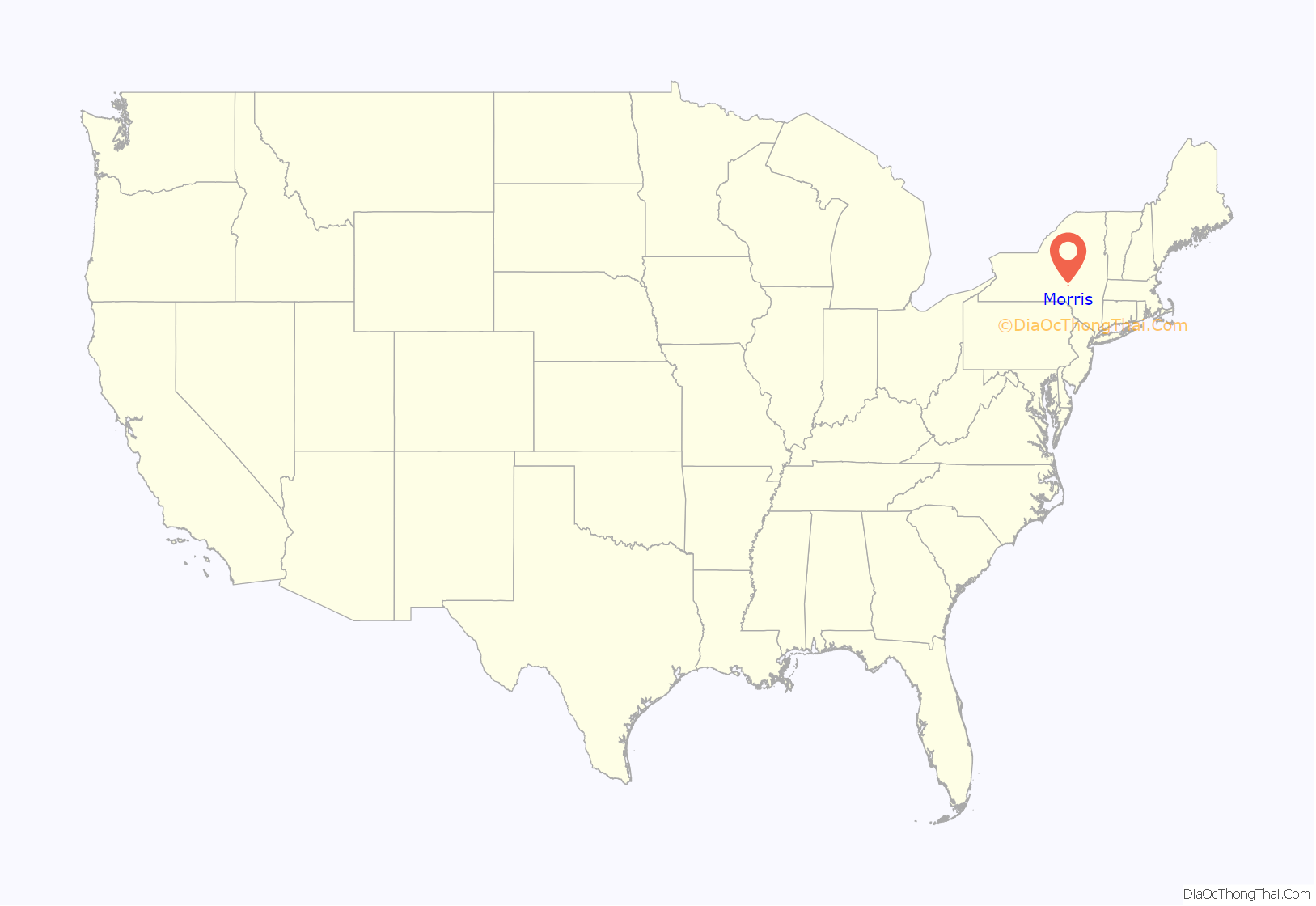
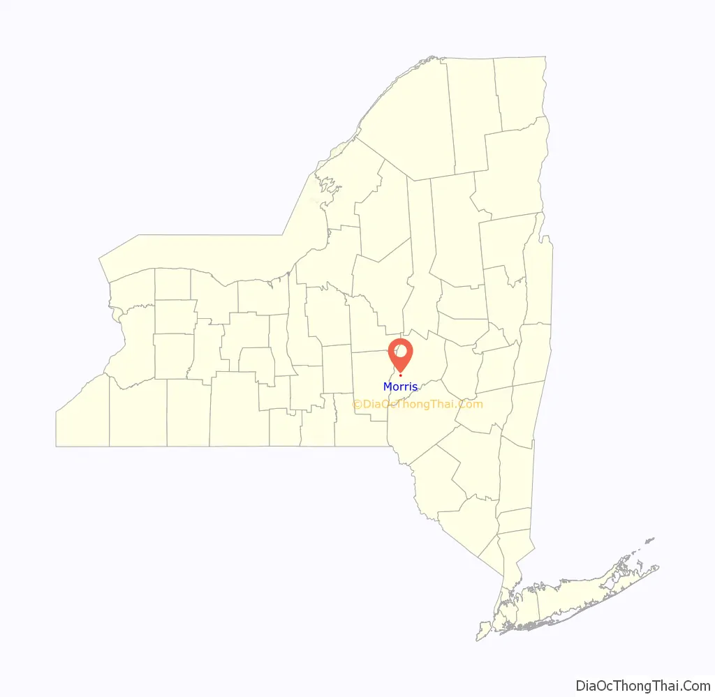
Morris location map. Where is Morris village?
History
The village was originally called “Louisville” by early French settlers, of whom Andre Renouard and family are the first known, the Franchots staying with them their first winter. When incorporated in 1870, the name was changed to “Morris” so as to avoid confusion with the other Louisville, New York. The water of Butternut Creek was used to power many textile mills in the valley, including the Hargrave factory on Lake St. and Butternuts Wool & Cotton Co. just below the village. Spring Street off West Main was laid out to a new plant that went bankrupt before machinery was installed when the local textile industry collapsed. More recently Spring St. has been abandoned, with Morris Central School expansion over what had once been planned as a development.
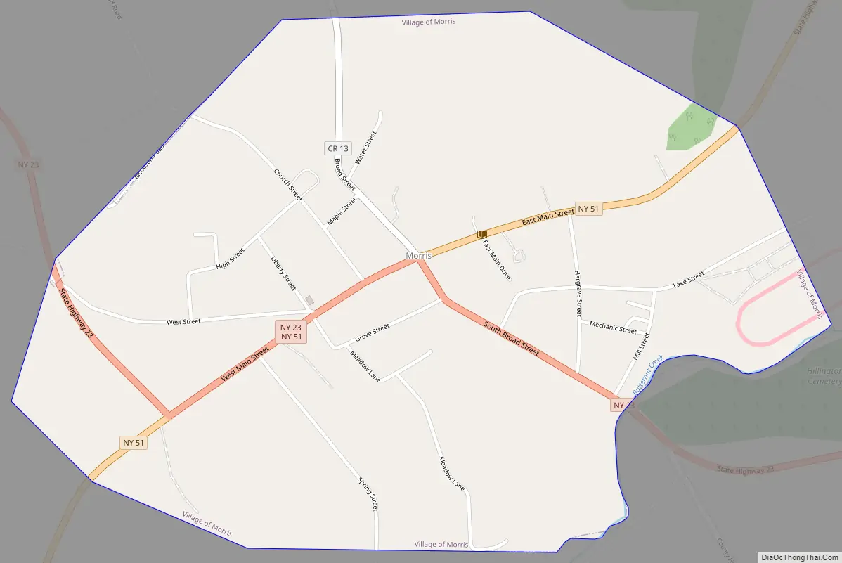
Morris Road Map
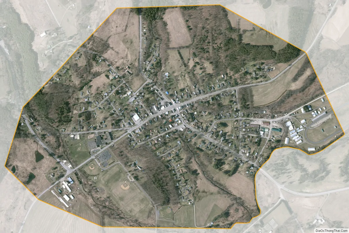
Morris city Satellite Map
Geography
Morris is located at 42°33′N 75°15′W / 42.550°N 75.250°W / 42.550; -75.250 (42.5481, -75.2451).
According to the United States Census Bureau, the village has a total area of 0.7 square mile (1.9 km), of which 0.7 square mile (1.9 km) is land and 1.35% is water.
Morris is located at the junction of New York State Route 23 and New York State Route 51, which are conjoined in part of the village. County Highway 13 enters the village from the north.
The village is bounded to the east and south by Butternut Creek, a tributary of the Unadilla River.
See also
Map of New York State and its subdivision:- Albany
- Allegany
- Bronx
- Broome
- Cattaraugus
- Cayuga
- Chautauqua
- Chemung
- Chenango
- Clinton
- Columbia
- Cortland
- Delaware
- Dutchess
- Erie
- Essex
- Franklin
- Fulton
- Genesee
- Greene
- Hamilton
- Herkimer
- Jefferson
- Kings
- Lake Ontario
- Lewis
- Livingston
- Madison
- Monroe
- Montgomery
- Nassau
- New York
- Niagara
- Oneida
- Onondaga
- Ontario
- Orange
- Orleans
- Oswego
- Otsego
- Putnam
- Queens
- Rensselaer
- Richmond
- Rockland
- Saint Lawrence
- Saratoga
- Schenectady
- Schoharie
- Schuyler
- Seneca
- Steuben
- Suffolk
- Sullivan
- Tioga
- Tompkins
- Ulster
- Warren
- Washington
- Wayne
- Westchester
- Wyoming
- Yates
- Alabama
- Alaska
- Arizona
- Arkansas
- California
- Colorado
- Connecticut
- Delaware
- District of Columbia
- Florida
- Georgia
- Hawaii
- Idaho
- Illinois
- Indiana
- Iowa
- Kansas
- Kentucky
- Louisiana
- Maine
- Maryland
- Massachusetts
- Michigan
- Minnesota
- Mississippi
- Missouri
- Montana
- Nebraska
- Nevada
- New Hampshire
- New Jersey
- New Mexico
- New York
- North Carolina
- North Dakota
- Ohio
- Oklahoma
- Oregon
- Pennsylvania
- Rhode Island
- South Carolina
- South Dakota
- Tennessee
- Texas
- Utah
- Vermont
- Virginia
- Washington
- West Virginia
- Wisconsin
- Wyoming