New Berlin (/ˈbɜːrlɪn/ BUR-lin) is a village in Chenango County, New York, United States. The population was 1,028 at the 2010 census. The village is by the eastern town line of the town of New Berlin and is northeast of Norwich.
| Name: | New Berlin village |
|---|---|
| LSAD Code: | 47 |
| LSAD Description: | village (suffix) |
| State: | New York |
| County: | Chenango County |
| Elevation: | 1,112 ft (339 m) |
| Total Area: | 1.07 sq mi (2.76 km²) |
| Land Area: | 1.07 sq mi (2.76 km²) |
| Water Area: | 0.00 sq mi (0.00 km²) |
| Total Population: | 901 |
| Population Density: | 845.22/sq mi (326.49/km²) |
| ZIP code: | 13411 |
| Area code: | 607 |
| FIPS code: | 3649946 |
| GNISfeature ID: | 0958391 |
| Website: | thevillageofnewberlin.org |
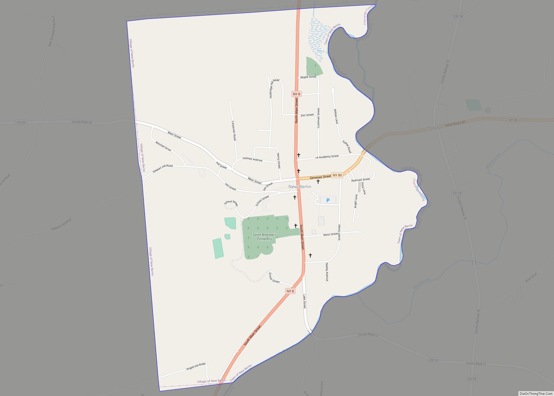
Online Interactive Map
Click on ![]() to view map in "full screen" mode.
to view map in "full screen" mode.
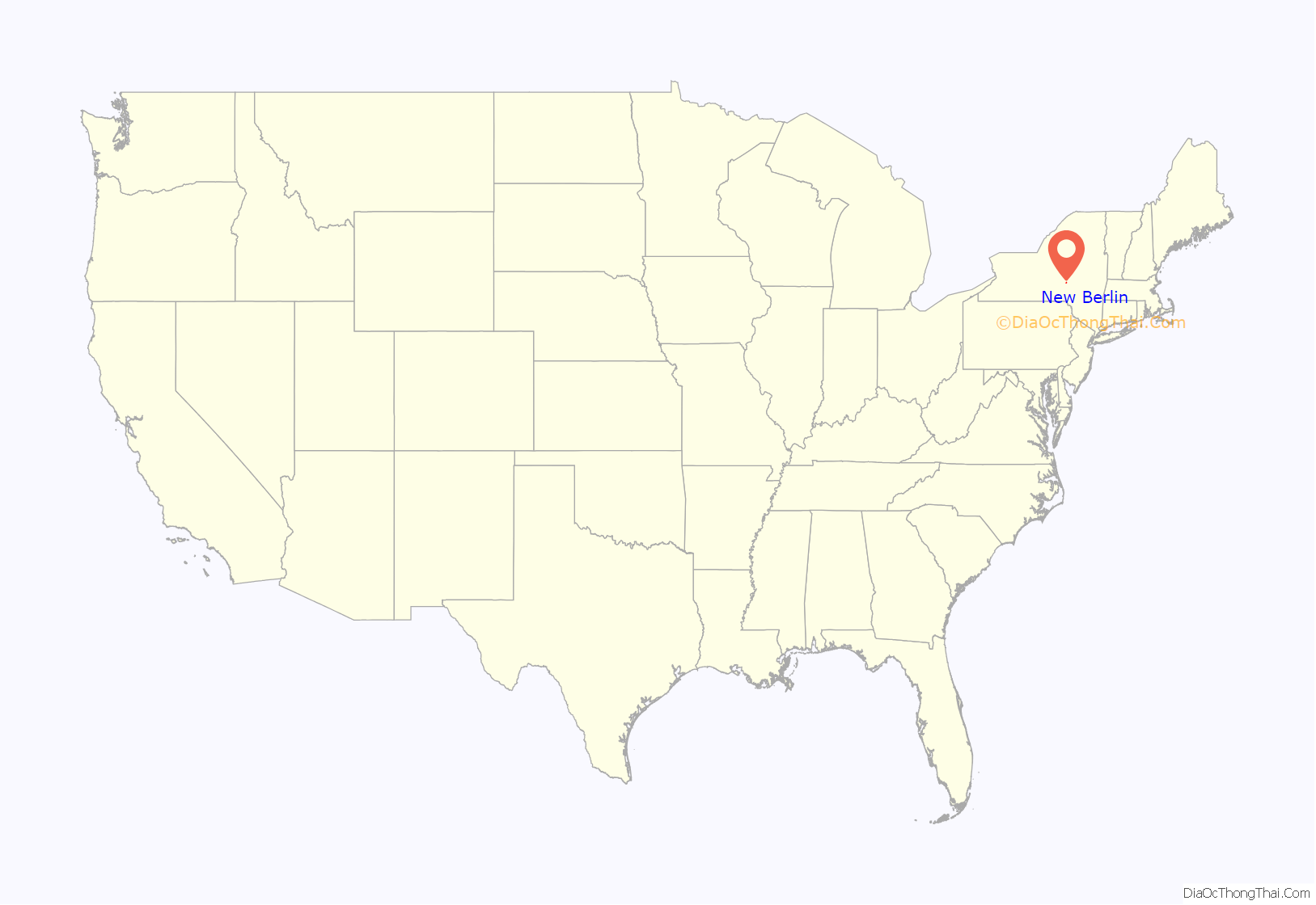
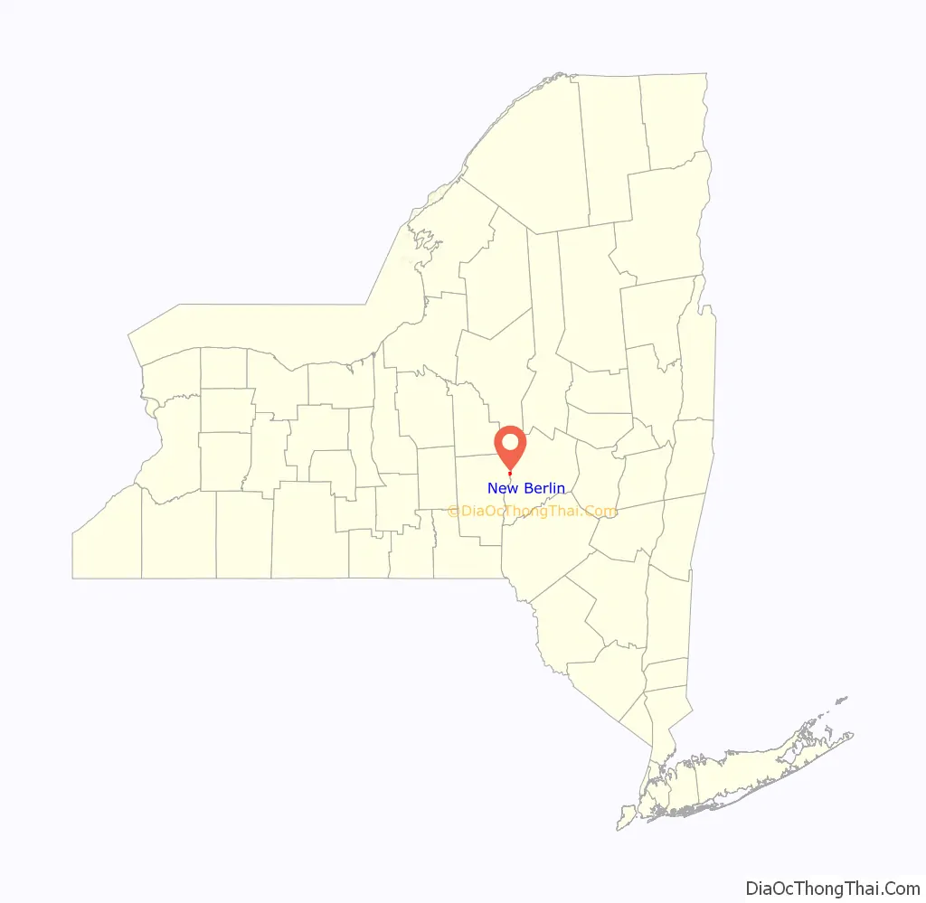
New Berlin location map. Where is New Berlin village?
History
The village was incorporated in 1816. The name of the village and town are believed to relate to the city, Berlin in Germany, due to the number of early German settlers. The true origin of the name comes from one of its earliest settlers’ heritage in Berlin, New York, or Berlin, Connecticut.
The Horace O. Moss House was listed on the National Register of Historic Places in 1974. The New Berlin Historic District was listed in 1982.
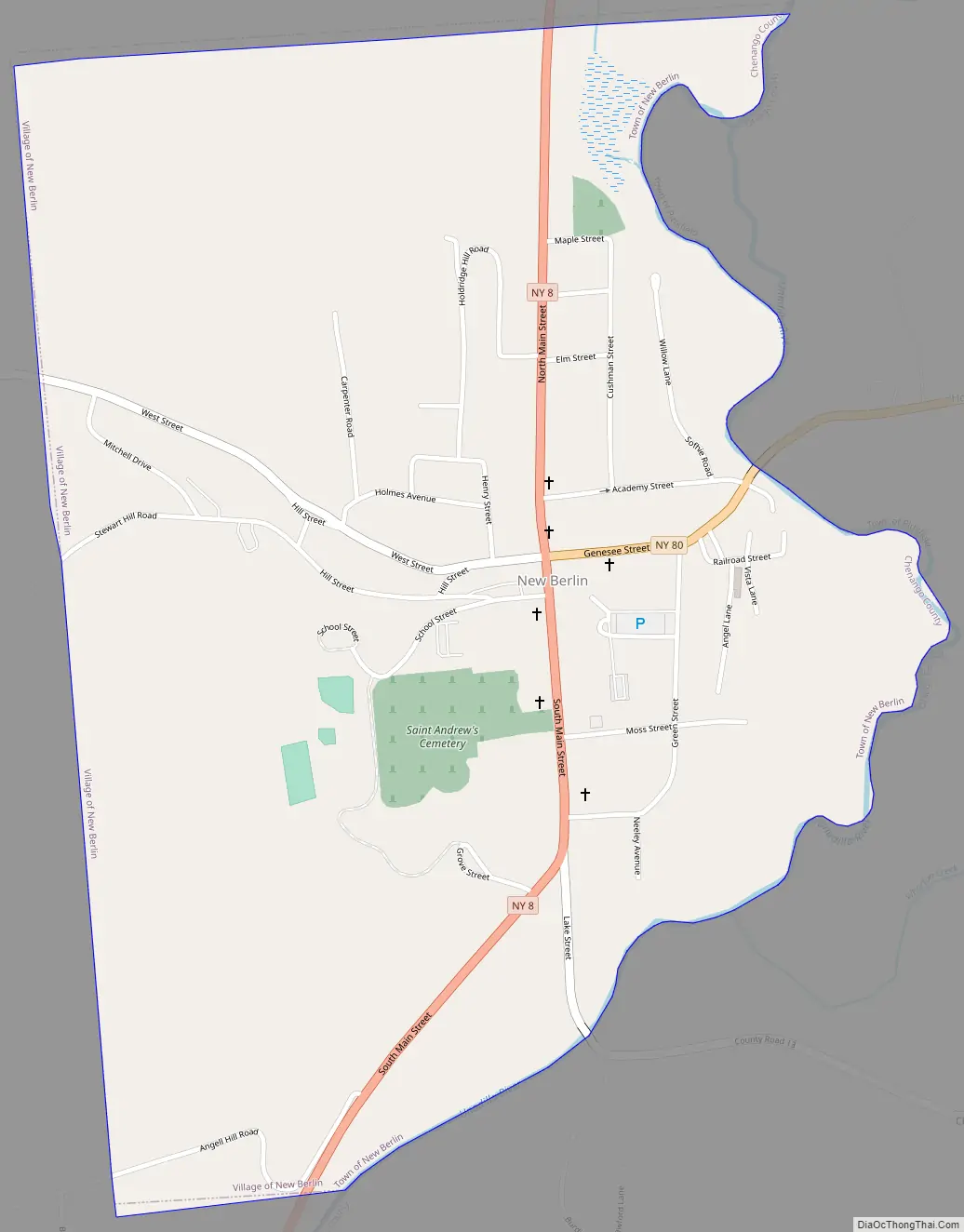
New Berlin Road Map
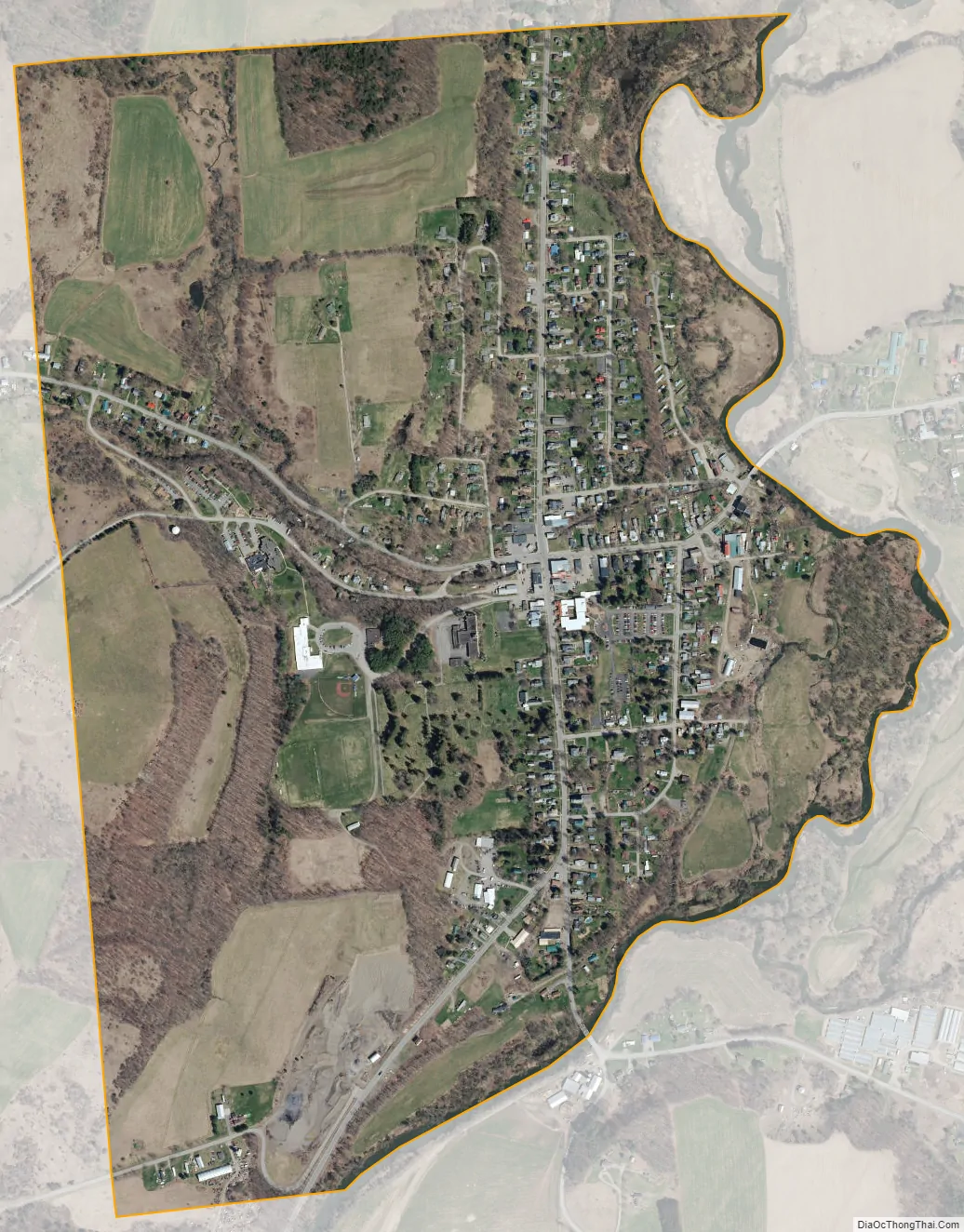
New Berlin city Satellite Map
Geography
New Berlin village is located near the northeastern corner of the town of New Berlin at 42°37′N 75°20′W / 42.617°N 75.333°W / 42.617; -75.333 (42.6241, -75.3334). It is adjacent to the Unadilla River, a south-flowing tributary of the Susquehanna River, and is at the border of Otsego County.
According to the United States Census Bureau, the village has a total area of 1.1 square miles (2.8 km), all land.
The village is situated where conjoined Routes NY-8 and NY-80 separate, with NY-8 going south and NY-80 going east. Sidney is 23 miles (37 km) to the south, Cooperstown is 26 miles (42 km) to the east, and Utica is 38 miles (61 km) to the north. County Road 29 enters the village from the west.
See also
Map of New York State and its subdivision:- Albany
- Allegany
- Bronx
- Broome
- Cattaraugus
- Cayuga
- Chautauqua
- Chemung
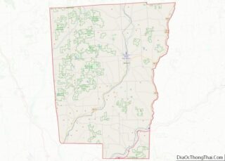
- Chenango
- Clinton
- Columbia
- Cortland
- Delaware
- Dutchess
- Erie
- Essex
- Franklin
- Fulton
- Genesee
- Greene
- Hamilton
- Herkimer
- Jefferson
- Kings
- Lake Ontario
- Lewis
- Livingston
- Madison
- Monroe
- Montgomery
- Nassau
- New York
- Niagara
- Oneida
- Onondaga
- Ontario
- Orange
- Orleans
- Oswego
- Otsego
- Putnam
- Queens
- Rensselaer
- Richmond
- Rockland
- Saint Lawrence
- Saratoga
- Schenectady
- Schoharie
- Schuyler
- Seneca
- Steuben
- Suffolk
- Sullivan
- Tioga
- Tompkins
- Ulster
- Warren
- Washington
- Wayne
- Westchester
- Wyoming
- Yates
- Alabama
- Alaska
- Arizona
- Arkansas
- California
- Colorado
- Connecticut
- Delaware
- District of Columbia
- Florida
- Georgia
- Hawaii
- Idaho
- Illinois
- Indiana
- Iowa
- Kansas
- Kentucky
- Louisiana
- Maine
- Maryland
- Massachusetts
- Michigan
- Minnesota
- Mississippi
- Missouri
- Montana
- Nebraska
- Nevada
- New Hampshire
- New Jersey
- New Mexico
- New York
- North Carolina
- North Dakota
- Ohio
- Oklahoma
- Oregon
- Pennsylvania
- Rhode Island
- South Carolina
- South Dakota
- Tennessee
- Texas
- Utah
- Vermont
- Virginia
- Washington
- West Virginia
- Wisconsin
- Wyoming