Norwich is a city and county seat of Chenango County, New York, United States. Surrounded on all sides by the Town of Norwich, the city’s name is taken from Norwich, England. Its population was 7,051 at the 2020 census.
Lt. Warren Eaton Airport (OIC), serving the area, is located north of the city in the town of North Norwich.
| Name: | Norwich city |
|---|---|
| LSAD Code: | 25 |
| LSAD Description: | city (suffix) |
| State: | New York |
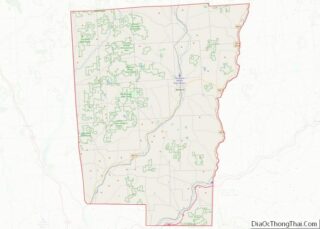
| County: | Chenango County |
| Elevation: | 1,014 ft (309 m) |
| Total Area: | 2.12 sq mi (5.50 km²) |
| Land Area: | 2.12 sq mi (5.50 km²) |
| Water Area: | 0.00 sq mi (0.00 km²) |
| Total Population: | 7,051 |
| Population Density: | 3,319.68/sq mi (1,281.50/km²) |
| ZIP code: | 13815 |
| Area code: | 607 |
| FIPS code: | 3653979 |
| GNISfeature ID: | 0959025 |
| Website: | www.norwichnewyork.net |
Online Interactive Map
Click on ![]() to view map in "full screen" mode.
to view map in "full screen" mode.
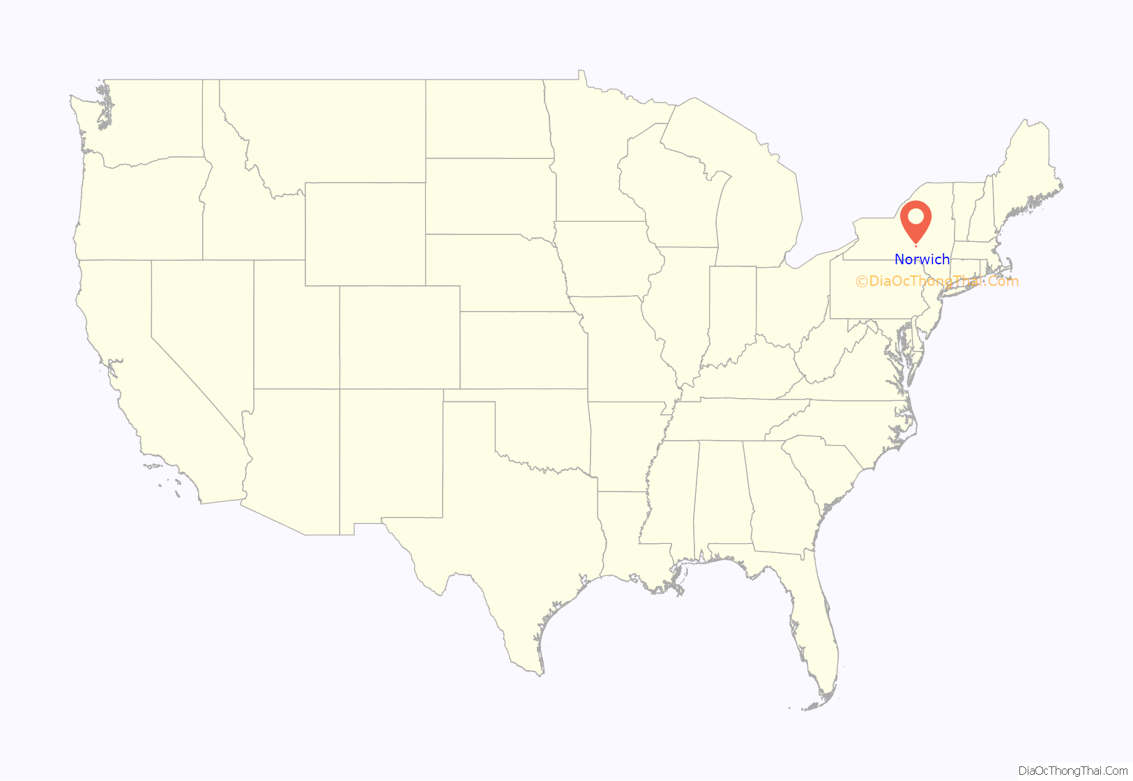
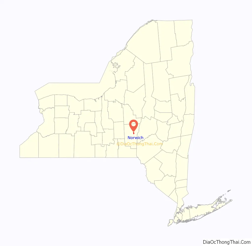
Norwich location map. Where is Norwich city?
History
The first log cabin was built in 1788 by Col. William Monroe, who served as a drummer boy during the Revolutionary War. The town of Norwich was formed in 1793 from the towns of Union (now in Broome County) and Bainbridge. Afterwards, Norwich, as a “mother town” of the county, lost substantial territory in the formation of new towns. In 1806, Norwich gave up territory to form the towns of Pharsalia, Plymouth and Preston. More of Norwich was lost in 1807 to form parts of the towns of New Berlin and Columbus. In 1808 and 1820, Norwich exchanged territory with the town of Preston.
The central community of Norwich set itself off from the town in 1816 by incorporating as a village, later becoming the city of Norwich in 1914.
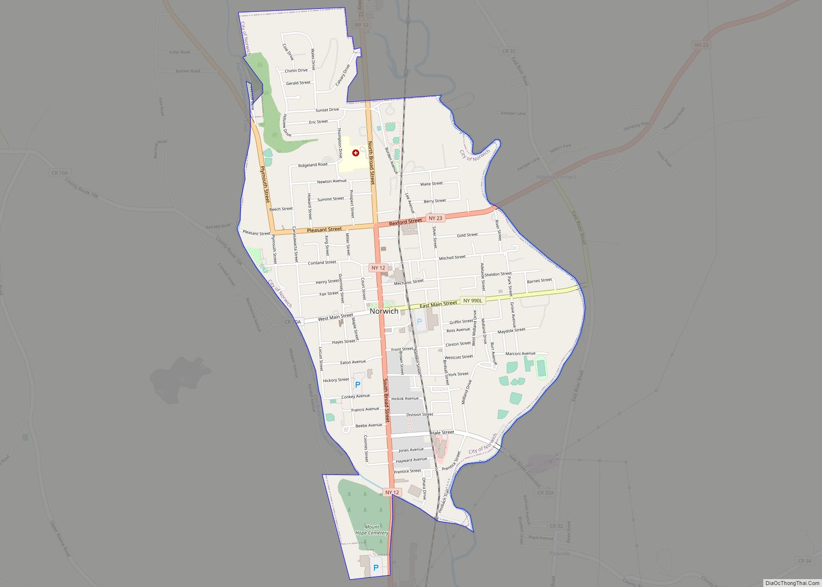
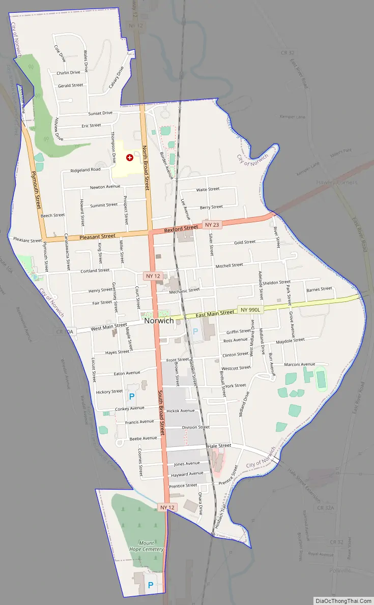
Norwich Road Map
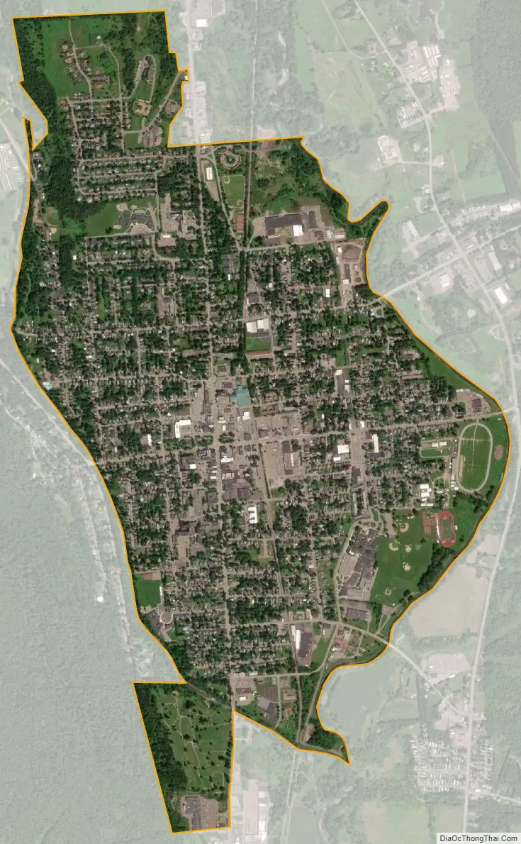
Norwich city Satellite Map
Geography
According to the United States Census Bureau, the city has a total area of 2.1 square miles (5.5 km), all land. Unlike many upstate cities, there are few, if any, defined neighborhoods or districts. Although the city is divided into six wards for political purposes, neighborhoods are seldom referred to in this manner.
Downtown is the main commercial district of Norwich, consisting of North and South Broad streets, East and West Main streets, and lesser side streets, including American Avenue, Lackawanna Avenue, and parts of Mechanic, Fair, and Hayes streets. The downtown district is bordered on the north by Cortland and Mitchell streets, and to the south by Front Street and Eaton Avenue.
Norwich is located in upstate New York, in the Chenango River valley. The river, a tributary of the Susquehanna, winds south along the eastern edge of the city. Along the western border, Canasawacta Creek flows south, until it unites with the Chenango River at the southern city limits.
Location
Norwich lies near the center of the triangle that can be drawn connecting the cities of Syracuse, Albany, and Binghamton, along Interstates 90, 88, and 81, respectively. The city is located at the intersection of New York State Route 12 and New York State Route 23. On Route 12, Utica and access to Interstate 90 is 48 miles (77 km) to the north, while Binghamton (and the Triple Cities) and access to Interstate 81 and Interstate 86 (currently New York State Route 17, known as the Southern Tier Expressway), is 40 miles (64 km) to the south. State Highway 23, which cuts laterally through the northern side of the city, leads east 32 miles (51 km) to the city of Oneonta and access to Interstate 88, while to the west NY 23 leads in the direction of Cortland and Interstate 81, 42 miles (68 km) away.
Climate
See also
Map of New York State and its subdivision:- Albany
- Allegany
- Bronx
- Broome
- Cattaraugus
- Cayuga
- Chautauqua
- Chemung
- Chenango
- Clinton
- Columbia
- Cortland
- Delaware
- Dutchess
- Erie
- Essex
- Franklin
- Fulton
- Genesee
- Greene
- Hamilton
- Herkimer
- Jefferson
- Kings
- Lake Ontario
- Lewis
- Livingston
- Madison
- Monroe
- Montgomery
- Nassau
- New York
- Niagara
- Oneida
- Onondaga
- Ontario
- Orange
- Orleans
- Oswego
- Otsego
- Putnam
- Queens
- Rensselaer
- Richmond
- Rockland
- Saint Lawrence
- Saratoga
- Schenectady
- Schoharie
- Schuyler
- Seneca
- Steuben
- Suffolk
- Sullivan
- Tioga
- Tompkins
- Ulster
- Warren
- Washington
- Wayne
- Westchester
- Wyoming
- Yates
- Alabama
- Alaska
- Arizona
- Arkansas
- California
- Colorado
- Connecticut
- Delaware
- District of Columbia
- Florida
- Georgia
- Hawaii
- Idaho
- Illinois
- Indiana
- Iowa
- Kansas
- Kentucky
- Louisiana
- Maine
- Maryland
- Massachusetts
- Michigan
- Minnesota
- Mississippi
- Missouri
- Montana
- Nebraska
- Nevada
- New Hampshire
- New Jersey
- New Mexico
- New York
- North Carolina
- North Dakota
- Ohio
- Oklahoma
- Oregon
- Pennsylvania
- Rhode Island
- South Carolina
- South Dakota
- Tennessee
- Texas
- Utah
- Vermont
- Virginia
- Washington
- West Virginia
- Wisconsin
- Wyoming