Newburgh is a city in the U.S. state of New York, within Orange County. With a population of 28,856 as of the 2020 census, it is a principal city of the Poughkeepsie–Newburgh–Middletown metropolitan area. Located 60 miles (97 km) north of New York City, and 90 miles (140 km) south of Albany on the Hudson River within the Hudson Valley Area, the city of Newburgh is located near Stewart International Airport, one of the primary airports for Downstate New York.
The Newburgh area was first settled in the early 18th century by the Germans and British. During the American Revolution, Newburgh served as the headquarters of the Continental Army. Prior to its chartering in 1865, the city of Newburgh was part of the town of Newburgh; the town now borders the city to the north and west. East of the city is the Hudson River; the city of Beacon is across the river and it is connected to Newburgh via the Newburgh–Beacon Bridge. The entire southern boundary of the city is with the town of New Windsor. Most of this boundary is formed by Quassaick Creek. In May 2016, the city requested help for its PFOS contaminated water supply under Superfund.
Newburgh is the location of numerous preserved landmarks, including Washington’s Headquarters, the David Crawford House, New York State Armory, the Dutch Reformed Church, and Newburgh Colored Burial Ground. George Washington and Franklin Delano Roosevelt had ties to the city; Ulysses S. Grant, Robert Kennedy, and Theodore Roosevelt also visited, the latter delivering a famous speech at a nearby shipyard. The city served as a planning ground for the Gothic Revival architectural movement in America, headed by native Andrew Jackson Downing with English architects Calvert Vaux and Frederick Clarke Withers.
Mount Saint Mary College is a private liberal arts college stimulating the city’s population and economy. Major corporations with significant operations in the city of Newburgh are Stop & Shop, M&T Bank, Chase Bank, Verizon Communications, Charter Communications, Dunkin’, McDonald’s, Metro by T-Mobile, Boost Mobile, and Marshalls.
| Name: | Newburgh city |
|---|---|
| LSAD Code: | 25 |
| LSAD Description: | city (suffix) |
| State: | New York |
| County: | Orange County |
| Land Area: | 3.81 sq mi (9.86 km²) |
| Water Area: | 0.98 sq mi (2.53 km²) |
| Population Density: | 7,581.71/sq mi (2,927.24/km²) |
| ZIP code: | 12550 |
| Area code: | 845 |
| FIPS code: | 3650034 |
| GNISfeature ID: | 0958498 |
| Website: | www.cityofnewburgh-ny.gov |
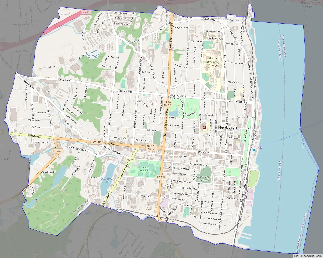
Online Interactive Map
Click on ![]() to view map in "full screen" mode.
to view map in "full screen" mode.
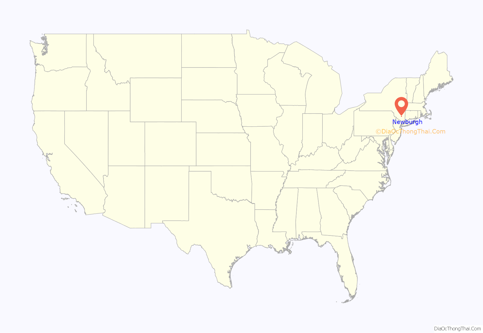
Newburgh location map. Where is Newburgh city?
History
At the time of European contact the area of Newburgh was occupied by the Waoranek, a branch of the Lenape. The area that became Newburgh was first explored by Europeans when Henry Hudson stopped by during his 1609 expedition up the river that now bears his name. His navigator, Robert Juet, is said to have called the site “a pleasant place to build a town”, although some later historians believe he may actually have been referring to the area where Cornwall-on-Hudson now stands.
Around 1683, provincial governor Thomas Dongan purchased the land from the Woaranek people. The first settlement was made in the spring of 1709 by fifty-four Palatine refugees, sponsored by Queen Anne of Great Britain. The settlers named it the Palatine Parish by Quassic. In 1743, a ferry at the foot of First Street had been established between Newburgh and Fishkill Landing (now Beacon, New York). In 1752, the land had been surveyed by Cadwallader Colden and named “Newburgh”, perhaps after one of the Newburghs (there are two) in his father’s native Scotland (Colden himself was born in Ireland). Shipyards were established and docks and warehouses lined the waterfront.
Newburgh was the headquarters of the Continental Army from March 1782 until late 1783. While the army was camped at Newburgh, some of its senior officers began the “Newburgh conspiracy” to overthrow the government. General George Washington was able to persuade his officers to stay loyal to him. The army was disbanded here in 1783. Washington received the famous Newburgh letter from Lewis Nicola proposing that he become king here. It drew a vigorous rebuke from Washington. In honor of his refusal of that suggestion, Kings Highway, the north–south street on which the Newburgh headquarters is located, was renamed Liberty Street.
Municipal growth
In 1793, Newburgh’s first newspaper, The Newburgh Packet, was established. The hamlet of Newburgh was incorporated as a village in 1800. At the time of its settlement it was in Ulster County and was that county’s seat. When Rockland County was split from Orange County in 1798, Newburgh and the other towns north of Moodna Creek were put in a redrawn Orange County. Newburgh thus lost its status as the county seat to Goshen, but as a political compromise supreme court sessions continued to be heard in Newburgh as well as the county seat of Goshen, the only place in New York State this is permitted. Although technically still permitted by statute, this practice was discontinued in the mid-1960s. The former County courthouse still stands as Newburgh’s old city courthouse building (currently used as municipal office space).
By 1793 there were four sloop lines operating out of Newburgh. As new turnpikes opened trade extended into the interior, passenger coaches and farm wagons raveled as far west as Canandaigua. This was the shortest route from the Hudson to Western New York. By 1819 a steamboat on Cayuga Lake connected Newburgh stage lines with Ithaca. Streets leading to the river were often blocked for hours with farmers’ wagons waiting to be unloaded at the wharves. With the opening of the Erie Canal much of the traffic from the Southern Tier was diverted. In 1830 Richard Carpenter of Newburgh had the steamboat William Young built at Low Point; it ran between Newburgh and Albany. Prosperity returned with the arrival of the railroads.
On the evening of September 24, 1824, beacon fires in the Hudson Highlands announced the arrival of the Marquis de Lafayette. Having been feted in New York, he sailed upriver on the chartered steamer James Kent. The next day, people came from the surrounding towns to catch a glimpse of the general as he made his way to a reception at the Orange Hotel. The Rev. John Brown of St. George’s Episcopal Church was part of the welcoming committee. At 2 am., Lafayette sailed from Reeve & Falls dock for Poughkeepsie.
The Erie Railroad charter was amended April 8, 1845, to allow the building of the Newburgh Branch, running from the main line near Greycourt northeast to Newburgh, also on the Hudson River. The branch opened January 8, 1850. It was later used as a connection to the New York and New England Railroad via a car float operation across the river to Beacon, New York.
Newburgh was chartered as a city in April 1865.
Newburgh became quite prosperous during the Gilded Age that followed. Newburgh had telephone service in 1879. In 1883 there was a steamboat landing on Second Street. The United States Hotel was on Front Street opposite the landing. Also on Front Street near the landing was the Union Depot. In 1883, the West Shore Railroad inaugurated service to the Pennsylvania Railroad Depot at Jersey City and by 1886 was traveling to Weehawken Terminal, where passengers transferred to ferries to Manhattan.
With its situation on the Hudson River, midway between New York City and Albany, it became a transportation hub and an industrial center. Its industries included the manufacturing of cottons, woolens, silks, paper, felt hats, baking powder, soap, paper boxes, brick, plush goods, steam boilers, tools, automobiles, coin silver, bleach, candles, waterway gates, ice machines, pumps, moving-picture screens, overalls, perfumes, furniture, carpets, carburetors, spiral springs, spiral pipe, shirt waists, shirts, felt goods, lawn mowers; shipyards; foundries and machine shops; tanneries; leatherette works; and plaster works.
J. J. Nutt made this comment about Newburgh:
Newburgh was home to the second Edison power plant, which installed and powered 126 lamps at the Orange Woolen Mill, and was the second American city (after New York’s Pearl Street) to have a street lit using electricity. Broadway, which at 132 feet (40 m) in width is one of the widest streets in the state of New York, runs through the city culminating with views of the Hudson River.
20th and 21st centuries
Newburgh played a pivotal role in television history. In October 1939, RCA chose to test-market televisions in Newburgh, which was within range of the television signal of RCA’s experimental station W2XBS. Six hundred sets were sold in Newburgh at a deep discount. The test-marketing campaign’s success encouraged RCA to go forward with developing the new medium. Additionally, with consumer television production ceasing during World War II, those Newburgh households which purchased televisions during 1939 and 1940 were among the few to enjoy television (albeit with a greatly reduced programming schedule) during the war.
Newburgh was one of the first cities in the country to fluoridate its water in 1945.
In the late 20th century the industrial base of the city declined as industries relocated operations south or to other locations with cheaper labor costs and lower taxes. The Hudson River, which previously served as the main means of transporting goods, lost much of its shipping traffic to trucking. The city’s trolley system was shut down in 1924 in favor of buses. The nation moved to the automobile for transportation and, as with many other cities, there was a resulting migration to the suburbs. In 1963 the Newburgh–Beacon Bridge was opened, carrying Interstate 84 and spanning the Hudson River, bypassing the Newburgh waterfront and the city of Newburgh altogether. The ferry closed down soon thereafter—it was not revived until 2005—and the waterfront area declined rapidly.
In 1962, Lloyd’s Department Store became the first major shopping center in Newburgh. Its motto was “Years Ahead”. Many features of Lloyd’s, including widely divergent ministores under one roof, did not become common in other shopping centers for many decades. Lloyd’s successfully drew a great deal of retail business away from the downtown area. In 1964, the Mid Valley Mall opened, also outside of the city limits in Newburgh, and attracted many long-established local businesses away from the waterfront and downtown city of Newburgh. Other retail shopping malls soon sprang up, all also outside the city of Newburgh, and the retail industry of the city declined further. The city continued to lose its previously well regarded retail sector along Water Street and Broadway to the suburban shopping malls, which did not share the city’s congested parking and traffic problems or the perceived rising crime rate.
In the late 1960s and early 1970s, the city’s response to the economic decline was an ambitious urban renewal plan. The city’s historic waterfront area, an area composed of several square blocks which included numerous historically significant buildings, was completely demolished between 1970 and 1973. Residents were relocated, or were supposed to be relocated, to newer housing projects around Muchattoes Lake in the city’s interior.
A grand complex that was planned for the urban renewal area was never built when state and federal spending began to dry up after the 1973 oil crisis. To this day, the blocks which slope down to the river remain open, grassy slopes, offering sweeping views of the Hudson but generating no property taxes for the city. Public sentiment is mixed on whether they should be built on again at all, and the city’s view-protection ordinances make it less likely. Below, the waterfront was developed in the late 1990s after the city was once again able to secure grants from the state’s Environmental Protection fund for riprap to stabilize the shoreline.
In the early 1960s, city manager Joseph McDowell Mitchell and the council attracted nationwide attention and the admiration of political conservatives when they attempted to require welfare recipients to pick up their payments at police headquarters. Mitchell later announced a program aimed largely at African Americans on welfare, whom many in the community blamed for its economic problems. The program would have denied welfare payments to all after three months except the aged, the blind and the handicapped. Those affected would have largely been single mothers of young children, the only category in which blacks were predominant. After opposition by both state and federal officials, the program created a national controversy and never went into effect. Along with the failed urban renewal, the mid to late 1960s in Newburgh were also marked by race riots and other tensions.
Newburgh in the early 21st century is more racially diverse than previously, with a growing Latin American immigrant population (mainly of Mexican descent) in addition to the city’s sizable African American demographic. Economic development has been a major concern, but poorly realized, as the good jobs once found in the local manufacturing sector have not been replaced. Pockets of poverty persist in the city, often mere blocks away from its many historical and architectural landmarks. In addition to this, the city has been facing issues regarding illegal immigration, like many other cities across the United States, ranging from overcrowded apartment buildings to mild racial conflict.
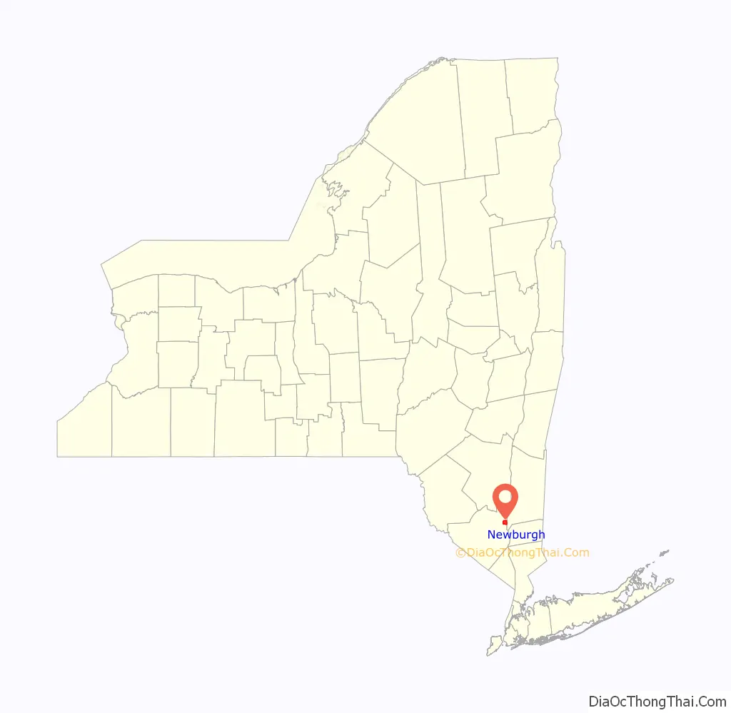
Newburgh Road Map
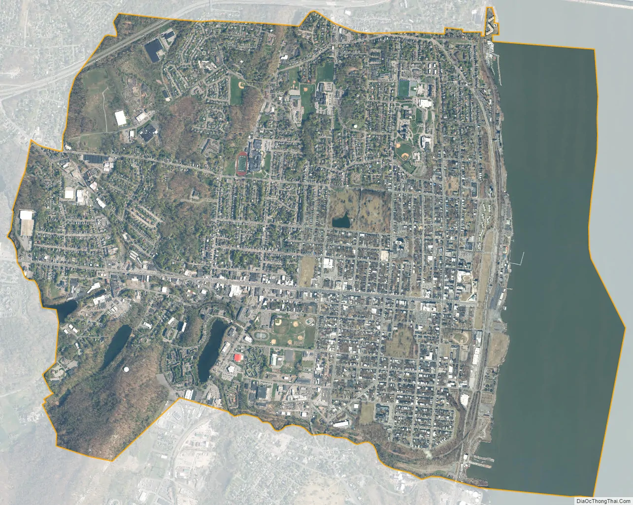
Newburgh city Satellite Map
Geography
Newburgh is situated in the Northeastern United States, in Downstate New York’s Hudson Valley region. It is located within Orange County bordering the Hudson River on the west bank. The town of Newburgh borders the city to the north and west, and the town of New Windsor borders the south.
Adjacent to Newburgh, the land rises at first sharply to a bluff, where many historic structures are located, offering sweeping views of the Hudson Highlands to the south; Mount Beacon to the east and the Newburgh—Beacon Bridge to the north; then more gradually to a relatively level western half. There are some notable hills in outlying areas such as the Washington Heights section in southeast Newburgh and Mount St. Mary’s at the northeast. The lowest elevation in the city is at sea level along the river; the highest is roughly 690 feet (210 m) on Snake Hill along the city’s boundary with the town of New Windsor.
According to the United States Census Bureau, the city is located at the following coordinates: (41.503193, −74.019636). According to the U.S. Census Bureau, Newburgh has a total area of 4.8 sq mi (12.4 km), of which 3.8 sq mi (9.9 km) is land and 0.97 sq mi (2.5 km) (20.08%) is water. Newburgh makes up a part of the Poughkeepsie—Newburgh—Middletown metropolitan area, which is a part of the New York megacity.
Climate
Typical to Downstate New York, the city of Newburgh lies in the transitional zone between humid subtropical and humid continental climates under the Köppen climate classification.
Annually, according to Sperling’s BestPlaces, the city receives an average of 191 sunny days. Winters are cold and damp, and the city of Newburgh may receive up to 36.8 inches (934.72 mm) of snowfall. The months of January and February are the coldest months of the year with an average low of 18 degrees Fahrenheit or -7.7 Celsius. February is also the driest month. Summers tend to be hot and humid, with an average high of 84 °F (28.8 °C) in July. June, August, and September are the most comfortable months according to Sperling’s BestPlaces. Newburgh receives approximately 47 inches (1,193.8 mm) of rainfall annually.
Preservation
Newburgh’s preservation history can be traced all the way back to 1850 when Washington’s Headquarters was designated a state historic site, the first in the country. The Historical Society of Newburgh Bay and the Highlands was chartered by the State of New York and incorporated in 1884. The David Crawford House on Montgomery Street, built in 1830, is the current home of the Historical Society of Newburgh Bay and the Highlands.
The city’s modern preservation efforts began when the Dutch Reformed Church, a Greek Revival structure designed by Alexander Jackson Davis, was slated for demolition as part of urban renewal after the congregation left the building in 1967. The movement to stop it led to the development of a historic district, now the second largest in New York State. The church was added to the National Register of Historic Places three years later, and in 2001 became the city’s second National Historic Landmark after Washington’s Headquarters.
The city was designated a Preserve America community in 2005 and it also signed an agreement with the State Office of Historic Preservation as a Certified Local Government community. Its East End Historic District, recognized by the National Register of Historic Places as that and the Montgomery-Grand-Liberty Streets Historic District, has the most contributing properties of any historic district in the state.
The city’s historic architecture, featuring designs by Alexander Jackson Davis, Calvert Vaux, Andrew Jackson Downing, Frederick Clarke Withers, George E. Harney, John H. Duncan, J. A. Wood, Warren and Wetmore, James Riely Gordon, and McKim, Mead & White have attracted a stable core of preservation-minded community activists willing to invest, spend time, and money in renovating property. Other notable native architects include Thornton MacNess Niven, ancestor of playwright Thornton Wilder, Elkanah K. Shaw, and Frank E. Estabrook, known for his civic buildings.
- Old Town Cemetery — The city’s first burying ground and religious site, with gravestones dating to the mid 18th century. Features a unique Egyptian Revival tomb thought to be designed by Davis.
- Newburgh Colored Burial Ground — Former site of a Black cemetery, destroyed around the turn of the 20th century. Construction in a parking lot prompted an archeological dig, which revealed possibly hundreds of remains.
- St. George’s Cemetery — An early planned rural cemetery situated in the city’s East End, with several notable interments. Maintained by St. George’s Episcopal Church, the oldest continually-operating church in the city.
- Washington’s Headquarters State Historic Site — Headquarters of George Washington during the end of the Revolutionary War, and home of the Huguenot Hasbrouck family. It is the first publicly owned historic site in the United States.
- David Crawford House — Headquarters of the Historical Society of Newburgh Bay and the Highlands, who use the house as a museum and library. Built by David Crawford, a freighter and merchant who contributed to the development of the city.
- Downing Park — A Vaux-Olmstead-designed public park given to the memory of Downing. Features pathways similar to Central Park, with a small pond, cafe, amphitheatre, and pergola designed by Estabrook on the foundation of an 18th-century farmhouse.
See also
Map of New York State and its subdivision:- Albany
- Allegany
- Bronx
- Broome
- Cattaraugus
- Cayuga
- Chautauqua
- Chemung
- Chenango
- Clinton
- Columbia
- Cortland
- Delaware
- Dutchess
- Erie
- Essex
- Franklin
- Fulton
- Genesee
- Greene
- Hamilton
- Herkimer
- Jefferson
- Kings
- Lake Ontario
- Lewis
- Livingston
- Madison
- Monroe
- Montgomery
- Nassau
- New York
- Niagara
- Oneida
- Onondaga
- Ontario
- Orange
- Orleans
- Oswego
- Otsego
- Putnam
- Queens
- Rensselaer
- Richmond
- Rockland
- Saint Lawrence
- Saratoga
- Schenectady
- Schoharie
- Schuyler
- Seneca
- Steuben
- Suffolk
- Sullivan
- Tioga
- Tompkins
- Ulster
- Warren
- Washington
- Wayne
- Westchester
- Wyoming
- Yates
- Alabama
- Alaska
- Arizona
- Arkansas
- California
- Colorado
- Connecticut
- Delaware
- District of Columbia
- Florida
- Georgia
- Hawaii
- Idaho
- Illinois
- Indiana
- Iowa
- Kansas
- Kentucky
- Louisiana
- Maine
- Maryland
- Massachusetts
- Michigan
- Minnesota
- Mississippi
- Missouri
- Montana
- Nebraska
- Nevada
- New Hampshire
- New Jersey
- New Mexico
- New York
- North Carolina
- North Dakota
- Ohio
- Oklahoma
- Oregon
- Pennsylvania
- Rhode Island
- South Carolina
- South Dakota
- Tennessee
- Texas
- Utah
- Vermont
- Virginia
- Washington
- West Virginia
- Wisconsin
- Wyoming


