Newport is a village in Herkimer County, New York, United States. The population was 640 at the 2010 census.
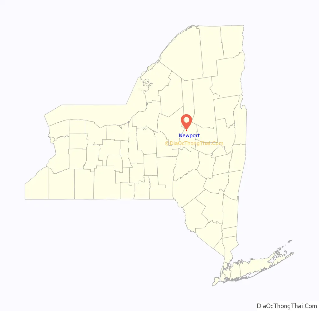
The village is in the eastern part of the town of Newport and is northeast of Utica.
| Name: | Newport village |
|---|---|
| LSAD Code: | 47 |
| LSAD Description: | village (suffix) |
| State: | New York |
| County: | Herkimer County |
| Elevation: | 663 ft (202 m) |
| Total Area: | 0.59 sq mi (1.53 km²) |
| Land Area: | 0.53 sq mi (1.36 km²) |
| Water Area: | 0.06 sq mi (0.17 km²) |
| Total Population: | 543 |
| Population Density: | 1,032.32/sq mi (398.68/km²) |
| ZIP code: | 13416 |
| Area code: | 315 |
| FIPS code: | 3650573 |
| GNISfeature ID: | 0958518 |
| Website: | www.villageofnewportny.org |
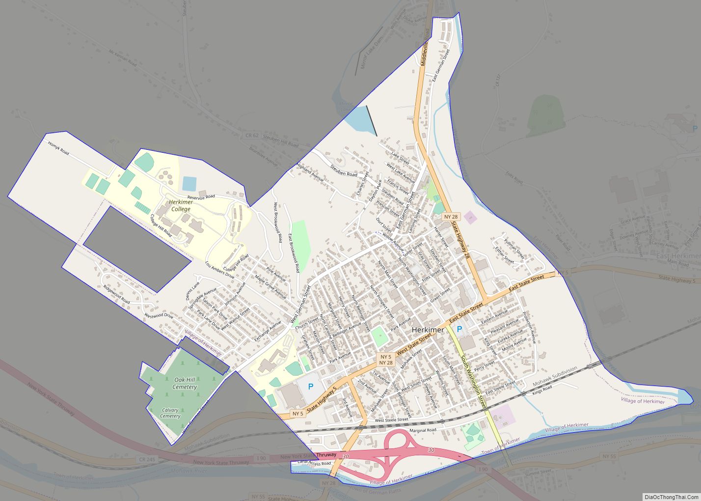
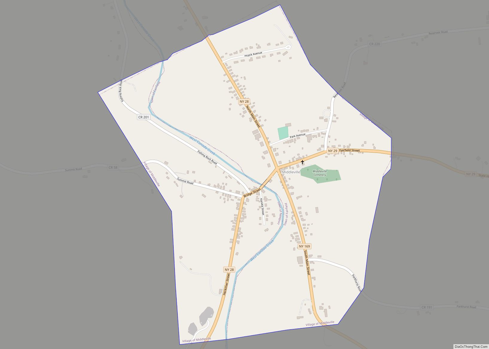
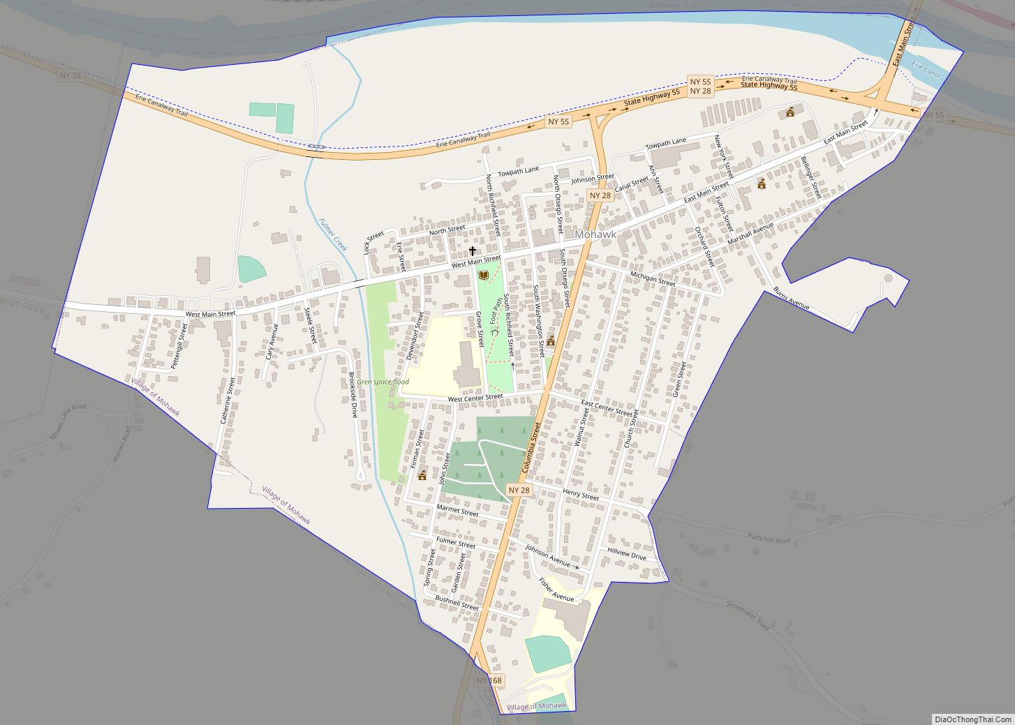
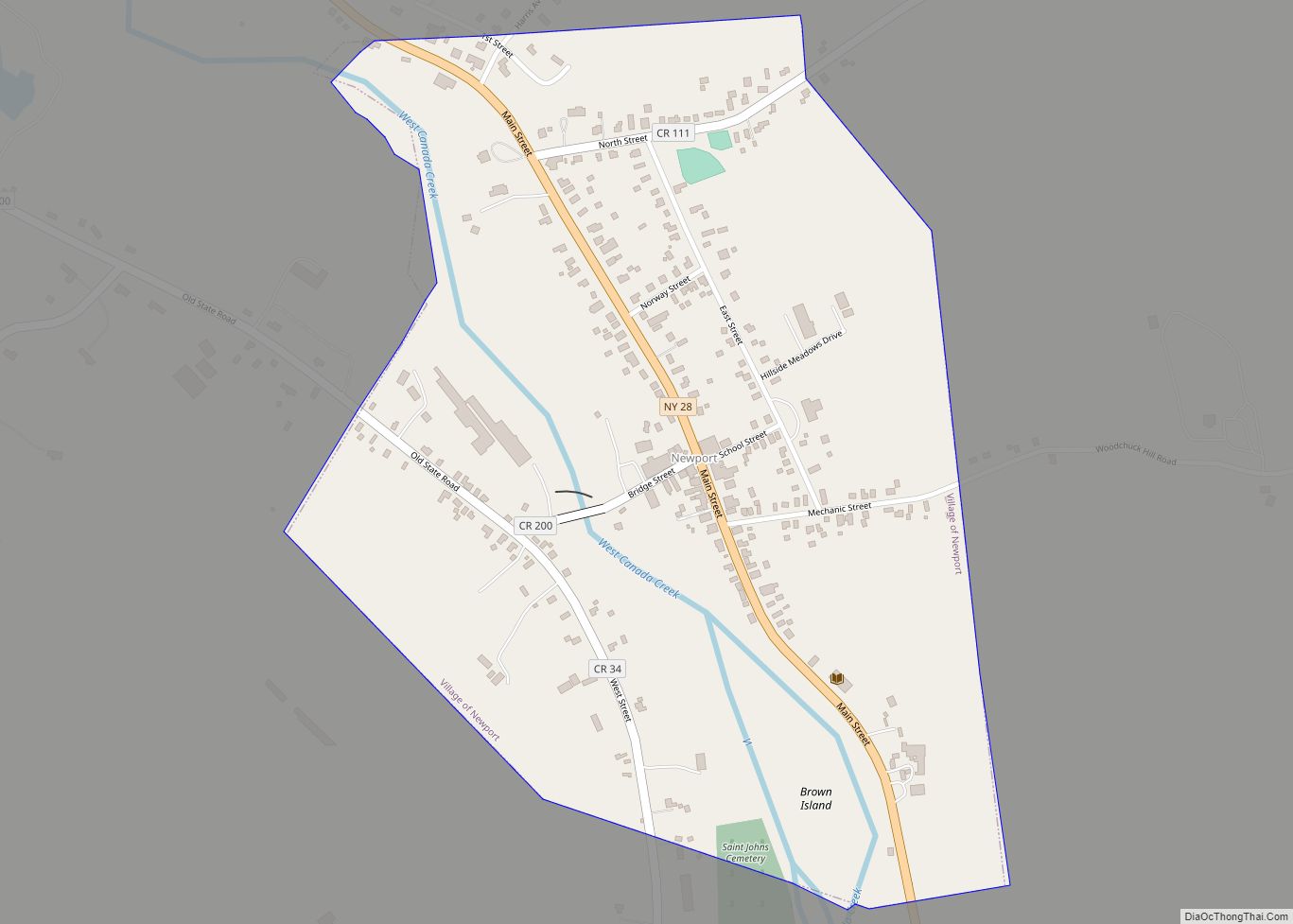
Online Interactive Map
Click on ![]() to view map in "full screen" mode.
to view map in "full screen" mode.
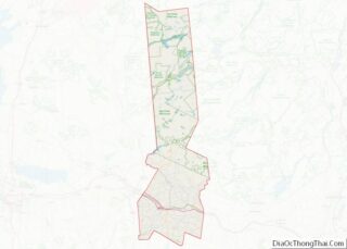
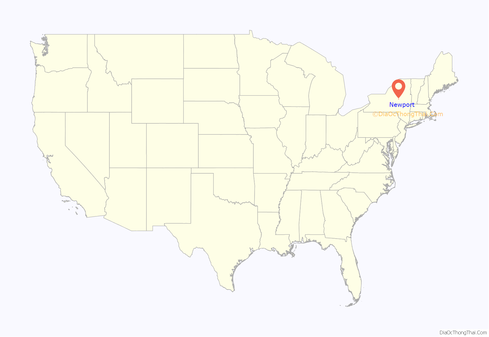
Newport location map. Where is Newport village?
History
The early community was known as the “Bowen Settlement”, after its founder Benjamin Bowen. He purchased the land around 1788 and began improvements and invited settlers to purchase land.
The village was incorporated in 1857. It was then an important cheese center.
Newport was the home of Algernon Smith (1842 – 1876), an officer in the U.S. 7th Cavalry Regiment who was killed in the Battle of the Little Bighorn. Newport was also the home of Linus Yale Sr. and Linus Yale Jr., lockmakers and inventors. The Yale-Cady Octagon House and Yale Lock Factory Site is located in Newport.
Five other structures in Newport are on the New York State and National Register of Historic Places: the Benjamin Bowen House, Newport Stone Arch Bridge, Masonic Temple — Newport Lodge No. 445 F. & A.M., and Stuart Perry and William Swezey Houses.
Newport Road Map
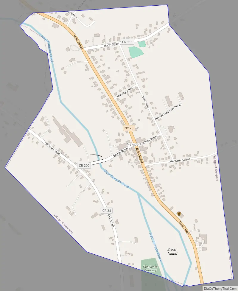
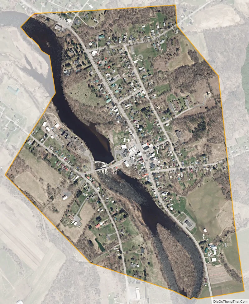
Newport city Satellite Map
Geography
The village is in the eastern part of the town of Newport, on both sides of West Canada Creek, a tributary of the Mohawk River, though the village center is on the eastern side of the creek. According to the United States Census Bureau, the village has a total area of 0.58 square miles (1.5 km), of which 0.54 square miles (1.4 km) are land and 0.066 square miles (0.17 km), or 10.87%, are water.
New York State Route 28, Main Street, is a north–south highway through the village, leading northwest 4 miles (6 km) to Poland and southeast the same distance to Middleville. Herkimer, the county seat, is 12 miles (19 km) to the south of Newport on NY 28. County Road 34 passes through the part of Newport on the west bank of West Canada Creek.
Brown Island in West Canada Creek is in the southern part of Newport.
See also
Map of New York State and its subdivision:- Albany
- Allegany
- Bronx
- Broome
- Cattaraugus
- Cayuga
- Chautauqua
- Chemung
- Chenango
- Clinton
- Columbia
- Cortland
- Delaware
- Dutchess
- Erie
- Essex
- Franklin
- Fulton
- Genesee
- Greene
- Hamilton
- Herkimer
- Jefferson
- Kings
- Lake Ontario
- Lewis
- Livingston
- Madison
- Monroe
- Montgomery
- Nassau
- New York
- Niagara
- Oneida
- Onondaga
- Ontario
- Orange
- Orleans
- Oswego
- Otsego
- Putnam
- Queens
- Rensselaer
- Richmond
- Rockland
- Saint Lawrence
- Saratoga
- Schenectady
- Schoharie
- Schuyler
- Seneca
- Steuben
- Suffolk
- Sullivan
- Tioga
- Tompkins
- Ulster
- Warren
- Washington
- Wayne
- Westchester
- Wyoming
- Yates
- Alabama
- Alaska
- Arizona
- Arkansas
- California
- Colorado
- Connecticut
- Delaware
- District of Columbia
- Florida
- Georgia
- Hawaii
- Idaho
- Illinois
- Indiana
- Iowa
- Kansas
- Kentucky
- Louisiana
- Maine
- Maryland
- Massachusetts
- Michigan
- Minnesota
- Mississippi
- Missouri
- Montana
- Nebraska
- Nevada
- New Hampshire
- New Jersey
- New Mexico
- New York
- North Carolina
- North Dakota
- Ohio
- Oklahoma
- Oregon
- Pennsylvania
- Rhode Island
- South Carolina
- South Dakota
- Tennessee
- Texas
- Utah
- Vermont
- Virginia
- Washington
- West Virginia
- Wisconsin
- Wyoming