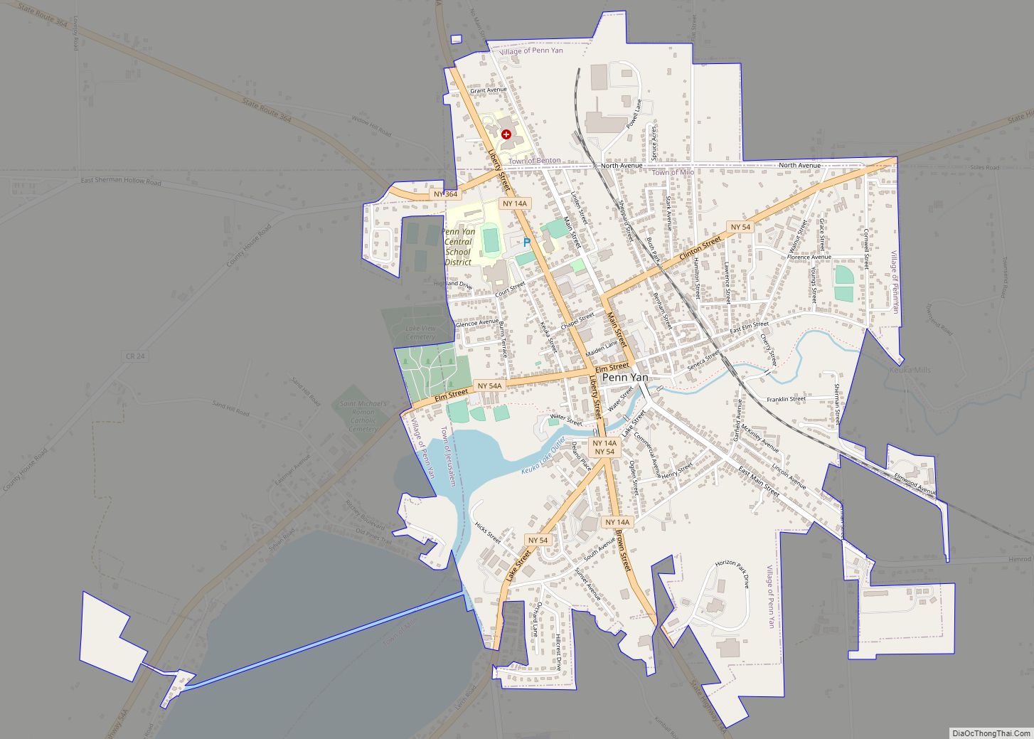
Penn Yan is an incorporated village and the county seat of Yates County, New York, United States. The population was 5,159 at the 2010 census. It lies at the north end of the east branch of Keuka Lake, one of the Finger Lakes. Penn Yan, New York is home to one of the oldest mills in the United States, The Birkett Mills, founded in 1797.
The Village of Penn Yan is primarily in the Town of Milo, but a small section is in the Town of Benton. A smaller section is in the Town of Jerusalem. The Penn Yan Airport is south of the village. The name “Penn Yan” is a syllabic abbreviation of “Pennsylvania Yankee”. It houses the Penn Yan Central School District.
| Name: | Penn Yan village |
|---|---|
| LSAD Code: | 47 |
| LSAD Description: | village (suffix) |
| State: | New York |
| County: | Yates County |
| Incorporated: | 1833 (1833) |
| Elevation: | 728 ft (222 m) |
| Total Area: | 2.46 sq mi (6.36 km²) |
| Land Area: | 2.40 sq mi (6.22 km²) |
| Water Area: | 0.06 sq mi (0.15 km²) |
| Total Population: | 5,056 |
| Population Density: | 2,106.67/sq mi (813.32/km²) |
| ZIP code: | 14527 |
| Area code: | 315 |
| FIPS code: | 3657177 |
| GNISfeature ID: | 0960144 |
| Website: | http://www.villageofpennyan.com |
Online Interactive Map
Click on ![]() to view map in "full screen" mode.
to view map in "full screen" mode.
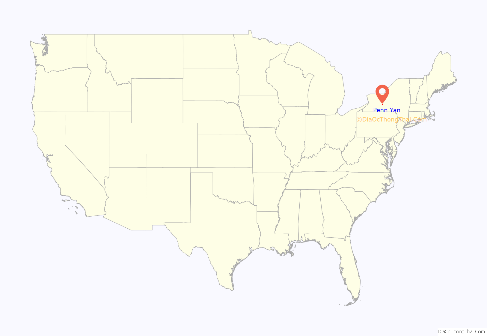
Penn Yan location map. Where is Penn Yan village?
History
The first frame dwelling at Penn Yan was built in 1799. The village became the county seat in 1823, when Yates County was created. It was incorporated in 1833.
The first settlers were chiefly followers of the Public Universal Friend, a religious enthusiast born in Cumberland, Providence County, Rhode Island, who obtained a large tract for a settlement (called Jerusalem in 1789) in the present Yates County, and founded the village of Hopeton on the outlet of Keuka Lake, approximately one mile from Seneca Lake. Many followers settled there, and lived there after 1790, but the community gradually broke up.
Penn Yan, the name of the village, is said to have been contrived from the first syllables of “Pennsylvania” and “Yankee”, as most of the early settlers were from Pennsylvania and New England; the latter were known as Yankees. It became a trading center for the agricultural county, with mills for lumber, buckwheat and other grains. The village was the western terminus of the former Crooked Lake Canal.
In 1921, the Penn Yan Boat Company was founded by German immigrant Charles A. Herrman. It produced wooden and glass-fiber boats until 2001.
During the late 1800s and through the mid-to-late 1900s, Penn Yan and surrounding Yates County areas were home to a large number of dairy farms, many settled by Danish immigrants and their descendants. Even today, names such as Christensen and Jensen are common. Since the late 20th century, Old Order Mennonite and Amish families have settled and taken over farms in the region. Beginning in 1974, many families of the Groffdale Conference Mennonite Church moved to Yates County from Lancaster County, Pennsylvania, seeking cheaper farmland. The Yates County Old Order Mennonites settlement is the largest horse-and-buggy community in the state of New York. There are also several Old Order Amish settlements in adjacent Steuben and Seneca counties, which were founded starting in 1979.
On May 13, 2014 heavy downpours caused severe flash flooding in the area, which ripped out roads as well as destroying at least one commercial building downtown as about five inches of rain fell over a few hours, considered to be at least a 100-year flood.
Historic properties
The Roderick M. Morrison House, Lake View Cemetery, Crooked Lake Outlet Historic District, Yates County Courthouse Park District, Sampson Theatre, United States Post Office, Charles Wagener House, and Penn Yan Historic District are listed on the National Register of Historic Places.
Penn Yan Road Map
Penn Yan city Satellite Map
See also
Map of New York State and its subdivision:- Albany
- Allegany
- Bronx
- Broome
- Cattaraugus
- Cayuga
- Chautauqua
- Chemung
- Chenango
- Clinton
- Columbia
- Cortland
- Delaware
- Dutchess
- Erie
- Essex
- Franklin
- Fulton
- Genesee
- Greene
- Hamilton
- Herkimer
- Jefferson
- Kings
- Lake Ontario
- Lewis
- Livingston
- Madison
- Monroe
- Montgomery
- Nassau
- New York
- Niagara
- Oneida
- Onondaga
- Ontario
- Orange
- Orleans
- Oswego
- Otsego
- Putnam
- Queens
- Rensselaer
- Richmond
- Rockland
- Saint Lawrence
- Saratoga
- Schenectady
- Schoharie
- Schuyler
- Seneca
- Steuben
- Suffolk
- Sullivan
- Tioga
- Tompkins
- Ulster
- Warren
- Washington
- Wayne
- Westchester
- Wyoming
- Yates
- Alabama
- Alaska
- Arizona
- Arkansas
- California
- Colorado
- Connecticut
- Delaware
- District of Columbia
- Florida
- Georgia
- Hawaii
- Idaho
- Illinois
- Indiana
- Iowa
- Kansas
- Kentucky
- Louisiana
- Maine
- Maryland
- Massachusetts
- Michigan
- Minnesota
- Mississippi
- Missouri
- Montana
- Nebraska
- Nevada
- New Hampshire
- New Jersey
- New Mexico
- New York
- North Carolina
- North Dakota
- Ohio
- Oklahoma
- Oregon
- Pennsylvania
- Rhode Island
- South Carolina
- South Dakota
- Tennessee
- Texas
- Utah
- Vermont
- Virginia
- Washington
- West Virginia
- Wisconsin
- Wyoming
