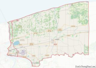
Rapids is a hamlet (also a census-designated place) located in the Town of Lockport in Niagara County, New York, United States. The population was 1,636 at the 2010 census. The ZIP code for Rapids is 14094.
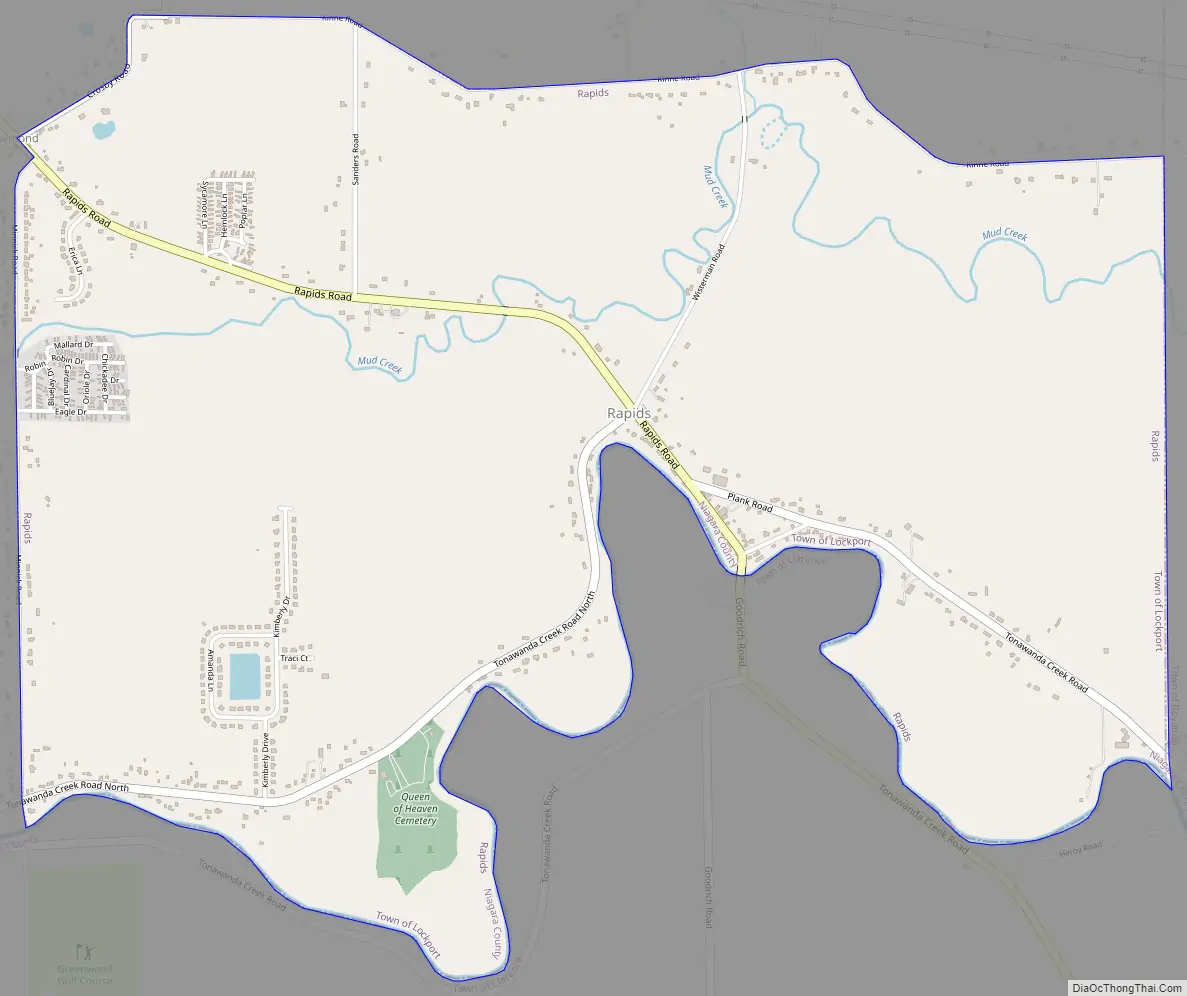
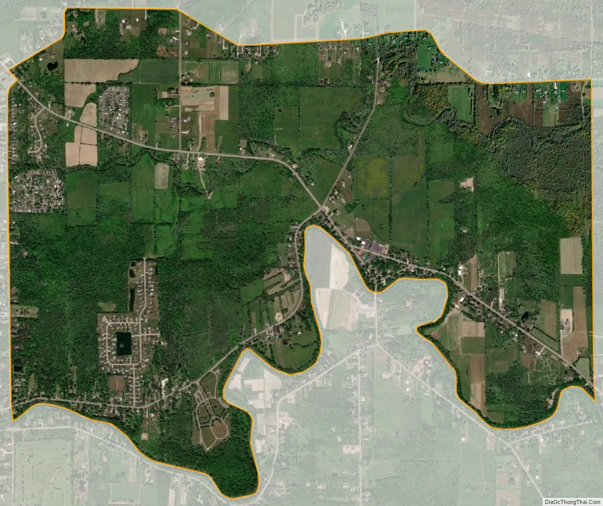
Rapids is located on the south edge of both the town and the county so that a small part of the community is in the Town of Clarence in Erie County. The hamlet is at the junction of Tonawanda Creek Road, Rapids Road, and Goodrich Road. The community consists of a fire hall, a church, a few businesses, and many residences, primarily in Niagara County. It is part of the Buffalo–Niagara Falls Metropolitan Statistical Area.
| Name: | Rapids CDP |
|---|---|
| LSAD Code: | 57 |
| LSAD Description: | CDP (suffix) |
| State: | New York |
| County: | Niagara County |
| Elevation: | 591 ft (180 m) |
| Total Area: | 3.64 sq mi (9.44 km²) |
| Land Area: | 3.64 sq mi (9.44 km²) |
| Water Area: | 0.00 sq mi (0.00 km²) |
| Total Population: | 1,584 |
| Population Density: | 434.69/sq mi (167.83/km²) |
| FIPS code: | 3660609 |
| GNISfeature ID: | 0962191 |
Online Interactive Map
Click on ![]() to view map in "full screen" mode.
to view map in "full screen" mode.
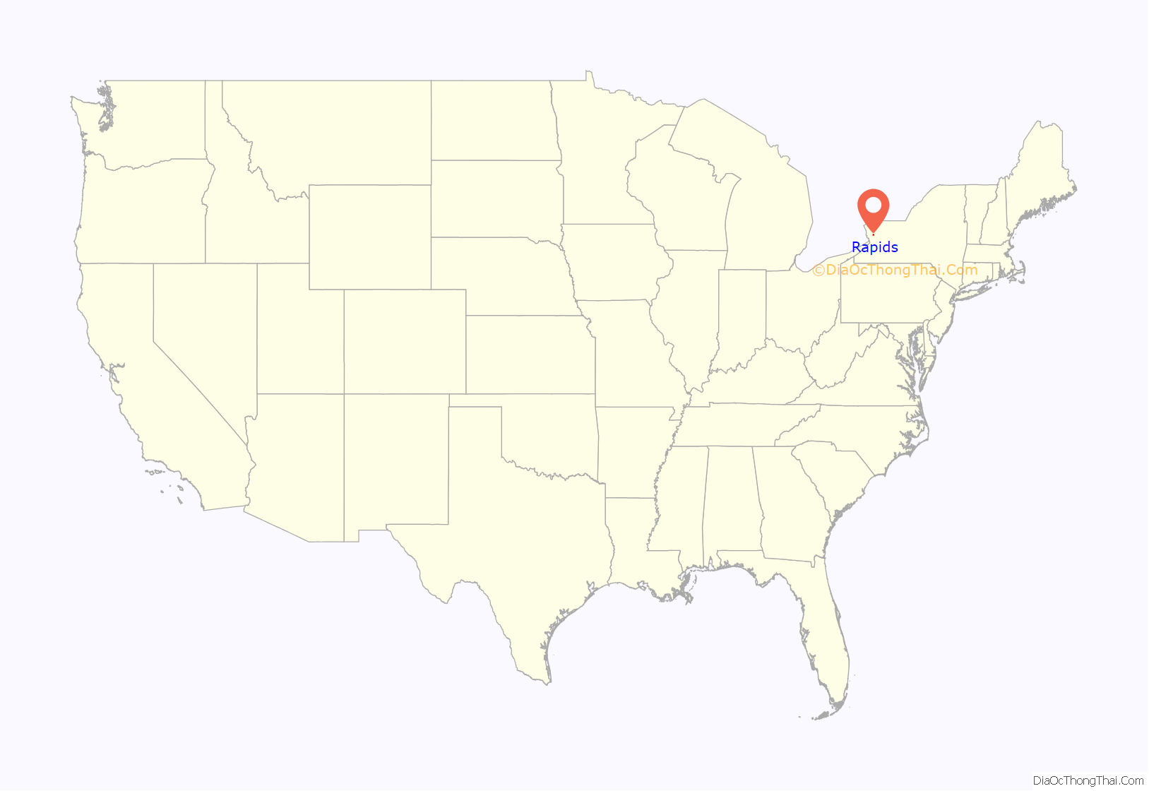
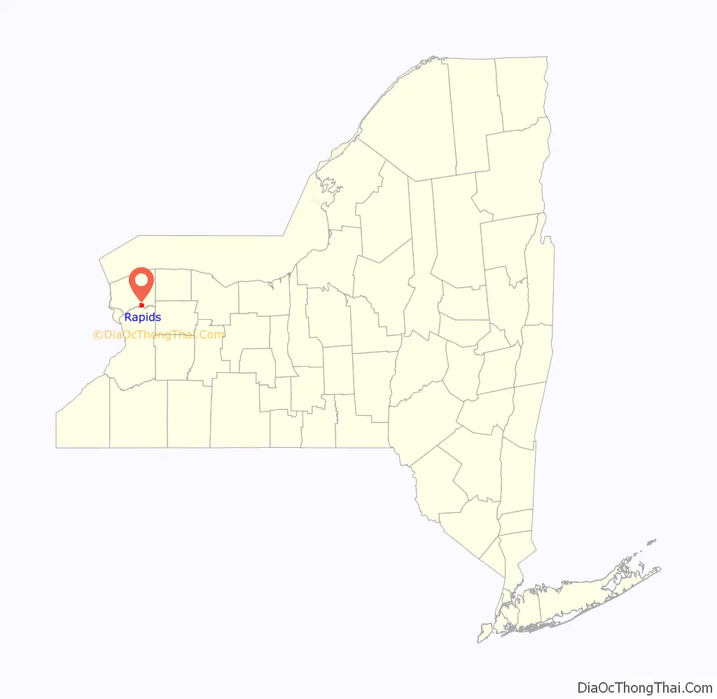
Rapids location map. Where is Rapids CDP?
Rapids Road Map
Rapids city Satellite Map
Geography
Rapids is located at 43°6′5″N 78°38′28″W / 43.10139°N 78.64111°W / 43.10139; -78.64111 (43.101324, -78.641134). The community is on the north side of the Tonawanda Creek, which forms the boundary between Niagara and Erie County.
According to the United States Census Bureau, the village has a total area of 3.7 square miles (9.6 km), all land.
Tonawanda Creek flows through the community.
See also
Map of New York State and its subdivision:- Albany
- Allegany
- Bronx
- Broome
- Cattaraugus
- Cayuga
- Chautauqua
- Chemung
- Chenango
- Clinton
- Columbia
- Cortland
- Delaware
- Dutchess
- Erie
- Essex
- Franklin
- Fulton
- Genesee
- Greene
- Hamilton
- Herkimer
- Jefferson
- Kings
- Lake Ontario
- Lewis
- Livingston
- Madison
- Monroe
- Montgomery
- Nassau
- New York
- Niagara
- Oneida
- Onondaga
- Ontario
- Orange
- Orleans
- Oswego
- Otsego
- Putnam
- Queens
- Rensselaer
- Richmond
- Rockland
- Saint Lawrence
- Saratoga
- Schenectady
- Schoharie
- Schuyler
- Seneca
- Steuben
- Suffolk
- Sullivan
- Tioga
- Tompkins
- Ulster
- Warren
- Washington
- Wayne
- Westchester
- Wyoming
- Yates
- Alabama
- Alaska
- Arizona
- Arkansas
- California
- Colorado
- Connecticut
- Delaware
- District of Columbia
- Florida
- Georgia
- Hawaii
- Idaho
- Illinois
- Indiana
- Iowa
- Kansas
- Kentucky
- Louisiana
- Maine
- Maryland
- Massachusetts
- Michigan
- Minnesota
- Mississippi
- Missouri
- Montana
- Nebraska
- Nevada
- New Hampshire
- New Jersey
- New Mexico
- New York
- North Carolina
- North Dakota
- Ohio
- Oklahoma
- Oregon
- Pennsylvania
- Rhode Island
- South Carolina
- South Dakota
- Tennessee
- Texas
- Utah
- Vermont
- Virginia
- Washington
- West Virginia
- Wisconsin
- Wyoming