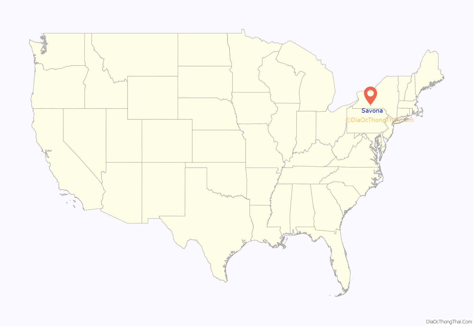
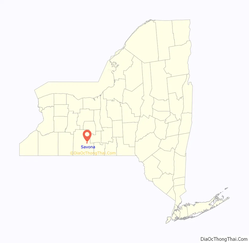
Savona is a village in Steuben County, New York, United States. The population was 827 at the 2010 census. The village is named after Savona in Italy.
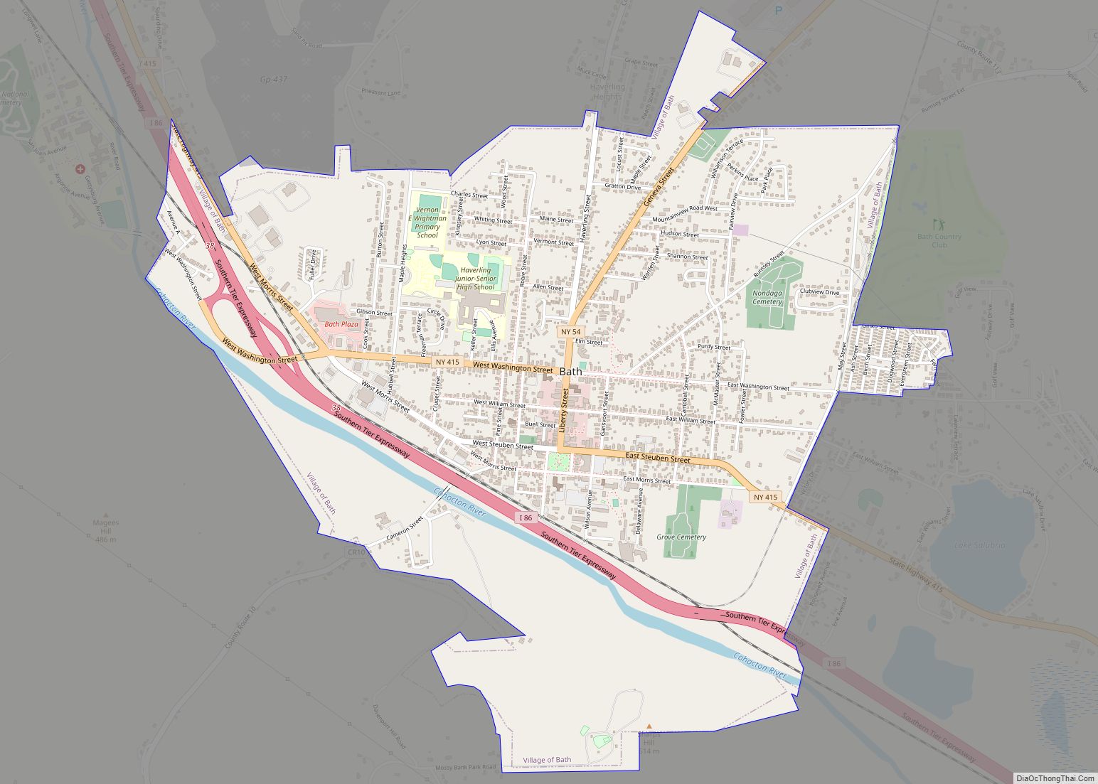
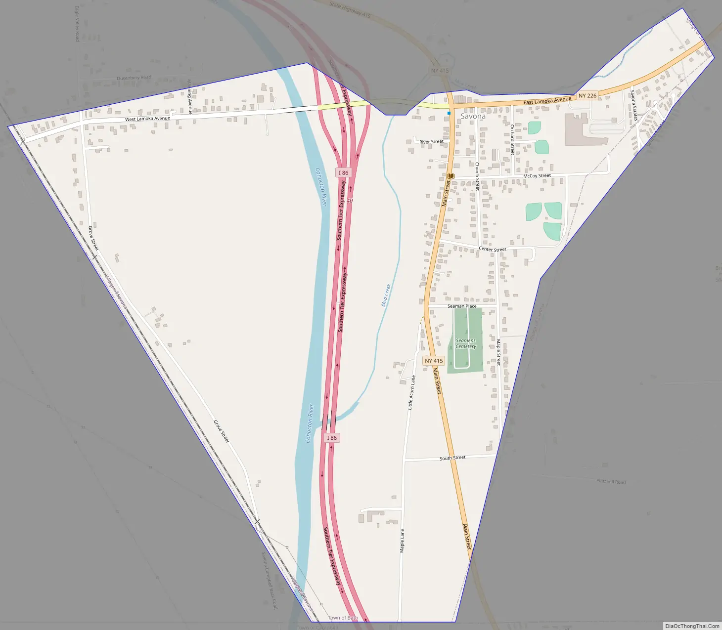
The Village of Savona is located in the eastern part of the Town of Bath. The village is located at the intersection of Routes 226, 415, and Interstate 86.
| Name: | Savona village |
|---|---|
| LSAD Code: | 47 |
| LSAD Description: | village (suffix) |
| State: | New York |
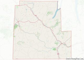
| County: | Steuben County |
| Elevation: | 1,053 ft (321 m) |
| Total Area: | 1.04 sq mi (2.69 km²) |
| Land Area: | 1.04 sq mi (2.69 km²) |
| Water Area: | 0.00 sq mi (0.00 km²) |
| Total Population: | 672 |
| Population Density: | 646.15/sq mi (249.58/km²) |
| ZIP code: | 14879 |
| Area code: | 607 |
| FIPS code: | 3665354 |
| GNISfeature ID: | 0964516 |
Online Interactive Map
Click on ![]() to view map in "full screen" mode.
to view map in "full screen" mode.
Savona location map. Where is Savona village?
History
The name “Mud Creek” was associated with the village in the 19th century. The village was incorporated in 1883.
Unwanted attention was brought to the village in 1993 by the slaying of a young boy, Derrick Robie, aged four, by thirteen-year-old Eric Smith.
Savona Road Map
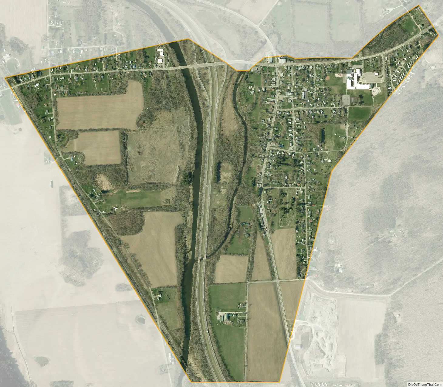
Savona city Satellite Map
Geography
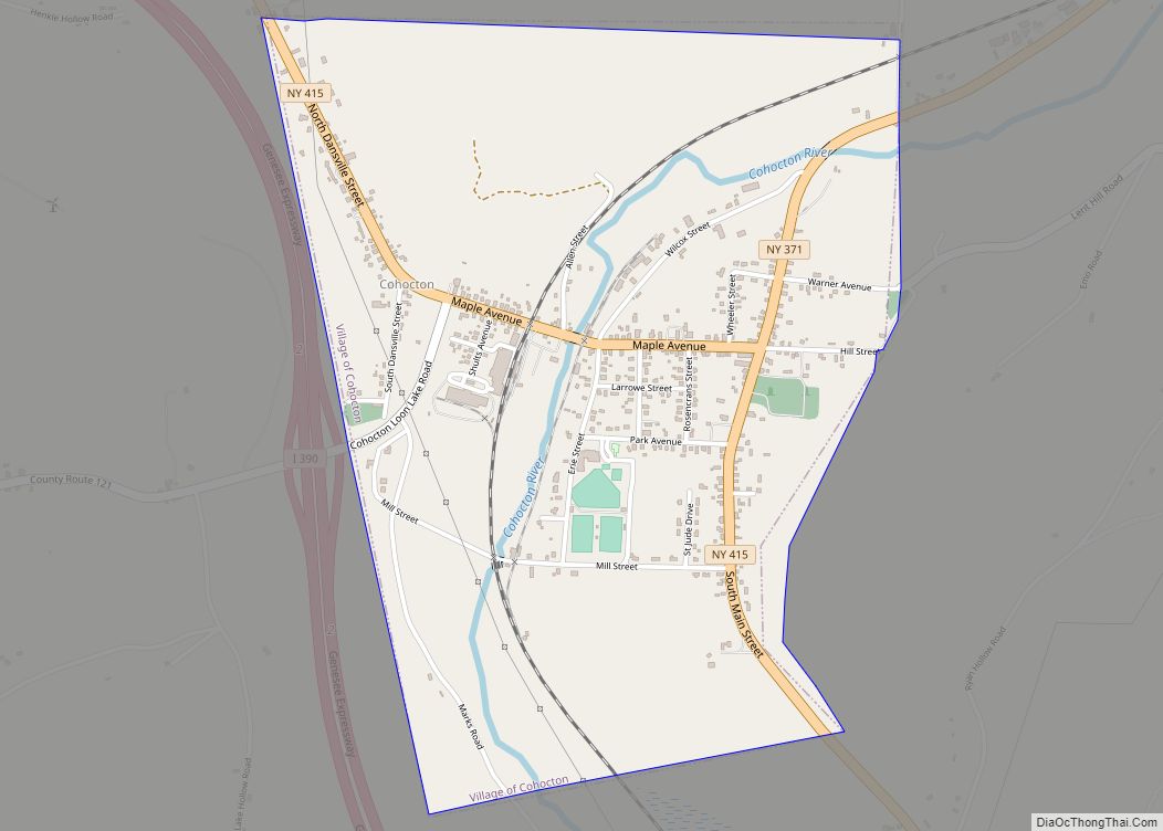
Savona is located at 42°17′7″N 77°13′8″W / 42.28528°N 77.21889°W / 42.28528; -77.21889 (42.285283, -77.218814).
According to the United States Census Bureau, the village has a total area of 1.0 square mile (2.6 km), all land.
The village lies next to the Cohocton River at the confluence of Mud Creek, and is at the intersection of state routes 226 and 415.
Sanford Lake is a small lake north of the village.
See also
Map of New York State and its subdivision:- Albany
- Allegany
- Bronx
- Broome
- Cattaraugus
- Cayuga
- Chautauqua
- Chemung
- Chenango
- Clinton
- Columbia
- Cortland
- Delaware
- Dutchess
- Erie
- Essex
- Franklin
- Fulton
- Genesee
- Greene
- Hamilton
- Herkimer
- Jefferson
- Kings
- Lake Ontario
- Lewis
- Livingston
- Madison
- Monroe
- Montgomery
- Nassau
- New York
- Niagara
- Oneida
- Onondaga
- Ontario
- Orange
- Orleans
- Oswego
- Otsego
- Putnam
- Queens
- Rensselaer
- Richmond
- Rockland
- Saint Lawrence
- Saratoga
- Schenectady
- Schoharie
- Schuyler
- Seneca
- Steuben
- Suffolk
- Sullivan
- Tioga
- Tompkins
- Ulster
- Warren
- Washington
- Wayne
- Westchester
- Wyoming
- Yates
- Alabama
- Alaska
- Arizona
- Arkansas
- California
- Colorado
- Connecticut
- Delaware
- District of Columbia
- Florida
- Georgia
- Hawaii
- Idaho
- Illinois
- Indiana
- Iowa
- Kansas
- Kentucky
- Louisiana
- Maine
- Maryland
- Massachusetts
- Michigan
- Minnesota
- Mississippi
- Missouri
- Montana
- Nebraska
- Nevada
- New Hampshire
- New Jersey
- New Mexico
- New York
- North Carolina
- North Dakota
- Ohio
- Oklahoma
- Oregon
- Pennsylvania
- Rhode Island
- South Carolina
- South Dakota
- Tennessee
- Texas
- Utah
- Vermont
- Virginia
- Washington
- West Virginia
- Wisconsin
- Wyoming