Sharon Springs is a village in Schoharie County, New York, United States. The population was 558 at the 2010 census. Its name derives from the hometown of the first Colonial settlers, Sharon, Connecticut, and the important springs in the village. Sharon Springs, Kansas likewise was settled by former residents of this Upstate New York village.
The Village of Sharon Springs sits in the northwest part of Schoharie County in the Town of Sharon, approximately 50 miles (80 km) west of Albany, the state capital. The city is surrounded by rolling hills and nestled in a winding valley, as well as being near to some of New York State’s most popular attractions. Howe Caverns is 15 miles (24 km) to the south, while The Mohawk River and Erie Canal are 10 miles (16 km) to the north. The Adirondack Park is further north, about one hour away, and the Catskill Park is 50 miles (80 km) to the south. Cooperstown, home to the National Baseball Hall of Fame and Museum, The Farmer’s Museum and the Fenimore Art Museum, is 22 miles (35 km) to the west.
Since the middle-to-late 1980s, Sharon Springs has gained increased local attention and prominence in Schoharie County. Entrepreneurs from outside the region started businesses and restored its structures, prompting regional and New York City media to track the progress. It has gained the attention of Korean spa investors, but their plans are currently unrealized. Sharon Springs was recently featured on a cable reality television series, and provided a backdrop for a memoir. The company Sharon Springs, Inc. has begun work on the baths and allowed for people to book stays online at the village’s Roseboro Hotel.
| Name: | Sharon Springs village |
|---|---|
| LSAD Code: | 47 |
| LSAD Description: | village (suffix) |
| State: | New York |
| County: | Schoharie County |
| Elevation: | 1,102 ft (336 m) |
| Total Area: | 1.83 sq mi (4.73 km²) |
| Land Area: | 1.83 sq mi (4.73 km²) |
| Water Area: | 0.00 sq mi (0.00 km²) |
| Total Population: | 483 |
| Population Density: | 264.37/sq mi (102.09/km²) |
| ZIP code: | 13459 |
| Area code: | 518 |
| FIPS code: | 3666663 |
| GNISfeature ID: | 0964946 |
Online Interactive Map
Click on ![]() to view map in "full screen" mode.
to view map in "full screen" mode.
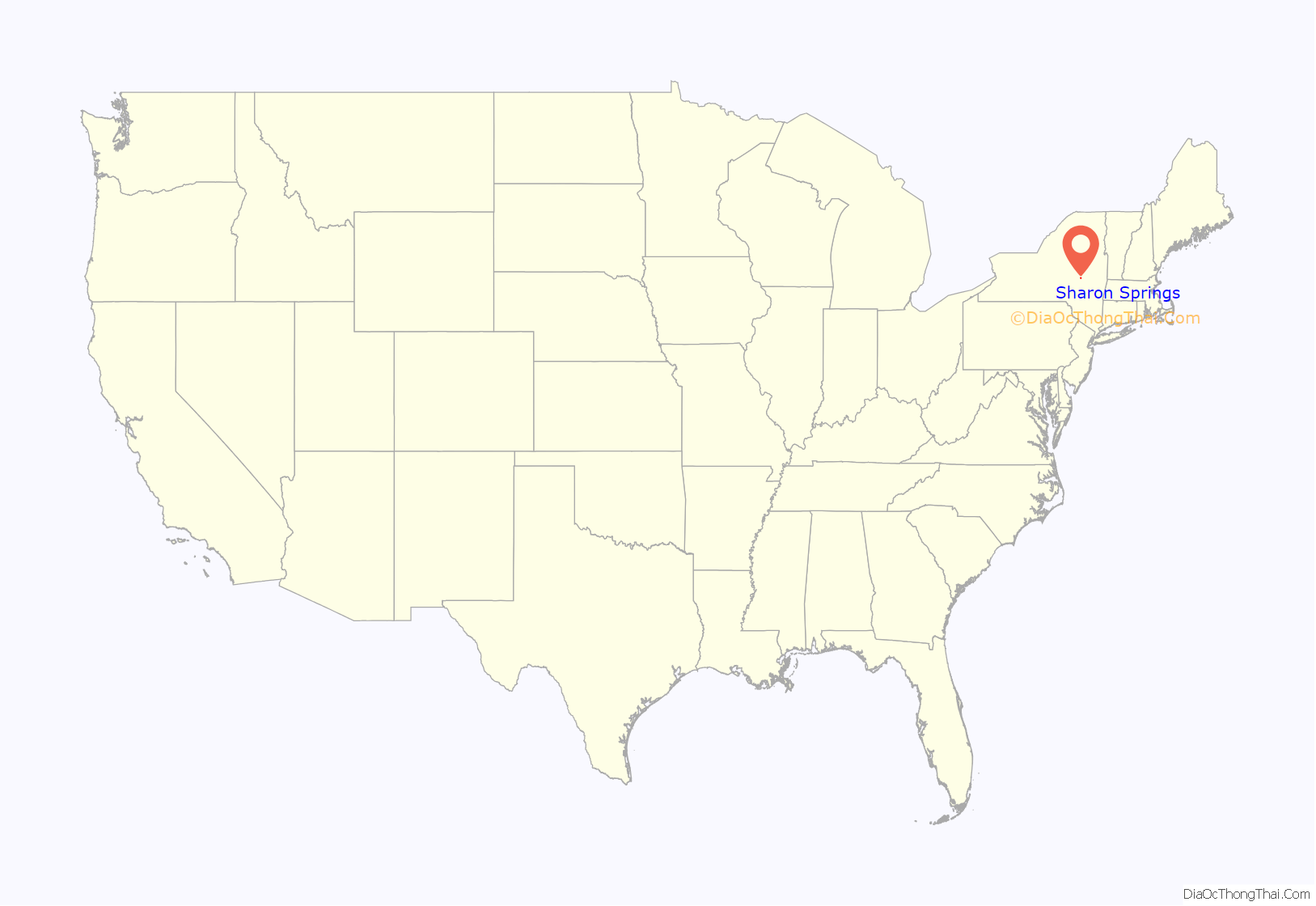
Sharon Springs location map. Where is Sharon Springs village?
History
Prior to being settled by Great Britain as part of the country’s Province of New York, Sharon Springs was frequented by the indigenous Iroquois population for its healing waters. After Britain’s Royal Proclamation of 1763, the Crown formed Tryon County in 1772, which lay at the westernmost reaches of the original Thirteen Colonies. Sharon Springs, then known as the town of New Dorlach, was settled circa 1780. Tryon County stretched from the Adirondack Mountains to the Delaware River and boasted a pre-Revolutionary War farming community of 10,000 people, known as the “Breadbasket of the Colonies”.
During the American Revolution, the Town of Sharon participated very little in combat, though it did see some battles. One significant moment was the Battle of Sharon, which was fought on July 10, 1781. Approximately 300 British and Iroquois troops commanded by John Doxtader camped at the Sharon Springs Swamp, near the present-day intersection of Route 20 and County Road 34. The group burned down 12 homes in a small Canajoharie River settlement and claimed victory in the Battle of Currytown on July 9. Colonel Marinus Willett of the American forces headed to their camp with a force of 150 men. Willet attacked the redcoats in the dense swamp, killing 40. Doxtader’s men fled and Willett claimed The Battle of Sharon as an American victory.
During and after the Revolution, Sharon Springs was part of the Town of Schoharie in Tryon County. In 1784, Tryon County was renamed Montgomery County to honor General Richard Montgomery, an American war hero who gave his life trying to capture the city of Quebec. In 1791, Otsego County broke off from Montgomery County, and in 1795, Schoharie County, New York was formed from adjoining parts of Otsego and Albany Counties. The Town of Sharon was formed shortly after in 1797. Almost 100 years later, Sharon Springs set itself apart from the Town of Sharon in 1871 by establishing itself as a village. In the process, it also absorbed the neighboring community of Rockville.
Immigration
According to an article published in The New York Times (26 August 2000), Sharon Springs lost its fashionable Social Register set to the horse-racing attractions of Saratoga Springs. Wealthy Jewish families of German origin, who were unwelcome at Saratoga due to the prevailing social bias of the time, filled the void and “made Sharon Springs a refuge of their own.” Eventually, these families moved on to other, more modern resorts, and the Village began to fade economically. Other factors that exacerbated the Village’s early 20th century decline were Prohibition (which reduced the need for the local hop harvest) and the opening of the New York State Thruway (which routed traffic away from the area).
Sharon Springs was also associated with several beer barons in the late 19th and early 20th centuries. Most American hops were grown in a belt stretching from Madison to Schoharie Counties in upstate New York. Thus, this area attracted brewers who summered in the area, two of whom, Henry Clausen and Max Shaefer, built homes in the Village. The New York hops trade disappeared after the first world war due to the combined effects of competition from Oregon, a hops blight, and the coming of Prohibition.
From the 1920s to the 1960s, kuchaleyans flourished. These were self-catered boarding houses, and in Yiddish the name means “cook-alones.” They were a more affordable alternative to the larger, more expensive hotels and were especially popular during the Depression and, after with poor, post-war refugees from Europe. Though none operated past the 1980s, one of them, “The Brustman House” on Union Street, survives as a retreat for the owners’ descendants. This house’s story is typical of the kuchaleyans.
As the cited New York Times article went on to explain that after World War II, Sharon Springs got a second wind from the West German government, which “paid medical care reparations to Holocaust survivors, holding that therapeutic spa vacations were a legitimate part of the medical package.” In the summer of 1946, one of the busboys at the Spanish Colonial Revival style Adler Hotel was Edward I. Koch, the future mayor of New York City.
The 1970s through the 1990s saw the succession of secular Jewish tourists to Sharon Springs by Hasidim and ultra-Orthodox Jewish visitors, fed in part by a parallel displacement in the nearby Borsht Belt. Their time in Sharon Springs is documented in “The Short Season of Sharon Springs,” published by Cornell University Press in 1980. A host of Hasidim-owned and frequented hotels flourished in the Village, bridging the gap between Sharon Springs’ shining past as a world-class resort for the rich and famous and its recent renascence as a regional travel and weekend destination.
Resurgence
In the 1970s, concurrent migration of weekend hunters and union trade workers from the Downstate New York City suburbs began coming to Sharon Springs and Schoharie County. As suburban and urban hunters tracked deer in the area, they also introduced the once-endangered wild turkey to this and other rural areas. Unlike the Hasidim tourists, who have mostly moved on to other destinations and have dwindled in number, the first wave of suburban weekenders added to the community by building their families in the Village and relocating their full-time lives to their former part-time escape.
Sharon Springs, after drifting into a rundown state by the late 1980s, has seen resurgence in the last 15 years. Much of it can be attributed to both a stabilization of the remaining historic structures (arson leveled many of the abandoned hotels) and an infusion of ambitious buyers from outside the area looking for an affordable community to start a business or to add rural weekends to their city life. The New York Times cites the revival to the “uninterrupted supply of affluent, educated second-homers from New York City (3.5 hours away) and Columbia County (2 hours away)… and the exponential growth of a new travel phenomenon, heritage tourism: the quest for things historic by well-heeled tourists.” Low real estate prices, early renovations, successful start-ups, positive press including back to back ‘Escapes’ New York Times articles in 2000, and later post-911 flight from New York City all contributed to an influx of entrepreneurs, artisans and artists.
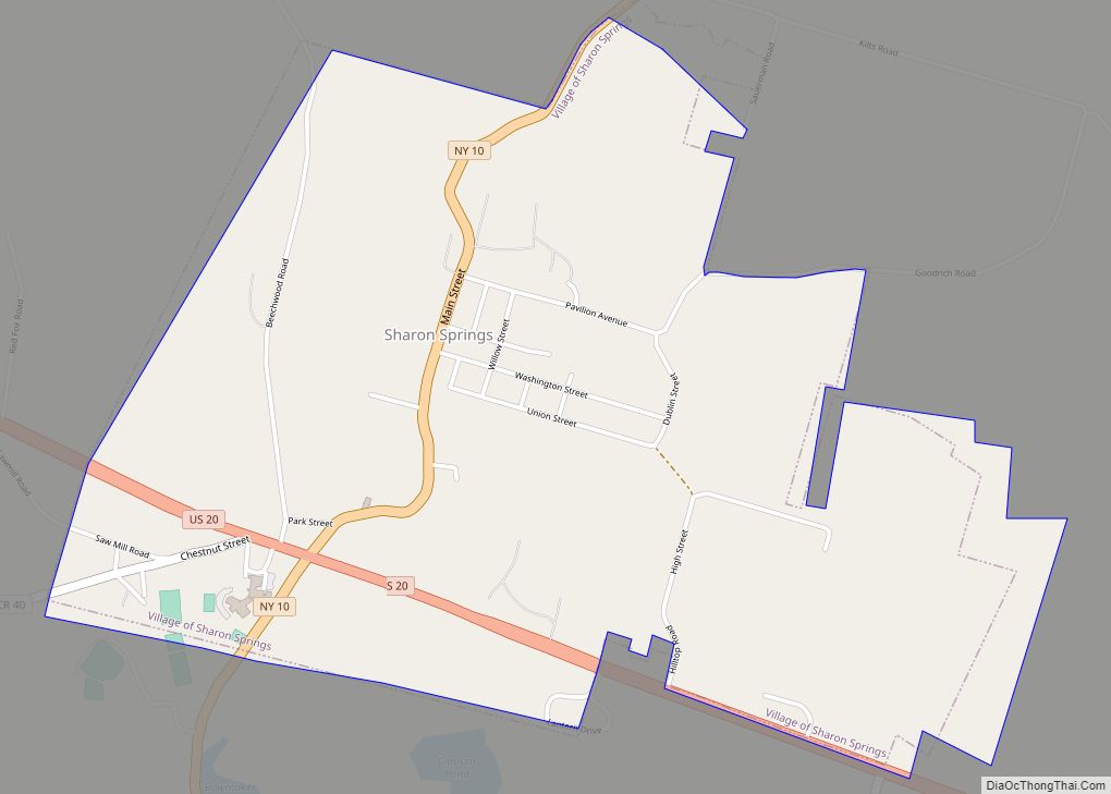
Sharon Springs Road Map
Sharon Springs city Satellite Map
Geography
Sharon Springs is located at 42°47′41″N 74°36′57″W / 42.79472°N 74.61583°W / 42.79472; -74.61583 (42.794783, -74.615946).
According to the United States Census Bureau, the village has a total area of 1.8 square miles (4.7 km), all land.
Sharon Springs is located on New York State Route 10 (Main Street) immediately north of U.S. Route 20. Bowmaker Pond and Clausen Pond are two small lakes, located south of the village.
See also
Map of New York State and its subdivision:- Albany
- Allegany
- Bronx
- Broome
- Cattaraugus
- Cayuga
- Chautauqua
- Chemung
- Chenango
- Clinton
- Columbia
- Cortland
- Delaware
- Dutchess
- Erie
- Essex
- Franklin
- Fulton
- Genesee
- Greene
- Hamilton
- Herkimer
- Jefferson
- Kings
- Lake Ontario
- Lewis
- Livingston
- Madison
- Monroe
- Montgomery
- Nassau
- New York
- Niagara
- Oneida
- Onondaga
- Ontario
- Orange
- Orleans
- Oswego
- Otsego
- Putnam
- Queens
- Rensselaer
- Richmond
- Rockland
- Saint Lawrence
- Saratoga
- Schenectady
- Schoharie
- Schuyler
- Seneca
- Steuben
- Suffolk
- Sullivan
- Tioga
- Tompkins
- Ulster
- Warren
- Washington
- Wayne
- Westchester
- Wyoming
- Yates
- Alabama
- Alaska
- Arizona
- Arkansas
- California
- Colorado
- Connecticut
- Delaware
- District of Columbia
- Florida
- Georgia
- Hawaii
- Idaho
- Illinois
- Indiana
- Iowa
- Kansas
- Kentucky
- Louisiana
- Maine
- Maryland
- Massachusetts
- Michigan
- Minnesota
- Mississippi
- Missouri
- Montana
- Nebraska
- Nevada
- New Hampshire
- New Jersey
- New Mexico
- New York
- North Carolina
- North Dakota
- Ohio
- Oklahoma
- Oregon
- Pennsylvania
- Rhode Island
- South Carolina
- South Dakota
- Tennessee
- Texas
- Utah
- Vermont
- Virginia
- Washington
- West Virginia
- Wisconsin
- Wyoming
