Walden is the largest of three villages of the town of Montgomery in Orange County, New York, United States. The population was 6,818 at the 2020 census. It has the ZIP Code 12586 and the 778 telephone exchange within the 845 area code. Walden is part of the Poughkeepsie−Newburgh−Middletown, NY Metropolitan Statistical Area as well as the larger New York−Newark−Bridgeport, NY-NJ–CT–PA Combined Statistical Area.
The precursor to the village began in the early 18th century as a mill town along the Wallkill River. One miller, Jacob Walden, was so successful the village that incorporated in the mid-19th century took its name from him. Later, it would be the village’s three knife manufacturers that brought it growth and prosperity. They are gone today, but other industrial concerns remain. Walden is the home of Spence Engineering, a steam regulator manufacturer founded by Paulson Spence in 1926. He located his manufacturing facilities in Walden to serve the district steam heating loops in the northeast, especially ConEd in New York City. In 2019, Emerson Electric purchased Spence Engineering, ultimately moving it to Mexico in 2021 to improve their profitability. Walden was the home of the Thruway Markets hypermarket complex, which closed in 2013.
| Name: | Walden village |
|---|---|
| LSAD Code: | 47 |
| LSAD Description: | village (suffix) |
| State: | New York |
| County: | Orange County |
| Elevation: | 260 ft (80 m) |
| Total Area: | 2.08 sq mi (5.40 km²) |
| Land Area: | 2.01 sq mi (5.20 km²) |
| Water Area: | 0.07 sq mi (0.19 km²) |
| Total Population: | 6,818 |
| Population Density: | 3,393.73/sq mi (1,310.43/km²) |
| ZIP code: | 12586 |
| Area code: | 845 |
| FIPS code: | 3677849 |
| Website: | http://www.villageofwalden.org/ |
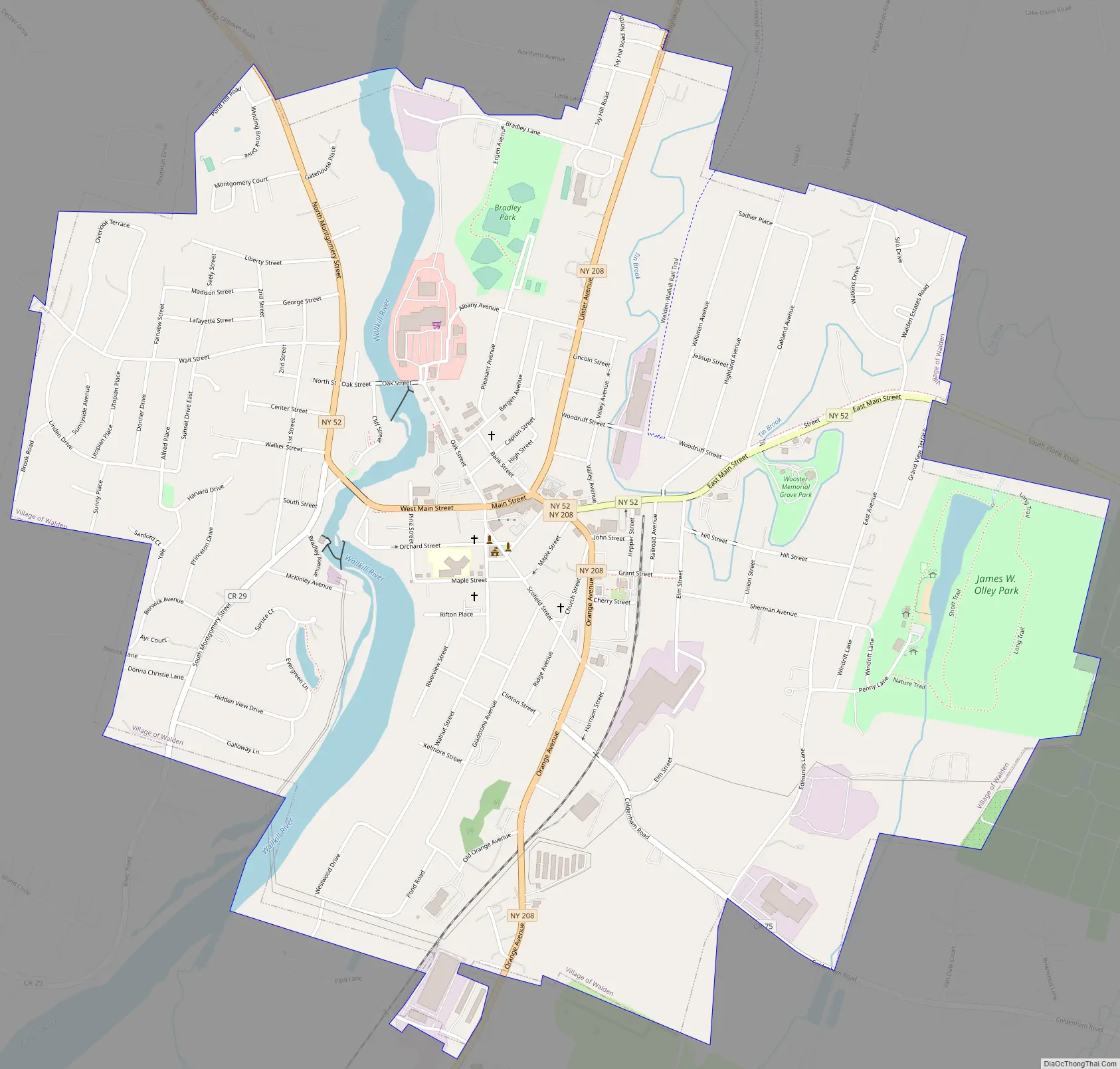
Online Interactive Map
Click on ![]() to view map in "full screen" mode.
to view map in "full screen" mode.
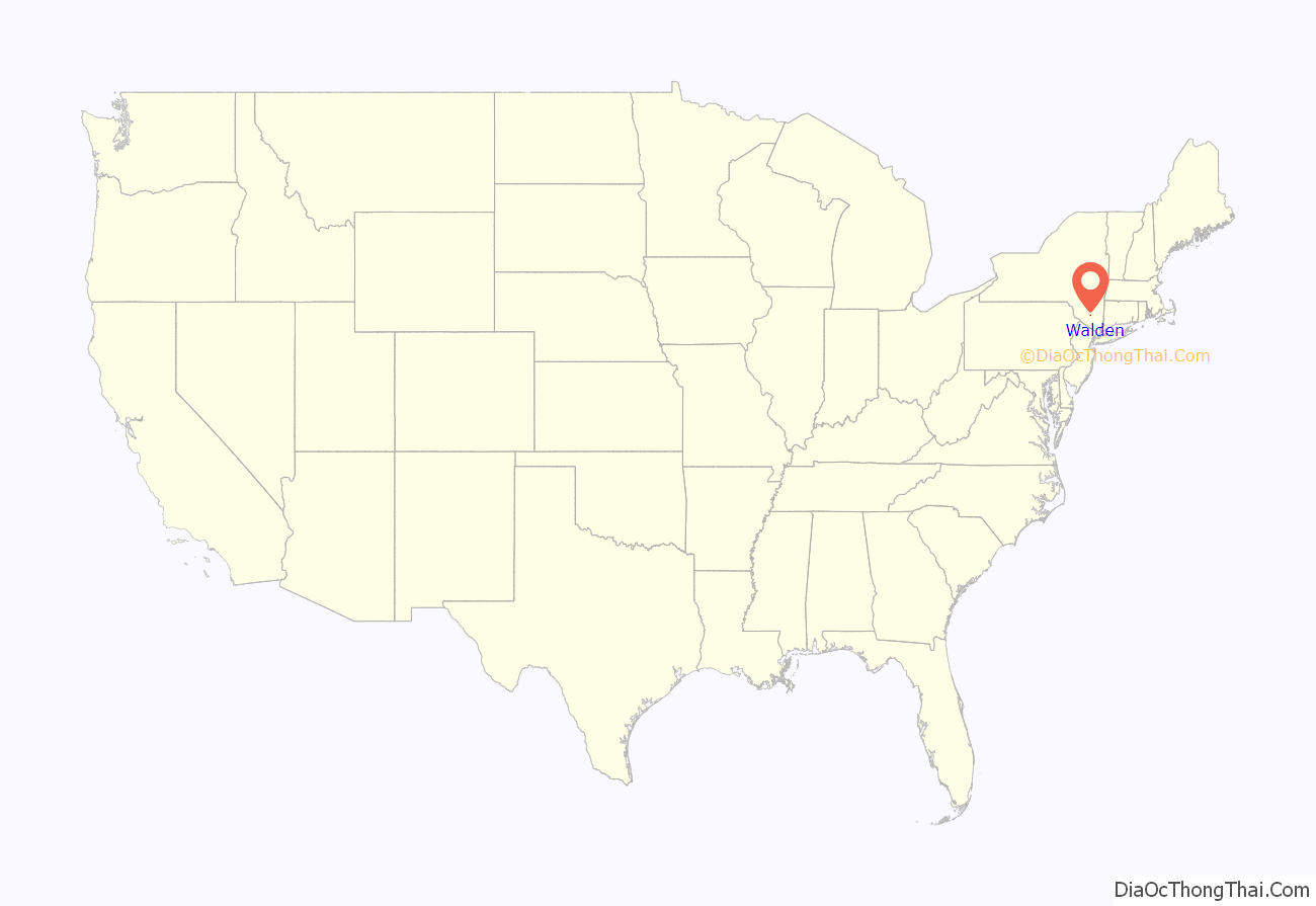
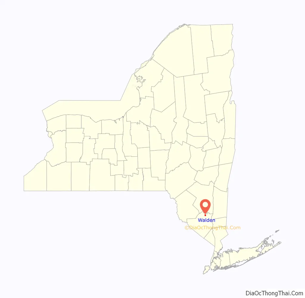
Walden location map. Where is Walden village?
History
The area around present-day Walden was purchased in 1736 by Alexander Kidd, and settlers of Scots-Irish, English and German descent started arriving not long afterwards. It was the first settlement west of the Wallkill River, known at the time as Kidd’s Town.
In the 1820s, a successful New York shipper named Jacob Walden convinced some of his business partners to finance the construction of wool mills on the river, attracted by the Great Falls as a source of power and the railroad connections at nearby Maybrook. He dammed the Wallkill above the falls, creating a power station that remains in use today, and his mill was a success.
Other wool-makers followed as the Industrial Revolution picked up steam and the growing population center became known instead as Walden’s Mills. Most of them failed a few decades later, but their influence was such that the village incorporated in 1855 as Walden.
The village fathers needed to replace the mills as a source of employment, and began encouraging knife manufacturers to relocate from nearby Dutchess County to the vacant buildings, where the New York Knife Company made much of the cutlery employed by the Union Army during the U.S. Civil War.
After the war, other knifemakers came to Walden, too, and the village became colloquially known as Knifetown. Other industrial concerns, making products as diverse as engines and women’s underwear, also set up shop.
In the early 1890s, President Grover Cleveland lowered tariffs on many imported goods, including knives. Competitively priced German cutlery began to flood the American market, and together with the Panic of 1893 and the economic slowdown that followed for several years, the knife companies and their owners went heavily into debt and it looked for a while as if they might not survive.
But in 1897 President William McKinley, a personal friend of Thomas Wilson Bradley of the U.S. Knife Company, pushed through the Dingley Tariff that restored the status quo ante. The knifemakers returned to profitability and were able to pay off their debts; and in gratitude Bradley had a statue of McKinley erected that remains in Walden today.
In the 1910s the facilities at the dam began to be primarily used for power and less for industry.
Walden’s Main Street was the site of an active retail trade which included Millspaugh’s Furniture as well as Roosa’s Jewelers, both still in business. Lustig’s Department Store, established by Carl Lustig in 1883, was the mainstay of Main Street until its closing in 1986.
The Depression was hard on many of the village’s economic concerns, but the knifemakers persisted. However, after World War II they gradually became less prominent and moved as the rail connections they had depended on were replaced by trucking on the growing Interstate Highways. The last company making knives in the village, Imperial Schrade, closed down its factory after a 1957 fire and moved to nearby Ellenville afterwards, where it lasted until 2004. The ruins of the factory still stand behind Walden’s most visible economic giant, the Thruway Markets hypermarket.
Walden retains some light industry and much of its working-class feel, enough for village residents to have gotten into a spat with WPDH-FM disc jockey the “Wolf” in the late 1990s over his constant on- and off-air joking about Walden as a redneck town.
From 1995 until 2016, Walden was the headquarters of the Big Apple Circus.
Walden Road Map
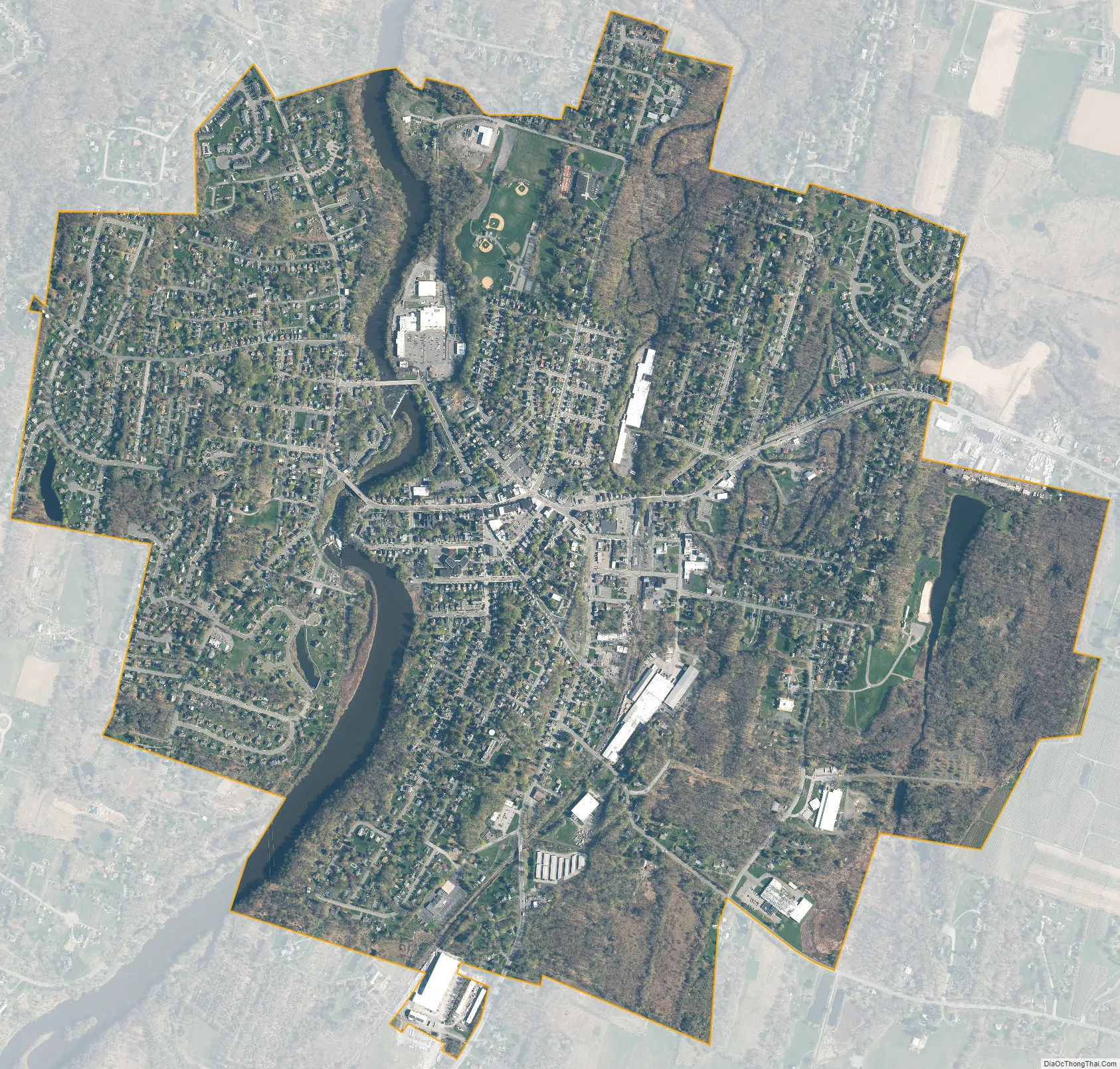
Walden city Satellite Map
Geography
According to the United States Census Bureau, the village has a total area of 2.0 square miles (5.2 km), of which 2.0 square miles (5.2 km) is land and 0.1 square miles (0.26 km) (3.9%) is water.
The village’s most notable geographical feature is the Wallkill River, which flows from the south to the north across the village and divides one-third of it from the rest. Within the eastern portion, Tin Brook, the Wallkill’s major right tributary in New York, meanders across as well, forming part of the northern village boundary. There are two waterfalls and dams on the river within the village limits, known as the Great and Little Falls; and two auto bridges, the “high” (formally, the Walden Veterans’ Memorial Bridge, which carries NY 52 through the village as West Main Street) and “low” (Oak Street) bridges).
The Wallkill passes through a small gorge between the two dams and loses approximately 60 feet (18 m) of elevation in the process. The surrounding topography in the village is, correspondingly, gentle rolling hills of this section of the Great Appalachian Valley between the higher rises of the Shawangunk Ridge, visible to the west from some sections of the village, and the Hudson Highlands to the southwest. The highest elevation is roughly 520 feet (160 m) above sea level along Overlook Road at the village’s western boundary; the lowest is 260 feet (79 m) along the Wallkill at the northern village line.
Walden’s growth began near the mills and later the knife-making plants, particularly the New York Knife Company, located on the steep east bank of the river just south of the Veterans’ Memorial Bridge; the building’s footings are still visible on the slope. The central business district of the village is today a few blocks to the east, along Main Street. Just to its south is the village hall and the main square. East Main Street, the section of 52 from the 208 junction to the village line, has seen many newer businesses locate there, including a small strip mall. There is also some scattered commercial presence along Orange Avenue (208 south of the junction), primarily professional office space. This parallels the village’s remaining industrial presence along the railroad line to the east, which at its northern terminus abuts downtown to the southeast. Walden’s other major commercial area is the Thruway Markets complex located along the river north of Oak Street, just south of the remains of the Walden Knife Company.
On the southern side of the village is the Fox Hill Bruderhof Community where about 250 community members live and work in their factories and the Plough Publishing House.
There are two schools, public Walden Elementary School on Orchard Street and Most Precious Blood Catholic school near the northern village line along Ulster Avenue. The village includes public parks and a walking trail.
- Bradley Park – along Albany Ave, on the high ground between Thruway Market and Ulster Ave (Rte 208), contains 4 baseball & 1 softball field (Home to the Walden Little League), 2 tennis courts, a playground, and a skateboard park.
- Wooster Grove – along East Main St (Rte 52), surrounded by the Tin Brook, offers a large playground, indoor & outdoor basketball courts, a bandstand, an ice rink; the village’s teen center is also here.
- James Olley Park – at the end of Sherman Ave, includes a manufactured beach with public swimming and fishing, a small playground, a picnic grove, unimproved walking trails, and a summer recreation camp.
- Alfred Place Park – the only park on the west side includes a small playground and basketball court.
- Walden–Wallkill Rail Trail – beginning at Woosters Grove, a 3.22-mile (5.18 km)-long paved walking and biking trail linking the village to the hamlet of Wallkill in Ulster County.
Much of the remainder of the village is residential, with houses tending from modest and small near downtown, the river and railroad, to more expansive homes (such as the Victorians along the west side of Ulster Avenue) being found on the hills, newer development near the southwestern and eastern borders with the town, and 6 small apartment and townhouse complexes.
A large tract along the river south of the power station had remained undeveloped until very recently. A small area between McKinley Avenue, South Mountgomery Street and the river remains open, used for NYSEG’s purposes. On the other end of the village, the sewage treatment plant is also in the middle of an undeveloped area.
Climate
Walden has a humid continental climate, and tends to be significantly cooler than Manhattan, especially at night.
See also
Map of New York State and its subdivision:- Albany
- Allegany
- Bronx
- Broome
- Cattaraugus
- Cayuga
- Chautauqua
- Chemung
- Chenango
- Clinton
- Columbia
- Cortland
- Delaware
- Dutchess
- Erie
- Essex
- Franklin
- Fulton
- Genesee
- Greene
- Hamilton
- Herkimer
- Jefferson
- Kings
- Lake Ontario
- Lewis
- Livingston
- Madison
- Monroe
- Montgomery
- Nassau
- New York
- Niagara
- Oneida
- Onondaga
- Ontario
- Orange
- Orleans
- Oswego
- Otsego
- Putnam
- Queens
- Rensselaer
- Richmond
- Rockland
- Saint Lawrence
- Saratoga
- Schenectady
- Schoharie
- Schuyler
- Seneca
- Steuben
- Suffolk
- Sullivan
- Tioga
- Tompkins
- Ulster
- Warren
- Washington
- Wayne
- Westchester
- Wyoming
- Yates
- Alabama
- Alaska
- Arizona
- Arkansas
- California
- Colorado
- Connecticut
- Delaware
- District of Columbia
- Florida
- Georgia
- Hawaii
- Idaho
- Illinois
- Indiana
- Iowa
- Kansas
- Kentucky
- Louisiana
- Maine
- Maryland
- Massachusetts
- Michigan
- Minnesota
- Mississippi
- Missouri
- Montana
- Nebraska
- Nevada
- New Hampshire
- New Jersey
- New Mexico
- New York
- North Carolina
- North Dakota
- Ohio
- Oklahoma
- Oregon
- Pennsylvania
- Rhode Island
- South Carolina
- South Dakota
- Tennessee
- Texas
- Utah
- Vermont
- Virginia
- Washington
- West Virginia
- Wisconsin
- Wyoming


