New Franklin is a city in southwestern Summit County, Ohio, United States, in the northeastern part of the state. The population was 13,877 according to the 2020 census. It is part of the Akron metropolitan area.
| Name: | New Franklin city |
|---|---|
| LSAD Code: | 25 |
| LSAD Description: | city (suffix) |
| State: | Ohio |
| County: | Summit County |
| Elevation: | 1,093 ft (333 m) |
| Total Area: | 26.63 sq mi (68.96 km²) |
| Land Area: | 24.99 sq mi (64.72 km²) |
| Water Area: | 1.64 sq mi (4.24 km²) |
| Total Population: | 13,877 |
| Population Density: | 555.35/sq mi (214.42/km²) |
| ZIP code: | 44203, 44216, 44319, 44614 |
| Area code: | 234, 330 |
| FIPS code: | 3954562 |
| GNISfeature ID: | 1777352 |
| Website: | http://www.newfranklin.org/ |
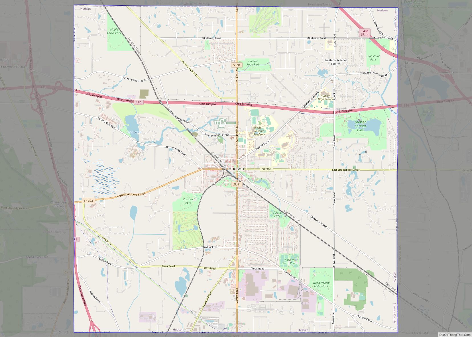
Online Interactive Map
Click on ![]() to view map in "full screen" mode.
to view map in "full screen" mode.
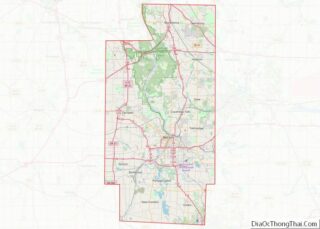
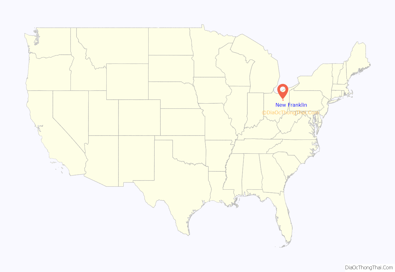
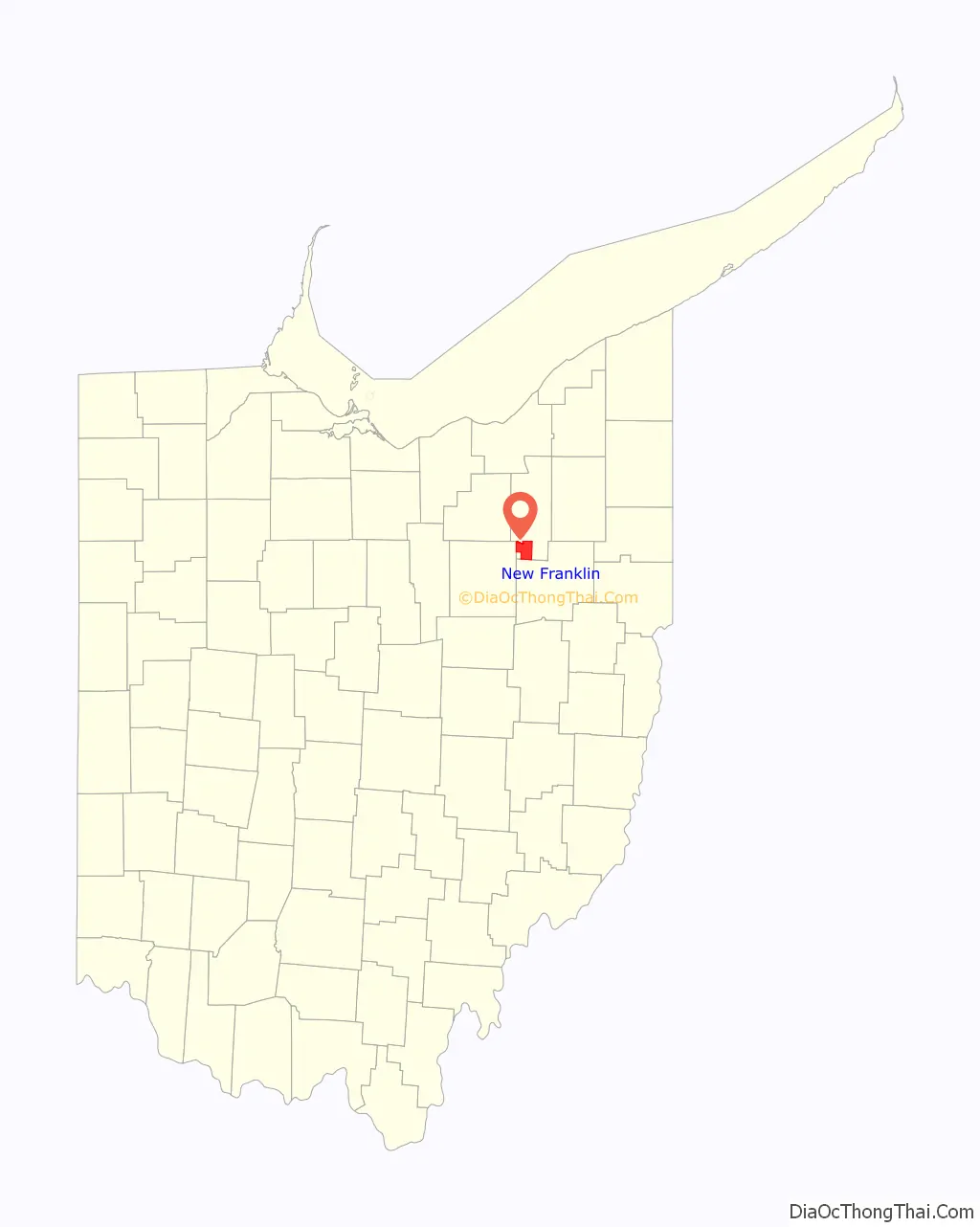
New Franklin location map. Where is New Franklin city?
History
In 1997 the village of New Franklin was incorporated from a section of Franklin Township to thwart annexation attempts from neighboring cities. New Franklin expanded significantly in November 2003 when the residents of Franklin Township and New Franklin voted to merge the two entities, rendering Franklin Township in Summit County defunct. The merger took effect January 1, 2005. The village officially became a city on March 5, 2006.
On November 6, 2007, city residents voted against changing the city’s name to Portage Lakes, 57% to 42%.
The area, originally known as Franklin Township, was founded in 1817. The village of New Franklin was a part of Franklin Township; its citizens were also citizens of Franklin Township.
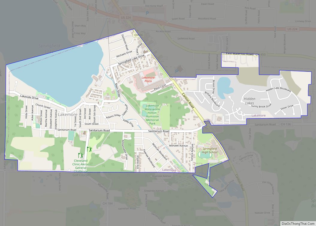
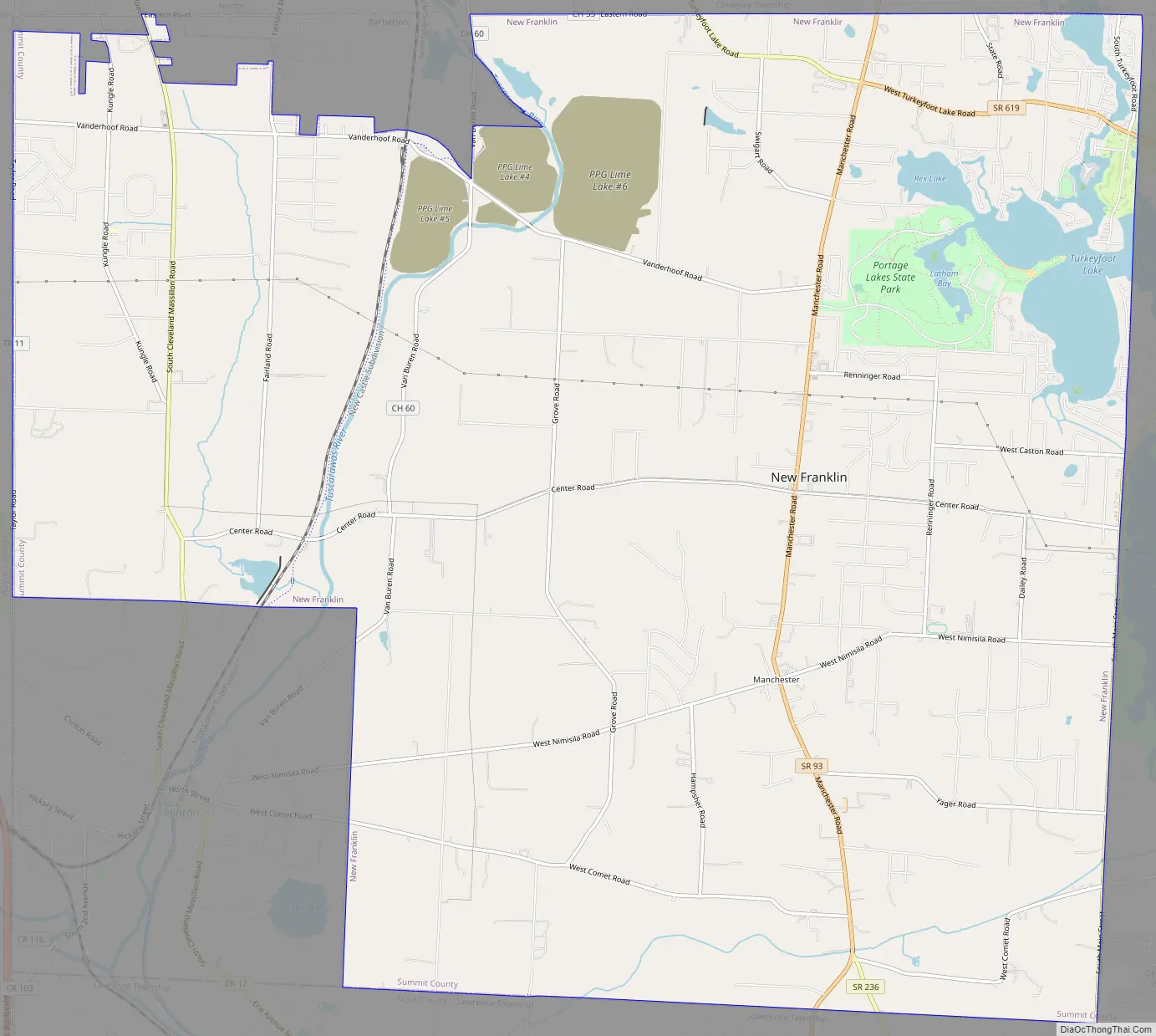
New Franklin Road Map
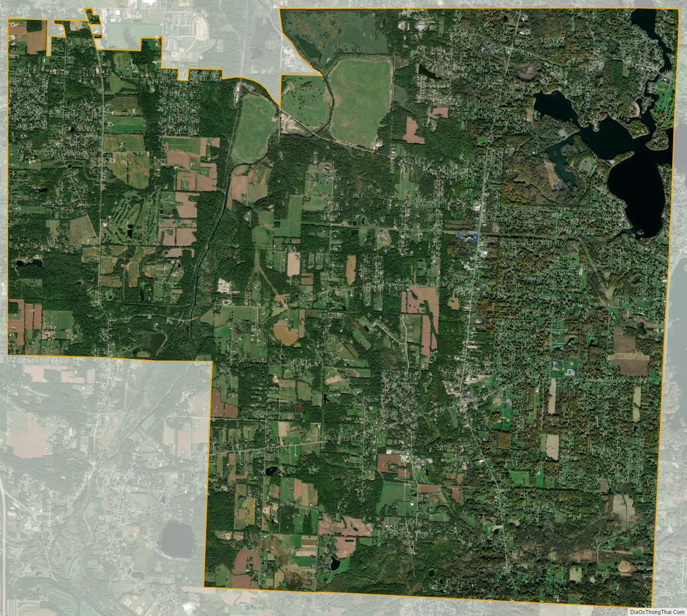
New Franklin city Satellite Map
Geography
New Franklin is bounded by Coventry Township, as well as the cities of Barberton and Norton to the north; by Chippewa Township, Wayne County; by Clinton to the southwest; by Green to the east; by Lawrence Township, Stark County to the south.
According to the United States Census Bureau, the city has a total area of 26.627 square miles (68.96 km), of which 24.988 square miles (64.72 km) is land and 1.639 square miles (4.24 km) is water.
New Franklin is home to Portage Lakes State Park and Craftsmen Park.
See also
Map of Ohio State and its subdivision:- Adams
- Allen
- Ashland
- Ashtabula
- Athens
- Auglaize
- Belmont
- Brown
- Butler
- Carroll
- Champaign
- Clark
- Clermont
- Clinton
- Columbiana
- Coshocton
- Crawford
- Cuyahoga
- Darke
- Defiance
- Delaware
- Erie
- Fairfield
- Fayette
- Franklin
- Fulton
- Gallia
- Geauga
- Greene
- Guernsey
- Hamilton
- Hancock
- Hardin
- Harrison
- Henry
- Highland
- Hocking
- Holmes
- Huron
- Jackson
- Jefferson
- Knox
- Lake
- Lake Erie
- Lawrence
- Licking
- Logan
- Lorain
- Lucas
- Madison
- Mahoning
- Marion
- Medina
- Meigs
- Mercer
- Miami
- Monroe
- Montgomery
- Morgan
- Morrow
- Muskingum
- Noble
- Ottawa
- Paulding
- Perry
- Pickaway
- Pike
- Portage
- Preble
- Putnam
- Richland
- Ross
- Sandusky
- Scioto
- Seneca
- Shelby
- Stark
- Summit
- Trumbull
- Tuscarawas
- Union
- Van Wert
- Vinton
- Warren
- Washington
- Wayne
- Williams
- Wood
- Wyandot
- Alabama
- Alaska
- Arizona
- Arkansas
- California
- Colorado
- Connecticut
- Delaware
- District of Columbia
- Florida
- Georgia
- Hawaii
- Idaho
- Illinois
- Indiana
- Iowa
- Kansas
- Kentucky
- Louisiana
- Maine
- Maryland
- Massachusetts
- Michigan
- Minnesota
- Mississippi
- Missouri
- Montana
- Nebraska
- Nevada
- New Hampshire
- New Jersey
- New Mexico
- New York
- North Carolina
- North Dakota
- Ohio
- Oklahoma
- Oregon
- Pennsylvania
- Rhode Island
- South Carolina
- South Dakota
- Tennessee
- Texas
- Utah
- Vermont
- Virginia
- Washington
- West Virginia
- Wisconsin
- Wyoming