Twinsburg is a suburban city in Summit County, Ohio, United States, located about halfway between Akron and Cleveland. The population was 19,248 as of the 2020 census. It is part of the Akron metropolitan area.
| Name: | Twinsburg city |
|---|---|
| LSAD Code: | 25 |
| LSAD Description: | city (suffix) |
| State: | Ohio |
| County: | Summit County |
| Elevation: | 1,001 ft (305 m) |
| Total Area: | 13.79 sq mi (35.72 km²) |
| Land Area: | 13.76 sq mi (35.63 km²) |
| Water Area: | 0.03 sq mi (0.09 km²) |
| Total Population: | 19,248 |
| Population Density: | 1,398.94/sq mi (540.14/km²) |
| ZIP code: | 44087 |
| Area code: | 330 |
| FIPS code: | 3978050 |
| GNISfeature ID: | 1061716 |
| Website: | http://www.mytwinsburg.com/ |
Online Interactive Map
Click on ![]() to view map in "full screen" mode.
to view map in "full screen" mode.
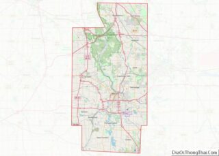
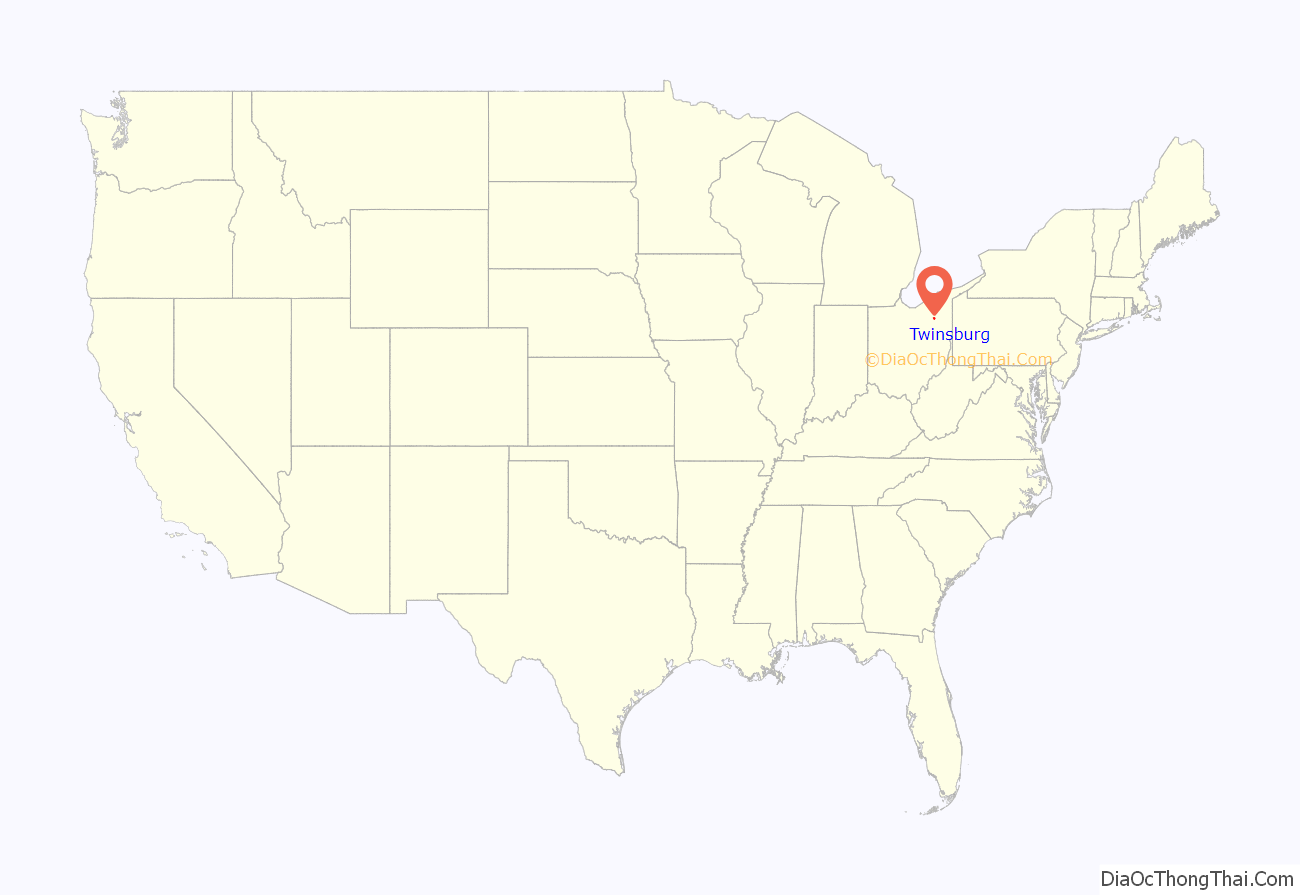
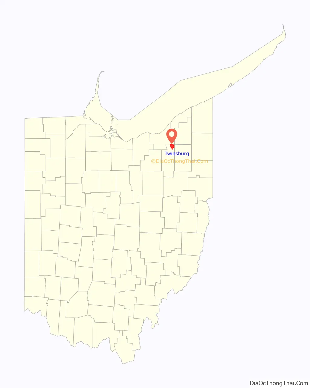
Twinsburg location map. Where is Twinsburg city?
History
In 1817 Ethan Alling, then aged 16, came to Township Five in the tenth range of the Connecticut Land Company, also known as Millsville. Alling was to survey the 400 acres (1.6 km) of land his Connecticut family had purchased. He is considered the first settler of the town that would be renamed Twinsburg, and later he became the postmaster of the town, as well as a merchant, stagecoach operator, and hotel proprietor. A pair of identical twins named Moses and Aaron Wilcox, from Killingworth, Connecticut, purchased some 4,000 acres (16 km) of land in 1819. They sold tracts at low prices to attract other settlers. The twins offered 6 acres (24,000 m) of land for a public square and $20 to support the town’s first school on the condition that the community would change its name from Millsville to Twinsburg.
In 1963, the Twinsburg Historical Society was founded. It was housed in the building formerly occupied by the Twinsburg Institute (founded by Samuel Bissell and built in 1863). The museum run by the Historical Society holds pictures, papers and documents related to the area’s history. Tools and artifacts used by early artisans and farmers, furniture, including domestic items, clothes, and books, as well as letters and records of Twinsburg’s early days, are all showcased. The Mail Pouch Tobacco sign displayed on the barn was one of the last ones painted by the famous barn painter Harley Warrick.
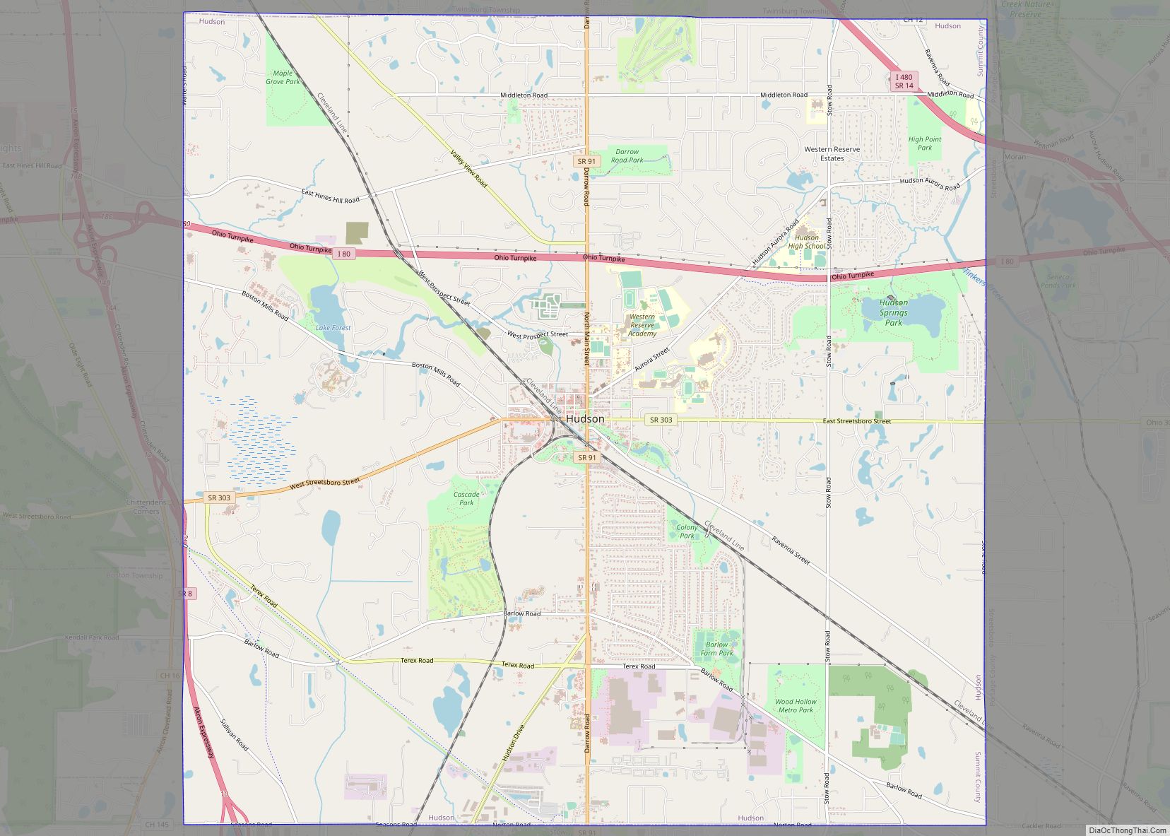
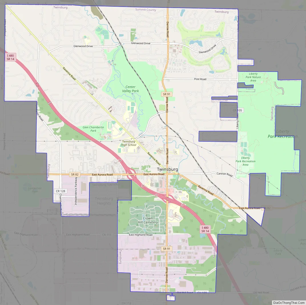
Twinsburg Road Map
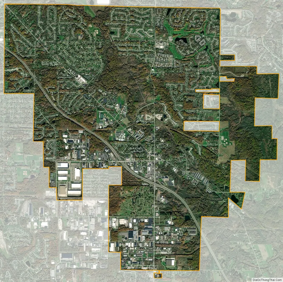
Twinsburg city Satellite Map
Geography
According to the United States Census Bureau, the city has a total area of 32.3 km² (12.5 mi²). 32.2 km (12.4 mi) of it is land and 0.1 km (0.04 mi) of it (0.24%) is water.
See also
Map of Ohio State and its subdivision:- Adams
- Allen
- Ashland
- Ashtabula
- Athens
- Auglaize
- Belmont
- Brown
- Butler
- Carroll
- Champaign
- Clark
- Clermont
- Clinton
- Columbiana
- Coshocton
- Crawford
- Cuyahoga
- Darke
- Defiance
- Delaware
- Erie
- Fairfield
- Fayette
- Franklin
- Fulton
- Gallia
- Geauga
- Greene
- Guernsey
- Hamilton
- Hancock
- Hardin
- Harrison
- Henry
- Highland
- Hocking
- Holmes
- Huron
- Jackson
- Jefferson
- Knox
- Lake
- Lake Erie
- Lawrence
- Licking
- Logan
- Lorain
- Lucas
- Madison
- Mahoning
- Marion
- Medina
- Meigs
- Mercer
- Miami
- Monroe
- Montgomery
- Morgan
- Morrow
- Muskingum
- Noble
- Ottawa
- Paulding
- Perry
- Pickaway
- Pike
- Portage
- Preble
- Putnam
- Richland
- Ross
- Sandusky
- Scioto
- Seneca
- Shelby
- Stark
- Summit
- Trumbull
- Tuscarawas
- Union
- Van Wert
- Vinton
- Warren
- Washington
- Wayne
- Williams
- Wood
- Wyandot
- Alabama
- Alaska
- Arizona
- Arkansas
- California
- Colorado
- Connecticut
- Delaware
- District of Columbia
- Florida
- Georgia
- Hawaii
- Idaho
- Illinois
- Indiana
- Iowa
- Kansas
- Kentucky
- Louisiana
- Maine
- Maryland
- Massachusetts
- Michigan
- Minnesota
- Mississippi
- Missouri
- Montana
- Nebraska
- Nevada
- New Hampshire
- New Jersey
- New Mexico
- New York
- North Carolina
- North Dakota
- Ohio
- Oklahoma
- Oregon
- Pennsylvania
- Rhode Island
- South Carolina
- South Dakota
- Tennessee
- Texas
- Utah
- Vermont
- Virginia
- Washington
- West Virginia
- Wisconsin
- Wyoming