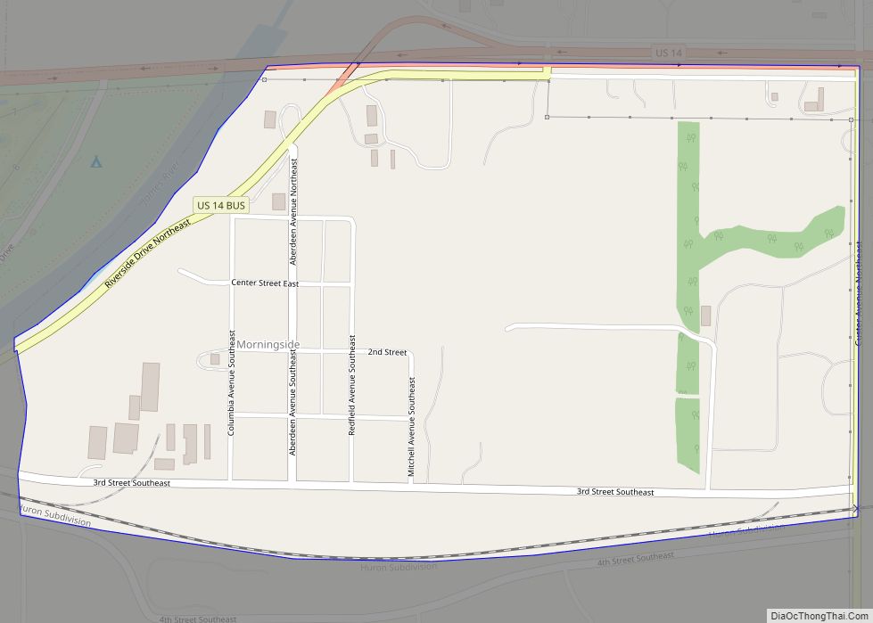
Morningside is a census-designated place (CDP) in Beadle County, South Dakota, United States. The population was 70 at the 2020 census.
| Name: | Morningside CDP |
|---|---|
| LSAD Code: | 57 |
| LSAD Description: | CDP (suffix) |
| State: | South Dakota |
| County: | Beadle County |
| Elevation: | 1,275 ft (389 m) |
| Total Area: | 0.53 sq mi (1.36 km²) |
| Land Area: | 0.52 sq mi (1.34 km²) |
| Water Area: | 0.01 sq mi (0.02 km²) |
| Total Population: | 70 |
| Population Density: | 135.92/sq mi (52.43/km²) |
| Area code: | 605 |
| FIPS code: | 4643780 |
| GNISfeature ID: | 1256539 |
Online Interactive Map
Click on ![]() to view map in "full screen" mode.
to view map in "full screen" mode.
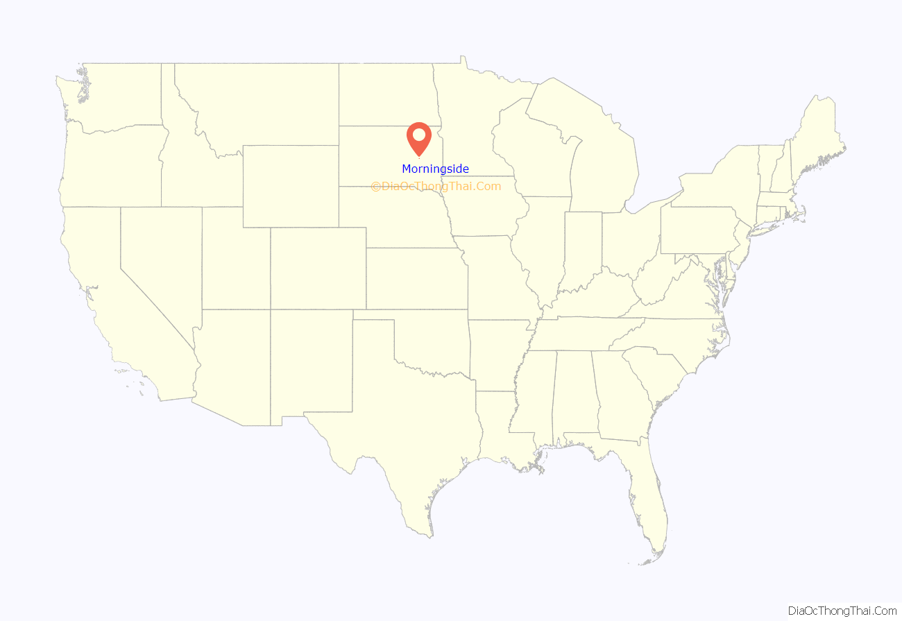
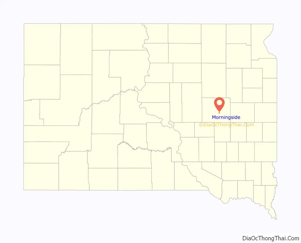
Morningside location map. Where is Morningside CDP?
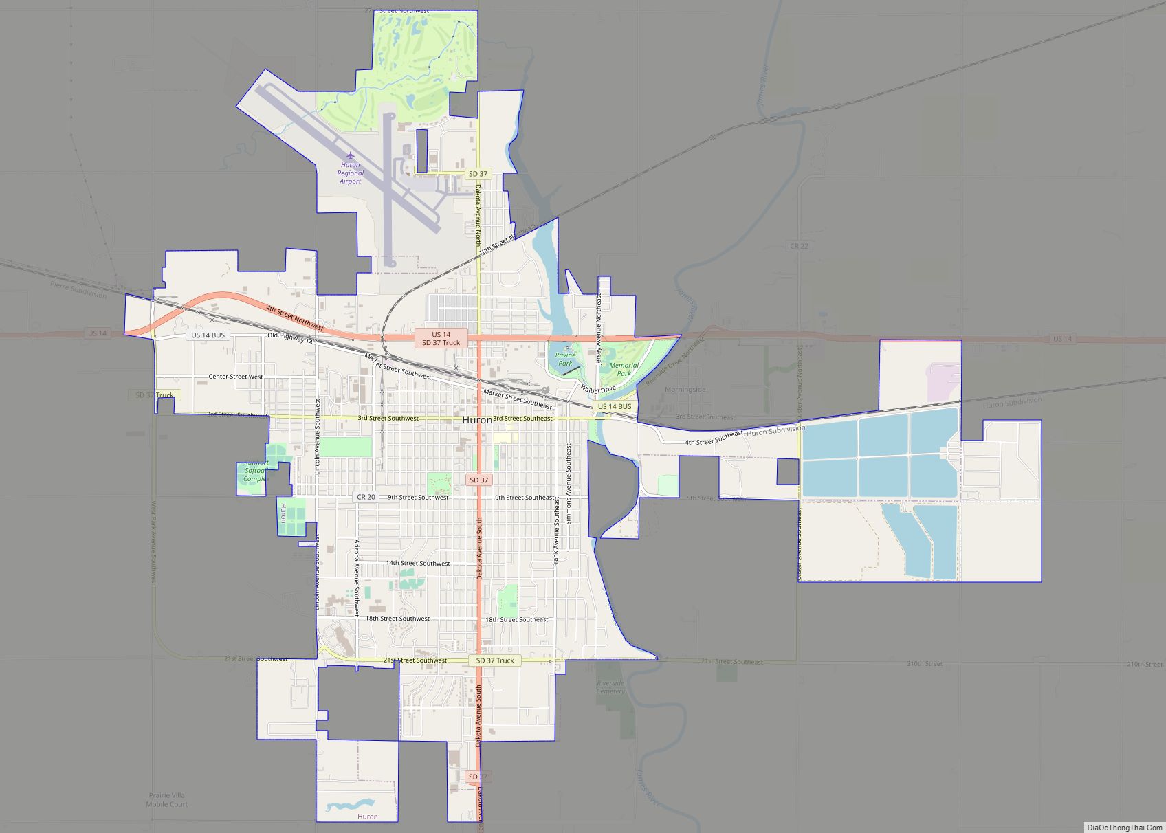
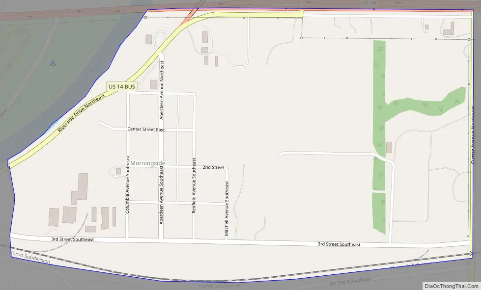
Morningside Road Map
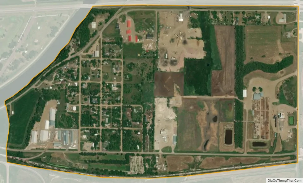
Morningside city Satellite Map
Geography
Morningside is located on the east side of the city of Huron, the Beadle County seat. The James River forms the western edge of Morningside and separates it from the center of Huron. An eastern extension of the city borders Morningside to the south. U.S. Route 14 forms the northern edge of Morningside and leads west into Huron and east 31 miles (50 km) to De Smet.
According to the United States Census Bureau, the Morningside CDP has a total area of 0.50 square miles (1.3 km), all land.
See also
Map of South Dakota State and its subdivision:- Aurora
- Beadle
- Bennett
- Bon Homme
- Brookings
- Brown
- Brule
- Buffalo
- Butte
- Campbell
- Charles Mix
- Clark
- Clay
- Codington
- Corson
- Custer
- Davison
- Day
- Deuel
- Dewey
- Douglas
- Edmunds
- Fall River
- Faulk
- Grant
- Gregory
- Haakon
- Hamlin
- Hand
- Hanson
- Harding
- Hughes
- Hutchinson
- Hyde
- Jackson
- Jerauld
- Jones
- Kingsbury
- Lake
- Lawrence
- Lincoln
- Lyman
- Marshall
- McCook
- McPherson
- Meade
- Mellette
- Miner
- Minnehaha
- Moody
- Pennington
- Perkins
- Potter
- Roberts
- Sanborn
- Shannon
- Spink
- Stanley
- Sully
- Todd
- Tripp
- Turner
- Union
- Walworth
- Yankton
- Ziebach
- Alabama
- Alaska
- Arizona
- Arkansas
- California
- Colorado
- Connecticut
- Delaware
- District of Columbia
- Florida
- Georgia
- Hawaii
- Idaho
- Illinois
- Indiana
- Iowa
- Kansas
- Kentucky
- Louisiana
- Maine
- Maryland
- Massachusetts
- Michigan
- Minnesota
- Mississippi
- Missouri
- Montana
- Nebraska
- Nevada
- New Hampshire
- New Jersey
- New Mexico
- New York
- North Carolina
- North Dakota
- Ohio
- Oklahoma
- Oregon
- Pennsylvania
- Rhode Island
- South Carolina
- South Dakota
- Tennessee
- Texas
- Utah
- Vermont
- Virginia
- Washington
- West Virginia
- Wisconsin
- Wyoming