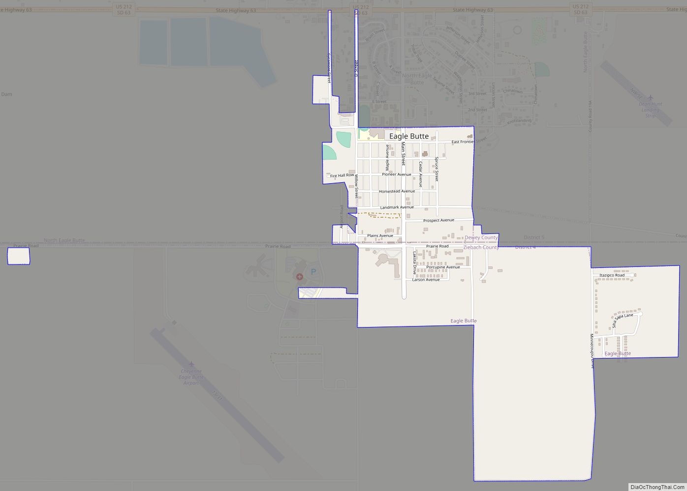
North Eagle Butte is a census-designated place (CDP) in Dewey County, South Dakota, United States, along the 45th parallel. The population was 1,879 at the 2020 census.
| Name: | North Eagle Butte CDP |
|---|---|
| LSAD Code: | 57 |
| LSAD Description: | CDP (suffix) |
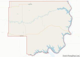
| State: | South Dakota |
| County: | Dewey County |
| Elevation: | 2,408 ft (734 m) |
| Total Area: | 8.83 sq mi (22.86 km²) |
| Land Area: | 8.82 sq mi (22.83 km²) |
| Water Area: | 0.01 sq mi (0.03 km²) |
| Total Population: | 1,879 |
| Population Density: | 213.11/sq mi (82.29/km²) |
| Area code: | 605 |
| FIPS code: | 4645548 |
| GNISfeature ID: | 1259250 |
Online Interactive Map
Click on ![]() to view map in "full screen" mode.
to view map in "full screen" mode.
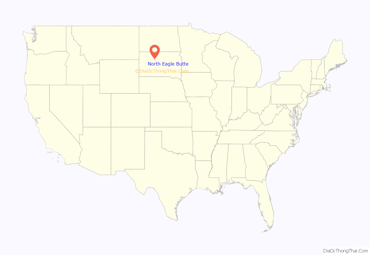
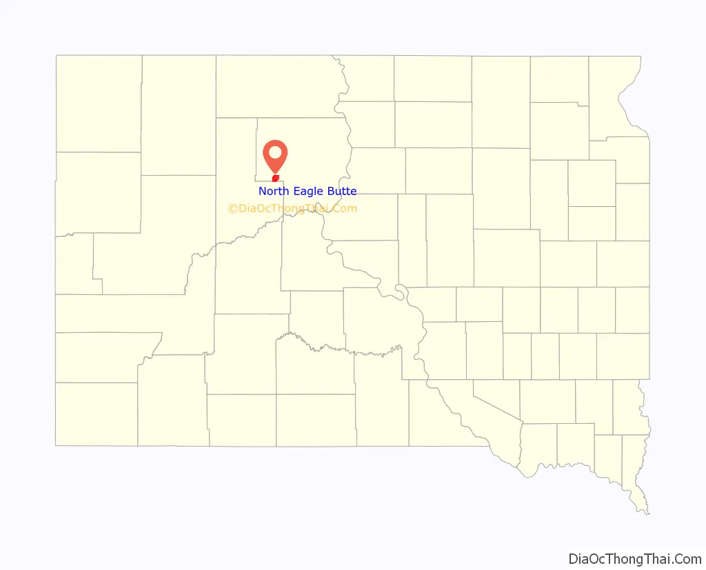
North Eagle Butte location map. Where is North Eagle Butte CDP?
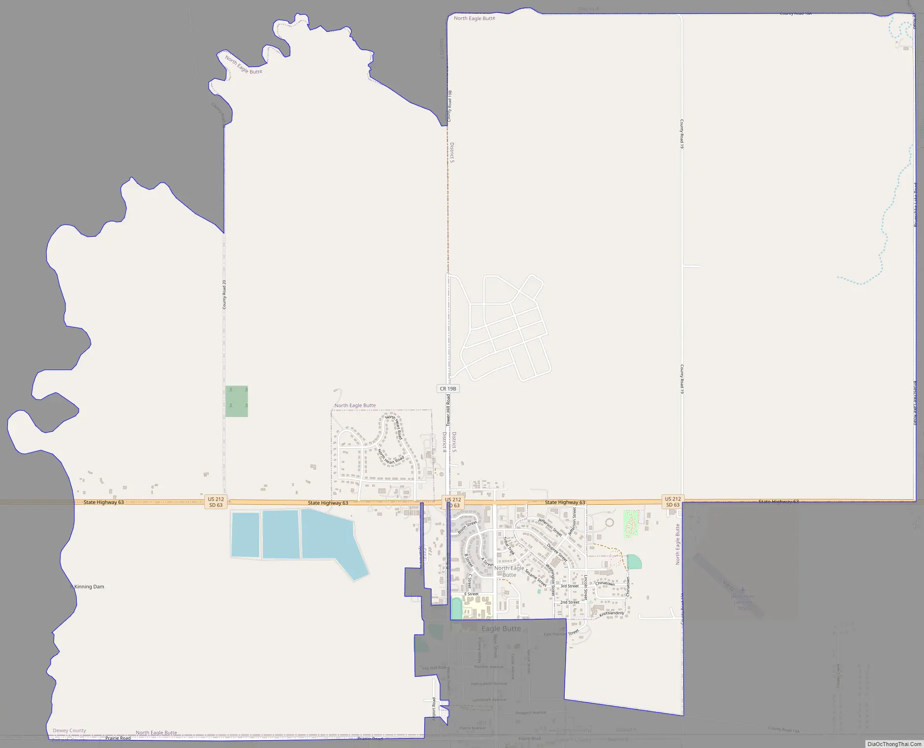
North Eagle Butte Road Map
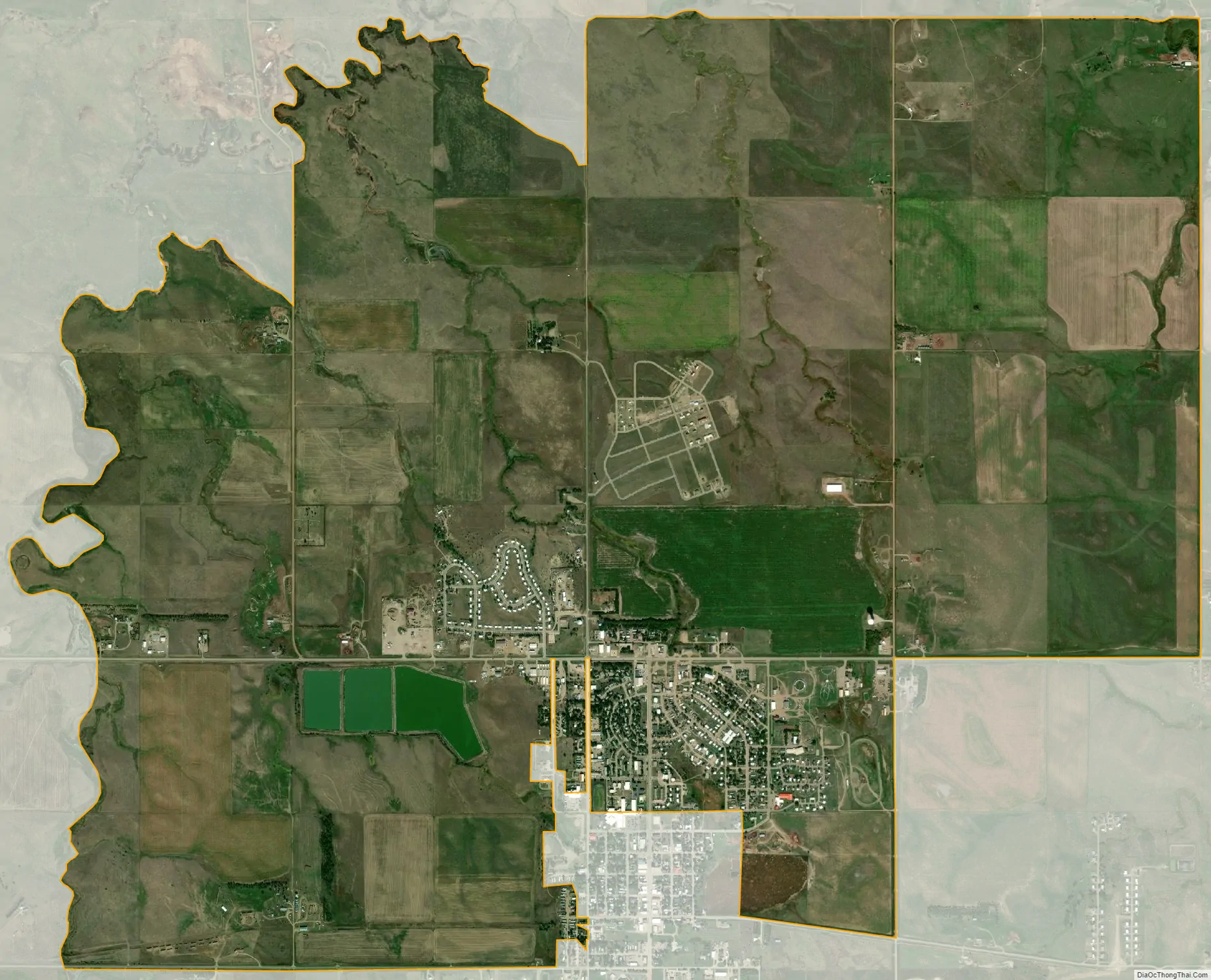
North Eagle Butte city Satellite Map
Geography
North Eagle Butte is located in western Dewey County at 45°0′23″N 101°13′53″W / 45.00639°N 101.23139°W / 45.00639; -101.23139 (45.006330, -101.231318). It is bordered to the south by the city of Eagle Butte and by Ziebach County. U.S. Route 212 passes through North Eagle Butte, leading east 71 miles (114 km) to Gettysburg and west 141 miles (227 km) to Belle Fourche. Pierre, the state capital, is 90 miles (140 km) to the southeast.
According to the United States Census Bureau, the CDP has a total area of 9.1 square miles (23.6 km), of which 0.01 square miles (0.03 km), or 0.11%, is water.
See also
Map of South Dakota State and its subdivision:- Aurora
- Beadle
- Bennett
- Bon Homme
- Brookings
- Brown
- Brule
- Buffalo
- Butte
- Campbell
- Charles Mix
- Clark
- Clay
- Codington
- Corson
- Custer
- Davison
- Day
- Deuel
- Dewey
- Douglas
- Edmunds
- Fall River
- Faulk
- Grant
- Gregory
- Haakon
- Hamlin
- Hand
- Hanson
- Harding
- Hughes
- Hutchinson
- Hyde
- Jackson
- Jerauld
- Jones
- Kingsbury
- Lake
- Lawrence
- Lincoln
- Lyman
- Marshall
- McCook
- McPherson
- Meade
- Mellette
- Miner
- Minnehaha
- Moody
- Pennington
- Perkins
- Potter
- Roberts
- Sanborn
- Shannon
- Spink
- Stanley
- Sully
- Todd
- Tripp
- Turner
- Union
- Walworth
- Yankton
- Ziebach
- Alabama
- Alaska
- Arizona
- Arkansas
- California
- Colorado
- Connecticut
- Delaware
- District of Columbia
- Florida
- Georgia
- Hawaii
- Idaho
- Illinois
- Indiana
- Iowa
- Kansas
- Kentucky
- Louisiana
- Maine
- Maryland
- Massachusetts
- Michigan
- Minnesota
- Mississippi
- Missouri
- Montana
- Nebraska
- Nevada
- New Hampshire
- New Jersey
- New Mexico
- New York
- North Carolina
- North Dakota
- Ohio
- Oklahoma
- Oregon
- Pennsylvania
- Rhode Island
- South Carolina
- South Dakota
- Tennessee
- Texas
- Utah
- Vermont
- Virginia
- Washington
- West Virginia
- Wisconsin
- Wyoming