Cudahy (/ˈkʌdəheɪ/) is a city in Milwaukee County, Wisconsin, United States. The population was 18,204 at the 2020 census.
| Name: | Cudahy city |
|---|---|
| LSAD Code: | 25 |
| LSAD Description: | city (suffix) |
| State: | Wisconsin |
| County: | Milwaukee County |
| Elevation: | 722 ft (220 m) |
| Total Area: | 4.77 sq mi (12.36 km²) |
| Land Area: | 4.77 sq mi (12.36 km²) |
| Water Area: | 0.00 sq mi (0.00 km²) |
| Total Population: | 18,204 |
| Population Density: | 3,792.21/sq mi (1,464.18/km²) |
| ZIP code: | 53110 |
| Area code: | 414 |
| FIPS code: | 5517975 |
| GNISfeature ID: | 1563607 |
| Website: | www.cudahy-wi.gov |
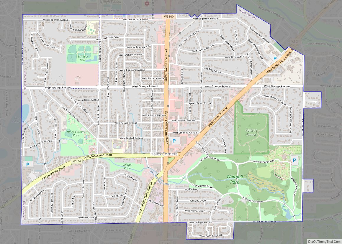
Online Interactive Map
Click on ![]() to view map in "full screen" mode.
to view map in "full screen" mode.
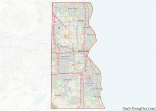
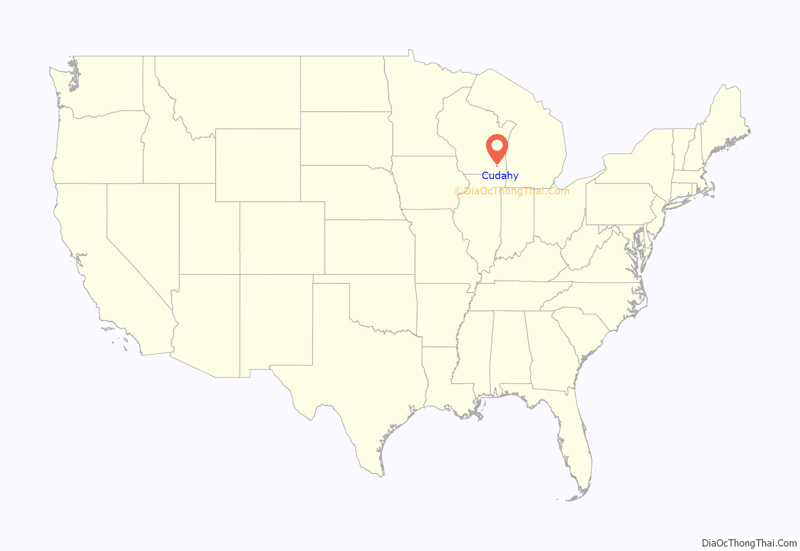
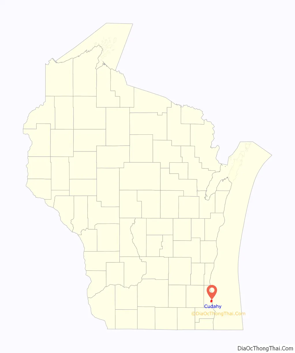
Cudahy location map. Where is Cudahy city?
History
Originally known as the Buckhorn Settlement, it was renamed in the late 1800s when Patrick Cudahy purchased 700 acres (280 ha) of land in the Town of Lake, two miles (three kilometers) from the Milwaukee city limits, to build his meatpacking plant. The first village president was elected in 1895, and by 1906 Cudahy was incorporated as a city with a population of 2,556.
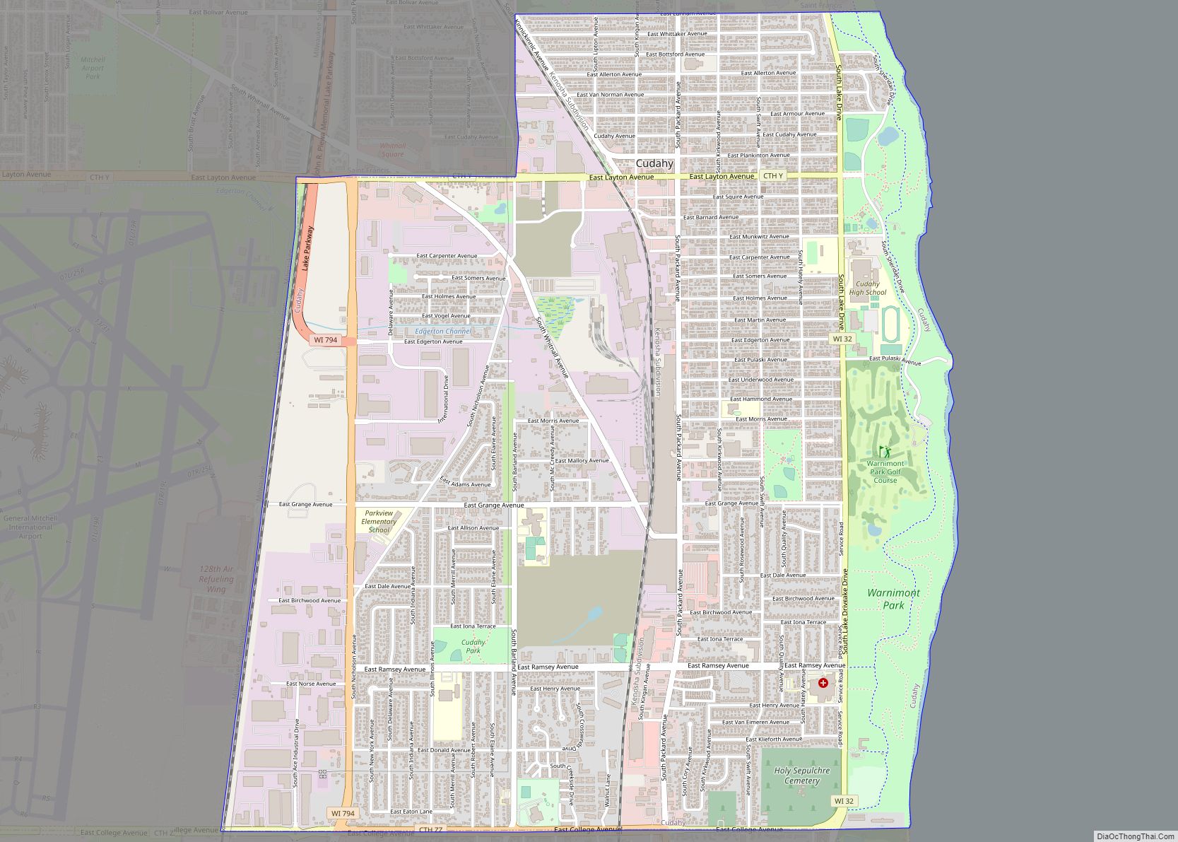
Cudahy Road Map
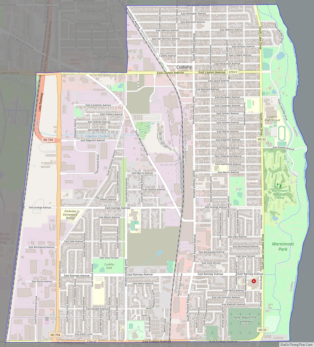
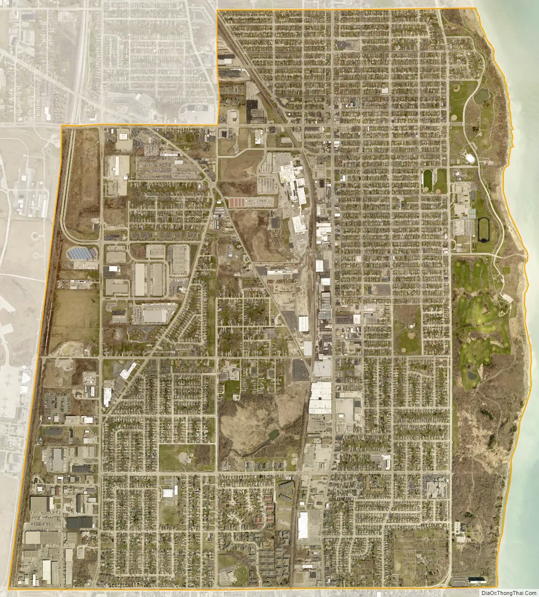
Cudahy city Satellite Map
Geography
Cudahy is located at 42°56′54″N 87°51′40″W / 42.94833°N 87.86111°W / 42.94833; -87.86111 (42.948416, −87.861010). According to the United States Census Bureau, the city has a total area of 4.76 square miles (12.3 km), all of it land. The city is next door to the Milwaukee Mitchell International Airport.
See also
Map of Wisconsin State and its subdivision:- Adams
- Ashland
- Barron
- Bayfield
- Brown
- Buffalo
- Burnett
- Calumet
- Chippewa
- Clark
- Columbia
- Crawford
- Dane
- Dodge
- Door
- Douglas
- Dunn
- Eau Claire
- Florence
- Fond du Lac
- Forest
- Grant
- Green
- Green Lake
- Iowa
- Iron
- Jackson
- Jefferson
- Juneau
- Kenosha
- Kewaunee
- La Crosse
- Lafayette
- Lake Michigan
- Lake Superior
- Langlade
- Lincoln
- Manitowoc
- Marathon
- Marinette
- Marquette
- Menominee
- Milwaukee
- Monroe
- Oconto
- Oneida
- Outagamie
- Ozaukee
- Pepin
- Pierce
- Polk
- Portage
- Price
- Racine
- Richland
- Rock
- Rusk
- Saint Croix
- Sauk
- Sawyer
- Shawano
- Sheboygan
- Taylor
- Trempealeau
- Vernon
- Vilas
- Walworth
- Washburn
- Washington
- Waukesha
- Waupaca
- Waushara
- Winnebago
- Wood
- Alabama
- Alaska
- Arizona
- Arkansas
- California
- Colorado
- Connecticut
- Delaware
- District of Columbia
- Florida
- Georgia
- Hawaii
- Idaho
- Illinois
- Indiana
- Iowa
- Kansas
- Kentucky
- Louisiana
- Maine
- Maryland
- Massachusetts
- Michigan
- Minnesota
- Mississippi
- Missouri
- Montana
- Nebraska
- Nevada
- New Hampshire
- New Jersey
- New Mexico
- New York
- North Carolina
- North Dakota
- Ohio
- Oklahoma
- Oregon
- Pennsylvania
- Rhode Island
- South Carolina
- South Dakota
- Tennessee
- Texas
- Utah
- Vermont
- Virginia
- Washington
- West Virginia
- Wisconsin
- Wyoming