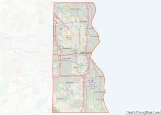
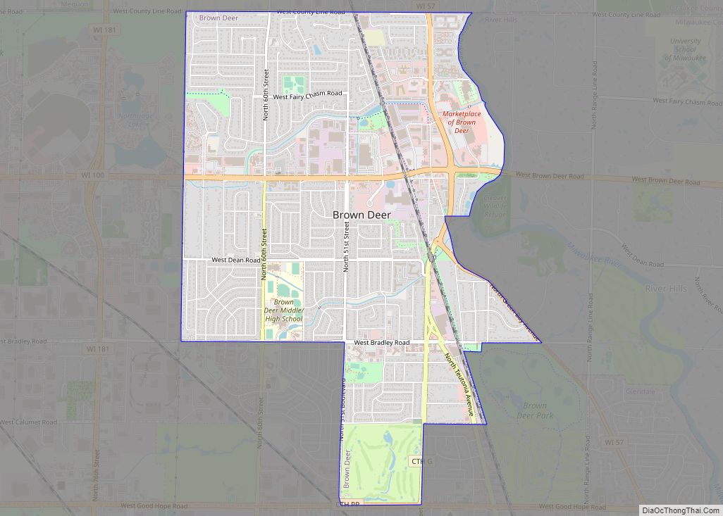
Brown Deer is a village in Milwaukee County, Wisconsin, United States. As a suburb of Milwaukee, it is part of the Milwaukee metropolitan area. The population was 12,507 at the 2020 census.
| Name: | Brown Deer village |
|---|---|
| LSAD Code: | 47 |
| LSAD Description: | village (suffix) |
| State: | Wisconsin |
| County: | Milwaukee County |
| Elevation: | 692 ft (211 m) |
| Total Area: | 4.39 sq mi (11.38 km²) |
| Land Area: | 4.39 sq mi (11.38 km²) |
| Water Area: | 0.00 sq mi (0.00 km²) |
| Total Population: | 12,507 |
| Population Density: | 2,848/sq mi (1,095/km²) |
| Area code: | 414 |
| FIPS code: | 5510375 |
| GNISfeature ID: | 1562261 |
| Website: | www.browndeerwi.org |
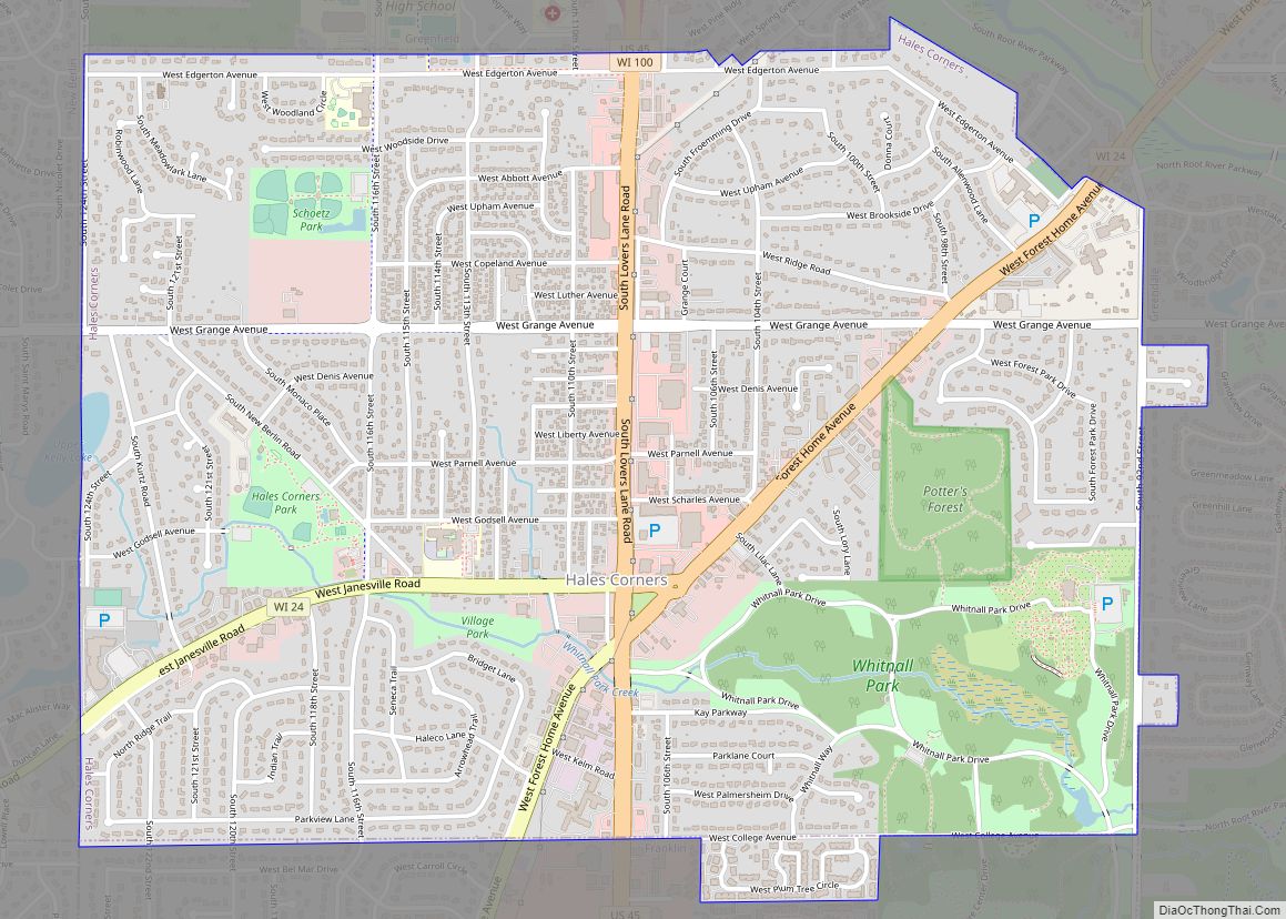
Online Interactive Map
Click on ![]() to view map in "full screen" mode.
to view map in "full screen" mode.
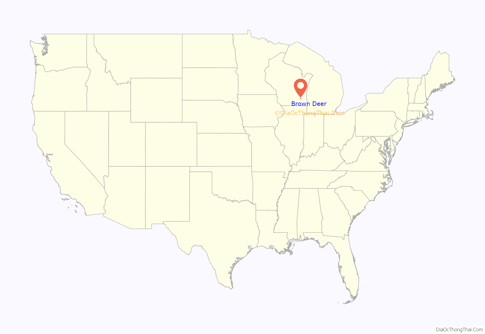
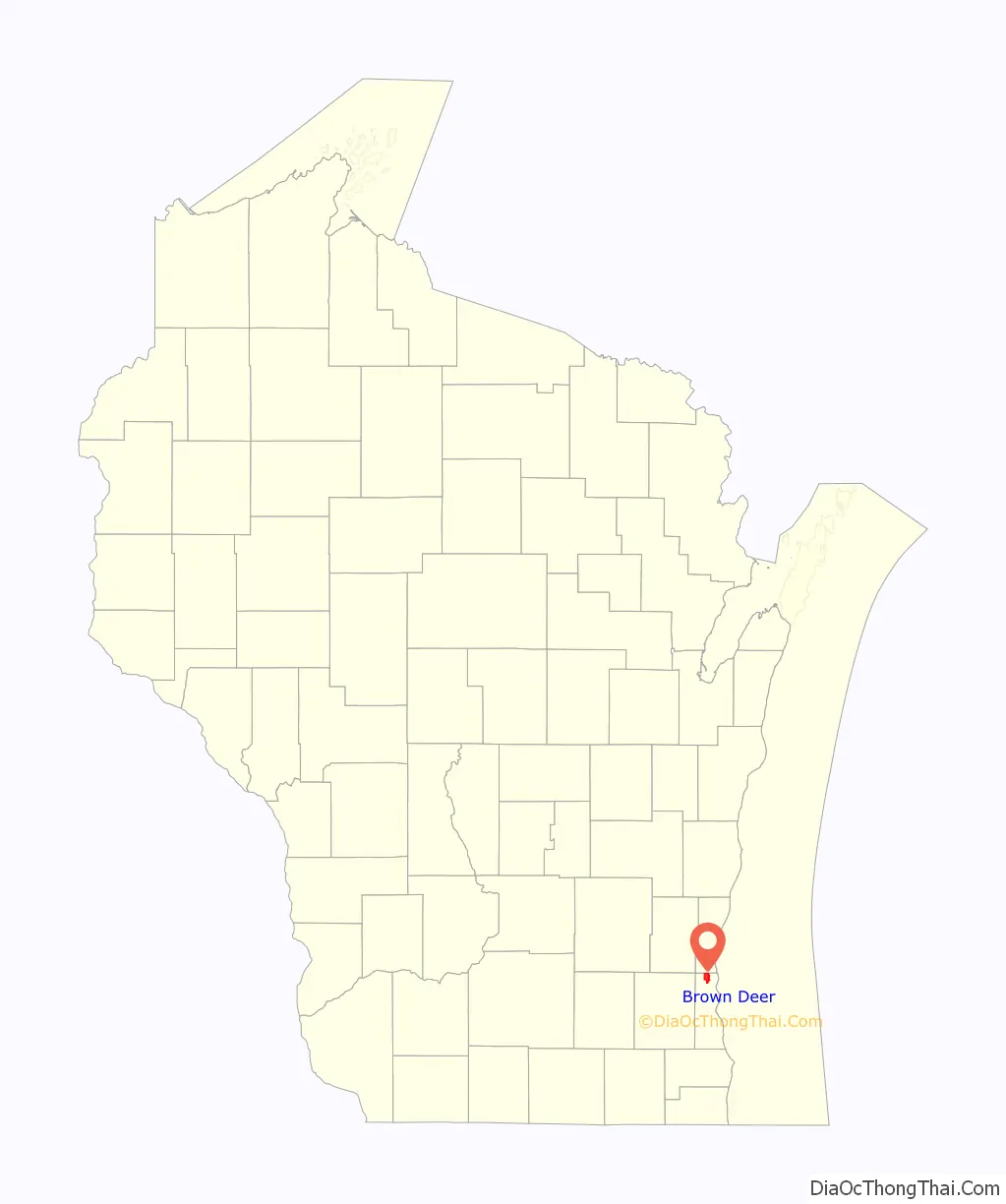
Brown Deer location map. Where is Brown Deer village?
History
The Brown Deer area was organized as part of the Town of Milwaukee in 1835, and the first white settlers began arriving around that time from New England and New York, including some settlers from Granville, New York. In 1841, the Town of Milwaukee was subdivided and the Brown Deer area became part of the new Town of Granville. In the 1800s, the town was a predominantly agricultural community, and many residents were of German and Irish extraction.
The Village of Brown Deer has its origins in a rural hamlet that formed at a crossroads in the northeastern quadrant of the Town of Granville in the 1870s. The area remained characteristically rural from the 19th century through the mid-1940s, when the post–World War II economic expansion caused a building boom in the area, and many of the farms were subdivided into suburban residential neighborhoods.
In the 1950s, Milwaukee mayor Frank Zeidler’s administration pursued an agenda of annexing unincorporated areas of Milwaukee County to grow the city. In 1951 and 1952, the city began proceedings to annex parts of the Town of Granville. Some residents in the Brown Deer area did not want their community to become part of Milwaukee and organized to incorporate as a village in 1953 in order to stave off annexation. Milwaukee challenged the incorporation, but after a protracted court battle, the Wisconsin Supreme Court upheld Brown Deer’s right to incorporate. When the Village of Brown Deer incorporated on January 20, 1955, it had an area of 1.8 square miles.
In 1955, the Village of Brown Deer and the City of Milwaukee scrambled to annex more of the Town of Granville, with Brown Deer making five annexations by the year’s end. In 1956, the city and the village both attempted to annex all of the Town of Granville’s remaining territory. The municipalities began a court battle that would last until 1962. Most of Granville’s residents supported annexation by Milwaukee, but some favored Brown Deer’s lower tax rates. The Wisconsin Supreme Court initially awarded the territory to Brown Deer, before overruling its own decision and awarding the territory to Milwaukee in 1959. The courts reaffirmed their decision in 1962 when they ruled that Brown Deer’s 1956 annexation ordinances were invalid, and awarded sixteen square miles of the former Town of Granville to the City of Milwaukee.
In August 2013, the village was listed as 19th on CNNMoney’s rankings of Best Places to Live – Where Homes Are Affordable, the highest ranking community in the state of Wisconsin.
Brown Deer Road Map
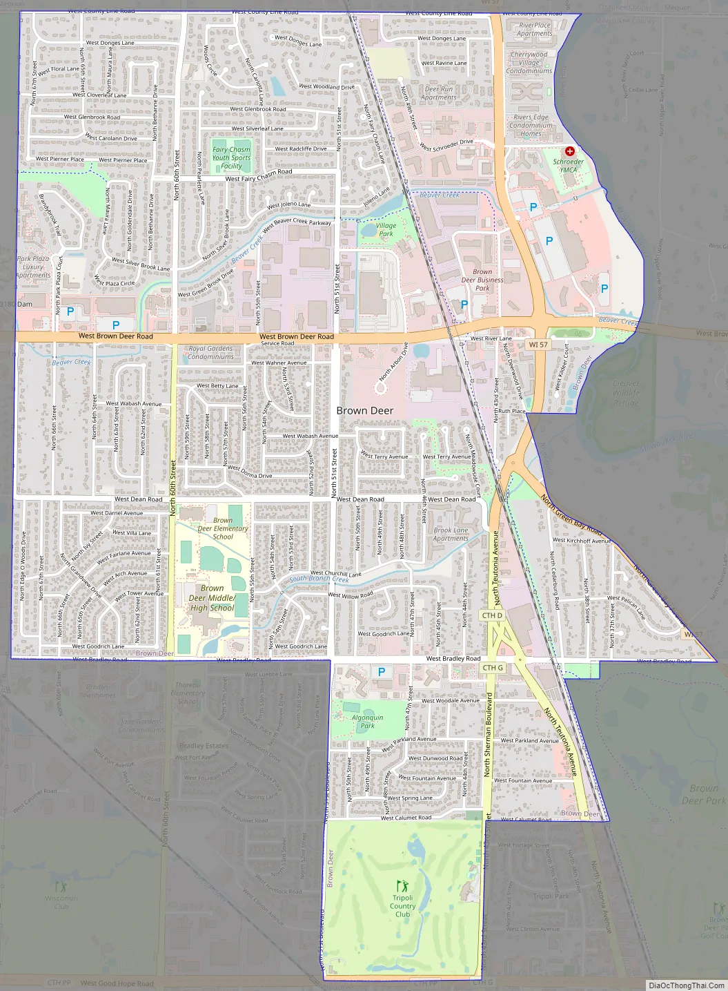
Brown Deer city Satellite Map

Geography
Brown Deer is located at 43°10′22″N 87°58′40″W / 43.17278°N 87.97778°W / 43.17278; -87.97778 (43.172858, −87.977899).
According to the United States Census Bureau, the village has a total area of 4.40 square miles (11.40 km), all of it land.
See also
Map of Wisconsin State and its subdivision:- Adams
- Ashland
- Barron
- Bayfield
- Brown
- Buffalo
- Burnett
- Calumet
- Chippewa
- Clark
- Columbia
- Crawford
- Dane
- Dodge
- Door
- Douglas
- Dunn
- Eau Claire
- Florence
- Fond du Lac
- Forest
- Grant
- Green
- Green Lake
- Iowa
- Iron
- Jackson
- Jefferson
- Juneau
- Kenosha
- Kewaunee
- La Crosse
- Lafayette
- Lake Michigan
- Lake Superior
- Langlade
- Lincoln
- Manitowoc
- Marathon
- Marinette
- Marquette
- Menominee
- Milwaukee
- Monroe
- Oconto
- Oneida
- Outagamie
- Ozaukee
- Pepin
- Pierce
- Polk
- Portage
- Price
- Racine
- Richland
- Rock
- Rusk
- Saint Croix
- Sauk
- Sawyer
- Shawano
- Sheboygan
- Taylor
- Trempealeau
- Vernon
- Vilas
- Walworth
- Washburn
- Washington
- Waukesha
- Waupaca
- Waushara
- Winnebago
- Wood
- Alabama
- Alaska
- Arizona
- Arkansas
- California
- Colorado
- Connecticut
- Delaware
- District of Columbia
- Florida
- Georgia
- Hawaii
- Idaho
- Illinois
- Indiana
- Iowa
- Kansas
- Kentucky
- Louisiana
- Maine
- Maryland
- Massachusetts
- Michigan
- Minnesota
- Mississippi
- Missouri
- Montana
- Nebraska
- Nevada
- New Hampshire
- New Jersey
- New Mexico
- New York
- North Carolina
- North Dakota
- Ohio
- Oklahoma
- Oregon
- Pennsylvania
- Rhode Island
- South Carolina
- South Dakota
- Tennessee
- Texas
- Utah
- Vermont
- Virginia
- Washington
- West Virginia
- Wisconsin
- Wyoming