Franklin is a city in Milwaukee County, Wisconsin, United States. It is a suburb of Milwaukee with a population of 36,816 as of the 2020 census.
| Name: | Franklin city |
|---|---|
| LSAD Code: | 25 |
| LSAD Description: | city (suffix) |
| State: | Wisconsin |
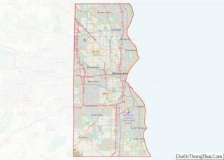
| County: | Milwaukee County |
| Founded: | 1841 |
| Incorporated: | 1956 |
| Elevation: | 790 ft (241 m) |
| Total Area: | 34.68 sq mi (89.82 km²) |
| Land Area: | 34.58 sq mi (89.55 km²) |
| Water Area: | 0.10 sq mi (0.27 km²) |
| Total Population: | 36,816 |
| Population Density: | 1,035.75/sq mi (399.91/km²) |
| ZIP code: | 53132 |
| Area code: | 414 |
| FIPS code: | 5527300 |
| GNISfeature ID: | 1583234 |
| Website: | www.franklinwi.gov |
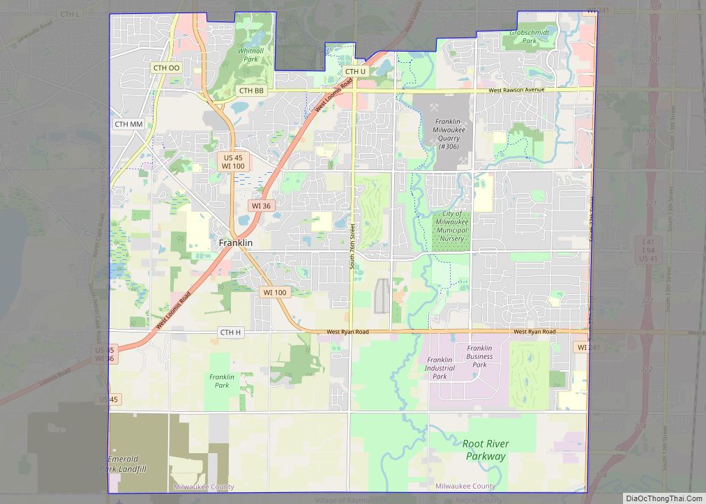
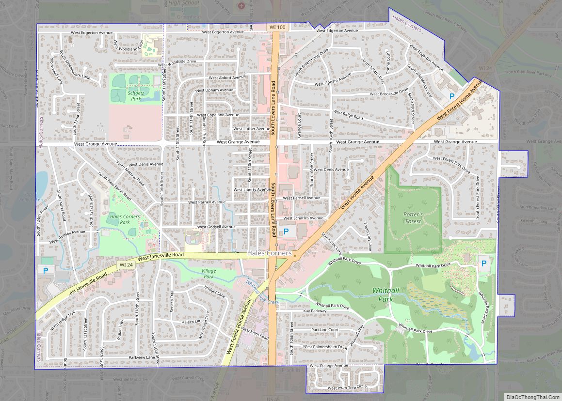
Online Interactive Map
Click on ![]() to view map in "full screen" mode.
to view map in "full screen" mode.
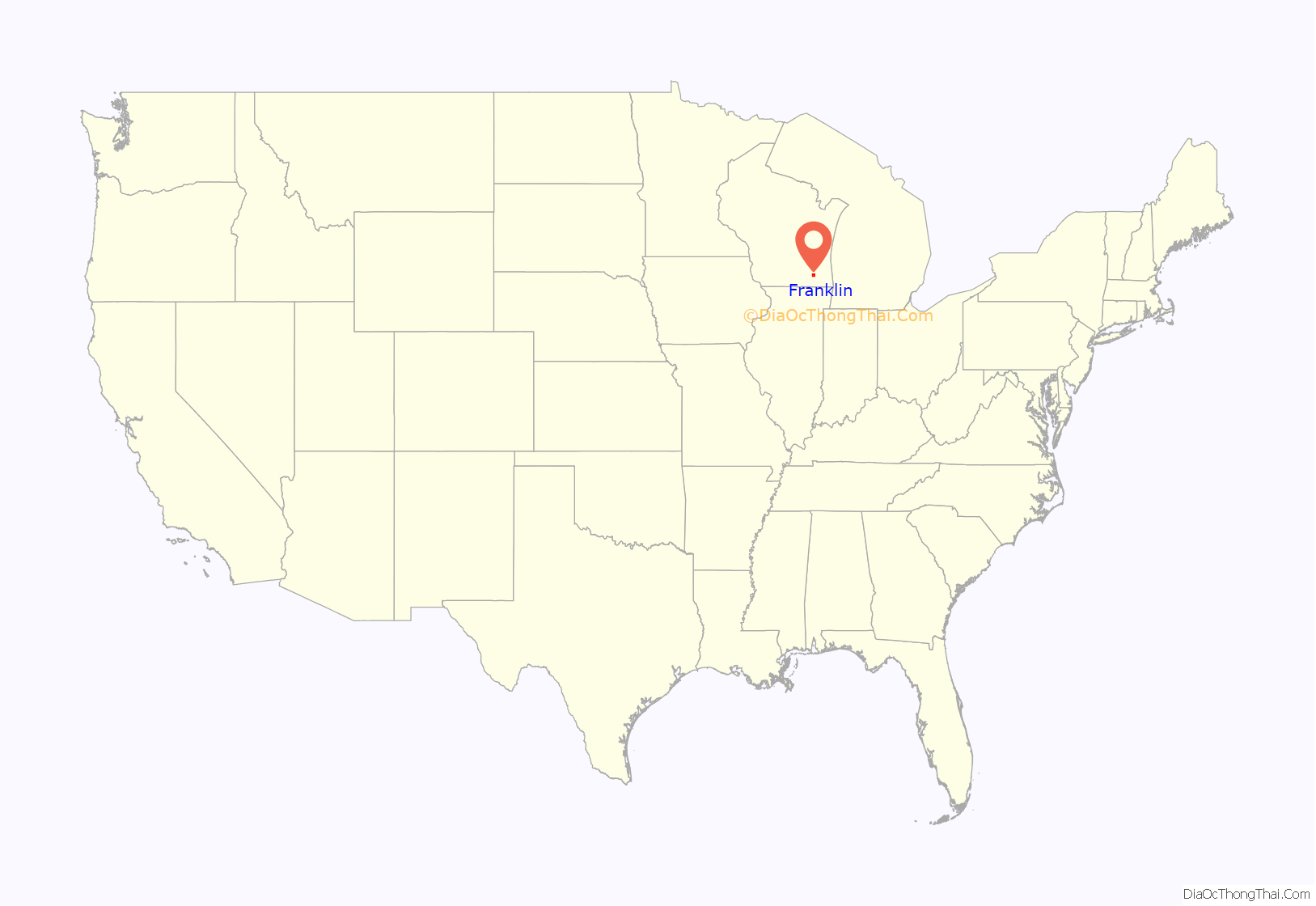
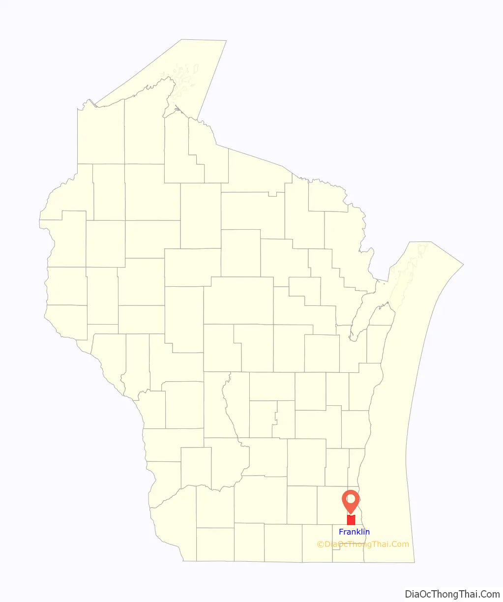
Franklin location map. Where is Franklin city?
History
On December 20, 1839, the south portion of the Town of Kinnikinick was split off to form the town of Franklin. The town consisted of a 36-square-mile area that was originally covered with heavy timber, which was mostly hardwoods such as hickory, walnut, and butternut. Most of the town’s drainage was delivered by the Root River and there was an abundance of wildlife including bears, deer, and wolves. As of the 1840 census, the population of the Town of Franklin was 248. The name “Franklin” was given in homage to Benjamin Franklin.
By the 1950s, Franklin was known as a “City of Homes” for its growing residential areas, which served as a suburb of the city of Milwaukee. In 1956, town officials were concerned by the possibility that the city of Milwaukee might attempt to annex portions of Franklin. In response, the town was incorporated as a fourth-class city on August 15, 1956.
Franklin Road Map
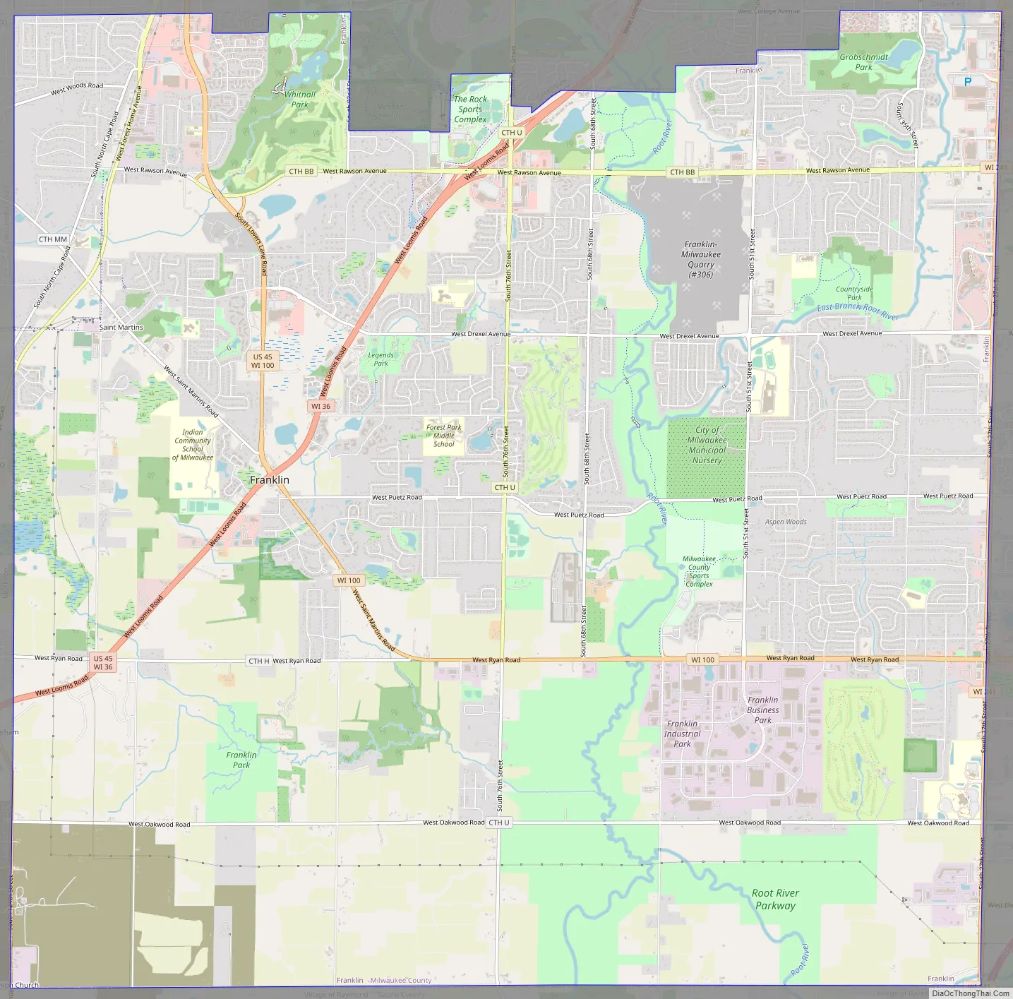
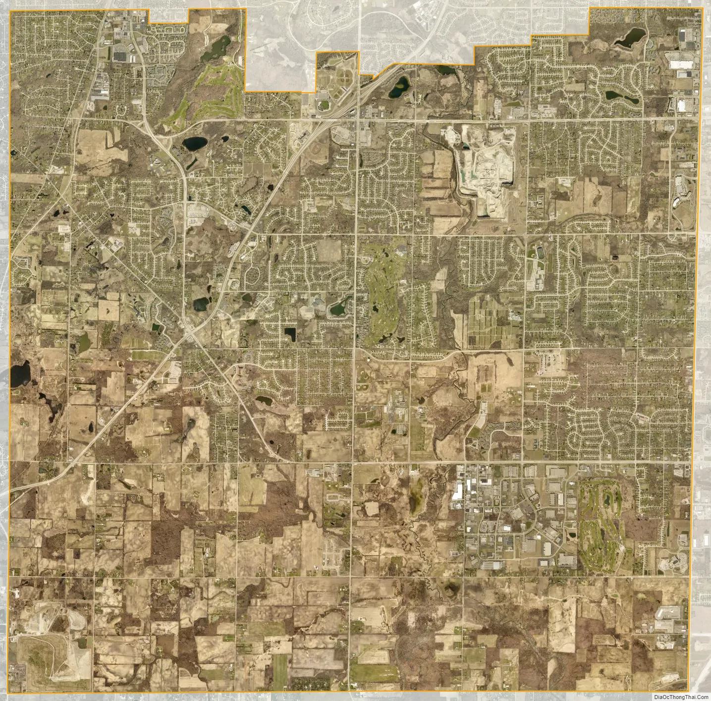
Franklin city Satellite Map
Geography
Franklin is located at 42°53′57″N 88°00′08″W / 42.899166°N 88.002204°W / 42.899166; -88.002204 (42.899166, −88.002204). It is bounded by the city of Oak Creek to the east, the villages of Greendale and Hales Corners and the city of Greenfield to the north, the county of Racine to the south, and the county of Waukesha to the west.
According to the United States Census Bureau, the city has a total area of 34.69 square miles (89.85 km), of which, 34.58 square miles (89.56 km) is land and 0.11 square miles (0.28 km) is water.
The Root River runs south through Franklin, cutting the city in half.
See also
Map of Wisconsin State and its subdivision:- Adams
- Ashland
- Barron
- Bayfield
- Brown
- Buffalo
- Burnett
- Calumet
- Chippewa
- Clark
- Columbia
- Crawford
- Dane
- Dodge
- Door
- Douglas
- Dunn
- Eau Claire
- Florence
- Fond du Lac
- Forest
- Grant
- Green
- Green Lake
- Iowa
- Iron
- Jackson
- Jefferson
- Juneau
- Kenosha
- Kewaunee
- La Crosse
- Lafayette
- Lake Michigan
- Lake Superior
- Langlade
- Lincoln
- Manitowoc
- Marathon
- Marinette
- Marquette
- Menominee
- Milwaukee
- Monroe
- Oconto
- Oneida
- Outagamie
- Ozaukee
- Pepin
- Pierce
- Polk
- Portage
- Price
- Racine
- Richland
- Rock
- Rusk
- Saint Croix
- Sauk
- Sawyer
- Shawano
- Sheboygan
- Taylor
- Trempealeau
- Vernon
- Vilas
- Walworth
- Washburn
- Washington
- Waukesha
- Waupaca
- Waushara
- Winnebago
- Wood
- Alabama
- Alaska
- Arizona
- Arkansas
- California
- Colorado
- Connecticut
- Delaware
- District of Columbia
- Florida
- Georgia
- Hawaii
- Idaho
- Illinois
- Indiana
- Iowa
- Kansas
- Kentucky
- Louisiana
- Maine
- Maryland
- Massachusetts
- Michigan
- Minnesota
- Mississippi
- Missouri
- Montana
- Nebraska
- Nevada
- New Hampshire
- New Jersey
- New Mexico
- New York
- North Carolina
- North Dakota
- Ohio
- Oklahoma
- Oregon
- Pennsylvania
- Rhode Island
- South Carolina
- South Dakota
- Tennessee
- Texas
- Utah
- Vermont
- Virginia
- Washington
- West Virginia
- Wisconsin
- Wyoming