Whitefish Bay is a village in Milwaukee County, Wisconsin, United States. The population was 14,954 at the 2020 census.
| Name: | Whitefish Bay village |
|---|---|
| LSAD Code: | 47 |
| LSAD Description: | village (suffix) |
| State: | Wisconsin |
| County: | Milwaukee County |
| Elevation: | 650 ft (198 m) |
| Total Area: | 2.12 sq mi (5.48 km²) |
| Land Area: | 2.12 sq mi (5.48 km²) |
| Water Area: | 0.00 sq mi (0.00 km²) |
| Total Population: | 14,954 |
| Population Density: | 7,053/sq mi (2,728/km²) |
| Area code: | 414 |
| FIPS code: | 5586700 |
| GNISfeature ID: | 1576675 |
| Website: | wfbvillage.org |
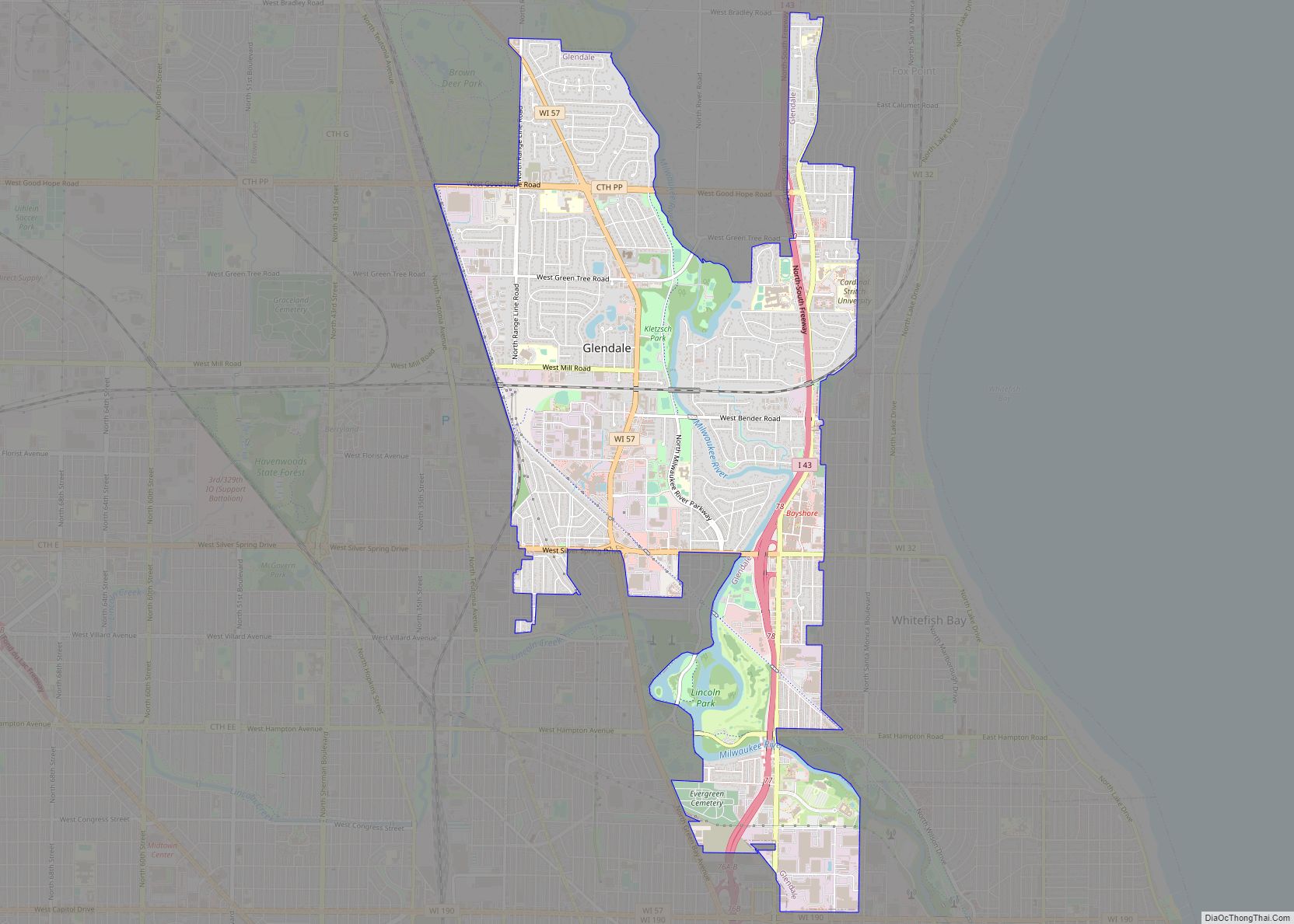
Online Interactive Map
Click on ![]() to view map in "full screen" mode.
to view map in "full screen" mode.
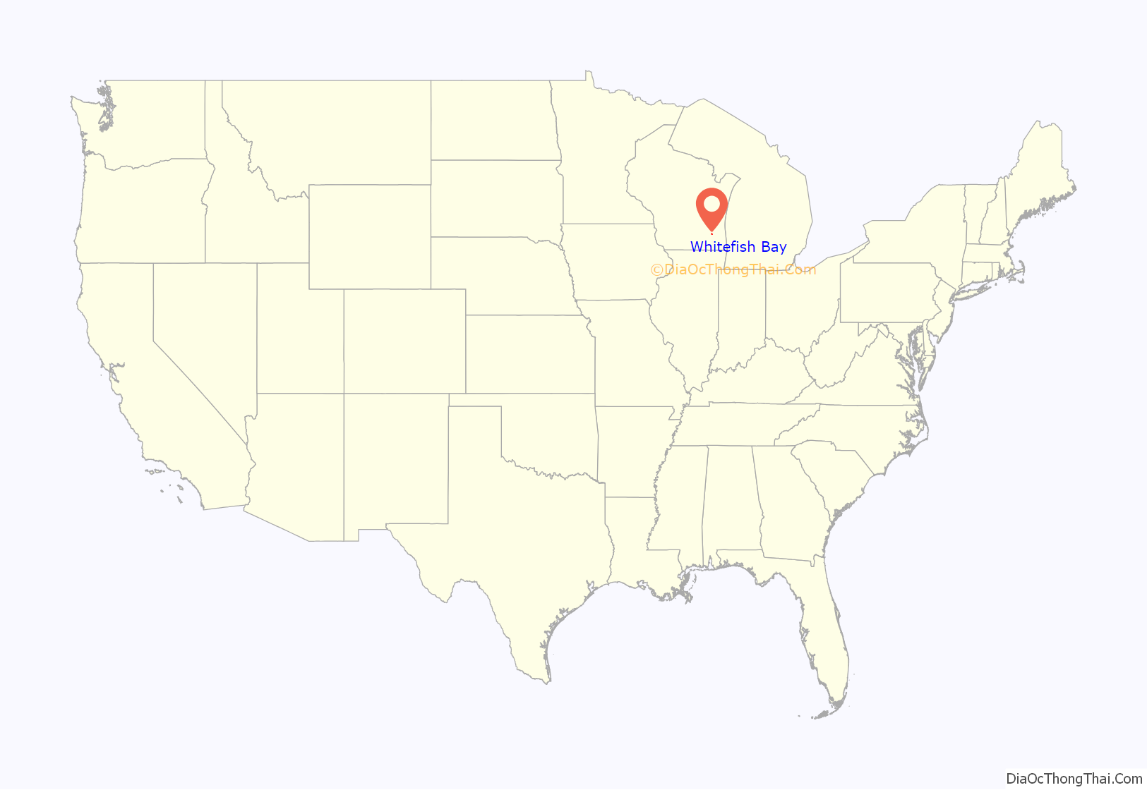
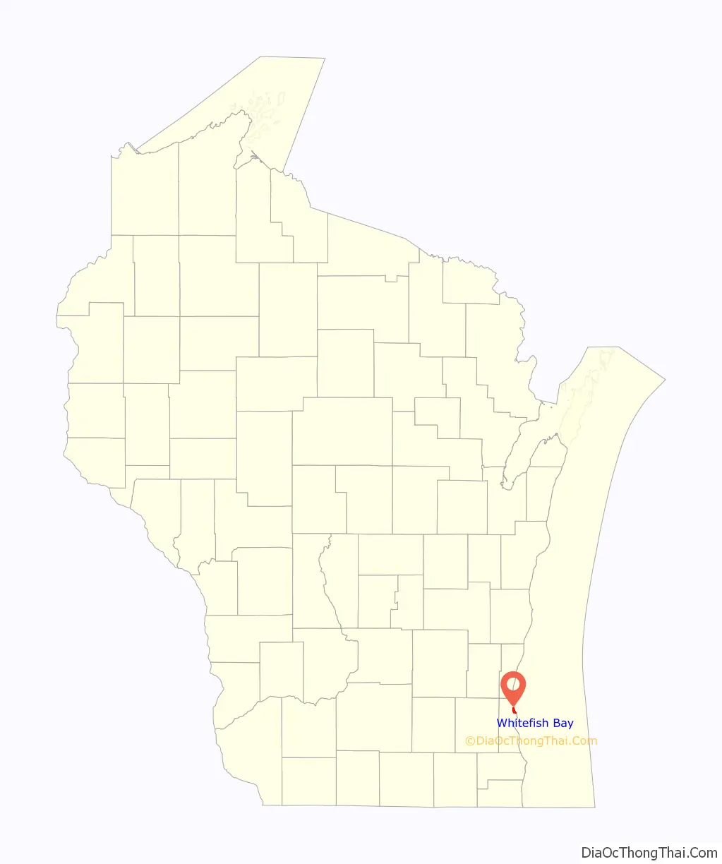
Whitefish Bay location map. Where is Whitefish Bay village?
History
In the early 19th century when the first white settlers arrived, the Whitefish Bay area was controlled by Native Americans, including the Menominee, Potawatomi, and Sauk people. The area came under the control of the United States Federal Government in 1832 when the Menominee surrendered their claims to the land by signing the Treaty of Washington. The land was organized as part of the Town of Milwaukee in 1835, and for much of the 19th century, the community’s main economic activities were farming and fishing. Many of the early settlers were German immigrants.
In 1889, Pabst Brewing Company-owner Frederick Pabst purchased land in the Whitefish Bay area which he developed into the Whitefish Bay Pabst Resort, which included a hotel, restaurant, beer garden, and bandshell. He later added a Ferris wheel and a carousel, as well. At its height, the park hosted as many as 15,000 visitors each weekend, and was once visited by President Theodore Roosevelt. Some leisure seekers travelled to the park from Milwaukee via steam boats that docked at Whitefish Bay’s lakeshore; others took the Milwaukee & Whitefish Bay Railroad, a steam-powered tram that began running to Whitefish Bay in 1886 and was replaced by the electric streetcars of the Milwaukee Electric Railway and Light Company in 1898.
In the early 1890s, the area’s residents lobbied the Town of Milwaukee for a local school; the nearest school was seven miles from Whitefish Bay. The town did not acquiesce to the residents’ demands, and in 1892, the local residents responded by incorporating as the Village of Whitefish Bay and forming a school district independent of the Town of Milwaukee. At the time, it was the first village in Milwaukee County.
In the early 20th century, the village developed as a streetcar suburb, with the population growing from 512 in 1900 to 9651 in 1940. As the population grew, real estate developers constructed new residential subdivisions. Even though the Whitefish Bay Pabst Resort closed in 1914, the lakeshore land it occupied was redeveloped into seventeen lakefront residential lots, including the National Register of Historic Places-listed Herman Uihlein Mansion, constructed between 1917 and 1919 for one of the sons of the president of the Joseph Schlitz Brewing Company. In the first decades of the 1900s, eastern Whitefish Bay became part of the “gold coast” area that developed along the lakeshore north of Milwaukee and attracted some of the city’s most affluent families.
Whitefish Bay continued to grow during the suburbanization that followed World War II, reaching a peak population of 18,390 in 1960, before the population began to slowly decline, stabilizing at approximately 14,000 at the turn of the 21st century.
Whitefish Bay Road Map
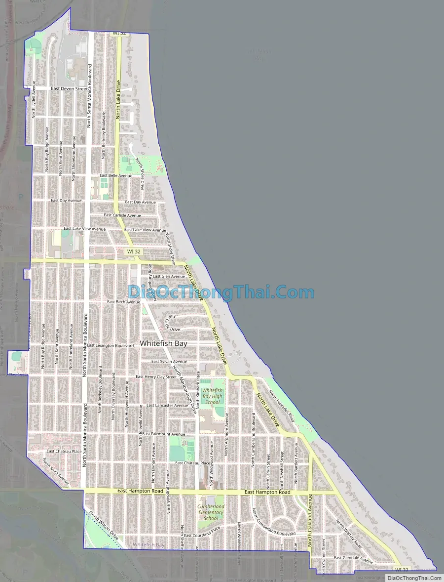
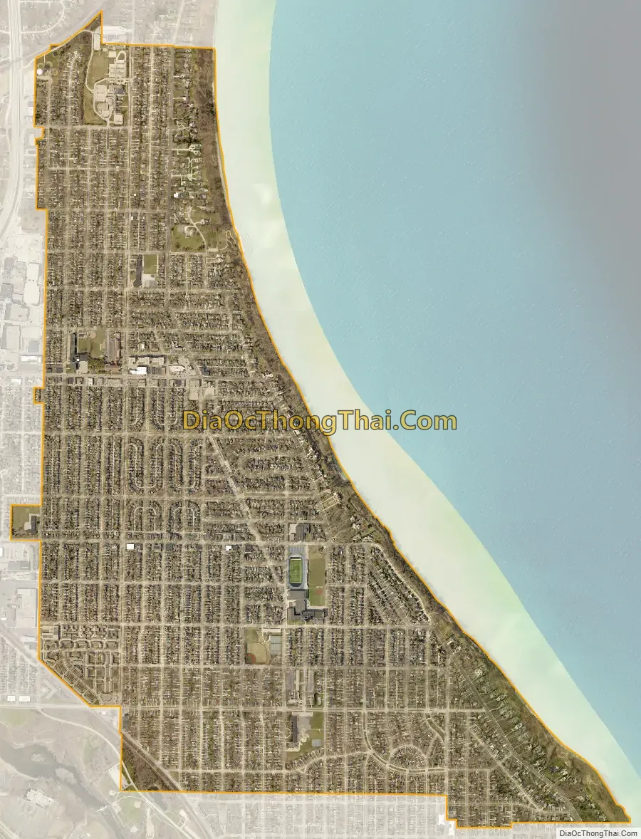
Whitefish Bay city Satellite Map
Geography
Whitefish Bay is located at 43°6′42″N 87°54′3″W / 43.11167°N 87.90083°W / 43.11167; -87.90083 (43.111711, −87.900762). According to the United States Census Bureau, the village has a total area of 2.13 square miles (5.52 km), all of it land.
See also
Map of Wisconsin State and its subdivision:- Adams
- Ashland
- Barron
- Bayfield
- Brown
- Buffalo
- Burnett
- Calumet
- Chippewa
- Clark
- Columbia
- Crawford
- Dane
- Dodge
- Door
- Douglas
- Dunn
- Eau Claire
- Florence
- Fond du Lac
- Forest
- Grant
- Green
- Green Lake
- Iowa
- Iron
- Jackson
- Jefferson
- Juneau
- Kenosha
- Kewaunee
- La Crosse
- Lafayette
- Lake Michigan
- Lake Superior
- Langlade
- Lincoln
- Manitowoc
- Marathon
- Marinette
- Marquette
- Menominee
- Milwaukee
- Monroe
- Oconto
- Oneida
- Outagamie
- Ozaukee
- Pepin
- Pierce
- Polk
- Portage
- Price
- Racine
- Richland
- Rock
- Rusk
- Saint Croix
- Sauk
- Sawyer
- Shawano
- Sheboygan
- Taylor
- Trempealeau
- Vernon
- Vilas
- Walworth
- Washburn
- Washington
- Waukesha
- Waupaca
- Waushara
- Winnebago
- Wood
- Alabama
- Alaska
- Arizona
- Arkansas
- California
- Colorado
- Connecticut
- Delaware
- District of Columbia
- Florida
- Georgia
- Hawaii
- Idaho
- Illinois
- Indiana
- Iowa
- Kansas
- Kentucky
- Louisiana
- Maine
- Maryland
- Massachusetts
- Michigan
- Minnesota
- Mississippi
- Missouri
- Montana
- Nebraska
- Nevada
- New Hampshire
- New Jersey
- New Mexico
- New York
- North Carolina
- North Dakota
- Ohio
- Oklahoma
- Oregon
- Pennsylvania
- Rhode Island
- South Carolina
- South Dakota
- Tennessee
- Texas
- Utah
- Vermont
- Virginia
- Washington
- West Virginia
- Wisconsin
- Wyoming