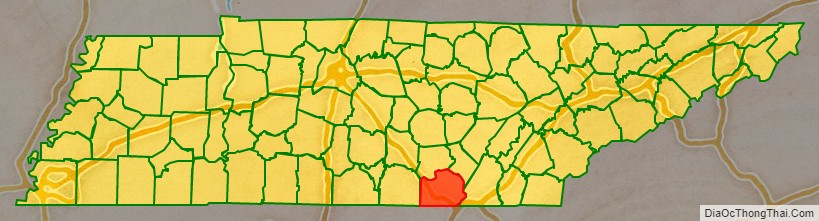
Marion County is a county located in the U.S. state of Tennessee. It is located in East Tennessee. As of the 2020 census, the population was 28,837. Its county seat is Jasper. Marion County is part of the Chattanooga, AL–TN–GA Metropolitan Statistical Area. Marion County is in the Central time zone, while Chattanooga proper is in the Eastern time zone.
| Name: | Marion County |
|---|---|
| FIPS code: | 47-115 |
| State: | Tennessee |
| Founded: | 1817 |
| Named for: | Francis Marion |
| Seat: | Jasper |
| Largest town: | Jasper |
| Total Area: | 512 sq mi (1,330 km²) |
| Land Area: | 498 sq mi (1,290 km²) |
| Total Population: | 28,837 |
| Population Density: | 57/sq mi (22/km²) |
| Time zone: | UTC−6 (Central) |
| Summer Time Zone (DST): | UTC−5 (CDT) |
| Website: | www.marioncountytn.net |
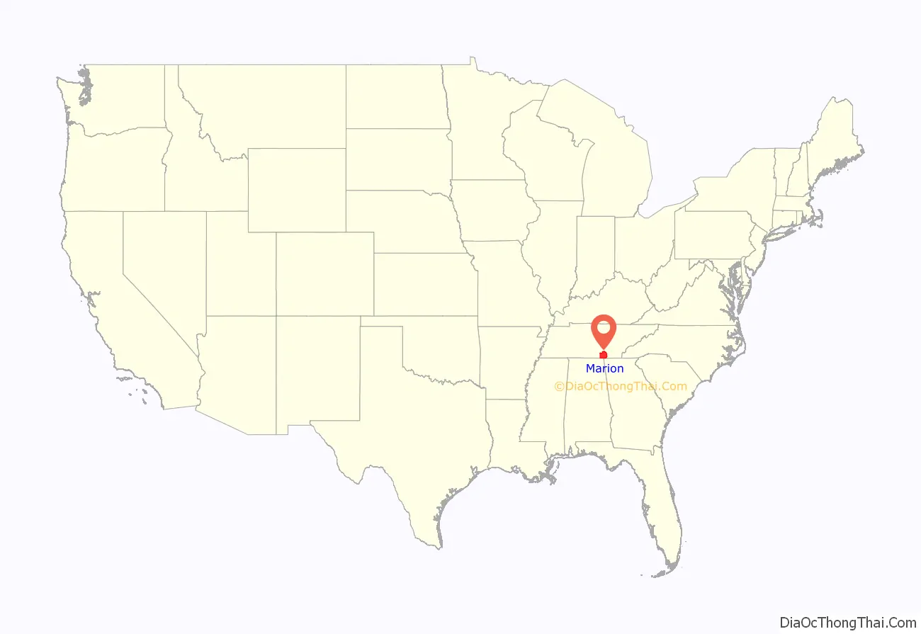
Marion County location map. Where is Marion County?
History
Marion County was established in 1817. In 1779 Cherokee chief Dragging Canoe moved down the Tennessee River from Chickamauga Creek to Running Water creek, and he helped establish the town of Nickajack at the entrance of Nickajack Cave. In 1794, the town was attacked and burned by militiamen commanded by Colonel James Orr of Nashville, Tennessee. The town was rebuilt and the Chickamauga Indians continued to live here until 1838, when all of the remaining Indians were removed from Tennessee, Alabama, and Georgia by the Trail of Tears.
During the spring of 1861, early in the American Civil War, Robert Cravens of Chattanooga began mining saltpeter, the main ingredient of gunpowder, at Nickajack Cave. The operation was soon taken over by the Confederate Niter Bureau. At one point, Nickajack Cave was one of the main sources of saltpeter for the Confederate States of America. However, its operation was halted in late 1862. Nickajack Cave was visited by thousands of soldiers of both side troops, who travelled up and down the Tennessee River on steamboats.
Another important mine during the Civil War was Monteagle Saltpeter Cave, located in Cave Cove, about 4 miles (6.4 km) southeast of Monteagle. During the war, it was officially referred to as Battle Creek Cave. A 1917 visitor reported that about 25 or 30 old hoppers still remained in the cave.
By the late 19th and early 20th centuries, coal and iron mining industries had come to dominate Marion County’s economy. Mines operated in Whitwell and Inman, while iron smelters were at South Pittsburg.
Hales Bar Dam, built on the Tennessee River in Marion County between 1905 and 1913, was one of the first major dams constructed in the United States across a navigable stream. in the 1960s, the Tennessee Valley Authority replaced Hales Bar with Nickajack Dam, further downstream in the 1960s, though the Hales Bar powerhouse still stands as a boathouse.
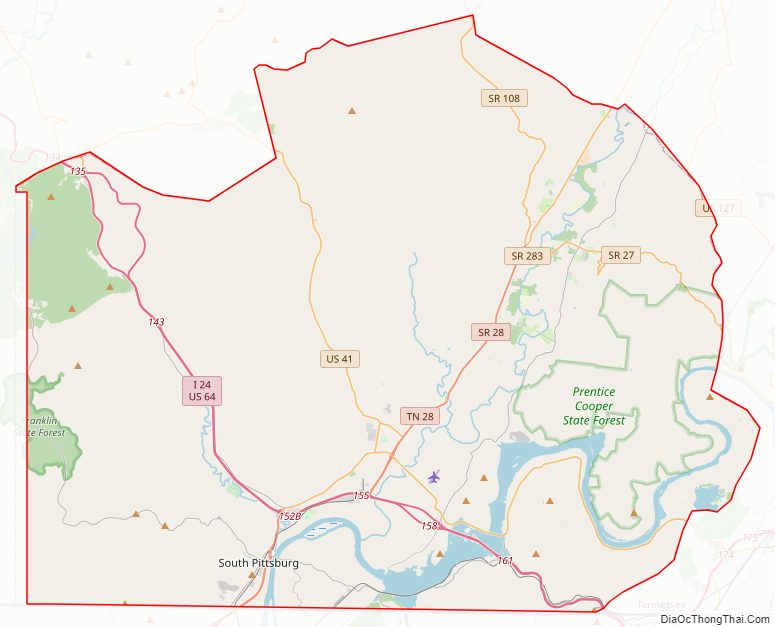
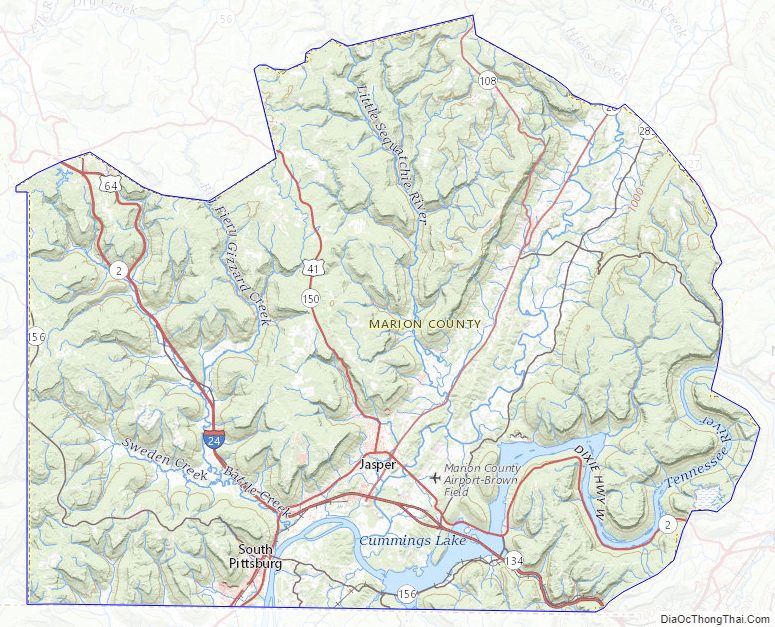
Marion County Road Map
Geography
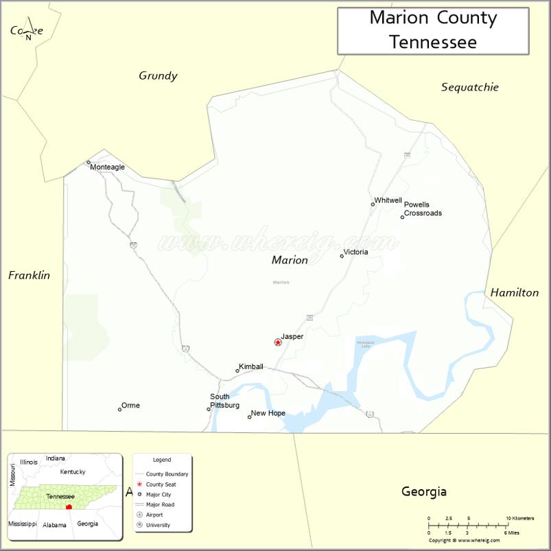
According to the U.S. Census Bureau, the county has a total area of 512 square miles (1,330 km), of which 498 square miles (1,290 km) is land and 14 square miles (36 km) (2.8%) is water. Marion is one of three Tennessee counties, along with Bledsoe and Sequatchie, located in the Sequatchie Valley, a long, narrow valley slicing through the southeastern Cumberland Plateau. The Sequatchie River, which drains the valley, empties into the Tennessee River just south of Jasper.
Nickajack Dam is located along the Tennessee River near Jasper, creating Nickajack Lake. The section of the river immediately downstream from the dam is part of Guntersville Lake. The Raccoon Mountain Pumped-Storage Plant is located in the extreme southeastern part of the county.
Adjacent counties
- Grundy County (north)
- Sequatchie County (northeast)
- Hamilton County (east/EST Border)
- Dade County, Georgia (southeast/EST Border)
- Jackson County, Alabama (southwest)
- Franklin County (west)
State protected areas
- Chimneys State Natural Area
- Cummings Cove Wildlife Management Area
- Franklin State Forest (part)
- Hicks Gap State Natural Area
- Prentice Cooper State Forest
- Sequatchie Cave State Natural Area
- South Cumberland State Park (part)
Marion County Topographic Map
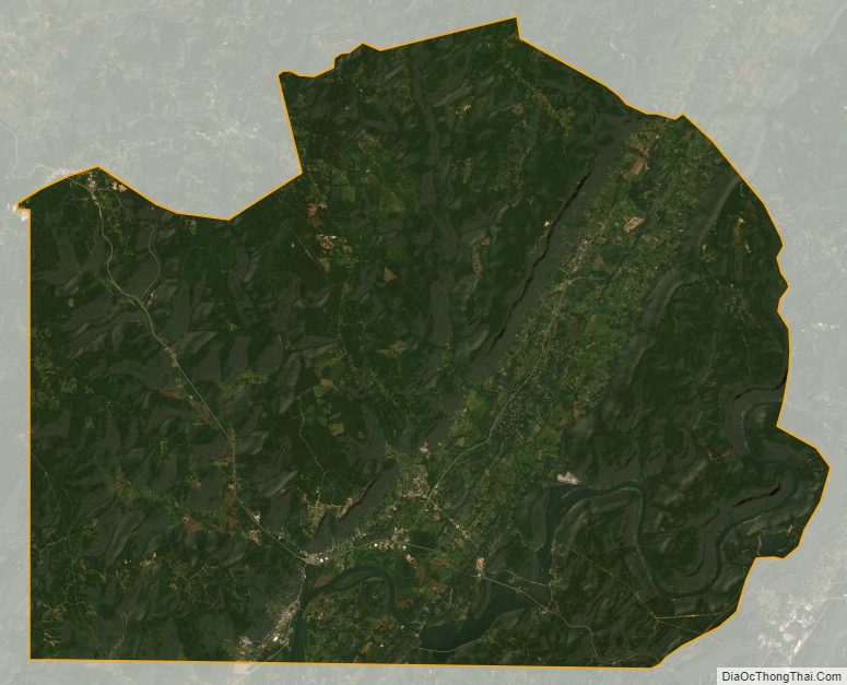
Marion County Satellite Map
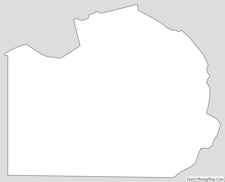
Marion County Outline Map
See also
Map of Tennessee State and its subdivision:- Anderson
- Bedford
- Benton
- Bledsoe
- Blount
- Bradley
- Campbell
- Cannon
- Carroll
- Carter
- Cheatham
- Chester
- Claiborne
- Clay
- Cocke
- Coffee
- Crockett
- Cumberland
- Davidson
- Decatur
- DeKalb
- Dickson
- Dyer
- Fayette
- Fentress
- Franklin
- Gibson
- Giles
- Grainger
- Greene
- Grundy
- Hamblen
- Hamilton
- Hancock
- Hardeman
- Hardin
- Hawkins
- Haywood
- Henderson
- Henry
- Hickman
- Houston
- Humphreys
- Jackson
- Jefferson
- Johnson
- Knox
- Lake
- Lauderdale
- Lawrence
- Lewis
- Lincoln
- Loudon
- Macon
- Madison
- Marion
- Marshall
- Maury
- McMinn
- McNairy
- Meigs
- Monroe
- Montgomery
- Moore
- Morgan
- Obion
- Overton
- Perry
- Pickett
- Polk
- Putnam
- Rhea
- Roane
- Robertson
- Rutherford
- Scott
- Sequatchie
- Sevier
- Shelby
- Smith
- Stewart
- Sullivan
- Sumner
- Tipton
- Trousdale
- Unicoi
- Union
- Van Buren
- Warren
- Washington
- Wayne
- Weakley
- White
- Williamson
- Wilson
- Alabama
- Alaska
- Arizona
- Arkansas
- California
- Colorado
- Connecticut
- Delaware
- District of Columbia
- Florida
- Georgia
- Hawaii
- Idaho
- Illinois
- Indiana
- Iowa
- Kansas
- Kentucky
- Louisiana
- Maine
- Maryland
- Massachusetts
- Michigan
- Minnesota
- Mississippi
- Missouri
- Montana
- Nebraska
- Nevada
- New Hampshire
- New Jersey
- New Mexico
- New York
- North Carolina
- North Dakota
- Ohio
- Oklahoma
- Oregon
- Pennsylvania
- Rhode Island
- South Carolina
- South Dakota
- Tennessee
- Texas
- Utah
- Vermont
- Virginia
- Washington
- West Virginia
- Wisconsin
- Wyoming