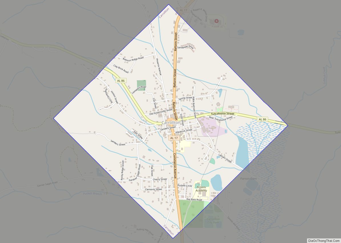
Carrollton is a city in and the county seat of Pickens County, Alabama, United States. At the 2010 census the population was 1,019, up from 987 in 2000.
The Pickens County Courthouse in the center of Carrollton was erected in 1877. The first courthouse in Carrollton was burned on April 5, 1865 by troops of Union General John T. Croxton. A second courthouse was destroyed by a fire on November 16, 1876.
| Name: | Carrollton town |
|---|---|
| LSAD Code: | 43 |
| LSAD Description: | town (suffix) |
| State: | Alabama |
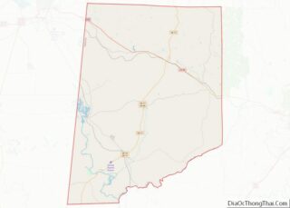
| County: | Pickens County |
| Elevation: | 243 ft (74 m) |
| Total Area: | 2.08 sq mi (5.39 km²) |
| Land Area: | 2.06 sq mi (5.33 km²) |
| Water Area: | 0.02 sq mi (0.06 km²) |
| Total Population: | 1,023 |
| Population Density: | 497.08/sq mi (191.88/km²) |
| ZIP code: | 35447 |
| Area code: | 205, 659 |
| FIPS code: | 0112304 |
| GNISfeature ID: | 0135481 |
Online Interactive Map
Click on ![]() to view map in "full screen" mode.
to view map in "full screen" mode.
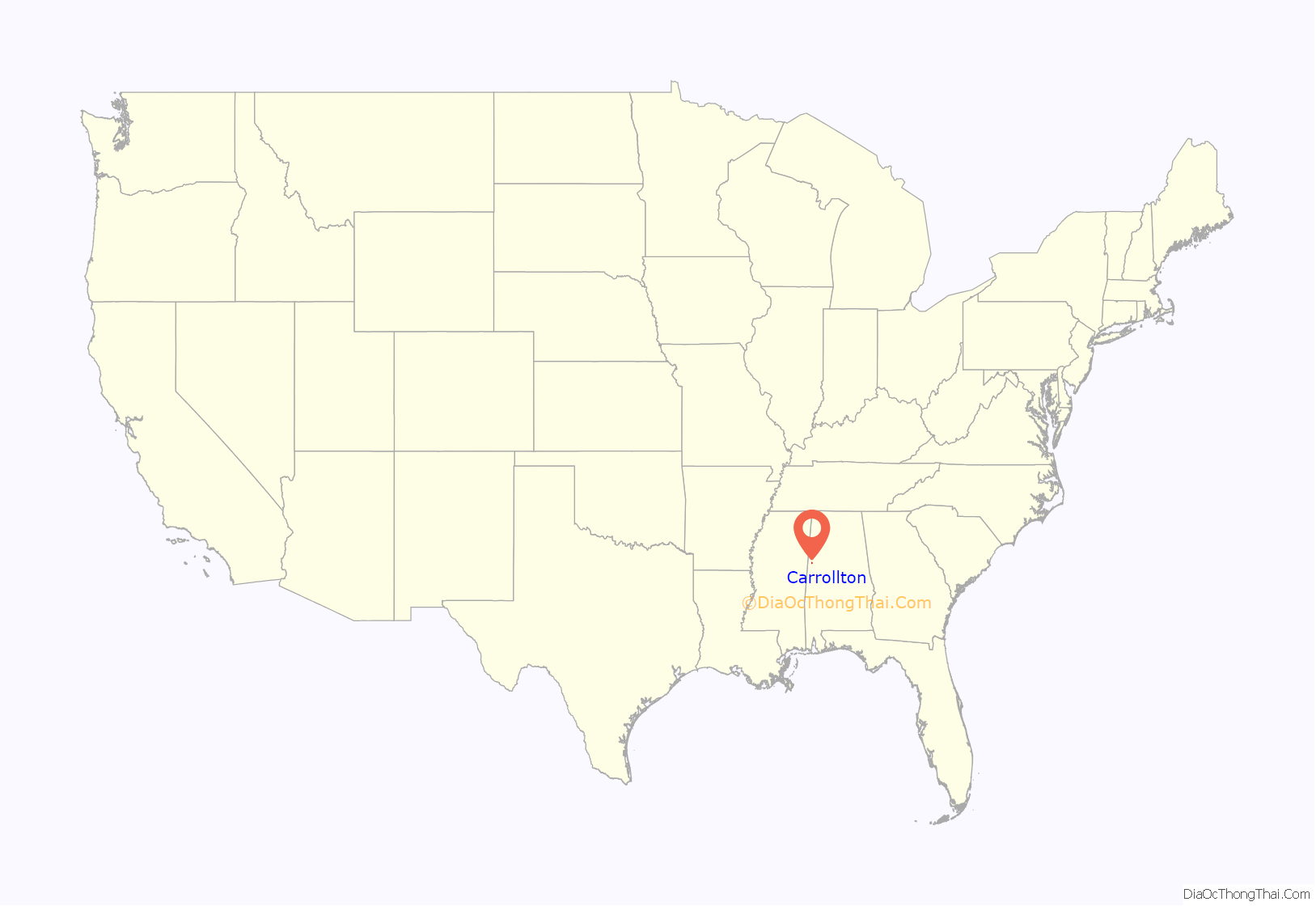
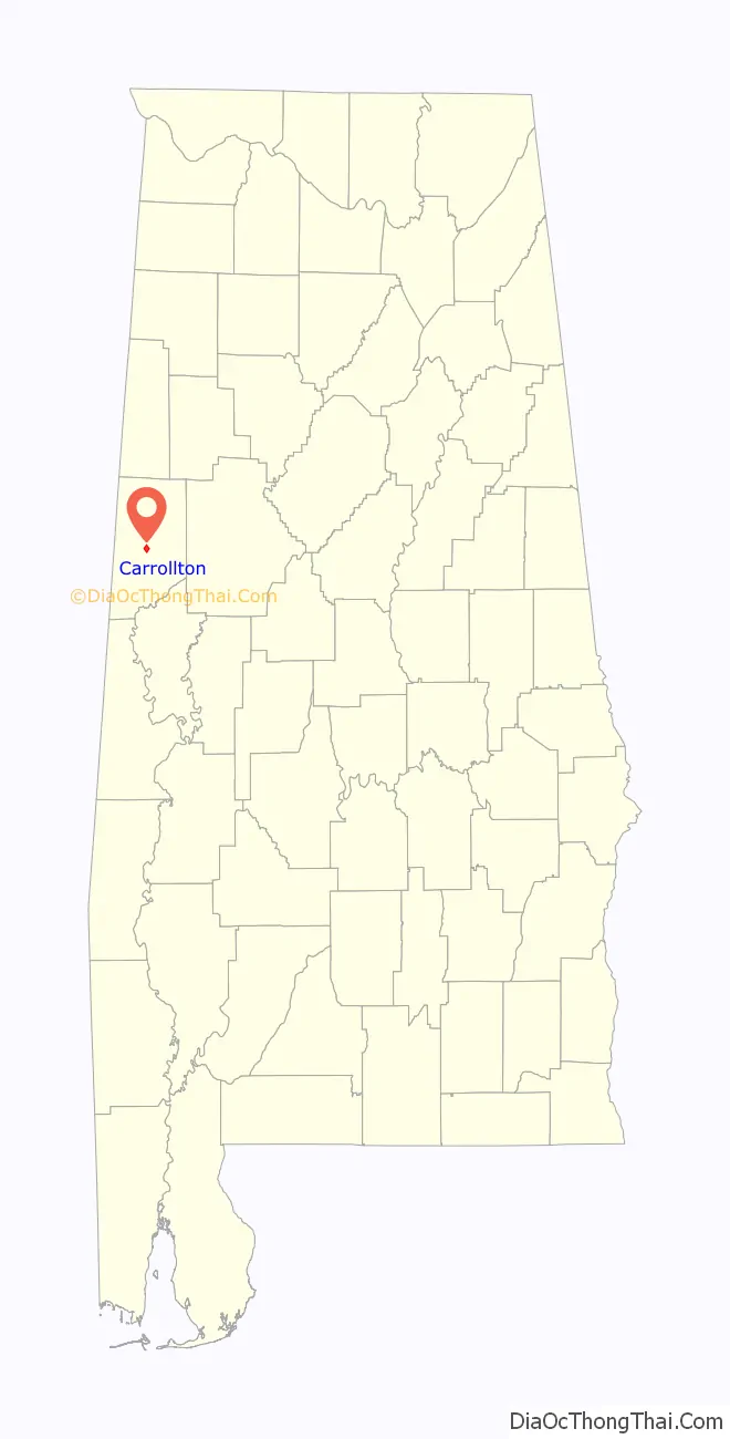
Carrollton location map. Where is Carrollton town?
History
Incorporated in 1831, the town was named after Charles Carroll of Carrollton, Maryland, the only Roman Catholic and longest-living signer of the Declaration of Independence. A post office has been in operation at Carrollton since 1831.
As was typical, the county jail was located at the courthouse. The courthouse square was used frequently as a site for public lynchings by whites of African Americans, part of numerous efforts to suppress them during a time of high tensions as whites struggled for dominance. It was part of a program of intimidation and racial terrorism, with these murders frequent in the decades on either side of the turn of the 20th century. Among the numerous African Americans lynched in Carrollton was John Gibson, hanged on August 28, 1907. Pickens County had the fifth highest total of lynchings in Alabama, according to Lynching in America (2015, 3rd edition), published by the Equal Justice Initiative.
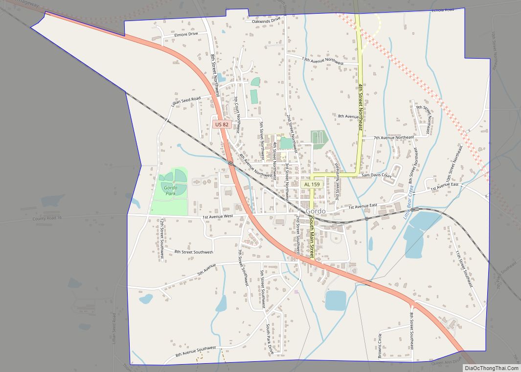
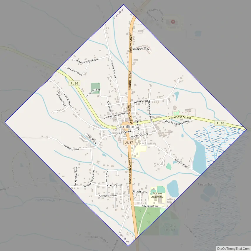
Carrollton Road Map
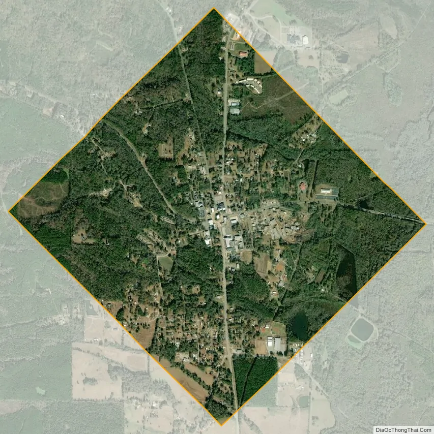
Carrollton city Satellite Map
Geography
Carrollton is located at 33°15′39″N 88°5′40″W / 33.26083°N 88.09444°W / 33.26083; -88.09444 (33.260858, -88.094452).
According to the U.S. Census Bureau, the town has a total area of 2.1 square miles (5.4 km), of which 2.1 square miles (5.4 km) is land and 0.04 square miles (0.10 km) (0.96%) is water.
See also
Map of Alabama State and its subdivision:- Autauga
- Baldwin
- Barbour
- Bibb
- Blount
- Bullock
- Butler
- Calhoun
- Chambers
- Cherokee
- Chilton
- Choctaw
- Clarke
- Clay
- Cleburne
- Coffee
- Colbert
- Conecuh
- Coosa
- Covington
- Crenshaw
- Cullman
- Dale
- Dallas
- De Kalb
- Elmore
- Escambia
- Etowah
- Fayette
- Franklin
- Geneva
- Greene
- Hale
- Henry
- Houston
- Jackson
- Jefferson
- Lamar
- Lauderdale
- Lawrence
- Lee
- Limestone
- Lowndes
- Macon
- Madison
- Marengo
- Marion
- Marshall
- Mobile
- Monroe
- Montgomery
- Morgan
- Perry
- Pickens
- Pike
- Randolph
- Russell
- Saint Clair
- Shelby
- Sumter
- Talladega
- Tallapoosa
- Tuscaloosa
- Walker
- Washington
- Wilcox
- Winston
- Alabama
- Alaska
- Arizona
- Arkansas
- California
- Colorado
- Connecticut
- Delaware
- District of Columbia
- Florida
- Georgia
- Hawaii
- Idaho
- Illinois
- Indiana
- Iowa
- Kansas
- Kentucky
- Louisiana
- Maine
- Maryland
- Massachusetts
- Michigan
- Minnesota
- Mississippi
- Missouri
- Montana
- Nebraska
- Nevada
- New Hampshire
- New Jersey
- New Mexico
- New York
- North Carolina
- North Dakota
- Ohio
- Oklahoma
- Oregon
- Pennsylvania
- Rhode Island
- South Carolina
- South Dakota
- Tennessee
- Texas
- Utah
- Vermont
- Virginia
- Washington
- West Virginia
- Wisconsin
- Wyoming