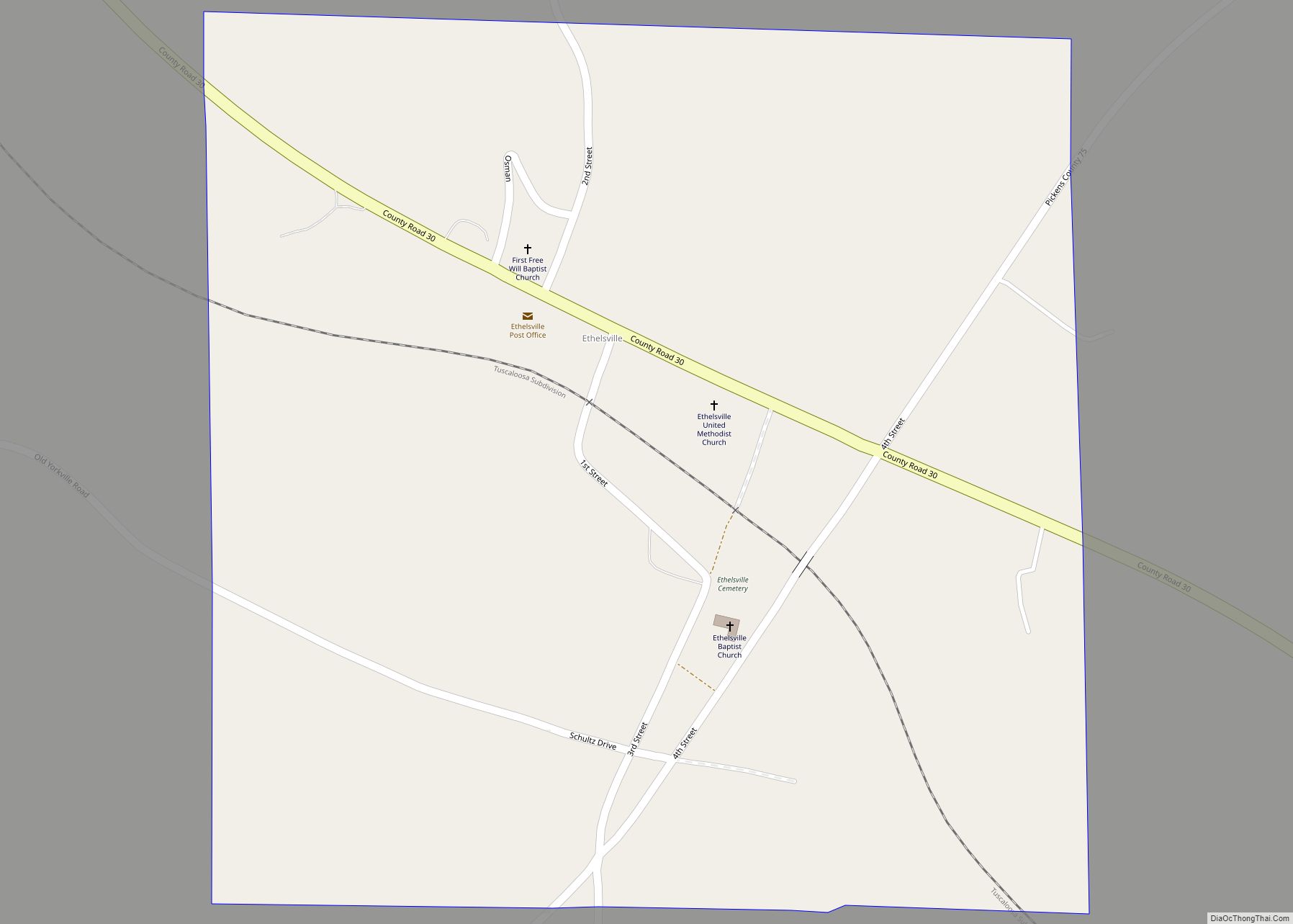
Ethelsville is a town in Pickens County, Alabama, United States.
Originally it name named Yorkville. It took its current name from Ethel Burgin Hancock, the daughter of local physician J. T. Hancock. His son Thomas was the town’s first postmaster. The town was incorporated in 1952 or 1956, depending on the source, and at the time was still an active railroad stop, with four freight trains and six passenger trains stopping there daily. When the railroad discontinued stops in Ethelsville, the population began to decline. In 1843, local resident John H. Alexander discovered a shield and pair of copper scales while plowing his fields. The shield was engraved with the word “Hispana,” which most historians have recognized as evidence that Spanish explorer Hernando de Soto likely passed through Pickens County. Local legend claims that De Soto and his men spent a winter on the hill where Ethelsville Baptist Church stands.
The town was moved one half mile from its original site when the M & O railroad was built in 1898.
| Name: | Ethelsville town |
|---|---|
| LSAD Code: | 43 |
| LSAD Description: | town (suffix) |
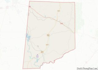
| State: | Alabama |
| County: | Pickens County |
| Elevation: | 364 ft (111 m) |
| Total Area: | 0.57 sq mi (1.47 km²) |
| Land Area: | 0.57 sq mi (1.47 km²) |
| Water Area: | 0.00 sq mi (0.00 km²) |
| Total Population: | 49 |
| Population Density: | 86.42/sq mi (33.36/km²) |
| ZIP code: | 35461 |
| Area code: | 205, 659 |
| FIPS code: | 0124472 |
| GNISfeature ID: | 0118045 |
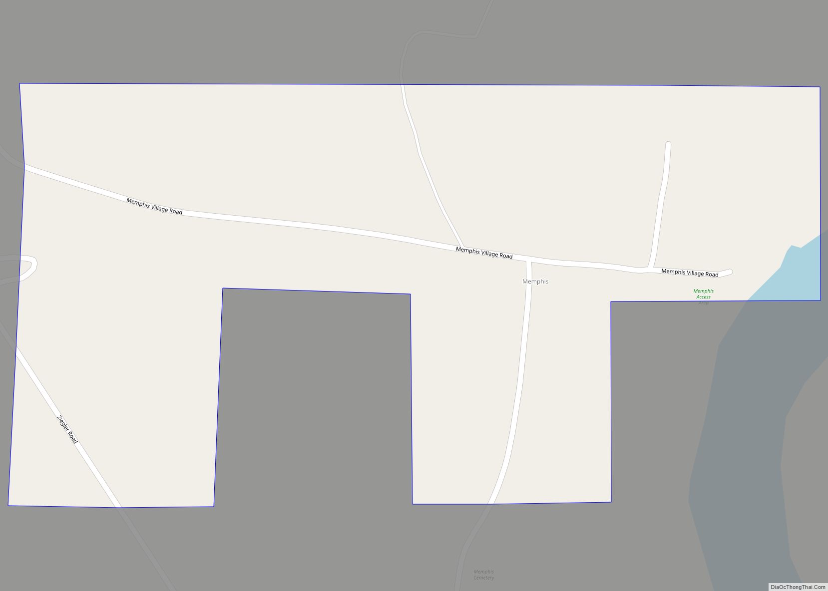
Online Interactive Map
Click on ![]() to view map in "full screen" mode.
to view map in "full screen" mode.
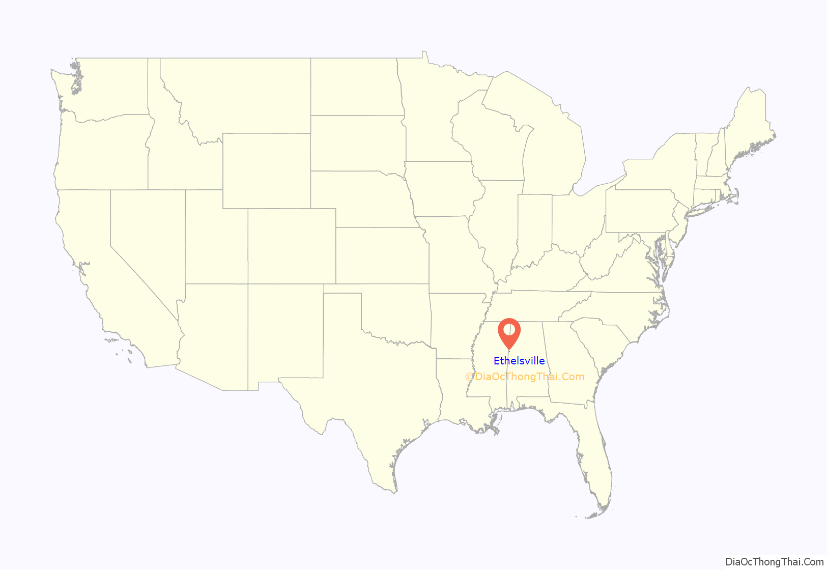
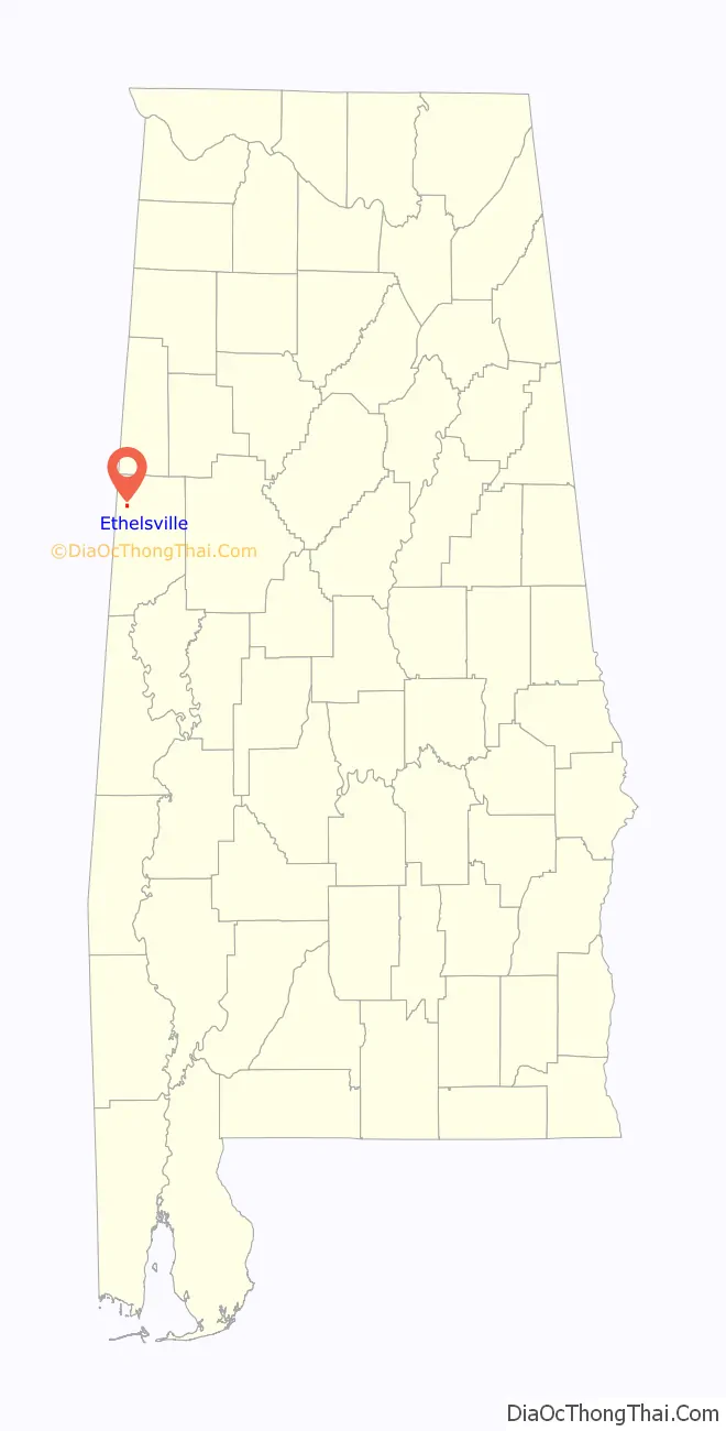
Ethelsville location map. Where is Ethelsville town?
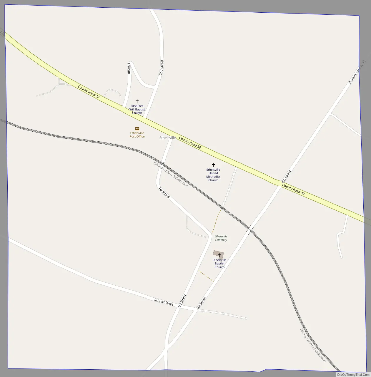
Ethelsville Road Map
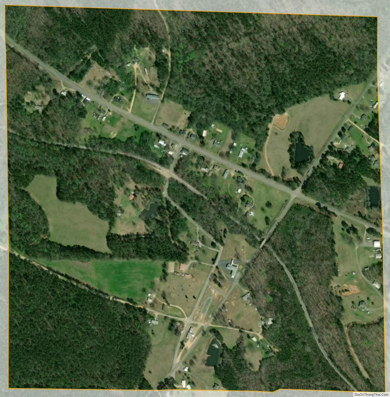
Ethelsville city Satellite Map
Geography
Ethelsville is located at 33°24′49″N 88°12′56″W / 33.41361°N 88.21556°W / 33.41361; -88.21556 (33.413563, -88.215516).
According to the U.S. Census Bureau, the town has a total area of 0.6 square miles (1.6 km), all land.
See also
Map of Alabama State and its subdivision:- Autauga
- Baldwin
- Barbour
- Bibb
- Blount
- Bullock
- Butler
- Calhoun
- Chambers
- Cherokee
- Chilton
- Choctaw
- Clarke
- Clay
- Cleburne
- Coffee
- Colbert
- Conecuh
- Coosa
- Covington
- Crenshaw
- Cullman
- Dale
- Dallas
- De Kalb
- Elmore
- Escambia
- Etowah
- Fayette
- Franklin
- Geneva
- Greene
- Hale
- Henry
- Houston
- Jackson
- Jefferson
- Lamar
- Lauderdale
- Lawrence
- Lee
- Limestone
- Lowndes
- Macon
- Madison
- Marengo
- Marion
- Marshall
- Mobile
- Monroe
- Montgomery
- Morgan
- Perry
- Pickens
- Pike
- Randolph
- Russell
- Saint Clair
- Shelby
- Sumter
- Talladega
- Tallapoosa
- Tuscaloosa
- Walker
- Washington
- Wilcox
- Winston
- Alabama
- Alaska
- Arizona
- Arkansas
- California
- Colorado
- Connecticut
- Delaware
- District of Columbia
- Florida
- Georgia
- Hawaii
- Idaho
- Illinois
- Indiana
- Iowa
- Kansas
- Kentucky
- Louisiana
- Maine
- Maryland
- Massachusetts
- Michigan
- Minnesota
- Mississippi
- Missouri
- Montana
- Nebraska
- Nevada
- New Hampshire
- New Jersey
- New Mexico
- New York
- North Carolina
- North Dakota
- Ohio
- Oklahoma
- Oregon
- Pennsylvania
- Rhode Island
- South Carolina
- South Dakota
- Tennessee
- Texas
- Utah
- Vermont
- Virginia
- Washington
- West Virginia
- Wisconsin
- Wyoming