Loxley is a city in Baldwin County, Alabama, United States. As of the 2010 census, the population of the town was 1,632. It is part of the Daphne-Fairhope-Foley metropolitan area. Loxley is becoming a popular location for the expansion of the suburbs from Daphne and Spanish Fort, Alabama, because it is served by an Interstate 10 exit and is almost directly between the cities of Mobile, Alabama, and Pensacola, Florida.
| Name: | Loxley town |
|---|---|
| LSAD Code: | 43 |
| LSAD Description: | town (suffix) |
| State: | Alabama |
| County: | Baldwin County |
| Elevation: | 171 ft (52 m) |
| Total Area: | 32.25 sq mi (83.54 km²) |
| Land Area: | 31.87 sq mi (82.55 km²) |
| Water Area: | 0.38 sq mi (0.99 km²) |
| Total Population: | 3,710 |
| Population Density: | 116.40/sq mi (44.94/km²) |
| ZIP code: | 36551 |
| Area code: | 251 |
| FIPS code: | 0144608 |
| GNISfeature ID: | 0155142 |
| Website: | www.townofloxley.org |
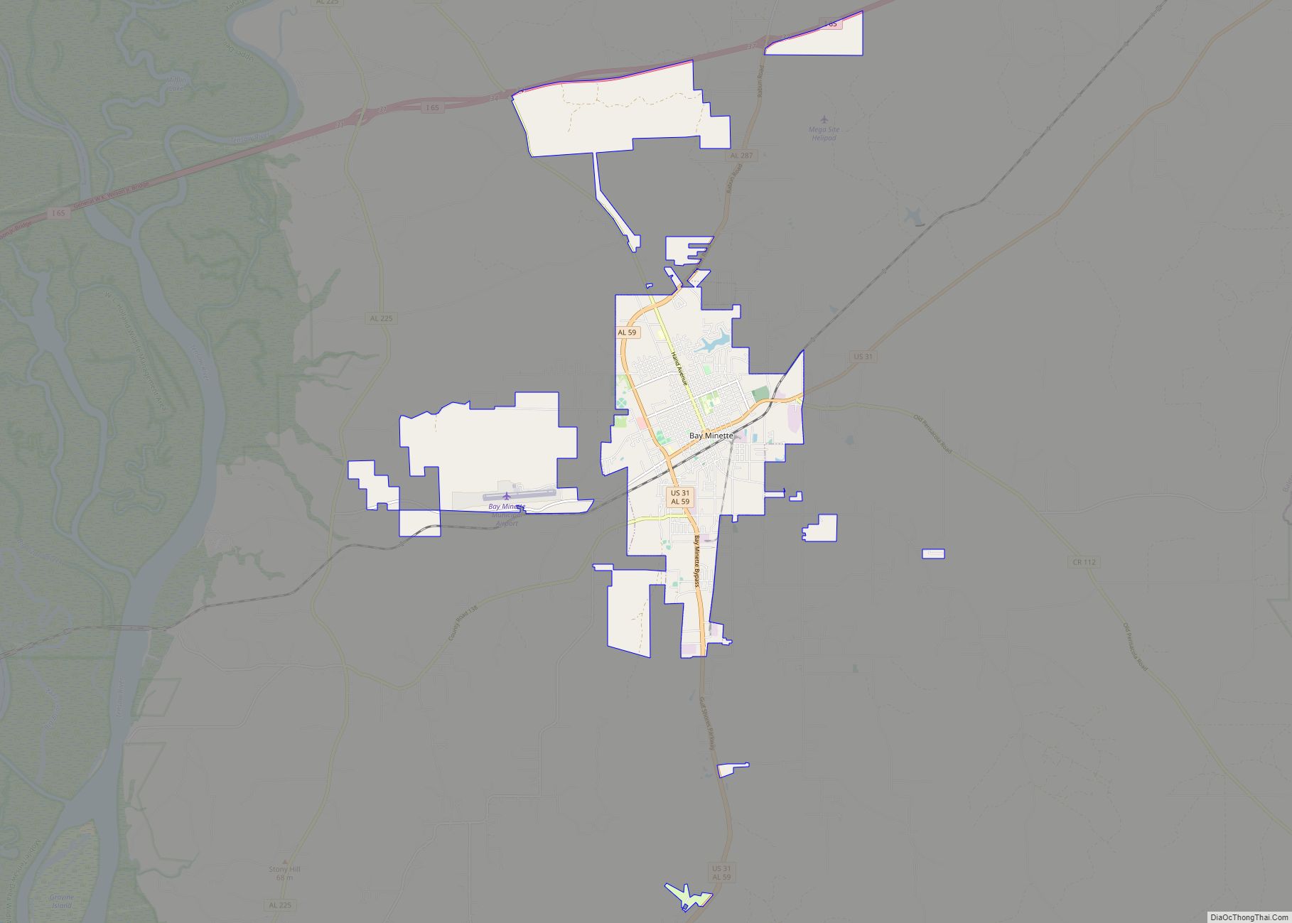
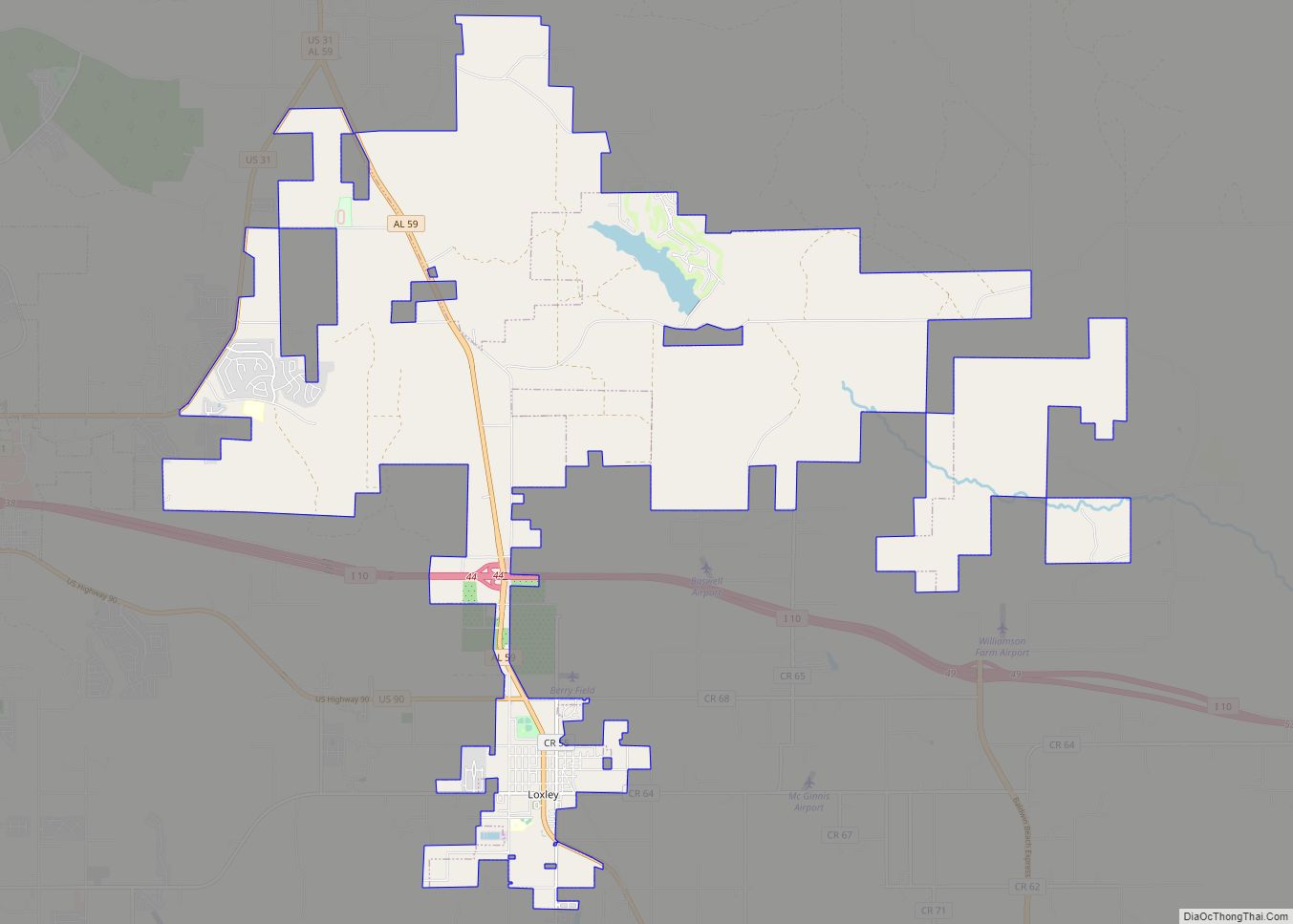
Online Interactive Map
Click on ![]() to view map in "full screen" mode.
to view map in "full screen" mode.
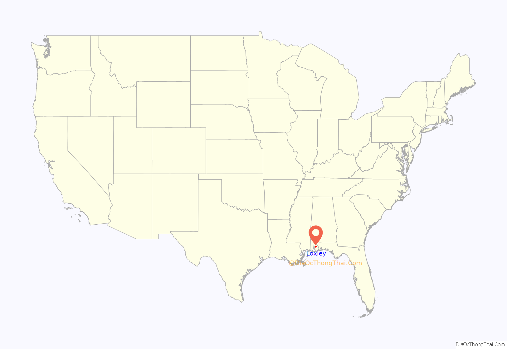
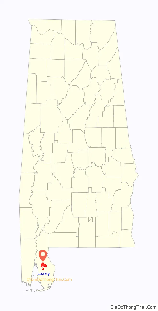
Loxley location map. Where is Loxley town?
History
19th century
In 1870, a man from Chicago by the name of John Loxley established a lumber camp in the area previously known as Bennet. The lumber camp included a commissary and saw mill. The men that traveled with Loxley settled in what later became the town of Loxley. John Loxley returned to Chicago when the lumber was exhausted.
20th century
The train depot opened on May 5, 1906, on the Fort Morgan Line. Before that, there were only wagon roads to Bay Minette. Also in 1906, the Loxley post office was opened by Octavia Sauer. She served as the postmistress and depot agent. By 1920, the businesses in Loxley consisted of an egg store, grocery store, two general merchandise stores, train depot, drug store, telegraph office, land office, repair garage, post office, bank, hotel, butcher shop, orange packing shed, cement block plant, a blacksmith, a feed and lumber store. A grammar school was built in 1925.
The Town of Loxley incorporated in March 1957.
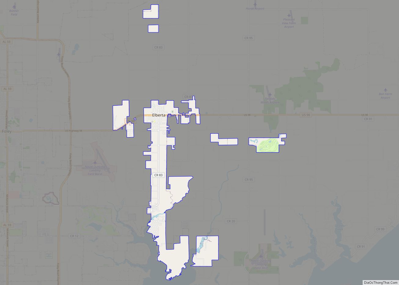
Loxley Road Map
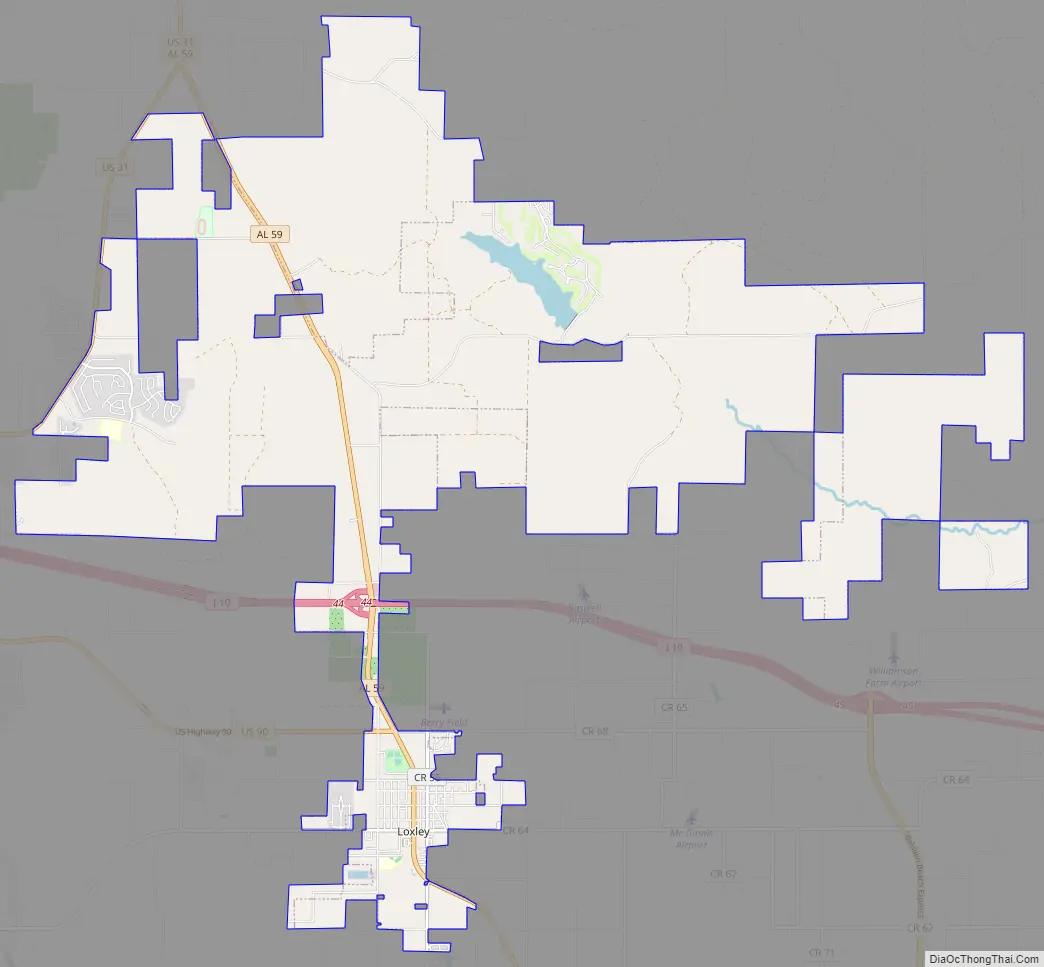
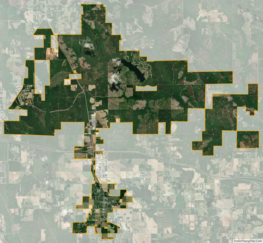
Loxley city Satellite Map
Geography
Loxley is located in south-central Baldwin County at 30°37’24.600″ North, 87°45’17.035″ West (30.623500, -87.754732). U.S. Route 90 (Hickory Street) passes through the center of the town, leading eastbound 5 miles (8 km) to Robertsdale, Alabama, and 39 miles (63 km) to Pensacola, Florida, and westbound 11 miles (18 km) to Spanish Fort and 20 miles (32 km) to Mobile. Interstate 10 passes through the northern end of town, with access via Exit 44 (Alabama State Route 59).
According to the U.S. Census Bureau, the town has a total area of 32.2 square miles (83.4 km), of which 31.9 square miles (82.5 km) is land and 0.39 square miles (1.0 km), or 1.15%, is water.
See also
Map of Alabama State and its subdivision:- Autauga
- Baldwin
- Barbour
- Bibb
- Blount
- Bullock
- Butler
- Calhoun
- Chambers
- Cherokee
- Chilton
- Choctaw
- Clarke
- Clay
- Cleburne
- Coffee
- Colbert
- Conecuh
- Coosa
- Covington
- Crenshaw
- Cullman
- Dale
- Dallas
- De Kalb
- Elmore
- Escambia
- Etowah
- Fayette
- Franklin
- Geneva
- Greene
- Hale
- Henry
- Houston
- Jackson
- Jefferson
- Lamar
- Lauderdale
- Lawrence
- Lee
- Limestone
- Lowndes
- Macon
- Madison
- Marengo
- Marion
- Marshall
- Mobile
- Monroe
- Montgomery
- Morgan
- Perry
- Pickens
- Pike
- Randolph
- Russell
- Saint Clair
- Shelby
- Sumter
- Talladega
- Tallapoosa
- Tuscaloosa
- Walker
- Washington
- Wilcox
- Winston
- Alabama
- Alaska
- Arizona
- Arkansas
- California
- Colorado
- Connecticut
- Delaware
- District of Columbia
- Florida
- Georgia
- Hawaii
- Idaho
- Illinois
- Indiana
- Iowa
- Kansas
- Kentucky
- Louisiana
- Maine
- Maryland
- Massachusetts
- Michigan
- Minnesota
- Mississippi
- Missouri
- Montana
- Nebraska
- Nevada
- New Hampshire
- New Jersey
- New Mexico
- New York
- North Carolina
- North Dakota
- Ohio
- Oklahoma
- Oregon
- Pennsylvania
- Rhode Island
- South Carolina
- South Dakota
- Tennessee
- Texas
- Utah
- Vermont
- Virginia
- Washington
- West Virginia
- Wisconsin
- Wyoming