Spanish Fort is a city in Baldwin County, Alabama, United States, located on the eastern shore of Mobile Bay. The 2020 census lists the population of the city as 10,049. It is a suburb of Mobile and is part of the Daphne-Fairhope-Foley metropolitan area.
| Name: | Spanish Fort city |
|---|---|
| LSAD Code: | 25 |
| LSAD Description: | city (suffix) |
| State: | Alabama |
| County: | Baldwin County |
| Elevation: | 23 ft (7 m) |
| Total Area: | 35.73 sq mi (92.53 km²) |
| Land Area: | 31.02 sq mi (80.34 km²) |
| Water Area: | 4.71 sq mi (12.19 km²) |
| Total Population: | 10,049 |
| Population Density: | 323.96/sq mi (125.08/km²) |
| ZIP code: | 36527, 36577 |
| Area code: | 251 |
| FIPS code: | 0171976 |
| GNISfeature ID: | 1669449 |
| Website: | www.cityofspanishfort.com |
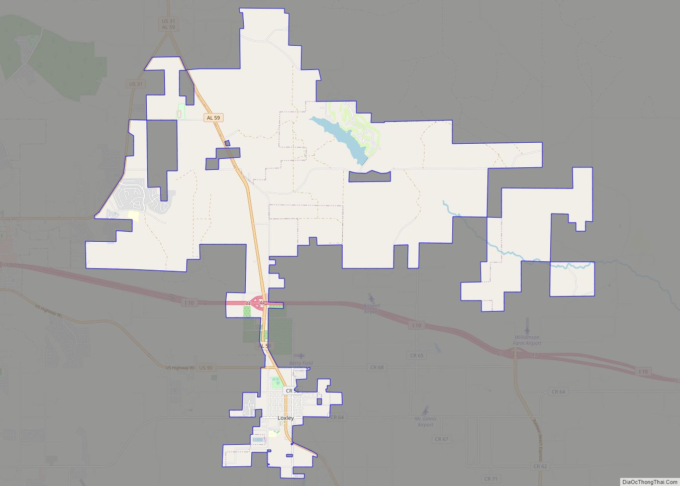
Online Interactive Map
Click on ![]() to view map in "full screen" mode.
to view map in "full screen" mode.
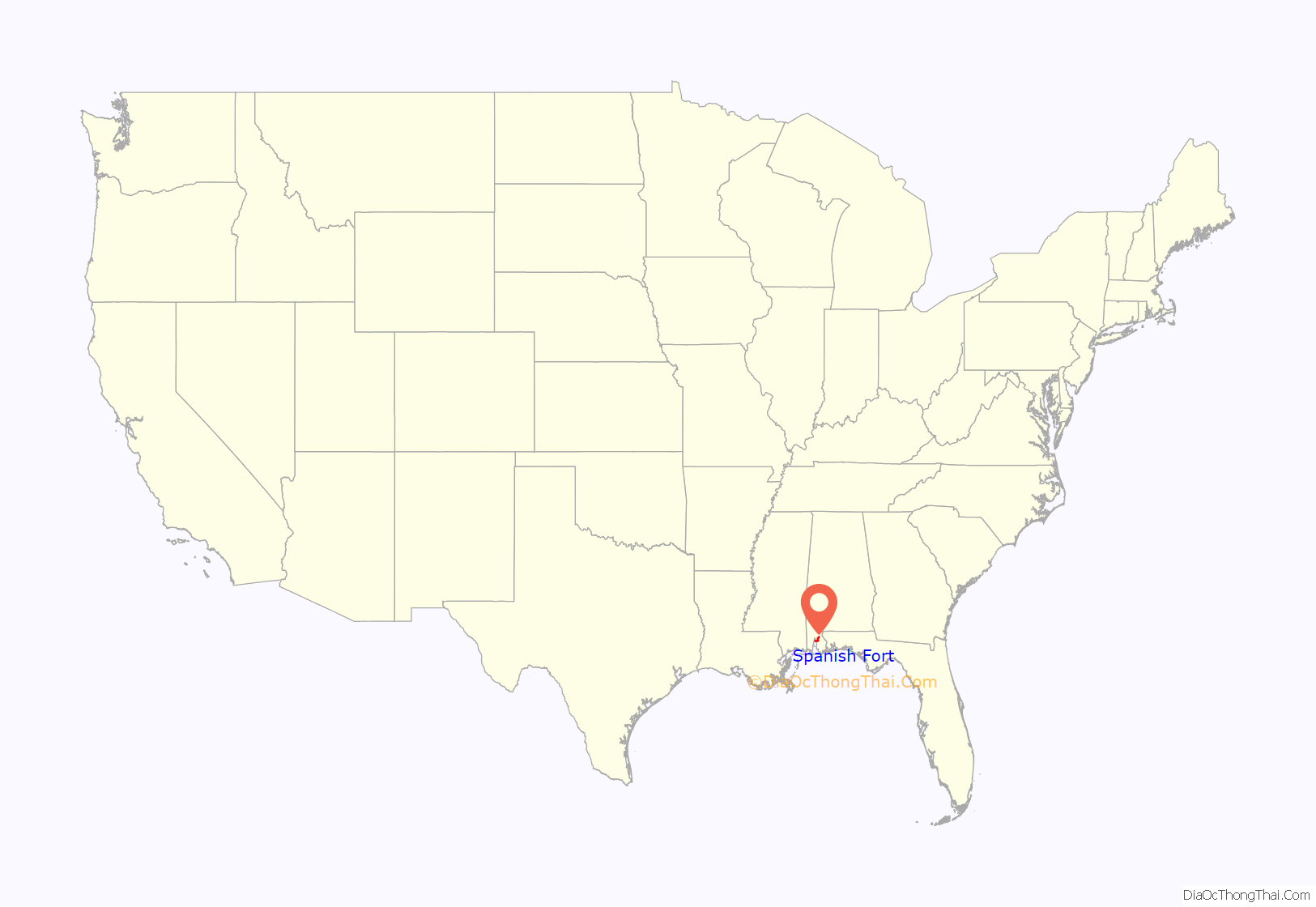
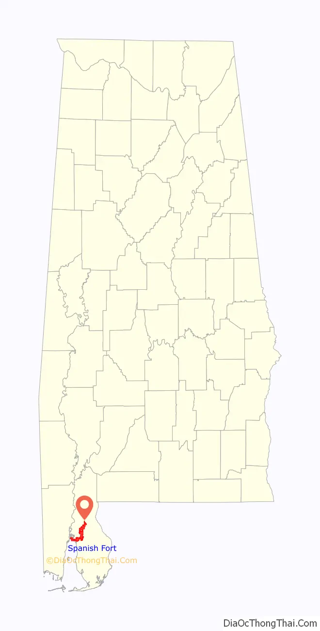
Spanish Fort location map. Where is Spanish Fort city?
History
The city of Spanish Fort is rich in history dating as far back as 1712 with the founding of Mobile by Jean-Baptiste Le Moyne de Bienville of France. Spanish Fort was originally the site of a trading post established by French-occupied Mobile. Following the French and Indian War, a large area on the Gulf Coast including the trading post was ceded to the British in 1763. During the Revolutionary War after the Spanish took Mobile and surrounding areas in the Battle of Fort Charlotte, a presidio or military fort was built on the site of the old trading post. This “Spanish Fort” was the site of a counterattack by British forces dispatched from Pensacola in 1781. The British were driven back and unsuccessful in recapturing the area. Following the Adams–Onís Treaty, Spanish Fort, as it was now commonly referred to, was officially property of the United States.
During the American Civil War, Spanish Fort was heavily fortified as an eastern defense to the city of Mobile. Fort Huger, Fort (Battery) Tracey, Fort (Battery) McDermott, Fort Alexis, Red Fort, and Old Spanish Fort were all part of the Mobile defenses in what is now Spanish Fort. After the Union victory in the Battle of Mobile Bay, Mobile nevertheless remained in Confederate hands. Union forces embarked on a land campaign in early 1865 to take Mobile from the east. Spanish Fort was the site of the Battle of Spanish Fort in the Mobile Campaign of the war. Its fall allowed Union forces to concentrate on Fort Blakeley to the north, and hence destroy the last organized resistance east of the Mississippi River. The falls of Spanish Fort and Fort Blakeley permitted Union troops to subsequently enter Mobile unopposed after the conclusion of the Civil War.
On November 1, 2012, groundbreaking ceremonies were held at the northwest corner of Spanish Fort Boulevard and Blakeley Way (map), site of the new Spanish Fort Community Center. Forrest Daniell & Associates, P.C., was contracted to design the center, working with the City’s Community Center Advisory Board on the conceptualization and functionality of the facility. J.F. Pate & Associates was awarded the contract to construct the Community Center. Though progress on the construction was often hindered by rainy weather and other hurdles, the administrative staff officially occupied the new facility in September 2015. The center is home to the city library, administrative offices, the office of the mayor, and other city-run services. The municipal complex is roughly 30,000 square feet and cost the city approximately $5 million to build.
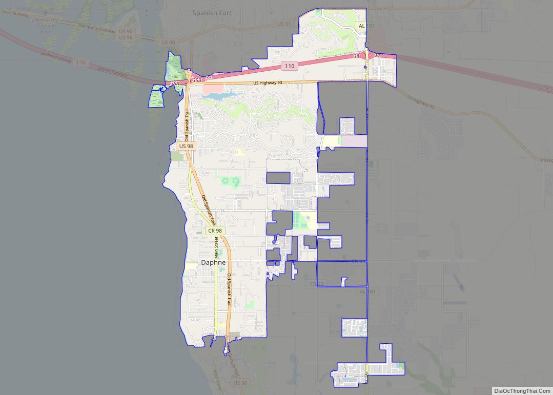
Spanish Fort Road Map
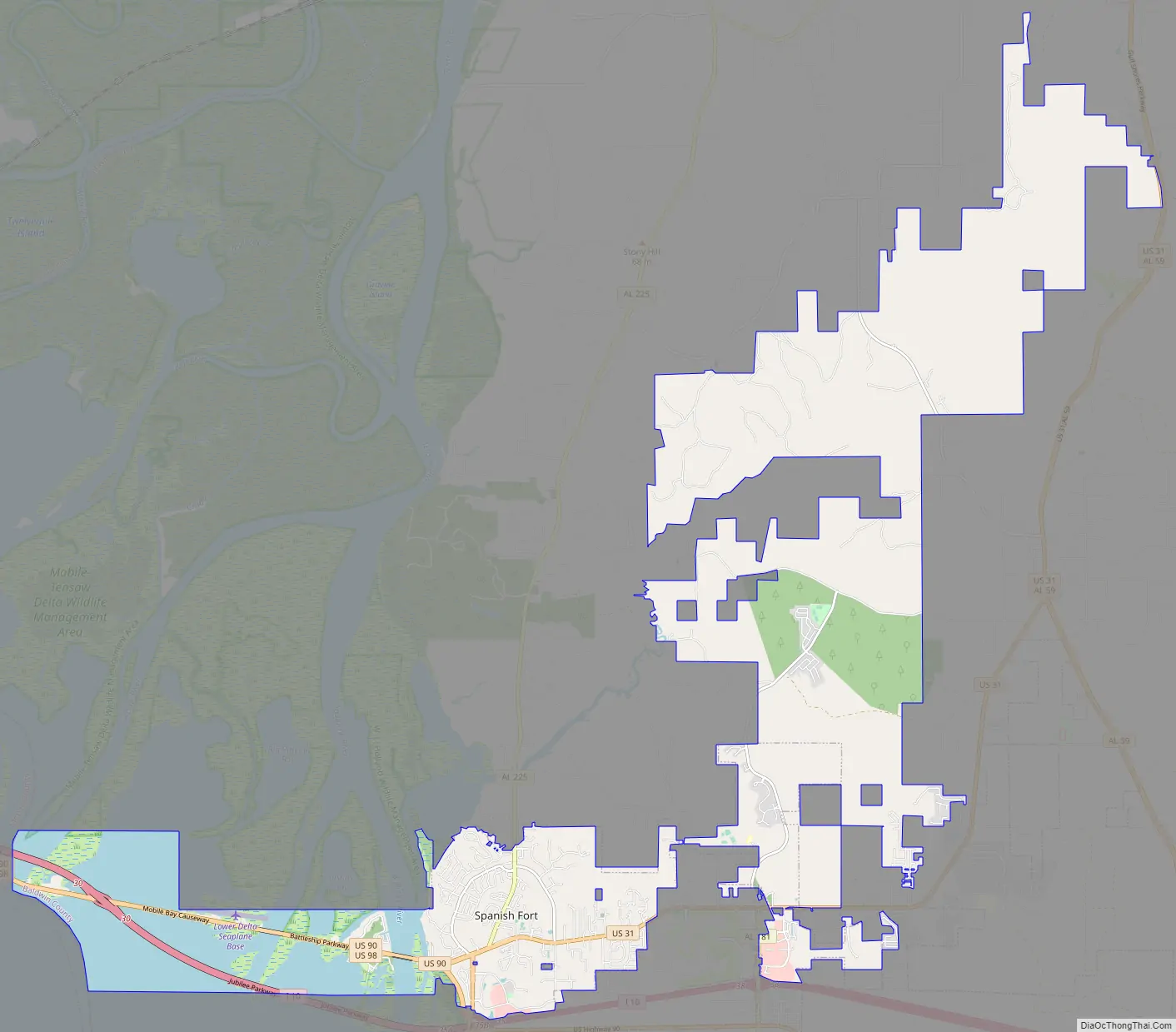
Spanish Fort city Satellite Map

Geography
Spanish Fort is located at 30°40’7.403″ North, 87°55’19.844″ West (30.668723, -87.922179), above the east shore of the Blakeley River where it enters Mobile Bay. U.S. Routes 90 and 98 (Battleship Parkway) lead west across the Mobile River and its distributaries 9 miles (14 km) to Mobile. Interstate 10 passes just to the south of Spanish Fort, with access from exits 35 and 38, and leads west across Mobile Bay to Mobile as well.
According to the U.S. Census Bureau, Spanish Fort has a total area of 33.4 square miles (86.5 km), of which 28.7 square miles (74.3 km) is land and 4.7 square miles (12.2 km), or 14.08%, is water.
See also
Map of Alabama State and its subdivision:- Autauga
- Baldwin
- Barbour
- Bibb
- Blount
- Bullock
- Butler
- Calhoun
- Chambers
- Cherokee
- Chilton
- Choctaw
- Clarke
- Clay
- Cleburne
- Coffee
- Colbert
- Conecuh
- Coosa
- Covington
- Crenshaw
- Cullman
- Dale
- Dallas
- De Kalb
- Elmore
- Escambia
- Etowah
- Fayette
- Franklin
- Geneva
- Greene
- Hale
- Henry
- Houston
- Jackson
- Jefferson
- Lamar
- Lauderdale
- Lawrence
- Lee
- Limestone
- Lowndes
- Macon
- Madison
- Marengo
- Marion
- Marshall
- Mobile
- Monroe
- Montgomery
- Morgan
- Perry
- Pickens
- Pike
- Randolph
- Russell
- Saint Clair
- Shelby
- Sumter
- Talladega
- Tallapoosa
- Tuscaloosa
- Walker
- Washington
- Wilcox
- Winston
- Alabama
- Alaska
- Arizona
- Arkansas
- California
- Colorado
- Connecticut
- Delaware
- District of Columbia
- Florida
- Georgia
- Hawaii
- Idaho
- Illinois
- Indiana
- Iowa
- Kansas
- Kentucky
- Louisiana
- Maine
- Maryland
- Massachusetts
- Michigan
- Minnesota
- Mississippi
- Missouri
- Montana
- Nebraska
- Nevada
- New Hampshire
- New Jersey
- New Mexico
- New York
- North Carolina
- North Dakota
- Ohio
- Oklahoma
- Oregon
- Pennsylvania
- Rhode Island
- South Carolina
- South Dakota
- Tennessee
- Texas
- Utah
- Vermont
- Virginia
- Washington
- West Virginia
- Wisconsin
- Wyoming